{{lang|sv|Virdois stad}}"},"other_name":{"wt":"Virdois"},"settlement_type":{"wt":"Town"},"image_skyline":{"wt":"File:Virrat, Virtaintie - Leivontie C IMG 2722.JPG"},"imagesize":{"wt":"250px"},"image_caption":{"wt":"An intersection of Virtaintie and Leivontie streets in Virrat"},"image_shield":{"wt":"Virrat.vaakuna.svg"},"shield_size":{"wt":"120x80px"},"image_map":{"wt":"Virrat sijainti Suomi.svg"},"map_caption":{"wt":"Location of Virrat in Finland"},"coordinates":{"wt":"{{coord|62|15|N|023|46|E|display=inline,title}}"},"subdivision_type":{"wt":"Country"},"subdivision_name":{"wt":"{{flag|Finland}}"},"subdivision_type1":{"wt":"[[Regions of Finland|Region]]"},"subdivision_name1":{"wt":"[[Pirkanmaa]]"},"subdivision_type2":{"wt":"[[Sub-regions of Finland|Sub-region]]"},"subdivision_name2":{"wt":"Upper Pirkanmaa sub-region"},"leader_title":{"wt":"[[Town manager]]"},"leader_name":{"wt":"Henna Viitanen"},"established_title":{"wt":"[[Charter]]"},"established_date":{"wt":"1868"},"area_footnotes":{"wt":"{{Data Finland municipality|area_footnotes|Virrat}}"},"area_total_km2":{"wt":"{{Data Finland municipality|area_total_km2|Virrat}}"},"area_land_km2":{"wt":"{{Data Finland municipality|area_land_km2|Virrat}}"},"area_water_km2":{"wt":"{{Data Finland municipality|area_water_km2|Virrat}}"},"area_rank":{"wt":"{{Data Finland municipality|area_rank|Virrat}}"},"population_as_of":{"wt":"{{Data Finland municipality|population_as_of|Virrat}}"},"population_footnotes":{"wt":"{{Data Finland municipality|population_footnotes|Virrat}}"},"population_total":{"wt":"{{Data Finland municipality|population_total|Virrat}}"},"population_density_km2":{"wt":"{{Data Finland municipality|population_density_km2|Virrat}}"},"population_rank":{"wt":"{{Data Finland municipality|population_rank|Virrat}}"},"demographics_type1":{"wt":"{{Data Finland municipality|demographics_type1|Virrat}}"},"demographics1_footnotes":{"wt":"{{Data Finland municipality|demographics1_footnotes|Virrat}}"},"demographics1_title1":{"wt":"{{Data Finland municipality|demographics1_title1|Virrat}}"},"demographics1_info1":{"wt":"{{Data Finland municipality|demographics1_info1|Virrat}}"},"demographics1_title2":{"wt":"{{Data Finland municipality|demographics1_title2|Virrat}}"},"demographics1_info2":{"wt":"{{Data Finland municipality|demographics1_info2|Virrat}}"},"demographics1_title3":{"wt":"{{Data Finland municipality|demographics1_title3|Virrat}}"},"demographics1_info3":{"wt":"{{Data Finland municipality|demographics1_info3|Virrat}}"},"demographics1_title4":{"wt":"{{Data Finland municipality|demographics1_title4|Virrat}}"},"demographics1_info4":{"wt":"{{Data Finland municipality|demographics1_info4|Virrat}}"},"demographics_type2":{"wt":"{{Data Finland municipality|demographics_type2|Virrat}}"},"demographics2_footnotes":{"wt":"{{Data Finland municipality|demographics2_footnotes|Virrat}}"},"demographics2_title1":{"wt":"{{Data Finland municipality|demographics2_title1|Virrat}}"},"demographics2_info1":{"wt":"{{Data Finland municipality|demographics2_info1|Virrat}}"},"demographics2_title2":{"wt":"{{Data Finland municipality|demographics2_title2|Virrat}}"},"demographics2_info2":{"wt":"{{Data Finland municipality|demographics2_info2|Virrat}}"},"demographics2_title3":{"wt":"{{Data Finland municipality|demographics2_title3|Virrat}}"},"demographics2_info3":{"wt":"{{Data Finland municipality|demographics2_info3|Virrat}}"},"blank_name":{"wt":"{{Data Finland municipality|blank_name|Virrat}}"},"blank_info":{"wt":"{{Data Finland municipality|blank_info|Virrat}}"},"timezone":{"wt":"[[Eastern European Time|EET]]"},"utc_offset":{"wt":"+02:00"},"timezone_DST":{"wt":"[[Eastern European Summer Time|EEST]]"},"utc_offset_DST":{"wt":"+03:00"},"website":{"wt":"{{Url|https://www.virrat.fi/}}"}},"i":0}}]}" id="mwCA">Town in Pirkanmaa, Finland
Virrat Virdois | |
---|---|
Town | |
Virtain kaupunki Virdois stad | |
An intersection of Virtaintie and Leivontie streets in Virrat | |
![]() Location of Virrat in Finland | |
Coordinates: 62°15′N023°46′E / 62.250°N 23.767°E | |
Country | ![]() |
Region | Pirkanmaa |
Sub-region | Upper Pirkanmaa sub-region |
Charter | 1868 |
Government | |
• Town manager | Henna Viitanen |
Area (2018-01-01) [1] | |
• Total | 1,299.07 km2 (501.57 sq mi) |
• Land | 1,162.63 km2 (448.89 sq mi) |
• Water | 136.73 km2 (52.79 sq mi) |
• Rank | 63rd largest in Finland |
Population (2024-08-31) [2] | |
• Total | 6,214 |
• Rank | 150th largest in Finland |
• Density | 5.34/km2 (13.8/sq mi) |
Population by native language | |
• Finnish | |
• Swedish | |
• Others | |
Population by age | |
• 0 to 14 | |
• 15 to 64 | |
• 65 or older | |
Time zone | UTC+02:00 (EET) |
• Summer (DST) | UTC+03:00 (EEST) |
Website | www |
Virrat (Finnish: [ˈʋirːɑt] ; Swedish : Virdois) is a town and municipality of Finland. It is part of the Pirkanmaa region, and it is located 104 kilometres (65 mi) north of Tampere and 113 kilometres (70 mi) west of Jyväskylä. The distance between Virrat and Helsinki is 285 kilometres (177 mi). The town has a population of 6,214 (31 August 2024) [2] and covers an area of 1,299.07 square kilometres (501.57 sq mi) of which 136.73 km2 (52.79 sq mi) is water. [1] The population density is 5.34 inhabitants per square kilometre (13.8/sq mi). The municipality is unilingually Finnish.
The town grew rapidly in the middle years of the twentieth century, and by 1950 the population reached more than 12,000. Virrat acquired town status in 1977, although it had received the right to hold markets three years earlier, in 1974. More recently the population level has been adversely impacted by the drift of employment opportunities and people to the larger towns. Apart from the town of Virrat itself, the administratively defined municipality is largely rural, and includes the villages of Äijänneva, Härkönen Jäähdyspohja, Killinkoski, Koro, Kotala, Kurjenkylä, Liedenpohja, Ohtola, Vaskuu, and Vaskivesi.
Major lakes in the area are Lake Toisvesi, beside which the town of Virrat is located, and Lake Tarjanne at the border of the municipalities of Virrat, Mänttä-Vilppula, and Ruovesi.
Virrat crater on Mars is named after it.
Virrat has a subarctic climate (Dfc). Diurnal air temperature variation is higher than in other parts of Pirkanmaa.
Climate data for Virrat Äijänneva (1991-2020 normals, extremes 1993-present) | |||||||||||||
---|---|---|---|---|---|---|---|---|---|---|---|---|---|
Month | Jan | Feb | Mar | Apr | May | Jun | Jul | Aug | Sep | Oct | Nov | Dec | Year |
Record high °C (°F) | 7.6 (45.7) | 8.6 (47.5) | 14.8 (58.6) | 22.9 (73.2) | 28.2 (82.8) | 31.0 (87.8) | 32.9 (91.2) | 30.7 (87.3) | 23.1 (73.6) | 19.5 (67.1) | 13.0 (55.4) | 9.4 (48.9) | 32.9 (91.2) |
Mean daily maximum °C (°F) | −3.6 (25.5) | −3.3 (26.1) | 1.1 (34.0) | 7.9 (46.2) | 14.6 (58.3) | 18.9 (66.0) | 21.6 (70.9) | 19.9 (67.8) | 14.2 (57.6) | 7.0 (44.6) | 1.6 (34.9) | −1.7 (28.9) | 8.2 (46.8) |
Daily mean °C (°F) | −6.5 (20.3) | −6.9 (19.6) | −3.3 (26.1) | 2.7 (36.9) | 8.8 (47.8) | 13.4 (56.1) | 16.0 (60.8) | 14.1 (57.4) | 9.3 (48.7) | 3.7 (38.7) | −0.6 (30.9) | −4.0 (24.8) | 3.9 (39.0) |
Mean daily minimum °C (°F) | −10.3 (13.5) | −11.2 (11.8) | −8.4 (16.9) | −2.2 (28.0) | 2.0 (35.6) | 6.7 (44.1) | 9.7 (49.5) | 8.1 (46.6) | 4.4 (39.9) | 0.8 (33.4) | −2.9 (26.8) | −7.2 (19.0) | −0.9 (30.4) |
Record low °C (°F) | −36.2 (−33.2) | −37.5 (−35.5) | −33.7 (−28.7) | −19.6 (−3.3) | −9.0 (15.8) | −5.4 (22.3) | −1.1 (30.0) | −2.4 (27.7) | −7.1 (19.2) | −18.3 (−0.9) | −26.9 (−16.4) | −34.2 (−29.6) | −37.5 (−35.5) |
Source 1: https://www.ilmatieteenlaitos.fi/ilmastollinen-vertailukausi | |||||||||||||
Source 2: https://kilotavu.com/asema-taulukko.php?asema=101310 |
Lempäälä is a municipality in Finland, located in the Pirkanmaa region. It lies south of the regional capital, Tampere. The population of Lempäälä is approximately 25,000, while the metropolitan area has a population of approximately 421,000. It is the 41st most populous municipality in Finland.
Alavus is a town and municipality of Finland. It is located in the province of Western Finland and is part of the Southern Ostrobothnia region, 52 kilometres (32 mi) southeast of Seinäjoki, 138 kilometres (86 mi) north of Tampere and 319 kilometres (198 mi) north of Helsinki. The town has a population of 10,851 and covers an area of 1,151.46 square kilometres (444.58 sq mi) of which 52.31 km2 (20.20 sq mi) is water. The population density is 9.98 inhabitants per square kilometre (25.8/sq mi). Neighbouring municipalities are Alajärvi, Kuortane, Seinäjoki, Virrat and Ähtäri.
Ähtäri is a town and municipality of Finland. It is located in the South Ostrobothnia region. The town has a population of 5,261 and covers an area of 910.87 square kilometres (351.69 sq mi) of which 105 km2 (41 sq mi) is water. The population density is 6.53 inhabitants per square kilometre (16.9/sq mi). Ähtäri is located 83 kilometres (52 mi) southeast of Seinäjoki.
Pirkkala is a municipality in Finland, located in the Pirkanmaa region. It lies to the southwest of the regional capital, Tampere. The population of Pirkkala is approximately 21,000, while the metropolitan area has a population of approximately 421,000. It is the 49th most populous municipality in Finland.
Valkeakoski is a town and municipality in Finland. It is located 35 kilometres (22 mi) south of Tampere, 45 km (28 mi) north of Hämeenlinna and 150 km (93 mi) north of Helsinki in the Pirkanmaa region. The municipality has a population of 20,788 (31 August 2024) and covers an area of 372.03 square kilometres (143.64 sq mi) of which 100.06 km2 (38.63 sq mi) is water. The population density is 76.41 inhabitants per square kilometre (197.9/sq mi).
Ylöjärvi is a town in Finland, located in the Pirkanmaa region. It lies to the west of the regional capital, Tampere. The population of Ylöjärvi is approximately 34,000, while the metropolitan area has a population of approximately 421,000. It is the 35th most populous municipality in Finland, and the third largest in the Pirkanmaa region after Tampere and Nokia.
Orivesi is a town in Finland, located in the Pirkanmaa region. It lies to the northeast of the regional capital, Tampere. The population of Orivesi is approximately 9,000, while the metropolitan area has a population of approximately 421,000. It is the 111th most populous municipality in Finland.
Pyhäntä is a municipality of Finland. It is located in the Northern Ostrobothnia region. The municipality has a population of 1,660 (31 August 2024) and covers an area of 847.48 square kilometres (327.21 sq mi) of which 36.72 km2 (14.18 sq mi) is water. The population density is 2.05 inhabitants per square kilometre (5.3/sq mi). The municipality is unilingually Finnish.
Pälkäne is a municipality of Finland. It is part of the Pirkanmaa region. The municipality has a population of 6,260 and covers an area of 738.15 square kilometres (285.00 sq mi) of which 177.65 km2 (68.59 sq mi). The population density is 11.16 inhabitants per square kilometre (28.9/sq mi). Onkkaala is the administrative center of the municipality. Tampere is located 38 kilometres (24 mi) northwest of the center of Pälkäne.
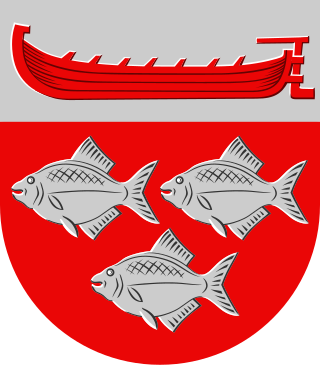
Ruovesi is a municipality of Finland.
Saarijärvi is a town and municipality of Finland located in the Central Finland region. The municipality has a population of 8,827, as of 31 August 2024, and covers an area of 1,422.72 square kilometres (549.32 sq mi) of which 170.8 km2 (65.9 sq mi), or 12%, is water. The population density is 7.05 inhabitants per square kilometre (18.3/sq mi).
Tohmajärvi is a municipality of Finland. It is located in the North Karelia region. The municipality has a population of 3,999 (31 August 2024) and covers an area of 895.36 square kilometres (345.70 sq mi) of which 57.62 km2 (22.25 sq mi) is water. The population density is 4.77 inhabitants per square kilometre (12.4/sq mi). The municipality is unilingually Finnish.
Urjala is a municipality of Finland. It is part of the Pirkanmaa region, near the town of Forssa. The municipality has a population of 4,528 and covers an area of 505.37 square kilometres (195.12 sq mi) of which 30.16 km2 (11.64 sq mi) is water. The population density is 9.52 inhabitants per square kilometre (24.7/sq mi).
Varkaus is a Middle-Savonian industrial town and municipality of Finland. It is located in the province of Eastern Finland and is part of the Northern Savonia region, between the city of Kuopio and the town of Savonlinna.
Vesilahti is a municipality in Finland, located in the Pirkanmaa region. It lies to the southwest of the regional capital, Tampere. The population of Vesilahti is approximately 4,000, while the metropolitan area has a population of approximately 421,000. It is the 181st most populous municipality in Finland.
Viitasaari is a Finnish town and municipality located in the Central Finland region. It is located between the neighbouring municipalities of Pihtipudas to the north and Äänekoski to the south. The town has a population of 5,768 (31 August 2024) and covers an area of 1,589.13 square kilometres (613.57 sq mi) of which 340.43 km2 (131.44 sq mi), or 21%, is water. There are all together 230 lakes in Viitasaari. The biggest lakes are Lake Keitele, Lake Kolima and Muuruejärvi. The population density is 4.62 inhabitants per square kilometre (12.0/sq mi).
Vimpeli is a municipality of Finland. It is located in the South Ostrobothnia region, 79 kilometres (49 mi) northeast of Seinäjoki and 166 kilometres (103 mi) northwest of Jyväskylä. The municipality has a population of 2,633 and covers an area of 328.79 square kilometres (126.95 sq mi) of which 41.52 km2 (16.03 sq mi) is water. The population density is 9.16 inhabitants per square kilometre (23.7/sq mi). The most significant road connection in the municipality is the main road 68 between towns of Virrat and Jakobstad.
Sulkava is a municipality of Finland. It is located in the Southern Savonia region. The municipality has a population of 2,382 and covers an area of 769.20 square kilometres (296.99 sq mi) of which 184.52 km2 (71.24 sq mi) is water. The population density is 4.08 inhabitants per square kilometre (10.6/sq mi).
Sastamala is a town in Finland, located in the Pirkanmaa region. Sastamala lies on both sides of River Kokemäenjoki in the southwest corner of Pirkanmaa. The population of Sastamala is approximately 23,000, while the sub-region has a population of approximately 26,000. It is the 44th most populous municipality in Finland.
Mänttä-Vilppula is a town and municipality of Finland. The municipalities of Mänttä and Vilppula were consolidated into a single municipality on January 1, 2009. It is located in the Pirkanmaa region.
Media related to Virrat at Wikimedia Commons