Kangasala is a town in Finland, located in the Pirkanmaa region. It lies to the east of the regional capital, Tampere. The population of Kangasala is approximately 33,000, while the metropolitan area has a population of approximately 417,000. It is the 35th most populous municipality in Finland.

Lempäälä is a municipality in Finland, located in the Pirkanmaa region. It lies south of the regional capital, Tampere. The population of Lempäälä is approximately 25,000, while the metropolitan area has a population of approximately 417,000. It is the 42nd most populous municipality in Finland.
Nurmijärvi is a municipality in Finland, located in the southern interior of the country. Nurmijärvi is situated in the Uusimaa region. The population of Nurmijärvi is approximately 45,000. It is the 26th most populous municipality in Finland and the most populous municipality without city status. Nurmijärvi is part of the Helsinki metropolitan area, which has approximately 1.58 million inhabitants.

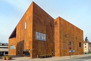
Pirkanmaa, also known as Tampere Region in government documents, is a region of Finland. It borders the regions of Satakunta, South Ostrobothnia, Central Finland, Päijät-Häme, Kanta-Häme and Southwest Finland. Most of the water area in the Kokemäki River watershed is located in the Pirkanmaa region, although Lake Vanajavesi is partly in the Kanta-Häme region. The region got its name from Pirkkala, which in the Middle Ages comprised most of present-day Pirkanmaa. Tampere is the regional center and capital of Pirkanmaa, and at the same time the largest city in the region.

Valkeakoski is a town and municipality in Finland. It is located 35 kilometres (22 mi) south of Tampere, 45 km (28 mi) north of Hämeenlinna and 150 km (93 mi) north of Helsinki in the Pirkanmaa region. The municipality has a population of 20,694 (31 December 2023) and covers an area of 372.03 square kilometres (143.64 sq mi) of which 100.06 km2 (38.63 sq mi) is water. The population density is 76.07 inhabitants per square kilometre (197.0/sq mi).

Ylöjärvi is a town in Finland, located in the Pirkanmaa region. It lies to the west of the regional capital, Tampere. The population of Ylöjärvi is approximately 34,000, while the metropolitan area has a population of approximately 417,000. It is the 34th most populous municipality in Finland, and the third largest in the Pirkanmaa region after Tampere and Nokia.

Huittinen is a town and municipality in Finland. It is located in the Satakunta region, 63 kilometres (39 mi) southeast of Pori and 75 kilometres (47 mi) southwest of Tampere. The town has a population of 9,646 and covers an area of 539.59 square kilometres (208.34 sq mi) of which 6.97 km2 (2.69 sq mi) is water. The population density is 18.11 inhabitants per square kilometre (46.9/sq mi).

Juupajoki is a municipality of Finland. It is located in the Pirkanmaa region. The municipality has a population of 1,708, which makes it the smallest municipality in Pirkanmaa in terms of population. It covers an area of 274.95 square kilometres (106.16 sq mi) of which 16.47 km2 (6.36 sq mi) is water. The population density is 6.61 inhabitants per square kilometre (17.1/sq mi). Korkeakoski is the administrative center of the municipality.

Jämsä is a town and municipality of Finland. It is located in the Central Finland region, about 58 kilometres (36 mi) southwest of Jyväskylä. The municipality has a population of 19,182, which makes it the second largest town of the Central Finland after Jyväskylä. It covers an area of 1,823.90 square kilometres (704.21 sq mi) of which 252.57 km2 (97.52 sq mi) is water. The population density is 12.21 inhabitants per square kilometre (31.6/sq mi).

Keuruu is a town and municipality of Finland. It is located in the province of Western Finland and is part of the Central Finland region. The municipality has a population of 9,184 and covers an area of 1,430.57 square kilometres (552.35 sq mi) of which 172.4 km2 (66.6 sq mi) is water. The population density is 7.3 inhabitants per square kilometre (19/sq mi). The town center and Haapamäki village are both the most populated places in Keuruu.

Kokemäki is a town and municipality in the Satakunta Region of Finland. The town has a population of 6,766 and covers an area of 531.27 square kilometres (205.12 sq mi) of which 50.04 km2 (19.32 sq mi) is water. The population density is 14.08 inhabitants per square kilometre (36.5/sq mi).

Outokumpu is a town and municipality of Finland. It is located in the North Karelia region, 48 kilometres (30 mi) west of Joensuu and 92 kilometres (57 mi) east of Kuopio. The municipality has a population of 6,409 and covers an area of 584.05 square kilometres (225.50 sq mi) of which 138.22 km2 (53.37 sq mi) is water. The population density is 14.37 inhabitants per square kilometre (37.2/sq mi). The most important road connection in the locality is Highway 9.

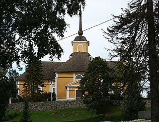
Pälkäne is a municipality of Finland. It is part of the Pirkanmaa region. The municipality has a population of 6,337 and covers an area of 738.15 square kilometres (285.00 sq mi) of which 177.65 km2 (68.59 sq mi). The population density is 11.3 inhabitants per square kilometre (29/sq mi). Onkkaala is the administrative center of the municipality. Tampere is located 38 kilometres (24 mi) northwest of the center of Pälkäne.
Ruovesi is a municipality of Finland.

Somero is a town and municipality of Finland. It is part of the Southwest Finland region in the province of Western Finland, located 36 kilometres (22 mi) northeast of Salo, 86 kilometres (53 mi) east of Turku and 105 kilometres (65 mi) northwest of Helsinki. The municipality has a population of 8,410 and covers an area of 697.67 square kilometres (269.37 sq mi) of which 29.9 km2 (11.5 sq mi) is water. The population density is 12.59 inhabitants per square kilometre (32.6/sq mi). Somero is unilingually Finnish.
Tohmajärvi is a municipality of Finland. It is located in the North Karelia region. The municipality has a population of 4,066 (31 December 2023) and covers an area of 895.36 square kilometres (345.70 sq mi) of which 57.62 km2 (22.25 sq mi) is water. The population density is 4.85 inhabitants per square kilometre (12.6/sq mi). The municipality is unilingually Finnish.

Tuusula is a municipality in Finland, located in the southern interior of the country. Tuusula is situated in the centre of the Uusimaa region. The population of Tuusula is approximately 41,000. It is the 27th most populous municipality in Finland and the second most populous municipality without city status after Nurmijärvi. Tuusula is part of the Helsinki metropolitan area, which has approximately 1.58 million inhabitants.
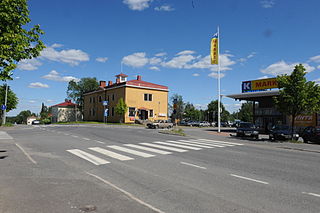
Urjala is a municipality of Finland. It is part of the Pirkanmaa region, near the town of Forssa. The municipality has a population of 4,568 and covers an area of 505.37 square kilometres (195.12 sq mi) of which 30.16 km2 (11.64 sq mi) is water. The population density is 9.61 inhabitants per square kilometre (24.9/sq mi).

Virrat is a town and municipality of Finland. It is part of the Pirkanmaa region, and it is located 104 kilometres (65 mi) north of Tampere and 113 kilometres (70 mi) west of Jyväskylä. The distance between Virrat and Helsinki is 285 kilometres (177 mi). The town has a population of 6,275 (31 December 2023) and covers an area of 1,299.07 square kilometres (501.57 sq mi) of which 136.73 km2 (52.79 sq mi) is water. The population density is 5.4 inhabitants per square kilometre (14/sq mi). The municipality is unilingually Finnish.

Mänttä-Vilppula is a town and municipality of Finland. The municipalities of Mänttä and Vilppula were consolidated into a single municipality on January 1, 2009. It is located in the Pirkanmaa region.


