Venetian Islands, Florida

Last updated
Venetian Islands
Venetian Causeway South Beach.jpg
View of the Venetian Causeway and Venetian Islands with South Beach in the background, as seen from the Arts & Entertainment District neighborhood
Miami neighborhoodsmap.png
Venetian Islands neighborhood within the City of Miami
Coordinates: 25°47′26.99″N80°9′39.51″W / 25.7908306°N 80.1609750°W / 25.7908306; -80.1609750
Country United States
State Florida
County Miami-Dade County
City Miami
Islands of the Venetians Islands
Government
  City of Miami CommissionerKen Russell
  Miami-Dade CommissionersAudrey Edmonson
   House of Representatives Vicki Lopez (R)
   State Senate Ileana Garcia (R)
   U.S. House Maria Elvira Salazar (R)
Time zone UTC-05 (EST)
ZIP Code
33139
Area code(s) 305, 786
Aerial view of the westernmost Venetian Islands from the Arts & Entertainment District Biscayne Island.jpg
Aerial view of the westernmost Venetian Islands from the Arts & Entertainment District

The Venetian Islands are a chain of artificial islands in Biscayne Bay in the cities of Miami and Miami Beach, Florida. The islands are, from west to east: Biscayne Island (Miami), San Marco Island (Miami), San Marino Island (Miami Beach), Di Lido Island (Miami Beach), Rivo Alto Island (Miami Beach), and Belle Isle (Miami Beach). Flagler Monument Island remains an uninhabited picnic island, originally built in 1920 as a memorial to railroad pioneer Henry Flagler. The islands are connected by bridges from the Miami mainland to Miami Beach.

Contents

History

The Venetian Islands project was proposed to be much larger than what exists today. Another causeway was to be built, called "The Drive of the Campanili." The causeway would connect Hibiscus Island (south of the Venetian Islands) with Di Lido Island. The road would then continue north right up the center of Biscayne Bay, with five new islands created along its path. The roadway would then veer slightly to the northeast, where it would end at Indian Creek Village. An additional four islands would be built along two east-west roads that would connect with the causeway. One of these roads was along the current route of the Julia Tuttle Causeway and the other along the current route of the 79th Street Causeway. [1]

The original bridge (called the Collins Bridge) was built by farmer and developer John S. Collins with financial assistance from automotive parts and racing pioneer Carl G. Fisher. At the time it was completed, it was the longest wooden bridge in the world. The 2½ mile wooden toll bridge opened on June 12, 1913, providing a critical link to the newly established city of Miami Beach, formerly accessible only by a ferry service.

While none of these islands were built, the foundation pillings for one of them can still be seen in Central Biscayne Bay between Di Lido Island and the Julia Tuttle Causeway. The island was to be called Isola di Lolando. [2] The demise of the island construction was due to a combination of the aftermath of the 1926 Miami Hurricane and the end of the Florida land boom of the 1920s. The Shoreland Company went bankrupt in 1927 due to objections of "further mutilation of the waterway". [3]

The original wooden causeway was replaced in 1925 by a series of arch drawbridges and renamed the Venetian Causeway. Today, the causeway is a popular stretch for people to jog, ride bikes, walk dogs and stroll. The islands offer residents a suburb feel that is located between (and within minutes of) Miami Beach's South Beach and Miami's new Adrienne Arsht Center for the Performing Arts.

Biscayne Island

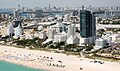
Biscayne Island is a neighborhood in the City of Miami, Florida, United States. It is also the westernmost of the Venetian Islands, a chain of artificial islands in Biscayne Bay. [4] During the 1930s, the island was used as an airport known as Viking Airport, with a hangar, 2,600-foot sod runway and seaplane ramps; the airport was closed by 1937 and residential development began in the 1940s. [5] The island is now home to apartment buildings, residential neighborhoods, and a toll plaza portion of the Venetian Causeway.

Demographics

As of 2000, the population of Biscayne Island had 412 people. The zip code for Biscayne Island is 33139. The area covers 0.181 square miles (0.47 km2). As of 2000, there were 215 males and 197 females. The median age for males were 42.1 years old, while the median age for females were 48.0 years old. The average household size had 1.6 people, while the average family size had 2.4 members. The percentage of married-couple families (among all households) was 28.8%, while the percentage of married-couple families with children (among all households) was 4.0%, and the percentage of single-mother households (among all households) was 0.8%. The percentage of never-married males 15 years old and over was 19.6%, while the percentage of never-married females 15 years old and over was 14.6%. [6]

As of 2000, the percentage of people that speak English not well or not at all made up 6.9% of the population. The percentage of residents born in Florida was 24.8%, the percentage of people born in another U.S. state was 24.8%, and the percentage of native residents but born outside the U.S. was 4.7%, while the percentage of foreign born residents was 45.7%. [6]

San Marco Island

San Marco Island is a neighborhood in the City of Miami, Florida, United States. It is the 2nd westernmost of the Venetian Islands, a chain of artificial islands in Biscayne Bay. It is between Biscayne Island and San Marino Island. It contains upscale houses and the Venetian Causeway. [7]

Education

The local school district for the entire county is Miami-Dade County Public Schools. Zoned schools for the Venetian Islands include:

Related Research Articles

<span class="mw-page-title-main">Bay Harbor Islands, Florida</span> Town in Florida

Bay Harbor Islands is a town in Miami-Dade County, Florida, United States. The town is part of the Miami metropolitan area of South Florida. It is separated from the mainland by Biscayne Bay. The population was 5,922 at the 2020 US census.

<span class="mw-page-title-main">Fisher Island, Florida</span> Census-designated place in Florida

Fisher Island is a census-designated place in Miami-Dade County, Florida, United States, located on a barrier island of the same name. Since 2015, Fisher Island has the highest per capita income of any place in the United States. It is located in the Miami metropolitan area of South Florida. As of the 2020 census, the population was 561.

<span class="mw-page-title-main">Indian Creek, Florida</span> Village in Florida

Indian Creek is a village, gated community, and man-made barrier island in Miami-Dade County, Florida, United States. It has 41 residential home sites and the Indian Creek Country Club. The village is part of the Miami metropolitan area of South Florida. The concentration of highly affluent people on the island has earned it the nickname "Billionaire Bunker". The population was 84 at the 2020 census. The village has its own government and law enforcement.

<span class="mw-page-title-main">North Bay Village, Florida</span> City in Florida

North Bay Village is a city located in Miami-Dade County, Florida. The city is part of the Miami metropolitan area of South Florida. As of the 2020 census, the city had a total population of 8,159.

<span class="mw-page-title-main">Biscayne Bay</span> Florida lagoon

Biscayne Bay is a lagoon with characteristics of an estuary located on the Atlantic coast of South Florida. The northern end of the lagoon is surrounded by the densely developed heart of the Miami metropolitan area while the southern end is largely undeveloped with a large portion of the lagoon included in Biscayne National Park.

<span class="mw-page-title-main">Key Biscayne</span> Island in Florida, United States

Key Biscayne is an island located in Miami-Dade County, Florida, located between the Atlantic Ocean and Biscayne Bay. It is the southernmost of the barrier islands along the Atlantic coast of Florida, and lies south of Miami Beach and southeast of Miami. The key is connected to Miami via the Rickenbacker Causeway, originally built in 1947.

<span class="mw-page-title-main">Watson Island</span> Neighborhood of Miami in Miami-Dade County, Florida, United States

Watson Island is a neighborhood and man-made island in Biscayne Bay, in Miami, Florida. It is located Immediately east of the Central Business District and Arts & Entertainment District neighborhoods of downtown Miami and is connected to the mainland and South Beach, Miami Beach by the MacArthur Causeway.

<span class="mw-page-title-main">Adrienne Arsht Center station</span> Miami Metromover station

Adrienne Arsht Center station, formerly Omni station, is a Metromover station in the Arts & Entertainment District neighborhood of Downtown, Miami, Florida, United States. The station is adjacent to the Adrienne Arsht Center for the Performing Arts, just west of The Miami Herald building and the Venetian Causeway, and directly south of the MacArthur Causeway.

<span class="mw-page-title-main">Venetian Causeway</span> Bridge in Miami-Dade County, Florida, Florida, United States

The Venetian Causeway crosses Biscayne Bay between Miami on the mainland and Miami Beach on a barrier island in the Miami metropolitan area. The man-made Venetian Islands and non-bridge portions of the causeway were created by materials which came from the dredging of the bay. The Venetian Causeway follows the original route of the Collins Bridge, a wooden 2.5 mi (4 km) long structure built in 1913 by John S. Collins and Carl G. Fisher which opened up the barrier island for unprecedented growth and development.

<span class="mw-page-title-main">Florida State Road 913</span> State highway in Florida, United States

State Road 913 is an access road between the village of Key Biscayne on the island of Key Biscayne and I-95 in Miami on the western end of Biscayne Bay.

<span class="mw-page-title-main">MacArthur Causeway</span> Bridge in Florida, United States of America

The General Douglas MacArthur Causeway is a six-lane causeway that connects Downtown Miami to South Beach via Biscayne Bay in Miami-Dade County.

<span class="mw-page-title-main">Rickenbacker Causeway</span> Bridge in Florida, United States of America

The Rickenbacker Causeway is a causeway that connects Miami, Florida to the barrier islands of Virginia Key and Key Biscayne across Biscayne Bay.

<span class="mw-page-title-main">Belle Isle (Miami Beach)</span> Neighborhood of Miami Beach in Miami-Dade County, Florida, United States

Belle Isle is a neighborhood in the city of Miami Beach on an island in Biscayne Bay, Florida, United States. It is the easternmost of the Venetian Islands, a chain of artificial islands in Biscayne Bay in the cities of Miami and Miami Beach. It is home to apartment buildings, a portion of the Venetian Causeway, a city of Miami Beach park, and a hotel. It is between Rivo Alto Island and the main barrier island of Miami Beach.

<span class="mw-page-title-main">Isola di Lolando</span>

Isola di Lolando is an unfinished artificial island in Biscayne Bay, Florida. Hurricane damage from the 1926 Miami hurricane, as well as the economic downturn that heralded the Great Depression, caused the project to be abandoned shortly after the start of construction, but pilings remain visible in the bay and are a hazard to navigation.

<span class="mw-page-title-main">Flagler Monument Island</span> Neighborhood of Miami Beach in Miami-Dade County, Florida, United States

Flagler Memorial Island is an uninhabited artificial island of South Beach in the city of Miami Beach in Biscayne Bay, Florida. A 110-foot (34 m) high obelisk with allegorical sculptures at its base stands as a monument to Miami pioneer Henry M. Flagler, and was built in the center of the freshly constructed island in memory of Flagler, who died in 1913.

<span class="mw-page-title-main">Brickell</span> Neighborhood of Miami in Miami-Dade County, Florida, United States

Brickell is a neighborhood in Miami, Florida, historically referenced at times as "Southside", located directly east of Interstate 95, south of the Miami River, and north of Coconut Grove. Brickell is known as the financial district of Miami, as well as South Florida.

<span class="mw-page-title-main">Greater Downtown Miami</span> Neighborhood in Miami-Dade County, Florida, United States

Downtown Miami is the urban city center of Miami, Florida, United States. The city's greater downtown region consists of the Central Business District, Brickell, the Historic District, Government Center, the Arts & Entertainment District, and Park West. It is divided by the Miami River and is bordered by Midtown Miami's Edgewater, and Wynwood sections to its north, Biscayne Bay to its east, the Health District and Overtown to its west, and Coconut Grove to its south.

Star Island is a neighborhood in the city of Miami Beach on a man-made island in Biscayne Bay, Florida, United States. The island is south of the Venetian Islands and just east of Palm and Hibiscus islands.

<span class="mw-page-title-main">Palm Island (Miami Beach)</span> Neighborhood of Miami Beach in Miami-Dade County, Florida, United States

Palm Island is a neighborhood in the city of Miami Beach on a man-made island in Biscayne Bay, Florida, United States; just south of Hibiscus Island. It is a residential neighborhood with high property values, solely accessible by land via the MacArthur Causeway. The entire island has an area of 82 acres (33 ha).

Isle of Normandy or Normandy Island or Normandy Isles or Normandy Isle is a neighborhood of North Beach in the city of Miami Beach, Florida. It is located along the eastern shore of Biscayne Bay.

References

  1. The Miami News – November 15, 1925, p. 13
  2. Florida InsideOut magazine, Competition No. 2
  3. Discussion of Biscayne Bay. nova.edu.
  4. Biscayne Island on Google Maps. Maps.google.com. Retrieved on 2012-07-03.
  5. Freeman, Paul. "Abandoned & Little-Known Airfields: Florida: Central Miami Area" . Retrieved 5 February 2016.
  6. 1 2 "Demographics of Biscayne Island, Miami, FL". city-data . Retrieved 2009-09-03.
  7. San Marco Island on Google Maps. Maps.google.com. Retrieved on 2012-07-03.
  8. "North Beach ES School Legal Boundaries Description." Miami-Dade County Public Schools. Retrieved on November 21, 2024.
  9. "Miami Beach Nautilus MS School Legal Boundaries Description." Miami-Dade County Public Schools. Retrieved on November 21, 2024.
  10. "Miami Beach SHS School Legal Boundaries Description." Miami-Dade County Public Schools. Retrieved on November 21, 2024.

25°47′26.99″N80°9′39.51″W / 25.7908306°N 80.1609750°W / 25.7908306; -80.1609750