
A cemetery, burial ground, gravesite, graveyard, or a green space called a memorial park, is a place where the remains of dead people are buried or otherwise interred. The word cemetery implies that the land is specifically designated as a burial ground and originally applied to the Roman catacombs. The term graveyard is often used interchangeably with cemetery, but a graveyard primarily refers to a burial ground within a churchyard.

Green-Wood Cemetery is a 478-acre (193 ha) cemetery in the western portion of Brooklyn, New York City. The cemetery is located between South Slope/Greenwood Heights, Park Slope, Windsor Terrace, Borough Park, Kensington, and Sunset Park, and lies several blocks southwest of Prospect Park. Its boundaries include, among other streets, 20th Street to the northeast, Fifth Avenue to the northwest, 36th and 37th Streets to the southwest, Fort Hamilton Parkway to the south, and McDonald Avenue to the east.

West Roxbury is a neighborhood in Boston, Massachusetts, United States, bordered by Roslindale to the northeast, the village of Chestnut Hill and the town of Brookline to the north, the city of Newton to the northwest, the towns of Dedham and Needham to the southwest, and Hyde Park to the southeast. West Roxbury is often mistakenly confused with Roxbury, but the two are separated from each other by Roslindale and Jamaica Plain.

Hollywood Cemetery is a historic rural cemetery located at 412 South Cherry Street in the Oregon Hill neighborhood of Richmond, Virginia. It was established in 1847 and designed by the landscape architect John Notman. It is 135-acres in size and overlooks the James River. It is one of three places in the United States that contains the burials of two U.S. Presidents, the others being Arlington National Cemetery and United First Parish Church.
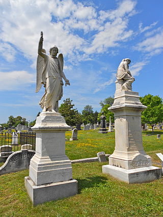
The Congressional Cemetery, officially Washington Parish Burial Ground, is a historic and active cemetery located at 1801 E Street, S.E., in Washington, D.C., on the west bank of the Anacostia River. It is the only American "cemetery of national memory" founded before the Civil War. Over 65,000 individuals are buried or memorialized at the cemetery, including many who helped form the nation and Washington, D.C. in the early 19th century.

Richmond National Cemetery is a United States National Cemetery three miles (4.8 km) east of Richmond in Henrico County, Virginia. Administered by the United States Department of Veterans Affairs, it encompasses 9.7 acres (3.9 ha), and as of 2021 had more than 11,000 interments. It is closed to new interments. Richmond National Cemetery was listed on the National Register of Historic Places in 1995.
East Parish Burying Ground, also known as Centre Street Burying Ground or Centre Street Cemetery, is an historic cemetery located at Centre and Cotton streets in the village of Newton Corner in the city of Newton, Massachusetts. On December 23, 1983, it was listed on the National Register of Historic Places. It has been called the "most important, the most evocative and also the most fragile historic site in the city."
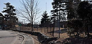
The South Burying Ground, also known as Winchester Street Cemetery, or Evergreen Cemetery, is an historic cemetery located on Winchester Street in the village of Newton Highlands, in the city of Newton, Massachusetts. Established in 1802, it is Newton's third cemetery. It has 357 recorded burials, dating between 1803 and 1938. The cemetery was listed on the National Register of Historic Places in 2004.
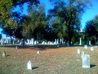
The Shockoe Hill Cemetery is a historic cemetery located on Shockoe Hill in Richmond, Virginia.

The Mechanic Street Cemetery is a historic early cemetery on Mechanic Street in Westfield, Massachusetts. The 4-acre (1.6 ha) cemetery is the city's oldest, with the oldest documented grave dating to 1683. It was used as a burying ground until the late 19th century, although its use began to decline in the middle of the century, with the advent of the popular rural cemetery movement, which was reflected in Westfield with the establishment of the new Pine Hill Cemetery in 1842. No burials were recorded in the 20th century. Although the cemetery has been subjected to some maintenance work, it continues to suffer the effects of vandalism and weather. The cemetery was listed on the National Register of Historic Places in 2002.

Oakwood Cemetery is a nonsectarian rural cemetery in northeastern Troy, New York, United States. It operates under the direction of the Troy Cemetery Association, a non-profit board of directors that deals strictly with the operation of the cemetery. It was established in 1848 in response to the growing rural cemetery movement in New England and went into service in 1850. The cemetery was designed by architect John C. Sidney and underwent its greatest development in the late 19th century under superintendent John Boetcher, who incorporated rare foliage and a clear landscape design strategy. Oakwood was the fourth rural cemetery opened in New York and its governing body was the first rural cemetery association created in the state.

Hope Cemetery is an historic rural cemetery at 119 Webster Street in Worcester, Massachusetts. Established in 1854, it was the city's sixth public cemetery, and is the burial site of remains originally interred at its first five cemeteries. Its landscaping and funerary art are examplars of the rural cemetery movement, and the cemetery was listed on the National Register of Historic Places in 1997. The cemetery occupies 168 acres (68 ha).

The English coastal city of Brighton and Hove, made up of the formerly separate Boroughs of Brighton and Hove in East Sussex, has a wide range of cemeteries throughout its urban area. Many were established in the mid-19th century, a time in which the Victorian "cult of death" encouraged extravagant, expensive memorials set in carefully cultivated landscapes which were even recommended as tourist attractions. Some of the largest, such as the Extra Mural Cemetery and the Brighton and Preston Cemetery, were set in particularly impressive natural landscapes. Brighton and Hove City Council, the local authority responsible for public services in the city, manages seven cemeteries, one of which also has the city's main crematorium. An eighth cemetery and a second crematorium are owned by a private company. Many cemeteries are full and no longer accept new burials. The council maintains administrative offices and a mortuary at the Woodvale Cemetery, and employs a coroner and support staff.

Mount Zion Cemetery/Female Union Band Society Cemetery is a historic cemetery located at 27th Street NW and Mill Road NW in the Georgetown neighborhood of Washington, D.C., in the United States. The cemetery is actually two adjoining burial grounds: the Mount Zion Cemetery and Female Union Band Society Cemetery. Together these cemeteries occupy approximately three and a half acres of land. The property fronts Mill Road NW and overlooks Rock Creek Park to the rear. Mount Zion Cemetery, positioned to the East, is approximately 67,300 square feet in area; the Female Union Band Cemetery, situated to the West, contains approximately 66,500 square feet. Mount Zion Cemetery, founded in 1808 as The Old Methodist Burial Ground, was leased property later sold to Mount Zion United Methodist Church. Although the cemetery buried both White and Black persons since its inception, it served an almost exclusively African American population after 1849. In 1842, the Female Union Band Society purchased the western lot to establish a secular burying ground for African Americans. Both cemeteries were abandoned by 1950.
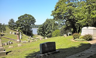
Woodland Cemetery is a historic cemetery located at 1020 South Fifth Street in Quincy, Illinois. Planned by politician John Wood and opened in 1846, the cemetery is a product of America's rural cemetery movement of the mid-nineteenth century. The cemetery's grave markers include smaller Victorian monuments and large Gothic Revival and Neoclassical structures. The cemetery was added to the National Register of Historic Places in 2002.

The Old Newton Burial Ground is a historic cemetery located in Newton, Sussex County, New Jersey. The cemetery was the primary burial ground in the town for a century after its establishment in 1762. As the burial ground would reach capacity, the state legislature incorporated the Newton Cemetery Company which began operating a new cemetery in 1867. After this time, interments would continue at the old burial ground intermittently until 1943. The burial ground contains the graves of members of local families from Newton and the surrounding areas, and includes several local and state political figures, prominent citizens, and veterans. While nineteenth-century sources attest 5,000 burials within the cemetery, a recent transcription lists only 1,287 individual known graves.
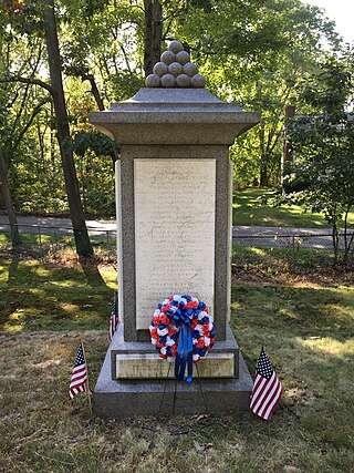
The Old Village Cemetery is an historic cemetery in Dedham, Massachusetts.
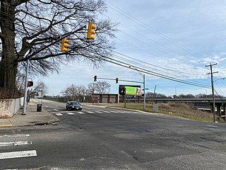
The Shockoe Hill African Burying Ground was established by the city of Richmond, Virginia, for the interment of free people of color, and the enslaved. The heart of this now invisible burying ground is located at 1305 N 5th St.

Piscatawaytown is the oldest neighborhood in Edison in Middlesex County, New Jersey. It was established in the 1660s as the original village in what was then within Piscataway. Piscatawaytown is centered around St. James Church, the Piscatawaytown Burial Ground and the Piscatawaytown Common, near the intersection of Plainfield and Woodbridge Avenues.


