Northmead is a suburb of Greater Western Sydney, in the state of New South Wales, Australia. Northmead is located 26 kilometres west of the Sydney central business district, in the local government area of the City of Parramatta.

Albion Park is a suburb situated in the Macquarie Valley in the City of Shellharbour, which is in turn one of the three local government areas that comprise the Wollongong Metropolitan Area, New South Wales, Australia. Although it is surrounded by a 'green belt' of farms, Albion Park had a population of 13,316 at the 2016 census.

The Fairfield City Council is a local government area in the west of Sydney, in the state of New South Wales, Australia. The council was first incorporated as the "Municipal District of Smithfield and Fairfield" on 8 December 1888, and the council's name was changed to the "Municipality of Fairfield" in 1920, before being proclaimed a city in 1979. The City of Fairfield comprises an area of 102 square kilometres (39 sq mi) and as of the 2016 census had a population of 198,817. The Mayor of the City of Fairfield is Cr. Frank Carbone, the first popularly-elected independent mayor of Fairfield.

The Lane Cove Council is a local government area located on the Lower North Shore of Sydney, New South Wales, Australia. The administrative seat of Lane Cove is located 10 kilometres (6.2 mi) north-west of the Sydney central business district.

The City of Penrith is a local government area in the state of New South Wales, Australia. The seat of the city is located in Penrith, located about 50 kilometres (31 mi) west of Sydney's central business district. It occupies part of the traditional lands of the Darug people. First incorporated as a municipality on 12 May 1871, on 1 January 1949, the municipalities of Penrith, St Marys and Castlereagh and part of the Nepean Shire amalgamated to form a new Municipality of Penrith. Penrith was declared a City on 21 October 1959, and expanded westwards to include Emu Plains and Emu Heights, formerly part of the City of Blue Mountains, on 25 October 1963. As at the 2016 census the City of Penrith had an estimated population of 196,066
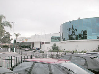
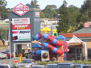
Mount Pritchard is a suburb of Sydney, in the state of New South Wales, Australia 34 kilometres south-west of the Sydney central business district, in the local government areas of the City of Fairfield and the City of Liverpool, and is part of the South-western Sydney region.

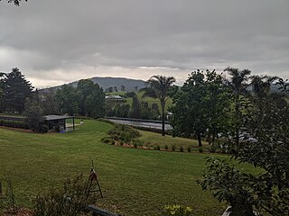
Mount Murray is a mountain in New South Wales, Australia with an elevation of 780 metres above sea level. It is located six kilometres outside Robertson. The mountain is named after Sir George Murray. Mount Murray is also the name of a location at the top of the Macquarie Pass on the Illawarra Highway. At the 2016 census, it had a population of 54.

The Wollongong High School of the Performing Arts is a government-funded co-educational comprehensive and specialist secondary day school with speciality in performing arts, located in Fairy Meadow, a suburb of Wollongong, New South Wales, Australia.
Willow Vale is a Northern Village of the Southern Highlands of New South Wales, Australia, in Wingecarribee Shire. It is located 1 km north of Mittagong and is often considered part of Braemar along with its neighbour Balaclava. At the 2016 census, Willow Vale had a population of 717.

The states and territories of Australia are the second level of government division in Australia, between the federal government and local governments. States and territories are self-administered regions with a local legislature, police force and certain civil authorities, and are represented in the Parliament of Australia. Territories though, unlike states, rely on federal legislation and additional financial contributions to operate, and have less representation in the Senate.
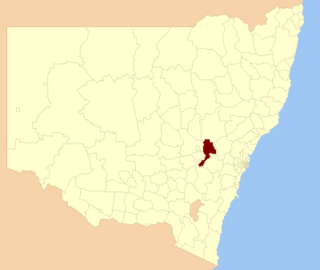
Bathurst Regional Council is a local government area in the Central West region of New South Wales, Australia. The area is located adjacent to the Great Western Highway, Mid-Western Highway, Mitchell Highway and the Main Western railway line. At the 2016 census, the Bathurst Region had a population of 41,300.

Brewarrina Shire is a local government area in the Orana region of New South Wales, Australia. The Shire is located adjacent to the Darling River, which is known as the Barwon River upstream from Bourke; and located adjacent to the Kamilaroi Highway. The northern boundary of the Shire is located adjacent to the border between New South Wales and Queensland. The Shire is a wool and cotton growing area.
St Georges Basin is a town in the South Coast region of New South Wales, Australia. St George Basin is located on the shores of St Georges Basin, within the City of Shoalhaven. It is roughly 25 kilometres (16 mi) south of Nowra, and approximately 200 kilometres (120 mi) south of Sydney.

Burrawang is a village in the Southern Highlands of New South Wales, Australia in Wingecarribee Shire. According to the 2016 Australian census, Burrawang's population was 361.
Glenquarry is a locality in the Southern Highlands of New South Wales, Australia, in Wingecarribee Shire. It is a scattered village on the banks of the Wingecarribee River. At the 2016 census, it had a population of 222.
Wattle Ridge is a locality in the Southern Highlands of New South Wales, Australia, in Wingecarribee Shire. It is located near Buxton and Balmoral. At the 2016 census, it had a population of 4.

Mount Fairy is a locality in the Queanbeyan–Palerang Regional Council, New South Wales, Australia. It is located to the east of the Bungendore–Tarago road. At the 2016 census, it had a population of 205.

Meroo Meadow is a suburb in the City of Shoalhaven in New South Wales, Australia. It lies on the Princes Highway about 33 southwest of Kiama and 9 km north of Nowra. At the 2016 census, it had a population of 472.
Far Meadow is a locality in the City of Shoalhaven in New South Wales, Australia. It lies to the south of Coolangatta Road to the southeast of Berry. At the 2016 census, it had a population of 215.
