
Snowtown is a town located in the Mid North of South Australia 145 km north of Adelaide and lies on the main road and rail routes between Adelaide and Perth – the Augusta Highway and Adelaide-Port Augusta railway line. The town's elevation is 103 metres and on average the town receives 389 mm of rainfall per annum.
Dublin is a small town on the Adelaide Plains in South Australia, 61 kilometres (38 mi) north of the state capital, Adelaide. Situated on Highway 1, the town is surrounded by farmland and rural industry. Along with nearby Windsor the area is home to a growing commuter population. At the 2006 census, Dublin had a population of 241.

Port Wakefield is a town at the mouth of the River Wakefield, at the head of the Gulf St Vincent in South Australia. It was the first government town to be established north of the state capital, Adelaide. Port Wakefield is situated 98.7 kilometres from the Adelaide city centre on the Port Wakefield Highway section of the A1 National Highway.

The town of Balaklava is located in South Australia, 92 kilometres north of Adelaide in the Mid North region. It is on the south bank of the Wakefield River, 25 kilometres east of Port Wakefield.

The City of Enfield was a local government area of South Australia from 1868 to 1996. It was known as Yatala South up until 1933, which was named for its local government area predecessor, the District Council of Yatala, and known as Enfield thereafter.

The Adelaide Plains Council is a local government area in South Australia. It consists of a largely rural region along the Gulf St Vincent, covering a total area of approximately 926 km2. The council seat lies at Mallala, but it also maintains a service centre at Two Wells.

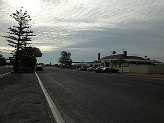
Whitwarta is a town in South Australia. The town is situated beside the Wakefield River about 100 km north of the state capital, Adelaide. The name Whitwarta means freshwater, a reference to the freshwater springs that exist along the pronounced bend in the river nearby. The constant availability of freshwater along an otherwise dry river meant that Whitwarta was a suitable place to establish a village. Approximately 20 people now live in the village.
The City of Port Adelaide was a local government area of South Australia centred at the port of Adelaide from 1855 to 1996.

John Howard Clark was editor of The South Australian Register from 1870 to 1877 and was responsible for its Echoes from the Bush column and closely associated with its Geoffry Crabthorn persona.
Francis Clark and Son was an engineering business in the early days of South Australia, which later became Francis Clark and Sons.
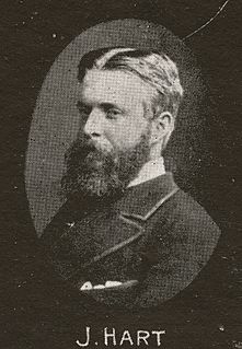
John Hart Jr. (1848–1881) was a member of the South Australian parliament from 1880 to 1881.

Alma is a small town in South Australia halfway between the Wakefield River, to the north, and River Light to the south. Alma, Alma South and Alma Plains were named for the cadastral Hundred of Alma in which they lie, which was in turn named after the Battle of the Alma, the site of an allied victory in the Crimean War.
Parham is a town and a locality in the Australian state of South Australia located on the eastern coastline of Gulf St Vincent about 63 kilometres north-northwest of the state capital of Adelaide and about 23 kilometres west of the municipal seat of Mallala.

Long Plains is a rural locality and small township on the northern Adelaide Plains in South Australia, 73 km north of Adelaide. It is divided between the Wakefield Regional Council and the Adelaide Plains Council. The formal boundaries were established in 1997 for the long established local name with respect of the section in the Adelaide Plains Council; the portion in the Wakefield Council was added in January 2000.
Grace Plains is a rural locality in South Australia on the northern Adelaide Plains about 64 kilometres (40 mi) north of the state capital of Adelaide. It is divided between the Adelaide Plains Council and the Wakefield Regional Council. The formal boundaries were established in June 1997 for the long established local name with respect of the section in the District Council of Mallala ; the portion in the Wakefield council was added in January 2000. It is named after Grace Montgomery Farrell, widow of Rev C. B. Howard, the first South Australian Colonial Chaplain; she later married James Farrell, Dean of Adelaide.
The District Council of Port Gawler was a local government area in South Australia from 1856 to 1935. It was proclaimed on 11 September 1856 after being severed from the District Council of Mudla Wirra.
The District Council of Balaklava was a local government area seated at Balaklava in South Australia from 1877 to 1983.

The District Council of Dublin was a local government area in South Australia from 1873 to 1935, seated at Dublin.
The District Council of Grace was a local government area in South Australia from 1874 to 1935, seated at Mallala.
John Crawford Woods, generally referred to as J. Crawford Woods, was the first minister of the Adelaide Unitarian Christian Church, South Australia, serving from 1855 to 1889.
