Yoder, Kansas

Last updated

Yoder, Kansas
CDP
Yoder Lumber Kansas.JPG
Hardware & Lumber (2014)
Map of Reno Co, Ks, USA.png
USA Kansas location map.svg
Red pog.svg
Yoder
Usa edcp location map.svg
Red pog.svg
Yoder
Coordinates: 37°56′25″N97°52′6″W / 37.94028°N 97.86833°W / 37.94028; -97.86833 [1]
Country United States
State Kansas
County Reno
Township Yoder
Founded1889
Named for Valentine Yoder
Area
  Total37.6 sq mi (97.5 km2)
  Land37.2 sq mi (96.5 km2)
  Water0.4 sq mi (1.0 km2)
Elevation
[1]
1,539 ft (469 m)
Population
 (2020) [2]
  Total165
  Density4.4/sq mi (1.7/km2)
Time zone UTC-6 (CST)
  Summer (DST) UTC-5 (CDT)
ZIP code
67585
Area code 620
FIPS code 20-80750
GNIS ID 473653 [1]
Website yoderkansas.com

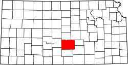
Yoder is a census-designated place (CDP) in Reno County, Kansas, United States. [1] As of the 2020 census, the population was 165. [2] It is located approximately 10 miles southeast of the city of Hutchinson on K-96. Although Yoder is unincorporated, with no city government, it does have a U.S. Post Office and its own ZIP code (67585). Yoder is the hub of a local Amish community.

Contents

History

The community derives its name from its Amish founder, Valentine Yoder.

The first post office in Yoder was established in November 1889. [3]

The community was home to the former Naval Air Station Hutchinson, later renamed to Hutchinson Air Force Station, and currently named as Sunflower Aerodrome Gliderport.

Geography

Climate

The climate in this area is characterized by hot, humid summers and generally mild to cool winters. According to the Köppen Climate Classification system, Yoder has a humid subtropical climate, abbreviated "Cfa" on climate maps. [4]

Demographics

Historical population
CensusPop.Note
2010 194
2020 165−14.9%
U.S. Decennial Census

Education

The community is served by Haven USD 312 public school district.

Area events

Yoder Heritage Day takes place annually on the fourth Saturday in August. [5]

Related Research Articles

<span class="mw-page-title-main">Oscoda, Michigan</span> Census-designated place & unincorporated community in Michigan, United States

Oscoda is an unincorporated community and census-designated place (CDP) in Iosco County in the U.S. state of Michigan. The CDP had a population of 916 at the 2020 census. The community is located within Au Sable Township and Oscoda Township at the mouth of the Au Sable River along Lake Huron.

<span class="mw-page-title-main">Reno County, Kansas</span> County in Kansas, United States

Reno County is a county located in the U.S. state of Kansas. Its county seat and largest city is Hutchinson. As of the 2020 census, the population was 61,898. The county is named for Jesse Reno, a general during the American Civil War.

<span class="mw-page-title-main">Hutchinson, Kansas</span> City in Reno County, Kansas

Hutchinson is the largest city and county seat in Reno County, Kansas, United States, and located on the Arkansas River. It has been home to salt mines since 1887, thus its nickname of "Salt City", but locals call it "Hutch". As of the 2020 census, the population of the city was 40,006.

<span class="mw-page-title-main">Camp Springs, Maryland</span> Census-designated place in Maryland

Camp Springs is an unincorporated area and census-designated place (CDP) in Prince George's County, Maryland, United States. The population was 22,734 at the 2020 census. Camp Springs is not an official post office designation; the area is divided among the surrounding mailing addresses of Temple Hills, Fort Washington, Clinton, and Suitland.

<span class="mw-page-title-main">K-96 (Kansas highway)</span> State highway in Kansas, United States

K-96 is a 300-mile-long (480 km) state highway in central and southern Kansas. Its western terminus is at the Colorado state line east of Towner, Colorado, where it continues as Colorado State Highway 96; its eastern terminus since 1999 is at U.S. Route 54/U.S. Route 400 in eastern Wichita.

<span class="mw-page-title-main">Ogallah, Kansas</span> Unincorporated community in Trego County, Kansas, United States

Ogallah is a census-designated place (CDP) in Trego County, Kansas, United States. As of the 2020 census, the population was 28. It is located approximately 7 miles east of WaKeeney.

<span class="mw-page-title-main">Mechanicsville, Maryland</span> Census-designated place in Maryland, United States

Mechanicsville is an unincorporated community and census-designated place in St. Mary's County, Maryland, United States. It is adjacent to the community of Charlotte Hall, which is known for its agriculture, Amish population, large farmers' market/flea market and the Maryland Veterans Home. Mechanicsville has many small businesses and restaurants along Maryland Route 5 and Maryland Route 235. The community is served by the St. Mary's County Public Schools, including Chopticon High School. At the 2010 census, Mechanicsville had a population of 1,528.

<span class="mw-page-title-main">Peck, Kansas</span> Unincorporated community in Sedgwick and Sumner Counties of Kansas

Peck is a census-designated place (CDP) in Sedgwick and Sumner counties in the U.S. state of Kansas. As of the 2020 census, the population areas was 162. It is located about 2 miles west of the Kansas Star Casino at Meridian Ave and 119th St S, next to the Union Pacific Railroad.

<span class="mw-page-title-main">Menoken, North Dakota</span> Census-designated place in North Dakota, United States

Menoken is an unincorporated community and a census-designated place (CDP) in southwestern Burleigh County, North Dakota, United States. It was designated as part of the U.S. Census Bureau's Participant Statistical Areas Program on June 10, 2010. It was not counted separately during the 2000 Census, but was included in the 2010 Census, where a population of 70 was reported.

<span class="mw-page-title-main">Sycamore, Kansas</span> Unincorporated community in Montgomery County, Kansas

Sycamore is a census-designated place (CDP) in northern Montgomery County, Kansas, United States. As of the 2020 census, the population was 70. It is located along U.S. Route 75 north of the city of Independence.

<span class="mw-page-title-main">Burdick, Kansas</span> Unincorporated community in Morris County, Kansas

Burdick is a census-designated place (CDP) in Morris County, Kansas, United States. It was named after Miss Burdick, the sweetheart of a Santa Fe Railroad official in 1887. As of the 2020 census, the population was 62. It is located southeast of Herington, about 5.6 miles (9.0 km) east of the intersection of U.S. Route 77 highway and 340th Street, or about 6.5 miles (10.5 km) east of Lost Springs.

<span class="mw-page-title-main">Grantville, Kansas</span> CDP in Kansas, United States

Grantville is a census-designated place (CDP) in Jefferson County, Kansas, United States. As of the 2020 census, the population was 182. It is located east of Topeka on the south side of US-24 highway between Barton Rd and KOA/Wilson Rd.

<span class="mw-page-title-main">Bridgeport, Kansas</span> Unincorporated community in Saline County, Kansas

Bridgeport is a census-designated place (CDP) in Smoky View Township, Saline County, Kansas, United States. As of the 2020 census, the population was 64. It is located south of Salina, along K-4 near Interstate 135.

<span class="mw-page-title-main">Centerville, Kansas</span> CDP in Kansas, United States

Centerville is a census-designated place (CDP) in Linn County, Kansas, United States. As of the 2020 census, the population was 78. It is located 8.5 miles (13.7 km) north of the city of Blue Mound.

<span class="mw-page-title-main">Vassar, Kansas</span> CDP in Kansas, United States

Vassar is a census-designated place (CDP) in Osage County, Kansas, United States. As of the 2020 census, the population was 584. It is located 4 miles (6.4 km) northeast of Lyndon, also about half a mile south of Pomona Lake.

<span class="mw-page-title-main">Greenwich, Kansas</span> Unincorporated community in Sedgwick County, Kansas

Greenwich is a census-designated place (CDP) in Sedgwick County, Kansas, United States. As of the 2020 census, the population was 64. It is located northeast of 53rd St North and Greenwich Rd.

<span class="mw-page-title-main">Rosalia, Kansas</span> Unincorporated community in Butler County, Kansas

Rosalia is a census-designated place (CDP) in Butler County, Kansas, United States. As of the 2020 census, the population was 149. It is located approximately 12 miles (19 km) east of El Dorado.

<span class="mw-page-title-main">Wright, Kansas</span> Unincorporated community in Ford County, Kansas

Wright is a census-designated place (CDP) in Ford County, Kansas, United States. As of the 2020 census, the population was 145. It is located along Highway 50.

<span class="mw-page-title-main">Eastshore, Kansas</span> Unincorporated community in Marion County, Kansas

Eastshore is a census-designated place (CDP) in Marion County, Kansas, United States. As of the 2020 census, the population was 92. The community name comes from it being near the east shore of the Marion Reservoir. It is located north of the intersection of Pawnee Road and 210th Street.

<span class="mw-page-title-main">Miller, Kansas</span> Unincorporated community in Lyon County, Kansas

Miller is an unincorporated community in Lyon County, Kansas, United States. It is located approximately 5.5 miles east of the city of Admire along Rd W7.

References

  1. 1 2 3 4 U.S. Geological Survey Geographic Names Information System: Yoder, Kansas
  2. 1 2 "Profile of Yoder, Kansas (CDP) in 2020". United States Census Bureau. Archived from the original on March 28, 2022. Retrieved March 28, 2022.
  3. "Kansas Post Offices, 1828-1961". Kansas Historical Society. p. 2. Retrieved June 22, 2014.
  4. Climate Summary for Yoder, Kansas
  5. Yoder Heritage Day

Further reading