
Ceredigion ( ), historically Cardiganshire, is a county in the west of Wales. It borders Gwynedd across the Dyfi estuary to the north, Powys to the east, Carmarthenshire and Pembrokeshire to the south, and the Irish Sea to the west. Aberystwyth is the largest settlement and, together with Aberaeron, is an administrative centre of Ceredigion County Council.

Devil's Bridge is a village and community in Ceredigion, Wales. Above the River Mynach on the edge of the village is a series of three stacked bridges, constructed hundreds of years apart, from which the village gets its English name.
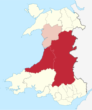
Mid Wales, or Central Wales, is a region of Wales, encompassing its midlands, in-between North Wales and South Wales. The Mid Wales Regional Committee of the Senedd covered the unitary authority areas of Ceredigion and Powys and the area of Gwynedd that had previously been the district of Meirionnydd. A similar definition is used by the BBC. The Wales Spatial Plan defines a region known as "Central Wales" which covers Ceredigion and Powys.
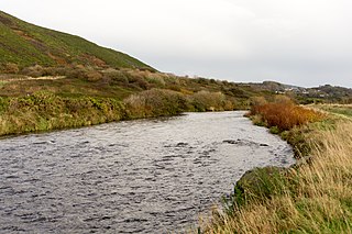
The River Ystwyth is a river in Ceredigion, Wales. The length of the main river is 20.5 miles (33.0 km). Its catchment area covers 75 square miles (190 km2). Its source is a number of streams that include the Afon Diliw, located on the west slopes of Plynlimon on the border of Ceredigion and Powys in the Cambrian Mountains. The Ystwyth flows westwards before its confluence with the Afon Rheidol and the estuary at Aberystwyth to drain into Cardigan Bay.

The Desert of Wales, or Green Desert of Wales, is an archaic term for an area in central Wales, so called for its lack of roads and towns, and its inaccessibility. The term was coined by English travel writers in the nineteenth century and has no equivalent in the Welsh language. The area corresponds roughly to the upland area called Elenydd in Welsh.

Afon Rheidol is a river in Ceredigion, Wales, 19 miles (31 km) in length. The source is Plynlimon. Receiving an average annual rainfall of 40 inches (1.02 m), Plynlimon is also the source of both the Wye and the Severn.

The Vale of Rheidol Railway is a 1 ft 11+3⁄4 in narrow gauge heritage railway in Ceredigion, Wales, between Aberystwyth and Devil's Bridge; a journey of 11+3⁄4 miles (18.9 km).
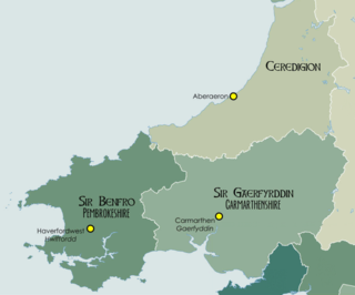
West Wales is a region of Wales.

Ponterwyd is a village in Ceredigion, Wales. It lies in the Cambrian Mountains of Mid Wales, approximately 12 miles (19 km) east of Aberystwyth on the A44 road.
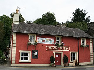
Cwmann is a small village in Carmarthenshire, Wales, in the community of Pencarreg. It is just on the border with Ceredigion and near Lampeter, with Cwmann being on the Carmarthenshire side of the border. The population in 2011 was around 872. As of 2021, the population was approximately 972.

Aberffrwd is a village in the Welsh principal area of Ceredigion. It has a railway station on the narrow-gauge Vale of Rheidol Railway, which was operated by British Rail as part of the island wide rail network until 1980.
The Plynlimon and Hafan Tramway was a 2 ft 3 in gauge narrow gauge railway in Cardiganshire in Mid Wales. It ran from Llanfihangel station on the Cambrian Line, through the village of Tal-y-bont and the valley of the Afon Leri, into the foothills of Plynlimon Fawr. It was built to serve the lead mines at Bwlch Glas and stone quarries around Hafan and opened in 1897, closing just two years later. The line was a little over 7 miles (11 km) long and, despite running a short-lived passenger service, it served no communities of more than 100 people.
Afon Mynach is a river in Ceredigion, Wales.

Capel Bangor is a small village in Ceredigion, Wales, approximately 5 miles (8.0 km) east of Aberystwyth.

Cwmystwyth mines are located in Cwmystwyth, Ceredigion, Wales and exploited a part of the Central Wales Orefield.

Creuddyn was a medieval commote and, later, a lordship in Ceredigion, Wales. It was located between the rivers Ystwyth and Rheidol, and was one of the three commotes of Cantref Penweddig. The name, of Old Welsh origin, probably refers to the Pen Dinas hill fort, anciently known as Dinas Maelor. The natural centre of the commote was Llanfihangel y Creuddyn where five roads meet at the village. The name survives in the name of a rural community and church of the same name; however the modern community is much smaller than the medieval commote.

Coed Rheidol National Nature Reserve forms part of a long ribbon of woodland adjoining the two rivers, Afon Rheidol and its tributary Afon Mynach, around the lower slopes of hills near Devil's Bridge, Ceredigion, Wales, about 10 miles or 16 km east of Aberystwyth.

Melindwr is a community in the county of Ceredigion, Wales, to the east of Aberystwyth and is 71.6 miles (115.1 km) from Cardiff and 173.8 miles (279.7 km) from London. In 2011 the population of Melindwr was 1070 with 54.7% of them able to speak Welsh.

Goginan is a small village in Ceredigion, Wales, about 7 miles outside Aberystwyth on the A44 between Ponterwyd and Capel Bangor. Afon Melindwr runs through the village, and is a tributary of the Afon Rheidol.

