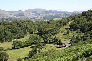
Ceredigion, historically Cardiganshire, is a county in the west of Wales. It borders Gwynedd across the Dyfi estuary to the north, Powys to the east, Carmarthenshire and Pembrokeshire to the south, and the Irish Sea to the west. Aberystwyth is the largest settlement and, together with Aberaeron, is an administrative centre of Ceredigion County Council.
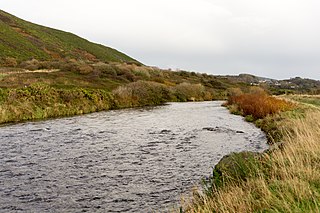
The River Ystwyth Welsh: Afon Ystwyth "winding river") is a river in Ceredigion, Wales. The length of the main river is 20.5 miles (33.0 km). Its catchment area covers 75 square miles (190 km2). Its source is a number of streams that include the Afon Diliw, located on the west slopes of Plynlimon on the border of Ceredigion and Powys in the Cambrian Mountains. The Ystwyth flows westwards before its confluence with the Afon Rheidol and the estuary at Aberystwyth to drain into Cardigan Bay.
Maelgwn ap Rhys was prince of part of the kingdom of Deheubarth in south west Wales.
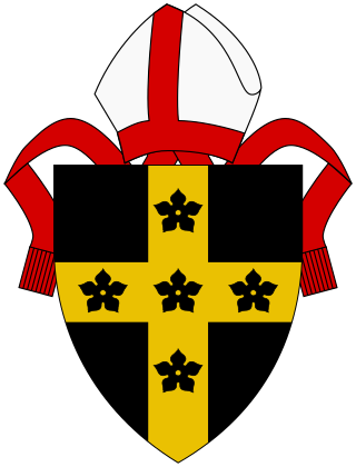
The Diocese of St Davids is a diocese of the Church in Wales, a church of the Anglican Communion. The diocese covers the historic extent of Ceredigion, Carmarthenshire and Pembrokeshire, together with a small part of western Glamorgan. The episcopal see is the Cathedral Church of St David in the City of St Davids, Pembrokeshire. The present cathedral, which was begun in 1181, stands on the site of a monastery founded in the 6th century by Saint David.
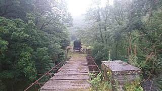
The Carmarthen–Aberystwyth line was originally a standard-gauge branch line of the Great Western Railway (GWR) in Wales, connecting Carmarthen and Aberystwyth.

Pen-y-garn is a small village in the Tirymynach district of Ceredigion, Wales, approximately 4 miles (6 km) north-east of Aberystwyth. Along with the hamlet of Rhydypennau, Pen-y-garn is now often considered to be part of the neighbouring larger village of Bow Street. All three places stretch in a long narrow strip along the main Aberystwyth to Machynlleth road (A487). As well as the houses on the main road from Cross Street up to Ysgol Rhydypennau, Pen-y-garn also includes the housing estates of Maes Ceiro, Bryn Meillion, Maes y Garn and Cae'r Odyn.
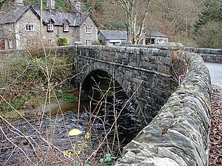
Pont-rhyd-y-groes is a village near Cwm Ystwyth and Pont ar Fynach, in Ceredigion, Wales. The village takes its name from the bridge and (earlier) ford over the River Ystwyth.

Ysbyty Ystwyth is a small village and community in Ceredigion, Wales, 11 mi (18 km) southeast of Aberystwyth. Its church and the parish of the same name were the property of the Order of the Knights of the Hospital of St John of Jerusalem, hence the 'Ysbyty' in the title, which never was a hospice for travellers to Strata Florida. The community includes the hamlet of Pont-rhyd-y-groes. The area is situated in the Desert of Wales and is wild country. The peak of Llan Ddu Fawr is located in the area and the lakes Llyn Fyrddon Fawr and Fach.
The office of High Sheriff of Dyfed was established in 1974 as part of the creation of the county of Dyfed in Wales following the Local Government Act 1972, and effectively replaced the shrievalties of the amalgamated counties of Cardiganshire, Carmarthenshire and Pembrokeshire. Since 1996 Dyfed has a purely ceremonial meaning, having been broken up for administrative purposes.
Capel Dewi may refer to the following places in Wales:

Capel Dewi is a small village in the county of Ceredigion, Wales. The village lies in the Clettwr Valley mostly on the eastern bank of the River Clettwr, a tributary of the River Teifi. Capel Dewi is part of the community of Llandysul along with the settlements of Horeb, Pont-Siân, Pren-gwyn, Tregroes, Rhydowen and the village of Llandysul itself. The village is one of two settlements in Ceredigion called Capel Dewi, the other being the smaller Capel Dewi near Aberystwyth.

Trefeurig is a community in Mid and West Wales, situated around 4 miles (6.4 km) north-east of Aberystwyth. It is a site of particular prehistoric, Roman, and Iron Age interest, and has a long history as a mining area. In 2011 the local population was estimated at 1,771 people.
The bedrock geology of Ceredigion in west Wales consists wholly of a considerable thickness of Ordovician and Silurian age sedimentary rocks of marine origin. Unconsolidated deposits of Quaternary age include a widespread cover of glacial till, valley floor alluvium and scattered peat deposits in both upland and lowland settings.
The Afon Gwyrfai is a short river in Gwynedd, Wales. For half of its length it flows through Snowdonia National Park. Exiting Llyn y Gader it flows north through the small village of Rhyd-ddu to enter the southeastern end of Llyn Cwellyn. Downstream of the lake it flows northwest past Betws Garmon, leaving the national park and continues to the southern edge of Waunfawr. It then turns slightly west to flow on to Bontnewydd beyond which it turns slightly south to enter Foryd Bay. The tidal channel within the bay flows north into the western end of the Menai Strait. Principal tributary streams include the Afon Treweunydd which contributes water from the reservoir of Llyn Ffynnon-y-gwas and from the lakes of Llyn Glas, Llyn Coch and Llyn Nadroedd in Cwm Clogwyn immediately west of the summit of Snowdon. The tidal channel of the Gwyrfai within Foryd Bay also accepts the flow of the left bank tributaries, the Afon Foryd, Afon Rhyd and Afon Carrog. The river is shadowed by the line of the Welsh Highland Railway for much of its length, and by which it is crossed four times.

The 2022 Ceredigion County Council election took place as of 5 May 2022 to elect 38 members to Ceredigion Council. On the same day, elections were held to the other 21 local authorities and to community councils in Wales as part of the 2022 Welsh local elections. The previous all-council election took place in May 2017 and future elections will take place every five years.


