
Birnamwood is a village in Marathon and Shawano counties in the U.S. state of Wisconsin. It is part of the Wausau, Wisconsin Metropolitan Statistical Area. The population was 818 at the 2010 census. Of this, 802 were in Shawano County, and 16 were in Marathon County. The village is located mostly within the town of Birnamwood in Shawano County; only a small portion extends into the town of Norrie in adjacent Marathon County.

The Telford Steam Railway (TSR) is a heritage railway located at Horsehay, Telford in Shropshire, England, formed in 1976.
Coseley railway station is located in the Coseley area of the borough of Dudley, West Midlands, England. It is situated on the Rugby-Birmingham-Stafford branch of the West Coast Main Line. The station, and all trains serving it, are operated by West Midlands Trains.

Polwarth is a mainly residential area of Edinburgh, Scotland. It is bounded by Bruntsfield and Merchiston to the east and south, Gorgie and Dalry to the north, Fountainbridge to the north and east, and Craiglockhart to the west.

Longton railway station is a railway station in England at Longton, Stoke-on-Trent. The station is served by trains on the Crewe to Derby Line which is also a community rail line known as the North Staffordshire line. The station is owned by Network Rail and managed by East Midlands Railway. The full range of tickets for travel are purchased from the guard on the train at no extra cost.

Dorridge railway station serves the large village of Dorridge in the West Midlands of England. The station is served by Chiltern Railways, who manage the station, and also by West Midlands Trains. It is situated 10+1⁄2 miles (16.9 km) south of Birmingham Snow Hill.

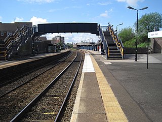
Rowley Regis railway station serves the town of Blackheath and the Rowley Regis area of Sandwell, in the county of West Midlands, England. It is located on the Birmingham to Worcester via Kidderminster Line. The station is managed by West Midlands Railway, who provide the majority of train services; there are also occasional services provided by Chiltern Railways.
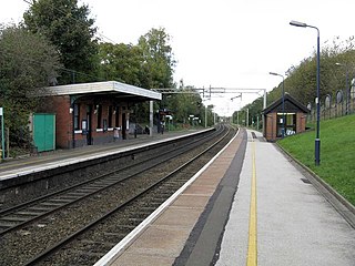
Langley Green railway station serves the Langley Green area of Oldbury in Sandwell, in the West Midlands, England. It is located on the Birmingham to Worcester via Kidderminster Line. The station is managed by West Midlands Trains, who provide the majority of train services; there are also occasional services provided by Chiltern Railways.

KVRP is a commercial radio station located in Stamford, Texas, broadcasting to the northern sections of the Abilene, Texas, area. KVRP airs a Christian contemporary music format branded as "The River". The programming is syndicated by Salem Radio Network.

The Ministry of Education and Children is an Icelandic cabinet-level ministry founded 16 December 1942. The ministry is divided into three departments and four offices. The current Minister of Education and Children's Affairs is Ásmundur Einar Daðason.

Capel Bangor is a small village in Ceredigion, Wales, approximately 5 miles (8.0 km) east of Aberystwyth.

Coventry Arena railway station is a railway station on the Coventry-Nuneaton Line. Located to the north of Coventry, England, it serves the adjacent Coventry Arena, for which it is named. It was opened on 18 January 2016, along with Bermuda Park station after considerable delays.
Rushden Parkway railway station is a proposed new railway station to serve the village of Irchester in Northamptonshire, England. It would also serve the nearby towns of Higham Ferrers and Rushden.
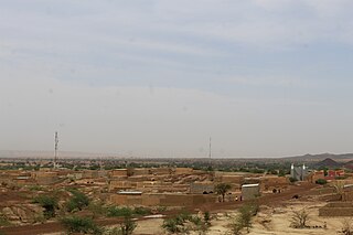
Ibrohamane is a village and rural commune in Niger. As of 2012, it had a population of 88,724.
Tempsford railway station was a railway station built by the Great Northern Railway to serve the village of Tempsford in Bedfordshire, England.
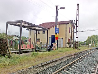
Jatxou or Jatsu is a former railway station in Jatxou, Nouvelle-Aquitaine, France. The station was opened in 1891 and is located on the Bayonne - Saint-Jean-Pied-de-Port railway line. The station is served by TER (local) services operated by the SNCF. It was closed in 2019.

The Llanfyllin Branch was a railway line extension of the Oswestry and Newtown Railway to access the limestone resources within the Llanfyllin area; it opened in 1863.
Sharon is an unincorporated community in Carroll County, Indiana, in the United States.
Honey Creek is a stream in Pottawattamie and Harrison counties, Iowa, in the United States. It is a tributary of Missouri River.

Rugby Parkway is a proposed railway station in Houlton on the eastern outskirts of Rugby, promoted by Warwickshire County Council. It was the subject of a high level feasibility study which recommended the station to be located on the Northampton Loop Line, near the Hillmorton area of Rugby, and close to new housing in Houlton and DIRFT.

