Yuanping City

Last updated
Yuanping
原平市
County-level city

Yuanping Zhushi Pailou.jpg

The Zhu Clan Pailou in Yuanping
Location map China Shanxi.png
Red pog.svg
Yuanping
Location in Shanxi
Coordinates: 38°44′N112°44′E / 38.733°N 112.733°E / 38.733; 112.733 Coordinates: 38°44′N112°44′E / 38.733°N 112.733°E / 38.733; 112.733
Country People's Republic of China
Province Shanxi
Prefecture-level city Xinzhou
Elevation 825 m (2,707 ft)
Time zone China Standard (UTC+8)
Postal code 034100
Area code(s) 0350
Website yuanping.gov.cn
Yuanping City
Chinese 原平

Yuanping is a county-level city in Xinzhou Prefecture, Shanxi Province, China.

County-level city Peoples Republic of China county-level subdivision

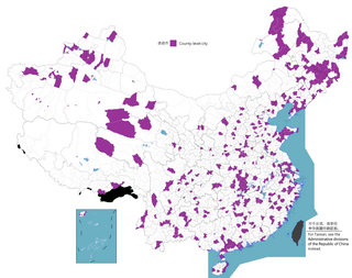
A county-level municipality, county-level city, or county city is a county-level administrative division of mainland China. County-level cities are usually governed by prefecture-level divisions, but a few are governed directly by province-level divisions. Formerly known as prefecture-controlled city.

China State in East Asia

China, officially the People's Republic of China (PRC), is a country in East Asia and the world's most populous country, with a population of around 1.404 billion. Covering approximately 9,600,000 square kilometers (3,700,000 sq mi), it is the third- or fourth-largest country by total area. Governed by the Communist Party of China, the state exercises jurisdiction over 22 provinces, five autonomous regions, four direct-controlled municipalities, and the special administrative regions of Hong Kong and Macau.

Contents

History

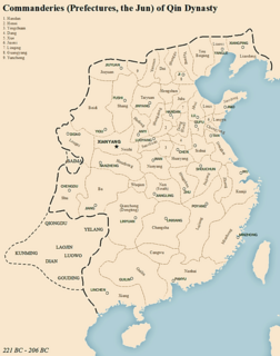
The territory of present-day Yuanping was held by Zhao during the Warring States Period of Chinese history. Under the Qin, it was part of Taiyuan Prefecture. It became Yuanping County in 114 BC under Emperor Wu of the Han. It became Xinxing County in Jian'an 15 during the Eastern Han. Three years later, its name was restored as Yuanping County but it was moved to Yanmen Commandery.

Qin dynasty Dynasty that ruled in China from 221 to 206 BC

The Qin dynasty was the first dynasty of Imperial China, lasting from 221 to 206 BC. Named for its heartland in Qin state, the dynasty was founded by Qin Shi Huang, the First Emperor of Qin. The strength of the Qin state was greatly increased by the Legalist reforms of Shang Yang in the fourth century BC, during the Warring States period. In the mid and late third century BC, the Qin state carried out a series of swift conquests, first ending the powerless Zhou dynasty, and eventually conquering the other six of the Seven Warring States. Its 15 years was the shortest major dynasty in Chinese history, consisting of only two emperors, but inaugurated an imperial system that lasted from 221 BC, with interruption and adaptation, until 1912 CE.

Emperor Wu of Han emperor Wu-Ti

Emperor Wu of Han, born Liu Che, courtesy name Tong, was the seventh emperor of the Han dynasty of China, ruling from 141–87 BC. His reign lasted 54 years — a record not broken until the reign of the Kangxi Emperor more than 1,800 years later. His reign resulted in a vast territorial expansion and the development of a strong and centralized state resulting from his governmental reorganization, including his promotion of Confucian doctrines. In the field of historical social and cultural studies, Emperor Wu is known for his religious innovations and patronage of the poetic and musical arts, including development of the Imperial Music Bureau into a prestigious entity. It was also during his reign that cultural contact with western Eurasia was greatly increased, directly and indirectly.

Han dynasty 3rd-century BC to 3rd-century AD Chinese dynasty

The Han dynasty was the second imperial dynasty of China, preceded by the Qin dynasty and succeeded by the Three Kingdoms period. Spanning over four centuries, the Han period is considered a golden age in Chinese history. To this day, China's majority ethnic group refers to themselves as the "Han Chinese" and the Chinese script is referred to as "Han characters". It was founded by the rebel leader Liu Bang, known posthumously as Emperor Gaozu of Han, and briefly interrupted by the Xin dynasty of the former regent Wang Mang. This interregnum separates the Han dynasty into two periods: the Western Han or Former Han and the Eastern Han or Later Han (25–220 AD).

Geography

Yuanping is located nearly due north of Taiyuan, the provincial capital.

Taiyuan Prefecture-level city in Shanxi, Peoples Republic of China

Taiyuan is the capital and largest city of Shanxi province in China. It is one of the main manufacturing bases of China. Throughout its long history, Taiyuan was the capital or provisional capital of many dynasties in China, hence the name Lóngchéng.

Climate

Yuanping has a monsoon-influenced, continental semi-arid climate (Köppen BSk), with cold and very dry winters, and hot, humid summers. The monthly 24-hour average temperature ranges from −7.7 °C (18.1 °F) in January to 23.3 °C (73.9 °F) in July, and the annual mean is 9.03 °C (48.3 °F). A majority of the 417 millimetres (16.4 in) of precipitation occurs in July and August alone. Due to the high elevation and dry climate, the diurnal temperature variation easily exceeds 15 °C (27 °F) in winter and spring. With monthly percent possible sunshine ranging from 50% in July to 62% in four months, and the average annual total is 2,585 hours.

Monsoon seasonal changes in atmospheric circulation and precipitation associated with the asymmetric heating of land and sea

Monsoon is traditionally defined as a seasonal reversing wind accompanied by corresponding changes in precipitation, but is now used to describe seasonal changes in atmospheric circulation and precipitation associated with the asymmetric heating of land and sea. Usually, the term monsoon is used to refer to the rainy phase of a seasonally changing pattern, although technically there is also a dry phase. The term is sometimes incorrectly used for locally heavy but short-term rains, although these rains meet the dictionary definition of monsoon.

Semi-arid climate climat with precipitation below potential evapotranspiration

A semi-arid climate or steppe climate is the climate of a region that receives precipitation below potential evapotranspiration, but not as low as a desert climate. There are different kinds of semi-arid climates, depending on variables such as temperature, and they give rise to different biomes.

Köppen climate classification widely used climate classification system

The Köppen climate classification is one of the most widely used climate classification systems. It was first published by the Russian climatologist Wladimir Köppen (1846–1940) in 1884, with several later modifications by Köppen, notably in 1918 and 1936. Later, the climatologist Rudolf Geiger introduced some changes to the classification system, which is thus sometimes called the Köppen–Geiger climate classification system.

Climate data for Yuanping (1971−2000)
MonthJanFebMarAprMayJunJulAugSepOctNovDecYear
Average high °C (°F) −0.1
(31.8)
3.5
(38.3)
10.1
(50.2)
19.0
(66.2)
25.3
(77.5)
28.6
(83.5)
29.2
(84.6)
27.5
(81.5)
23.1
(73.6)
17.0
(62.6)
8.1
(46.6)
1.5
(34.7)
16.1
(60.9)
Average low °C (°F) −13.7
(7.3)
−9.5
(14.9)
−3
(27)
3.9
(39)
10.2
(50.4)
14.7
(58.5)
17.7
(63.9)
16.3
(61.3)
10.0
(50)
3.3
(37.9)
−4.4
(24.1)
−11.3
(11.7)
2.9
(37.1)
Average precipitation mm (inches) 1.9
(0.075)
3.7
(0.146)
9.2
(0.362)
15.9
(0.626)
30.7
(1.209)
54.9
(2.161)
102.9
(4.051)
114.8
(4.52)
52.6
(2.071)
19.9
(0.783)
8.9
(0.35)
1.7
(0.067)
417.1
(16.421)
Average precipitation days (≥ 0.1 mm) 1.7 2.4 3.7 4.3 5.7 9.7 13.3 12.8 9.2 5.4 3.0 1.3 72.5
Average relative humidity (%) 47 45 48 42 43 54 69 73 68 59 57 51 55
Mean monthly sunshine hours 185.7 185.8 211.2 238.0 273.8 255.2 226.4 222.6 217.6 216.3 181.6 170.5 2,584.7
Percent possible sunshine 62 62 57 60 62 58 50 53 59 62 60 58 58
Source: China Meteorological Administration

Transportation

The city lies on the G55 Erenhot–Guangzhou Expressway. Yuanping is also at the junction of the Beijing–Yuanping Railway and the Datong–Puzhou Railway.

G55 Erenhot–Guangzhou Expressway controlled-access highway

The Erenhot–Guangzhou Expressway, commonly referred to as the Erguang Expressway is an expressway that connects the cities of Erenhot, Inner Mongolia, and Guangzhou, Guangdong. When fully complete, it will be 2,685 km (1,668 mi) in length.

Related Research Articles

Shaoguan Prefecture-level city in Guangdong, Peoples Republic of China

Shaoguan is a prefecture-level city in northern Guangdong Province, China, bordering Hunan to the northwest and Jiangxi to the northeast. It is home to the mummified remains of the sixth Zen Buddhist patriarch Huineng. Its built-up or metro area made up of Zhenjiang and Wujiang urban districts was home to 688,229 inhabitants at the 2010 census, Qujiang district not being conurbated yet.

Karamay Prefecture-level city in Xinjiang, Peoples Republic of China

Karamay is a prefecture-level city in the north of the Xinjiang Uyghur Autonomous Region, People's Republic of China. The name of the city comes from the Uyghur language, and means "black oil", referring to the oil fields near the city.

Jiulong County County in Sichuan, Peoples Republic of China

Gyézil County, also Jiulong County ; is a county located in southeastern Garzê Tibetan Autonomous Prefecture, Sichuan province, People's Republic of China. With a population of 52 thousand, mainly Tibetans, Hans, and Yis, it contains 1 town and 17 townships.

Heze Prefecture-level city in Shandong, Peoples Republic of China

Heze, formerly known as Caozhou, is a prefecture-level city in southwestern Shandong, China. It is home to 8,287,693 inhabitants, of whom 1,346,717 live in the built-up area around the seat of government in Mudan District. The westernmost prefecture-level city in Shandong, it borders Jining to the east and the provinces of Henan and Anhui to the west and south respectively.

Wuzhou Prefecture-level city in Guangxi, Peoples Republic of China

Wúzhōu, formerly Ngchow, is a prefecture-level city in the east of Guangxi Zhuang Autonomous Region, People's Republic of China.

Yuncheng Prefecture-level city in Shanxi, Peoples Republic of China

Yuncheng is the southernmost prefecture-level city in Shanxi province, People's Republic of China. It borders Linfen and Jincheng municipalities to the north and east, and Henan and Shaanxi provinces to the south and west. At the 2010 census, its population was 5,134,779 inhabitants, of whom 680,036 lived in the built-up area made of Yanhu District.
Yangjiang Prefecture-level city in Guangdong, Peoples Republic of China

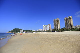
Yangjiang, formerly romanized as Yeungkong, is a prefecture-level city in southwestern Guangdong Province in the People's Republic of China. It borders Maoming to the west, Yunfu to the north, Jiangmen to the east, and looks out to the South China Sea to the south. The local dialect is the Gaoyang dialect, a branch of Cantonese. During the 2010 census, its population was 2,421,748 inhabitants of whom 1,119,619 lived in the built-up and largely urbanized area comprising Jiangcheng District and Yangdong County.

Pingliang Prefecture-level city in Gansu, Peoples Republic of China

Pingliang is a prefecture-level city in eastern Gansu province, China, bordering Shaanxi province to the south and east and the Ningxia Hui Autonomous Region to the north. Pingliang is well known for the nearby Kongtong Mountains, which are sacred to Taoism and location of the mythical meeting place of the Yellow Emperor and Guangchengzi, an immortal.

Lüliang Prefecture-level city in Shanxi, Peoples Republic of China

Lüliang or Lyuliang is a prefecture-level city in the west of Shanxi province, People's Republic of China, bordering Shaanxi province across the Yellow River to the west, Jinzhong and the provincial capital of Taiyuan to the east, Linfen to the south, and Xinzhou to the north. It has a total area of 21,143 square kilometres (8,163 sq mi) and total population of 3,727,057. The metro area of Lüliang has a population of 320,142 at the 2010 census.

Jinghe County County in Xinjiang, Peoples Republic of China

Jinghe County as the official romanized name, also transliterated from Uyghur as Jing County, is a county of the Xinjiang Uyghur Autonomous Region and is under the administration of the Börtala Mongol Autonomous Prefecture. It contains an area of 11,181 square kilometres (4,317 sq mi). According to the 2002 census, it has a population of 120,000.

Huailai County County in Hebei, Peoples Republic of China

Huailai is a county in northwestern Hebei province, People's Republic of China, under the administration of the prefecture-level city of Zhangjiakou.
Barkam County-level city in Sichuan, Peoples Republic of China

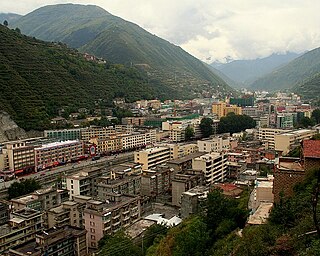
Barkam or Markang or Muerkvua is a county-level city in Ngawa Tibetan and Qiang Autonomous Prefecture, in the northwest of Sichuan province, People's Republic of China. The city seat is the town of Barkam.

Nancheng County County in Jiangxi, Peoples Republic of China

Nancheng is a county of eastern Jiangxi province, People's Republic of China. It is under the jurisdiction of the prefecture-level city of Fuzhou. Historically it has been known as Jianchangfu (建昌府).

Qingyuan Manchu Autonomous County Autonomous county in Liaoning, Peoples Republic of China

Qingyuan Manchu Autonomous County, or simply Qingyuan County (清原县) is one of the three counties under the administration of the prefecture-level city of Fushun, in the east of Liaoning, People's Republic of China, and is also one of the 11 Manchu autonomous counties and one of 117 autonomous counties nationally. It has a population of about 340,000, covering an area of 3,921 square kilometres (1,514 sq mi).

Fujin City County-level city in Heilongjiang, Peoples Republic of China

Fujin is a county-level city in the east of Heilongjiang province, People's Republic of China. It is under the jurisdiction of the prefecture-level city of Jiamusi.

Gangca County County in Qinghai, Peoples Republic of China

Gangca County is a county of northeastern Qinghai province, China, on the northern shore of Qinghai Lake. It is under the administration of Haibei Tibetan Autonomous Prefecture.

Tongde County County in Qinghai, Peoples Republic of China

Tongde County is a county of Qinghai province, China. It is under the administration of Hainan Tibetan Autonomous Prefecture.

Xingren is a county-level city of southwestern Guizhou province, China. It is under the administration of the Qianxinan Buyei and Miao Autonomous Prefecture.

Youyu County County in Shanxi, Peoples Republic of China

Youyu County, also known by its Chinese name Youyuxian, is a county under the administration of the prefecture-level city of Shuozhou, in the northwest of Shanxi Province, China. It borders Inner Mongolia to the north and west.

Wuzhai County County in Shanxi, Peoples Republic of China

Wuzhai is a county of northwestern Shanxi province, China. It is under the administration of Xinzhou City.

References