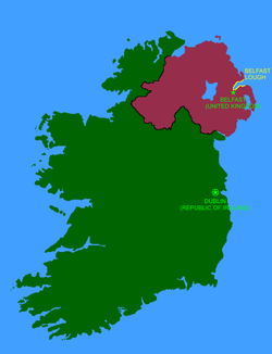
The island of Ireland, with the Republic of Ireland in green, Northern Ireland (UK) in magenta, and Belfast Lough in yellow.The jetty at Cloghan Point is used to off-load oil from tankers, for use at the nearby Kilroot power station.Sunset over Belfast Lough, viewed from Bangor.Blackhead Lighthouse is one of three lighthouses in Belfast Lough.
Belfast Lough is a long, wide and deep expanse of water, virtually free of strong tides. The inner part of the lough comprises a series of mudflats and lagoons. The outer lough is restricted to mainly rocky shores with some small sandy bays. The outer boundary of the lough is a line joining Orlock Point and Blackhead.
Belfast Lough is known in Irish as Loch Lao, which was Anglicised as 'Lough Lee'. Earlier spellings include Loch Laoigh and Loch Laigh. This name means "sea inlet of the calf". The River Lagan, which flows into it, was also historically known as the Lao. It is believed that the lough and river were named after a "bovine goddess". In the 2nd century, the Greek geographer Ptolemy referred to it as the Logia.[6]
Before Belfast grew into a city, the lough was known in English as 'Carrickfergus Bay'. In Ulster-Scots it is called Bilfawst Loch or Craigfergus Loch.[7][8]
The "inner lough" was made an Area of Special Scientific Interest (ASSI) in 1987. Recorded wildlife includes Crepidula fornicata Lamarck (Slipper Limpet).[9][10]
Ramsar site
The Belfast Lough Ramsar site (wetlands of international importance designated under the Ramsar Convention), is 432.14 hectares in area, at latitude 54 38 00 N and longitude 05 54 00 W. It was designated a Ramsar site on 5 August 1998.[11]
In the outer lough, the Ramsar boundary entirely coincides with that of Outer Belfast Lough Area of Special Scientific Interest but within the immediate harbour area the boundary has been redrawn to take into account permitted port related development and landfill which has taken place since the Inner Belfast Lough Area of Special Scientific Interest was declared in 1987. Marine areas below mean low water are not included. The Ramsar boundary entirely coincides with that of the Belfast Lough Special Protection Area. The site qualifies under Criterion 3c of the Ramsar Convention by regularly supporting internationally important numbers of common redshank in winter. The site also regularly supports nationally important numbers of common shelduck, Eurasian oystercatcher, purple sandpiper, dunlin, black-tailed godwit, bar-tailed godwit, Eurasian curlew and ruddy turnstone.[12] In recent years, Otters have been seen more regularly on the lough shores.[13][14][15]
Sailing
Popular for sailing, the lough has three marinas: one at Bangor, one at Carrickfergus and a third located at Titanic Quarter. Belfast docks at the head of a lough contain the famous shipbuilder of the RMS Titanic fame, Harland & Wolff, who are no longer building ships for the foreseeable future and has shed most of its workforce and diversified into repairing and refitting large tankers and oilrigs. Coastguard offices for the lough, although referred to as Belfast Coastguard, are in the town of Bangor by the marina. In 1912, the RMS Titanic sailed down the lough from Belfast to the Irish Sea for its sea trials.
The lough has 30 square miles (78km2) of open water and enough coastline to make short inshore races day-long affairs.[citation needed] Three main arteries serve the lough close to Belfast: the Herdman Channel on the County Antrim coast side; the Victoria Channel, the central and longest route; and the Musgrave Channel on the County Down side.
This page is based on this Wikipedia article Text is available under the CC BY-SA 4.0 license; additional terms may apply. Images, videos and audio are available under their respective licenses.