Related Research Articles

The Yarra River or historically, the Yarra Yarra River, is a perennial river in south-central Victoria, Australia.
The City of Manningham is a local government area in Victoria, Australia in the north-eastern suburbs of Melbourne and is divided into 12 suburbs, with the largest being Doncaster and Doncaster East. It comprises an area of 113 square kilometres and had a population of 125,508 in June 2018.
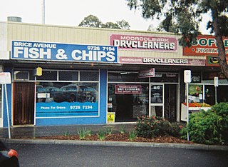
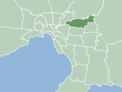
Mooroolbark is a suburb of Melbourne, Victoria, Australia, 31 km north-east of Melbourne's central business district, located within the Shire of Yarra Ranges local government area. Mooroolbark recorded a population of 23,059 at the 2021 census.

Wonga Park is a locality on the edge of Greater Melbourne, beyond the Melbourne Metropolitan Urban Growth Boundary area, 28 km north-east from Melbourne's Central Business District, located within the Cities of Manningham and Maroondah and the Shire of Yarra Ranges local government areas. Wonga Park recorded a population of 3,843 at the 2021 census.

Warranwood is a suburb of Melbourne, Victoria, Australia, 25 km east of Melbourne's Central Business District, located within the City of Maroondah local government area. Warranwood recorded a population of 4,820 at the 2021 census.

Croydon railway station is located on the Lilydale line in Victoria, Australia. It serves the eastern Melbourne suburb of Croydon, and it opened on 1 December 1882 as Warrandyte. It was renamed Croydon on 1 August 1884.

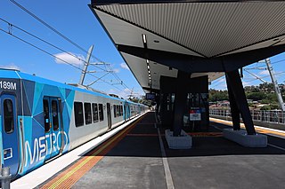
Mooroolbark railway station is located on the Lilydale line in Victoria, Australia. It serves the eastern Melbourne suburb of Mooroolbark, and opened on 10 October 1887.
Lilydale railway station is the terminus of the suburban electrified Lilydale line in Victoria, Australia. It serves the north-eastern Melbourne suburb of Lilydale, and opened on 1 December 1882 as Lillydale.

Mullum Mullum Creek is a creek in the outer eastern suburbs of Melbourne, Victoria, Australia. It is the main watercourse of the Mullum Mullum Valley, a tributary of the Yarra River and Yarra Valley. For tens of thousands of years it was used as a food and tool source sustainably by the Wurundjeri people, Indigenous Australians of the Kulin nation, who spoke variations of the Woiwurrung language group.
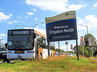
Croydon North is a suburb of Melbourne, Victoria, Australia, 29 km north-east of Melbourne's Central Business District, located within the City of Maroondah local government area. Croydon North recorded a population of 8,092 at the 2021 census.

Croydon is a suburb of Melbourne, Victoria, Australia, 28 km east of Melbourne's Central Business District, located within the City of Maroondah local government area. Croydon recorded a population of 28,608 at the 2021 census.
The Eastern Football Netball League is an Australian rules football league, based in the eastern suburbs of metropolitan Melbourne.

The Dandenong Creek is an urban creek of the Port Phillip catchment, located in the eastern and south-eastern Greater Melbourne region of the Australian east coast state of Victoria. The creek descends approximately 550 metres (1,800 ft) over its course of 53 kilometres (33 mi) before joining the Eumemmerring Creek to form the Patterson River and eventually draining into the Beaumaris Bay.

The Mullum Mullum Creek Trail is a shared use path for cyclists and pedestrians, which follows Mullum Mullum Creek in the outer eastern suburbs in Melbourne, Victoria, Australia.
The Ringwood and District Cricket Association is a club cricket competition based in the outer eastern suburbs of Melbourne, Victoria. The competition consists of 31 clubs based around the Ringwood area of Melbourne and has been running seasonally since its induction in 1920/21 season.

The Shire of Lillydale was a local government area about 40 kilometres (25 mi) northeast of Melbourne, the state capital of Victoria, Australia. The shire covered an area of 397.49 square kilometres (153.5 sq mi), and existed from 1856 until 1994.
The Yarra River is a river in East-Central Victoria, Australia that flows through the city of Melbourne. This article contains explanations and lists of the river's tributaries and other geographic features. The river flows atop layers of silt that built up within an ancient river valley around 10,000-15,000 years ago.

The Yarra River is a river in southern Victoria, Australia that flows through the city of Melbourne. There are many parklands, including state parks and national parks, that adjoin the river along its 250 km length. Every park listed has walking tracks, smaller parks usually have unsealed paths, while bigger parks will have sealed pathways suitable for walking and cycling. The Yarra River Trail runs along much of the length of the river's lower reaches through Melbourne. Most parks listed have parking available, the quality and quantity of which varies according to the size of the park. Dogs are not permitted in parklands adjoining the river unless otherwise stated in special off-lead areas.

Warrandyte State Park is a state park, located in Warrandyte, east of Melbourne, Victoria on the banks of the Yarra River and surroundings. The park comprises 586 hectares of remnant bushland in various locations throughout Warrandyte and Wonga Park around Pound Bend, Fourth Hill, Black Flat, Yarra Brae and various other locations in the area. It hosts many significant geographical, environmental, archaeological and historical sites, such as the site of the first gold discovery in Victoria in 1851 and preserves the sites of former gold mines and tunnels. It is a popular destination for school and community groups and is frequented by local bush walkers and hikers.
References
Waterways of the Greater Melbourne catchment, Victoria, Australia | |
|---|---|
| Ocean inlets, harbours and bays | |
| Rivers | |
| Creeks |
|
| Lagoons and lakes | |
| Adjoining rivers and bays | |
Rivers of the Port Phillip and Western Port catchment, Victoria, Australia | |||||||||
|---|---|---|---|---|---|---|---|---|---|
| Bunyip Basin |
| ||||||||
| Maribyrnong Basin |
| ||||||||
| Moorabool Basin |
| ||||||||
| South Gippsland Basin |
| ||||||||
| Werribee Basin |
| ||||||||
| Yarra Basin |
| ||||||||
| | This article about a place in Melbourne is a stub. You can help Wikipedia by expanding it. |