Moonee Ponds Creek

Last updated
Moonee Ponds Creek as a stormwater drain at Brunswick West MooneePondsCreek WestBrunswick.jpg
Moonee Ponds Creek as a stormwater drain at Brunswick West
Map of Moonee Ponds Creek Mooneecreekmap.png
Map of Moonee Ponds Creek

The Moonee Ponds Creek is a creek and major tributary of the Yarra River running through urban Melbourne, Victoria, Australia from northern to inner suburbs. In 2004 a reporter for The Age described it as "arguably the most abused tributary of the Yarra River, and part of the true underside of Melbourne". [1]

Contents

It is rural in its upper sections near Greenvale, passing across basalt plains around Woodlands Historic Park, [2] just north of Melbourne Airport. Towards its mouth it is hemmed in by the Cenozoic caps of Essendon and Royal Park before joining the Yarra River.

Through the heavily urbanised areas it flows through it is best characterised as a concrete stormwater drain.

It winds its way through the suburbs of Westmeadows, Meadow Heights, Tullamarine, Broadmeadows, Gowanbrae, Glenroy, Strathmore Heights, Oak Park, Strathmore, Pascoe Vale, Pascoe Vale South, Essendon, Brunswick West, Moonee Ponds, Ascot Vale, Flemington, Parkville, North Melbourne (where its artificially widened section is named Railway Canal) before joining the Yarra River at Melbourne Docklands.

History

Before European settlement, the Moonee Ponds Creek was the home of the Wurundjeri People of the Kulin nation. Though there are no written records it is probable that the creek takes its name from an indigenous inhabitant Moonee Moonee, who, along with Tullamareena, burnt down and escaped from the first Melbourne gaol in 1838. The Port Phillip area was first colonised by Europeans in 1835. The first land sales in the area of Strathmore on Moonee Ponds Creek were made in 1843 and 1845.

The creek formed a series of marshy ponds on the floodplain, with extensive salt water marshes near its entry to the Yarra river known as Batman's lagoon. With rapid development of Melbourne due to the Victorian gold rush in the 1850s, the swamp quickly became a receptacle for waste waters from Flemington, North Melbourne and Parkville.

In 1879 Batman lagoon was drained and filled to make way for the North Melbourne railway yards at its northern end. At its southern area, the filled in marshes were called Dudley Flats, where impoverished people scrounged building material from the land-fill tip to build shelters and huts during the 1930s depression.

In the 1890s the lower Moonee Ponds Creek was widened for use as a canal for barges carrying coal to the North Melbourne Locomotive Depot.

In 1950s and 1960s the Melbourne and Metropolitan Board of Works realigned and concreted the creek from Strathmore to Flemington Road, in an attempt to stop periodic flooding. [3] The modifications were part of extensive urban development of the lower floodplain. For much of its length through the northern suburbs it is now characterised as a concrete stormwater drain that parallels the Tullamarine Freeway.

In 1998 the Moonee Ponds Creek Co-ordination Committee Inc (MPCCC) was founded to oversee planning, restoration, education, and development of guidelines and policies aimed at protecting and enhancing the Creek and its tributaries. The MPCCC members are each of the four councils (Hume, Merri-bek, Moonee Valley and Melbourne) and the Friends of Moonee Ponds Creek. MPCCC also has excellent working relationships with Melbourne Water, Parks Victoria, Department of Sustainability, Department of Primary Industries and Port Phillip and Westernport Catchment Management Authority.

In 2002 the downstream end of the creek was realigned, to accommodate development of Victoria Dock at the Port of Melbourne. Moving the confluence with the Yarra River about 600 metres upstream, the creek mouth once located at the east end of Appleton Dock was removed, with a new watercourse dug leading directly south parallel with the Bolte Bridge approach spans. [3] The realignment created a buffer zone between the port and the Melbourne Docklands residential and commercial areas. [4] While realigning waterways is not a preferred option for Melbourne Water, the work was permitted as previous modifications had left the creek lacking a "true remaining 'natural' alignment" in the area. [3]

Conservation

Railway Canal near 37 Dynon Rd at North Melbourne Moonee Ponds Creek Reserve 201708.jpg
Railway Canal near 37 Dynon Rd at North Melbourne

In recent years some improvement work has focused on enhancing habitat and stabilising, reshaping and replanting the banks of the creek. In 2005 the water quality, aquatic life and flow were all rated as poor; vegetation was rated as very poor; habitat and stability were rated as good.

During 2004 a major stormwater improvement program was embarked upon in the creek's catchment area, and wetlands at Jacana and litter traps have been built. Recent habitat conservation work has resulted in some wildlife returning to the creek, including the pobblebonk frog around the Strathmore Secondary College, and nankeen night heron in the upper catchment.

Along the entire length of the Moonee Ponds Creek, starting at Melbourne Docklands and continuing to Woodlands Homestead within Woodlands Historic Park, a shared pathway the Moonee Ponds Creek Trail provides a recreational path for cyclists and walkers, connecting many reserves, parks and sporting grounds along the creek.

Dynon Road bridge Dynon road bridge.jpg
Dynon Road bridge

Related Research Articles

<span class="mw-page-title-main">Yarra River</span> River in Victoria, Australia

The Yarra River or historically, the Yarra Yarra River, is a perennial river in south-central Victoria, Australia.

<span class="mw-page-title-main">City of Moonee Valley</span> Local government area in Victoria, Australia

The City of Moonee Valley is a local government area located within the metropolitan area of Melbourne, Victoria, Australia. It comprises the north-western suburbs between 3 and 13 kilometres from the Melbourne city centre, and in June 2018, the city had a population of 127,883.

<span class="mw-page-title-main">CityLink</span> Tollway network in Melbourne, Australia

CityLink is a network of tollways in Melbourne, Victoria, Australia, linking the Tullamarine, West Gate and Monash Freeways and incorporating Bolte Bridge, Burnley Tunnel and other works. In 1996, Transurban was awarded the contract to augment two existing freeways and construct two new toll roads – labelled the Western and Southern Links– directly linking a number of existing freeways to provide a continuous, high-capacity road route to, and around, the central business district. CityLink uses a free-flow tolling electronic toll collection system, called e-TAG. CityLink is currently maintained by Lendlease Services.

Strathmore is a suburb in Melbourne, Victoria, Australia, 10 km (6.2 mi) north-west of Melbourne's Central Business District, located within the City of Moonee Valley local government area. Strathmore recorded a population of 8,980 at the 2021 census.

<span class="mw-page-title-main">Tullamarine Freeway</span>

The Tullamarine Freeway, is a major urban freeway in Melbourne, Victoria, Australia, linking Melbourne Airport to the Melbourne City Centre. It carries up to 210,000 vehicles per day and is one of Australia's busiest freeways. The entire stretch of the Tullamarine Freeway bears the designation M2.

<span class="mw-page-title-main">Flemington, Victoria</span> Suburb of Melbourne, Victoria, Australia

Flemington is an inner-city suburb in Melbourne, Victoria, Australia, 5 km (3.1 mi) north-west of Melbourne's Central Business District, located within the Cities of Melbourne and Moonee Valley local government areas. Flemington recorded a population of 7,025 at the 2021 census.

<span class="mw-page-title-main">Moonee Ponds Creek Trail</span>

The Moonee Ponds Creek Trail is a shared use path for cyclists and pedestrians, which follows the Moonee Ponds Creek through the northern suburbs of Melbourne, Victoria, Australia.

<span class="mw-page-title-main">Capital City Trail</span>

The Capital City Trail is a shared use path in Melbourne, Victoria, Australia, which circles the city centre and some inner eastern and northern suburbs. It is 29km in length, and mostly consists of sections of other trails, such as the Merri Creek Trail, Main Yarra Trail, Moonee Ponds Creek Trail and Inner Circle Rail Trail.

<span class="mw-page-title-main">Bolte Bridge</span> Bridge in Melbourne, Australia

The Bolte Bridge is a large twin cantilever road bridge in Melbourne, Victoria, Australia. The Bolte Bridge carries a total of eight lanes of traffic – four lanes northbound and four lanes southbound. While officially only 490 metres in length, the actual structure appears much longer as it forms part of a 5 kilometre elevated roadway between Flemington Road and the West Gate Freeway. It spans the Yarra River and Victoria Harbour in the Docklands precinct to the west of the Melbourne CBD. It forms part of the CityLink system of toll roads that connects the Tullamarine Freeway from the northern suburbs with the West Gate Freeway and the Domain and Burnley tunnels to the Monash Freeway and the south eastern suburbs. It is named after Victoria's 38th and longest-serving Premier, Sir Henry Bolte.

<span class="mw-page-title-main">Electoral district of Melbourne</span> State electoral district of Victoria, Australia

The electoral district of Melbourne is an electorate of the Victorian Legislative Assembly. It currently includes the localities of Docklands, Carlton, Melbourne, East Melbourne, West Melbourne, North Melbourne, Parkville, Newmarket, Kensington and Flemington, and includes Melbourne University. The district has been in existence since 1856.

<span class="mw-page-title-main">Mount Alexander Road</span> Road in Melbourne, Victoria

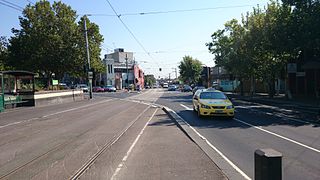
Mount Alexander Road is a major road in Melbourne's inner northern suburbs, connecting the northern edges of the city district to just south of Essendon Airport. It was named after its original destination: the Gold Fields of Mount Alexander, now known as Castlemaine.

<span class="mw-page-title-main">City of Essendon</span> Local government area in Victoria, Australia

The City of Essendon was a local government area about 5 kilometres (3 mi) northwest of Melbourne, the state capital of Victoria, Australia. The city covered an area of 21.22 square kilometres (8.19 sq mi), and existed from 1861 until 1994.

Melbourne West Province was an electorate of the Victorian Legislative Council from 1904 until 2006.

<span class="mw-page-title-main">Lakes and reservoirs of Melbourne</span>

Melbourne is the capital city of southeastern Australian state of Victoria and also the nation's second most populous city, and has been consistently voted one of the most liveable cities in the world. Located on the northern/eastern coastal plains of Port Phillip Bay, the city is the one of the drier capital cities in Australia, but due to its relatively flat terrain and the runoffs fed from surrounding highlands, still has many lakes, ponds and wetlands, mainly managed by Melbourne Water and Parks Victoria. The larger waterbodies are used for water sports, mostly boating but some are used for recreational activities like swimming, water skiing or model boating.

<span class="mw-page-title-main">Geography of Melbourne</span>

Melbourne, the capital city of Victoria, Australia, is situated on the southeastern fringe of the Australian landmass and in the southern central part of the state. Melbourne covers an urbanised area of approximately 2,453 km²–larger than that of Sydney, Greater London and Mexico City, with population density roughly around 16 people per hectare on average.

<span class="mw-page-title-main">West Melbourne Swamp</span>

The West Melbourne Swamp also known as Batman's Swamp, was a large saltwater wetland located to the west of the city of Melbourne, Victoria. It was an important resource for Aboriginal people.

<span class="mw-page-title-main">Moonee Ponds Junction tram stop</span>

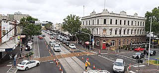
Moonee Ponds Junction is a bus and tram interchange on the junction of Ascot Vale Road / Pascoe Vale Road and Mount Alexander Road in Moonee Ponds, Melbourne. It is located approximately 400 metres east of Moonee Ponds station. In June 2015, Yarra Trams revealed plans to build a covered tram stop. The work was completed in January 2016.

References

  1. Margaret Simons (January 18, 2004). "City creek continues its fight for survival". The Age. Retrieved 20 March 2011.
  2. parkweb.vic.gov.au - Woodlands Historic Park
  3. 1 2 3 Melbourne Water (June 2002). "Changing Course". The Source. Retrieved 20 March 2011.
  4. Port of Melbourne. "Highlights of the year". Port of Melbourne: 2002 annual report. Archived from the original on 17 February 2011. Retrieved 20 March 2011.

37°49′S144°56′E / 37.817°S 144.933°E / -37.817; 144.933