East Caln Township, Chester County, Pennsylvania

Last updated
East Caln Township
East Caln Township Pennsylvania Muni Bldg.JPG
Municipal building
Chester County Pennsylvania incorporated and unincorporated areas East Caln highlighted.svg
Location in Chester County and the state of Pennsylvania.
Pennsylvania in United States (US48).svg
Location of Pennsylvania in the United States
Coordinates: 40°00′59″N75°40′51″W / 40.01639°N 75.68083°W / 40.01639; -75.68083 Coordinates: 40°00′59″N75°40′51″W / 40.01639°N 75.68083°W / 40.01639; -75.68083
CountryUnited States
StatePennsylvania
County Chester
Area
[1]
  Total3.68 sq mi (9.53 km2)
  Land3.58 sq mi (9.28 km2)
  Water0.10 sq mi (0.25 km2)
Elevation
289 ft (88 m)
Population
 (2020) [2]
  Total5,380 Increase2.svg
  Estimate 
(2021) [2]
5,465
  Density1,353.79/sq mi (522.77/km2)
Time zone UTC-5 (EST)
  Summer (DST) UTC-4 (EDT)
Area code 610
FIPS code 42-029-20920
Website www.eastcalntownship.com

East Caln Township is a township in Chester County, Pennsylvania, United States. The population was 5,380 at the 2020 census. [2] The township wraps around the east half of Downingtown and is mostly indistinguishable from it. East Caln Township is very developed, containing several shopping centers, including the regionally important Brandywine Square Center, several recently constructed housing developments varying from condominiums to large single family homes, and some industry in the southern fringe of the township.

Contents

Geography

According to the United States Census Bureau, the township has a total area of 3.7 square miles (9.6 km2), of which 3.6 square miles (9.3 km2) is land and 0.1 square miles (0.26 km2), or 1.63%, is water.

Adjacent townships

East Caln Township surrounds the borough of Downingtown on the north, east, and south sides.

Demographics

Historical population
CensusPop.Note
1930 297
1940 3156.1%
1950 40327.9%
1960 75888.1%
1970 1,739129.4%
1980 2,18725.8%
1990 2,61919.8%
2000 2,8579.1%
2010 4,83869.3%
2020 5,38011.2%
2021 (est.)5,465 [2] 1.6%
[3] [4]

At the 2010 census, the township was 72.1% non-Hispanic White, 6.1% Black or African American, 0.2% Native American, 17.0% Asian, and 2.3% were two or more races. 2.8% of the population were of Hispanic or Latino ancestry. [5]

As of the census [6] of 2000, there were 2,857 people, 1,205 households, and 771 families residing in the township. The population density was 786.6 people per square mile (303.9/km2). There were 1,276 housing units at an average density of 351.3/sq mi (135.7/km2). The racial makeup of the township was 87.75% White, 6.16% African American, 0.35% Native American, 4.03% Asian, 0.04% Pacific Islander, 0.18% from other races, and 1.51% from two or more races. Hispanic or Latino of any race were 1.89% of the population.

There were 1,205 households, out of which 30.1% had children under the age of 18 living with them, 51.8% were married couples living together, 8.1% had a female householder with no husband present, and 36.0% were non-families. 29.5% of all households were made up of individuals, and 7.9% had someone living alone who was 65 years of age or older. The average household size was 2.35 and the average family size was 2.96.

In the township the population was spread out, with 23.7% under the age of 18, 6.5% from 18 to 24, 33.7% from 25 to 44, 24.7% from 45 to 64, and 11.3% who were 65 years of age or older. The median age was 37 years. For every 100 females there were 100.1 males. For every 100 females age 18 and over, there were 94.9 males.

The median income for a household in the township was $65,000, and the median income for a family was $78,108. Males had a median income of $52,344 versus $35,329 for females. The per capita income for the township was $33,430. About 2.0% of families and 3.2% of the population were below the poverty line, including 1.7% of those under age 18 and 1.2% of those age 65 or over.

Education

Undated photo of Belle School in East Caln Township BelleSchoolEastCaln.jpeg
Undated photo of Belle School in East Caln Township

School age students residing in East Caln Township attend schools in the Downingtown Area School District. [7] There are no public schools located within the boundaries of the township.

Residents are within the Beaver Creek, East Ward, or Uwchlan Hills elementary boundaries. [8] The township is divided into two secondary boundaries: Downingtown Middle School and Downingtown West High School, and Lionville Middle School and Downingtown East High School. [9]

Governance

East Caln Township is designated by the Commonwealth of Pennsylvania as a township of the second class, and is governed by a three-member Board of Supervisors. The day-to-day operations of the township are managed by the Township Manager.

Public safety

Police services in East Caln Township are provided by the Downingtown Police Department under a contract that was initiated in 2005. Fire and emergency medical services are provided by the Downingtown Fire Department.

Transportation

US 30 eastbound in East Caln Township 2022-09-15 16 31 41 View east along U.S. Route 30 (Coatesville-Downingtown Bypass) from the overpass for Pennsylvania State Route 113 (Uwchlan Avenue) in East Caln Township, Chester County, Pennsylvania.jpg
US 30 eastbound in East Caln Township

As of 2018, there were 21.94 miles (35.31 km) of public roads in East Caln Township, of which 8.11 miles (13.05 km) were maintained by the Pennsylvania Department of Transportation (PennDOT) and 13.83 miles (22.26 km) were maintained by the township. [10]

U.S. Route 30 is the main highway serving East Caln Township. It follows the Coatesville-Downingtown Bypass and the Exton Bypass along an east-west alignment across the northern portion of the township. U.S. Route 30 Business follows the old route of US 30 along Lancaster Avenue on an east-west alignment through the central portion of the township. U.S. Route 322 follows Brandywine Avenue along a northwest-southeast alignment through the southwestern corner of the township. Pennsylvania Route 113 follows Uwchlan Avenue along a northeast-southwest alignment through the northern portion of the township. Finally, Pennsylvania Route 282 follows Creek Road on a north-south alignment through the western tip of the township.

Related Research Articles

<span class="mw-page-title-main">Birmingham Township, Chester County, Pennsylvania</span> Township in Pennsylvania, United States

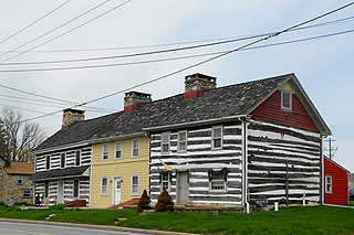
Birmingham Township is a township in Chester County, Pennsylvania. The population was 4,085 at the 2020 census.

<span class="mw-page-title-main">Caln Township, Chester County, Pennsylvania</span> Township in Pennsylvania, United States

Caln Township is a township in Chester County, Pennsylvania, United States. The population was 14,428 at the 2020 census. The township was founded by settlers from Calne, Wiltshire in England in 1714. The relationship with Calne, Wiltshire, continues today as the two towns are sister cities. Caln is a Township of the First Class. The governing body is a Board of Commissioners. The Board President is President Paul Mullin, Vice President Jane Kennedy, Board Members Joshua Young, Lorraine Tindaro and Mark Evans. The Township Manager is Kristen Denne. The township also owns Ingleside Golf Club and over 200 acres (0.81 km2) of green space and parks. There are 53 employees, including 20 police officers, that work for Caln Township.

<span class="mw-page-title-main">Charlestown Township, Chester County, Pennsylvania</span> Township in Pennsylvania, United States

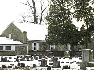
Charlestown Township is a township in Chester County, Pennsylvania, United States. The population was 6,003 at the 2020 census.

<span class="mw-page-title-main">Downingtown, Pennsylvania</span> Borough in Pennsylvania, United States

Downingtown is a borough in Chester County, Pennsylvania, United States, 33 miles (53 km) west of Philadelphia. As of the 2020 census it had a population of 7,898. Downingtown was settled by European colonists in the early 18th century and has a number of historic buildings and structures.

<span class="mw-page-title-main">East Bradford Township, Chester County, Pennsylvania</span> Township in Pennsylvania, United States

East Bradford Township is a township in Chester County, Pennsylvania, United States. The population was 10,308 at the 2020 census.

<span class="mw-page-title-main">East Brandywine Township, Chester County, Pennsylvania</span> Township in Pennsylvania, United States

East Brandywine Township is a township in Chester County, Pennsylvania, United States. The population was 9,746 at the 2020 census.

<span class="mw-page-title-main">East Fallowfield Township, Chester County, Pennsylvania</span> Township in Pennsylvania, United States

East Fallowfield Township is a township in Chester County, Pennsylvania, United States. The population was 7626 at the 2020 census.

<span class="mw-page-title-main">East Goshen Township, Chester County, Pennsylvania</span> Township in Pennsylvania, United States

East Goshen Township is a township in Chester County, Pennsylvania, United States. The population was 18,026 at the 2010 census.

<span class="mw-page-title-main">East Nantmeal Township, Chester County, Pennsylvania</span> Township in Pennsylvania, United States

East Nantmeal Township is a township in Chester County, Pennsylvania, United States. The population was 1,803 at the 2010 census. It, along with West Nantmeal Township, was originally part of a single Nantmeal Township, which was divided in 1739.

<span class="mw-page-title-main">Honey Brook Township, Chester County, Pennsylvania</span> Township in Pennsylvania, United States

Honey Brook Township is a township in Chester County, Pennsylvania. The population was 8,274 at the time of the 2020 census.

<span class="mw-page-title-main">Lionville, Pennsylvania</span> Census-designated place in Pennsylvania, United States

Lionville is a census-designated place (CDP) in Uwchlan Township, Chester County, Pennsylvania, United States. The population was 6,189 at the 2010 census. Prior to 2010 the CDP was recorded as Lionville-Marchwood. "Marchwood", however, refers only to the housing development begun in the early 1960s that is located south of the 100-113 intersection.

<span class="mw-page-title-main">Sadsbury Township, Chester County, Pennsylvania</span> Township in Pennsylvania, United States

Sadsbury Township is a township in Chester County, Pennsylvania, United States. The population was 3,570 at the 2010 census.

<span class="mw-page-title-main">Thorndale, Pennsylvania</span> Census-designated place in Pennsylvania, United States

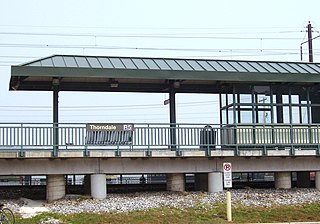
Thorndale is a census-designated place in Chester County, Pennsylvania, United States. The population was 3,407 at the 2010 census. Thorndale is the commercial and administrative center of Caln Township. The community's main street is U.S. Route 30 Business. Many of Thorndale's old houses fell into disrepair from the late 1990s to present and have been torn down and replaced with new businesses. Thorndale is historically notable for containing a summer house of US President James Buchanan, which still stands and has been incorporated into a golf course and turned into a restaurant. The community contains the Thorndale Fire Station and Caln Elementary School, part of the Coatesville Area School District. Thorndale sits along SEPTA's Paoli/Thorndale Line and is currently the last station stop on that line. It is also served by the SEPTA Route 135 bus.

<span class="mw-page-title-main">Upper Uwchlan Township, Chester County, Pennsylvania</span> Township in Pennsylvania, United States

Upper Uwchlan Township is a township in Chester County, Pennsylvania. The population was 11,227 at the 2010 census. The township included the community of Milford Mills before it was inundated by the creation of the Marsh Creek Dam in 1972.

<span class="mw-page-title-main">Uwchlan Township, Chester County, Pennsylvania</span> Township in Pennsylvania, United States

Uwchlan Township is a township in Chester County, Pennsylvania, United States. The population was 19,161 at the 2020 census.

<span class="mw-page-title-main">Wallace Township, Chester County, Pennsylvania</span> Township in Pennsylvania, United States

Wallace Township is a township in Chester County, Pennsylvania, United States. The population was 3,458 at the 2010 census.

<span class="mw-page-title-main">West Bradford Township, Chester County, Pennsylvania</span> Township in Pennsylvania, United States

West Bradford Township is a township in Chester County, Pennsylvania, United States. The population was 12,376 at the 2010 census.

<span class="mw-page-title-main">West Brandywine Township, Chester County, Pennsylvania</span> Township in Pennsylvania, United States

West Brandywine Township is a township in Chester County, Pennsylvania, United States. The population was 7,394 at the 2010 census.

<span class="mw-page-title-main">West Caln Township, Chester County, Pennsylvania</span> Township in Pennsylvania, United States

West Caln Township is a township in Chester County, Pennsylvania, United States. The population was 9,014 at the 2010 census.

<span class="mw-page-title-main">West Pikeland Township, Chester County, Pennsylvania</span> Township in Pennsylvania, United States

West Pikeland Township is a township in Chester County, Pennsylvania, United States. The population was 4,024 at the 2010 census.

References

  1. "2016 U.S. Gazetteer Files". United States Census Bureau. Retrieved Aug 13, 2017.
  2. 1 2 3 4 Bureau, US Census. "City and Town Population Totals: 2020-2021". Census.gov. US Census Bureau. Retrieved 12 July 2022.
  3. "DVRPC > Site Search". Archived from the original on 2019-04-09. Retrieved 2014-03-21.
  4. "Census 2020".
  5. "Census 2010: Philadelphia gains, Pittsburgh shrinks in population". USA Today . Archived from the original on 2011-03-14.
  6. "U.S. Census website". United States Census Bureau . Retrieved 2008-01-31.
  7. "Zoning Map". East Caln Township. Retrieved 2021-06-18. - Compare to school boundary maps.
  8. "Elementary Attendance Boundaries" (PDF). Downingtown Area School District . Retrieved 2021-06-18. - This map indicates the township limits.
  9. "Secondary Attendance Boundaries" (PDF). Downingtown Area School District . Retrieved 2021-06-18. - This map indicates the township limits.
  10. "East Caln Township map" (PDF). PennDOT. Retrieved March 13, 2023.