Thornbury | |
---|---|
Coordinates: 39°55′50″N75°32′43″W / 39.93056°N 75.54528°W Coordinates: 39°55′50″N75°32′43″W / 39.93056°N 75.54528°W | |
Country | United States |
State | Pennsylvania |
County | Chester |
Area | |
• Total | 3.87 sq mi (10.01 km2) |
• Land | 3.83 sq mi (9.93 km2) |
• Water | 0.03 sq mi (0.08 km2) |
Elevation | 249 ft (76 m) |
Population (2010) | |
• Total | 3,017 |
• Estimate (2016) [2] | 3,146 |
• Density | 820.77/sq mi (316.89/km2) |
Time zone | UTC-5 (EST) |
• Summer (DST) | UTC-4 (EDT) |
Area code | 610 |
FIPS code | 42-029-76568 |
Website | www |
Thornbury Township is a township in Chester County, Pennsylvania, United States. The population was 3,017 at the 2010 census. It is adjacent to, and was once joined with, Thornbury Township, Delaware County.
Thornbury Township was organized in 1687 with the appointment of Hugh Durborrow as constable and received its name from Thornbury, in Gloucestershire, England. At the time, no more than five or six families lived within the limits of the township. George Peirce, one of the earliest and most influential inhabitants of the township, was married to a native of Thornbury, England, and the township was purportedly named to compliment her. Thornbury, Birmingham and Westtown townships are the only townships within the present limits of Chester County which were organized before 1704. [3]
The township was divided when Delaware County was separated from Chester County in 1798. As a result, there is a Thornbury Township in each county. Landowners were allowed to choose which county they wished to be in, causing the line between the two townships, and the two counties, to be very irregular. [3] [4] [5]
The Battle of Brandywine, part of the American Revolutionary War took place partially in the town. It was one of Thornbury's citizens, Squire Thomas Cheyney, who informed George Washington, commander of the Continental Army, of the approach of the British troops. [6] [7]
The Squire Cheyney Farm and William J. Barnard Residence are listed on the National Register of Historic Places. [8]
Entries in the National Register of Historic Places
According to the United States Census Bureau, the township has a total area of 3.9 square miles (10 km2), all land.
Census | Pop. | Note | %± |
---|---|---|---|
1930 | 244 | — | |
1940 | 233 | −4.5% | |
1950 | 297 | 27.5% | |
1960 | 746 | 151.2% | |
1970 | 803 | 7.6% | |
1980 | 1,323 | 64.8% | |
1990 | 1,131 | −14.5% | |
2000 | 2,678 | 136.8% | |
2010 | 3,017 | 12.7% | |
2020 | 3,177 | 5.3% | |
[15] |
At the 2010 census, the township was 85.5% non-Hispanic White, 3.4% Black or African American, 0.1% Native American, 7.6% Asian, and 1.4% were two or more races. 1.9% of the population were of Hispanic or Latino ancestry. [16]
As of the census [17] of 2000, there were 2,678 people, 1,023 households, and 734 families residing in the township. The population density was 684.8 people per square mile (264.4/km2). There were 1,095 housing units at an average density of 280.0/sq mi (108.1/km2). The racial makeup of the township was 91.90% White, 2.58% African American, 4.56% Asian, 0.04% Pacific Islander, 0.22% from other races, and 0.71% from two or more races. Hispanic or Latino of any race were 0.78% of the population.
There were 1,023 households, out of which 33.6% had children under the age of 18 living with them, 65.6% were married couples living together, 4.2% had a female householder with no husband present, and 28.2% were non-families. 22.6% of all households were made up of individuals, and 3.0% had someone living alone who was 65 years of age or older. The average household size was 2.60 and the average family size was 3.10.
In the township the population was spread out, with 26.0% under the age of 18, 5.4% from 18 to 24, 34.8% from 25 to 44, 26.7% from 45 to 64, and 7.2% who were 65 years of age or older. The median age was 37 years. For every 100 females there were 95.6 males. For every 100 females age 18 and over, there were 95.6 males.
The median income for a household in the township was $84,225, and the median income for a family was $112,291. Males had a median income of $70,602 versus $42,371 for females. The per capita income for the township was $47,505. None of the families and 1.6% of the population were living below the poverty line, including no people under eighteen, and 2.0% of those over 64.
The West Chester Area School District operates public schools serving the township. [18] Elementary schools serving sections include Penn Wood, Sarah Starkweather, and Westtown-Thornbury. [19] All residents are zoned to Stetson Middle School and West Chester Rustin High School. [20]
As of 2020, there were 24.18 miles (38.91 km) of public roads in Thornbury Township, of which 6.11 miles (9.83 km) were maintained by the Pennsylvania Department of Transportation (PennDOT) and 18.07 miles (29.08 km) were maintained by the township. [21]
U.S. Route 202, U.S. Route 322 and Pennsylvania Route 926 are the numbered highways serving Thornbury Township. US 202/US 322 concurrently follow the Wilmington-West Chester Pike along a northwest-southeast alignment through the southwestern portion of the township. PA 926 follows Street Road along a southwest-northeast alignment along the northwest edge of the township.
Delaware County, colloquially referred to as Delco, is a county in the Commonwealth of Pennsylvania. With a population of 576,830 as of the 2020 census, it is the fifth-most populous county in Pennsylvania and the third-smallest in area. The county was created on September 26, 1789, from part of Chester County and named for the Delaware River.
Birmingham Township is a township in Chester County, Pennsylvania. The population was 4,085 at the 2020 census.
East Bradford Township is a township in Chester County, Pennsylvania, United States. The population was 10,308 at the 2020 census.
East Brandywine Township is a township in Chester County, Pennsylvania, United States. The population was 9,746 at the 2020 census.
East Caln Township is a township in Chester County, Pennsylvania, United States. The population was 5,380 at the 2020 census. The township wraps around the east half of Downingtown and is mostly indistinguishable from it. East Caln Township is very developed, containing several shopping centers, including the regionally important Brandywine Square Center, several recently constructed housing developments varying from condominiums to large single family homes, and some industry in the southern fringe of the township.
East Goshen Township is a township in Chester County, Pennsylvania, United States. The population was 18,026 at the 2010 census.
Upper Uwchlan Township is a township in Chester County, Pennsylvania, United States. The population was 11,227 at the 2010 census. The township included the community of Milford Mills before it was inundated by the creation of the Marsh Creek Dam in 1972.
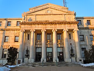
West Chester is a borough and the county seat of Chester County, Pennsylvania, United States. Located within the Philadelphia metropolitan area, the borough had a population of 18,461 at the 2010 census. West Chester is the mailing address for most of its neighboring townships. When calculated by mailing address, the population as of the 2010 U.S. Census was 108,696, which would make it the 10th largest city by mailing address in the state of Pennsylvania.
West Goshen Township is a township in Chester County, Pennsylvania, United States. The population was 23,040 at the 2020 census. In 2013, Money Magazine voted West Goshen as the 10th best place to live in America. West Goshen has also been ranked in the top 15 places to live in America from 2014 to 2017 and is also at the top of best neighborhoods to raise a family in Pennsylvania every year.
West Pikeland Township is a township in Chester County, Pennsylvania, United States. The population was 4,024 at the 2010 census.
West Whiteland Township is a township in Chester County, Pennsylvania, United States. The population was 19,632 at the 2020 census.
Westtown Township is a township in Chester County, Pennsylvania, United States. The population was 10,827 at the 2010 census.
Willistown Township is a township in Chester County, Pennsylvania, United States. The population was 10,497 at the 2010 census. At the 1860 census, the population of Willistown was 1,521, and in 1980 it was 8,269.
Chester Heights is a borough in Delaware County, Pennsylvania, United States. The population was 2,531 at the 2010 census. Most of the borough lies south of U.S. 1, about a mile southwest of Wawa.
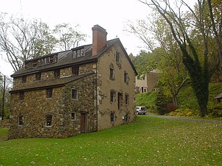
Concord Township is a township in Delaware County, Pennsylvania, United States. The population was 17,231 at the 2010 census. It contains the unincorporated communities of Concordville and Glen Mills.
Edgmont Township is a township in Delaware County, Pennsylvania. Edgmont contains the unincorporated community of Gradyville. The population was 3,987 at the 2010 census.
Marple Township is a township in Delaware County, Pennsylvania, United States. It contains the census designated place of Broomall. The population was 23,743 at 2015. ZIP codes include mainly 19008, but also partially 19064 and 19063. The township is run by Marple Township board of commissioners.
Thornbury Township is a township in Delaware County, Pennsylvania. As of the 2010 U.S. census, the population was 8,028, up from 7,093 at the 2000 census. It is adjacent to, and was once joined with, Thornbury Township in Chester County. It includes part of the census designated place of Cheyney University.
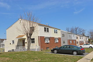
Upper Chichester Township is a civil township in Delaware County, Pennsylvania, United States. The population was 16,738 at the 2010 census.
Chester Township is a township in Delaware County, Pennsylvania, United States. The population was 3,940 at the 2010 census, down from 4,604 at the 2000 census.