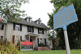
Claymont is a census-designated place (CDP) in New Castle County, Delaware. The estimated 2017 population of the 19703 ZIP code, which Claymont encompasses, was 15,292.

Brandywine is the name of an unincorporated area in Prince George's County, Maryland, United States, that refers both to a census-designated place (CDP) and a zip code area which is much larger (20613), whose areas overlap. The population of Brandywine at the 2020 U.S. Census was 10,550 for the CDP, and the population of ZIP code 20613 was 11,860 in 2010.

James Joseph Croce was an American folk and rock singer-songwriter. Between 1966 and 1973, he released five studio albums and numerous singles. During this period, Croce took a series of odd jobs to pay bills while he continued to write, record, and perform concerts. After Croce formed a partnership with songwriter and guitarist Maury Muehleisen, his fortunes turned in the early 1970s. Croce's breakthrough came in 1972; his third album, You Don't Mess Around with Jim, produced three charting singles, including "Time in a Bottle", which reached No. 1 after Croce died. The follow-up album, Life and Times, included the song "Bad, Bad Leroy Brown", which was the only No. 1 hit he had during his lifetime.

Brandywine Creek is a tributary of the Christina River in southeastern Pennsylvania and northern Delaware in the United States. The Lower Brandywine is 20.4 miles (32.8 km) long and is a designated Pennsylvania Scenic River with several tributary streams. The East Branch and West Branch of the creek originate within 2 miles (3 km) of each other on the slopes of Welsh Mountain in Honey Brook Township, Pennsylvania, about 20 miles (32 km) northwest of their confluence.

Fountain City is a neighborhood in northern Knoxville, Tennessee, in the southeastern United States. Although not a census-designated place, the populations of the two ZIP codes that serve Fountain City— 37918 and 37912— were 36,815 and 18,695, respectively, as of the 2000 U.S. census. At the time of its annexation by the city of Knoxville in 1962, Fountain City was the largest unincorporated community in the United States.
Milford Mills was a village in the Marsh Creek Valley of Chester County, Pennsylvania, United States that was inundated by the construction of the Marsh Creek Dam in 1972.
The Brandywine Battlefield Historic Site is a National Historical Landmark. The historic park is owned and operated by the Pennsylvania Historical and Museum Commission, on 52 acres (210,000 m2), near Chadds Ford, Delaware County, Pennsylvania in the United States.

Pennsylvania Route 282 is an 11.9-mile-long (19.2 km) state highway in Chester County, Pennsylvania. The route runs from PA 82 in West Nantmeal Township southeast to U.S. Route 30 Business in Downingtown. PA 282 follows Creek Road, a two-lane undivided road that winds along the East Branch Brandywine Creek through rural areas, for most of its length. The route passes through the communities of Glenmoore and Lyndell along the way. PA 282 was designated onto its current alignment in 1928.

Bethel is a census-designated place in Bethel Township, Berks County, Pennsylvania, United States. It is located at the junction of Interstate 78/U.S. Route 22 and Pennsylvania Route 501. It is in the Susquehanna watershed and drained southward into the Little Swatara Creek. Its area code is 717. As of the 2010 census, the population was 499. Bethel was the original location that Cabela's was going to build their new location before they decided to build it in Hamburg. It is the home to the international headquarters of the Assemblies of Yahweh, to several small town business shops, and to a large distribution center for Dollar General and PetSmart, which can be seen while driving down Interstate 78.

Beaver Valley straddles the Pennsylvania and Delaware border in Delaware County, PA and New Castle County, DE. An unincorporated place name, it is traversed by several streams which drain to Beaver Run which itself empties into the Brandywine River. It is approximately bounded by US Route 202 to the east, The Brandywine River to the west, Thompsons Bridge Road to the south, and Smithbridge Road to the north, with Beaver Valley Road encircling a large portion of the valley.
Tavistock is an unincorporated community in New Castle County, Delaware, United States. It is within ZIP Code Tabulation Area for 19803.
Edenridge is an unincorporated community in New Castle County, Delaware, United States in the Brandywine Hundred, north of Wilmington.

Boyers Junction is an unincorporated community in Berks County, Pennsylvania, United States. The village is located in southwestern Rockland Township, near the Ruscombmanor Township line. It is also southeast of Fleetwood and south of Lyons. It is drained by the Bieber Creek southward into the Manatawny Creek, a tributary of the Schuylkill River. The Brandywine Heights Area School District serves Boyers Junction, which uses the Fleetwood zip code of 19522.

Spinnerstown is a census-designated place in Milford Township, Bucks County, Pennsylvania, United States. It is located just northwest of the Quakertown interchange of I-476 with Route 663. As of the 2010 census, the population was 1,826 residents.
Milford Square is a census-designated place in Milford Township, Bucks County, Pennsylvania, United States. It is located along PA Route 663 near the borough of Trumbauersville. As of the 2010 census, the population was 897 residents. While the village has a PO Box post office, with the ZIP code of 18935, the surrounding area uses the Quakertown ZIP code of 18951. It is located on the Unami Creek which drains into the Perkiomen Creek. It was formerly known as Heistville, after the Heist family, who operated Achey's Mill and lived in, and greatly renovated, the miller's home.
Dryville is a census-designated place in Rockland Township, Berks County, Pennsylvania, United States. It is located one mile south of Lyons, and is located in the South Mountains and is drained by Bieber Creek into Manatawny Creek, a tributary of the Schuylkill River. It is split between the Fleetwood zip code of 19522 and the Mertztown zip code of 19539. As of the 2010 census, the population was 398 residents.

Colmar is a suburban unincorporated community located in Montgomery County, Pennsylvania, United States, along State Route 309 just northeast of Lansdale. The West Branch Neshaminy Creek forms the community's natural northern boundary and flows eastward into the Neshaminy Creek. It is located in Hatfield and Montgomery Townships. It is served by the North Penn School District and is part of the North Penn Valley region that is centered on the borough of Lansdale. Colmar is important to transportation in the northern Delaware Valley due to its location on Route 309 and having the Colmar station on the Lansdale/Doylestown Line of SEPTA Regional Rail. While Colmar has its own post office, with the ZIP code of 18915, nearby areas use the Hatfield ZIP code of 19440 or the Lansdale ZIP code of 19446.

Camp Hill is an unincorporated community that straddles Whitemarsh Township, Upper Dublin Township, and Springfield Township, Montgomery County, Pennsylvania, United States. Located approximately three miles outside Philadelphia, the area played a role in the Revolutionary War.
Venus is an unincorporated community in Clarion and Venango counties, Pennsylvania, United States. The community is located on Pennsylvania Route 157, 12.7 miles (20.4 km) east-southeast of Oil City. Venus has a post office with ZIP code 16364.
Indian Head is an unincorporated community in Fayette County, Pennsylvania, United States. The community is located along Pennsylvania Route 381, 10.4 miles (16.7 km) east of Connellsville. Indian Head has a post office with ZIP code 15446, which opened on December 17, 1853. The community was named for its location near the headwaters of Indian Creek.


