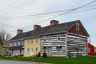
William Penn State Forest is a Pennsylvania State Forest in Pennsylvania Bureau of Forestry District #17. The main offices are located in Elverson in Chester County, Pennsylvania in the United States.

Pennsylvania Route 796 is a state highway in Chester County, Pennsylvania. The route runs 5.8 miles (9.3 km) from PA 896 in New London Township north to PA 41 in Londonderry Township. PA 796 heads through rural areas with some development along its route. In Jennersville, the route crosses Baltimore Pike and has an interchange with the U.S. Route 1 freeway. PA 796 crosses PA 926 a short distance south of its northern terminus. PA 796 was originally designated by 1930 between the Maryland border near Kemblesville and north of Jennersville. In 1937, the southern terminus was moved to its current location, with PA 896 replacing the route south to the Maryland border, while the northern end was extended to PA 926 by 1940. PA 796 was extended north to PA 41 in the 1940s.
Russellville is an unincorporated community in Upper Oxford Township in Chester County, Pennsylvania, United States. Russellville is located at the intersection of state routes 10 and 896.

Chatham is an unincorporated community in London Grove Township in Chester County, Pennsylvania, United States. Chatham is located at the intersection of state routes 41 and 841.
Springdell is an unincorporated community in West Marlborough Township in Chester County, Pennsylvania, United States. Springdell is located at the intersection of Pennsylvania Route 841 and Spring Dell Road.
Pocopson is an unincorporated community in Pocopson Township in Chester County, Pennsylvania, United States. Pocopson is located at the intersection of Pennsylvania Route 926 and Pocopson Road.
Devault is an unincorporated community in Charlestown Township in Chester County, Pennsylvania, United States. Devault is located at the intersection of Pennsylvania Route 29, Phoenixville Pike, and Charlestown Road.
Compass is an unincorporated community in West Caln Township in Chester County, Pennsylvania, United States. Compass is located at the intersection of state routes 10 and 340.
Siousca is an unincorporated community in Chester County, Pennsylvania, United States. Siousca is located at the intersection of state routes 82 and 340, at the tripoint of the city of Coatesville and Valley and West Brandywine townships.
Goshenville is an unincorporated community in East Goshen Township in Chester County, Pennsylvania, United States. Goshenville is located at the intersection of Pennsylvania Route 352 and Paoli Pike.
Lenape is an unincorporated community in Pocopson Township in Chester County, Pennsylvania, United States. Lenape is centered on the intersection of Pennsylvania Route 52 and Pocopson Road, west of the Brandywine Creek.
Mendenhall is an unincorporated community in Kennett Township in Chester County, Pennsylvania, United States. Mendenhall is located at the intersection of Pennsylvania Route 52 and Hillendale Road.
Lewisville is an unincorporated community in Elk Township in Chester County, Pennsylvania, United States. Lewisville is located at the intersection of state routes 472 and 841, just north of the Maryland border.
Doe Run is an unincorporated community in West Marlborough Township in Chester County, Pennsylvania, United States. Doe Run is located at the intersection of state routes 82 and 841.
Chesterville is an unincorporated community in Franklin Township in Chester County, Pennsylvania, United States. Chesterville is located at the intersection of Pennsylvania Route 841, Chesterville Road, and North Creek Road.
Brandamore is an unincorporated community in West Brandywine Township in Chester County, Pennsylvania, United States. Brandamore is located at the intersection of Hibernia Road and Brandamore Road, north of Coatesville.

Sadsburyville is an unincorporated area in Sadsbury Township in Chester County, Pennsylvania, United States
Suplee is an unincorporated community in Honey Brook Township in Chester County, Pennsylvania, United States. Suplee is located along Suplee Road, east of Honey Brook.
Feltonville is an unincorporated community in Delaware County in the U.S. state of Pennsylvania. Feltonville is located at the intersection of Felton Avenue and Bethel Road, adjacent to Interstate 95/U.S. Route 322 in Chester Township, northwest of the city of Chester.
Darlington Corners is an unincorporated community in Thornbury and Westtown townships in Chester County, Pennsylvania, United States. Darlington Corners is located at the intersection of U.S. Route 202/U.S. Route 322 and Pennsylvania Route 926, south of West Chester.


