East Nottingham Township, Chester County, Pennsylvania

Last updated
East Nottingham Township
Chester County Pennsylvania incorporated and unincorporated areas East Nottingham highlighted.svg
Location in Chester County and the state of Pennsylvania.
Pennsylvania in United States (US48).svg
Location of Pennsylvania in the United States
Coordinates: 39°44′00″N75°58′59″W / 39.73333°N 75.98306°W / 39.73333; -75.98306
CountryUnited States
StatePennsylvania
County Chester
Area
[1]
  Total20.14 sq mi (52.17 km2)
  Land20.03 sq mi (51.87 km2)
  Water0.12 sq mi (0.31 km2)
Elevation
499 ft (152 m)
Population
 (2020) [2]
  Total8,650
  Density430/sq mi (170/km2)
Time zone UTC-5 (EST)
  Summer (DST) UTC-4 (EDT)
Area code 610
FIPS code 42-029-21624
Website www.eastnottingham.org

East Nottingham Township is a township in Chester County, Pennsylvania, United States. The population was 8,650 at the 2020 census. [2]

Contents

History

1883 map of East Nottingham Township from Breou's Farm Atlas Breou's Farm Atlas East Nottingham Township.png
1883 map of East Nottingham Township from Breou's Farm Atlas

It is named after Nottinghamshire, England. [3] The township was originally disputed territory between Pennsylvania and Maryland, resolved eventually by the Mason–Dixon line. [3] Half of the current township also formed part of the northern section of Susquehanna Manor, a large settlement tract as part of Maryland belonging to George Talbot, nephew of Lord Baltimore, which he later named New Connaught after the western province of Connacht in Ireland that courted Irish settlement into the area. [3] [4] The dispute led to heavy Quaker and Scotch-Irish settlement of the area. [3] The Hopewell Historic District is listed on the National Register of Historic Places. [5]

Geography

According to the United States Census Bureau, the township has a total area of 20.1 square miles (52 km2), of which 20.0 square miles (52 km2) is land and 0.04 square miles (0.10 km2), or 0.10%, is water.

Demographics

2020 census

As of the 2020 United States census, [6] there were 8,982 people.

2010 census

At the 2010 census, the township was 86.0% non-Hispanic White, 3.1% Black or African American, 0.4% Asian, and 2.0% were two or more races. 9.2% of the population were of Hispanic or Latino ancestry. [7]

As of the census [8] of 2000, there were 5,516 people, 1,759 households, and 1,442 families living in the township. The population density was 275.3 inhabitants per square mile (106.3/km2). There were 1,837 housing units at an average density of 91.7 per square mile (35.4/km2). The racial makeup of the township was 92.97% White, 2.94% African American, 0.25% Native American, 0.24% Asian, 2.32% from other races, and 1.29% from two or more races. Hispanic or Latino of any race were 5.29% of the population.

Historical population
CensusPop.Note
1930 1,339
1940 1,57617.7%
1950 1,74810.9%
1960 2,29831.5%
1970 2,4024.5%
1980 3,11129.5%
1990 3,84123.5%
2000 5,51643.6%
2010 8,65056.8%
2020 8,9823.8%
[9] [2]

There were 1,759 households, out of which 44.3% had children under the age of 18 living with them, 70.6% were married couples living together, 7.0% had a female householder with no husband present, and 18.0% were non-families. 12.7% of all households were made up of individuals, and 4.7% had someone living alone who was 65 years of age or older. The average household size was 3.13 and the average family size was 3.41.

In the township the population was spread out, with 32.6% under the age of 18, 7.0% from 18 to 24, 33.3% from 25 to 44, 19.9% from 45 to 64, and 7.3% who were 65 years of age or older. The median age was 32 years. For every 100 females there were 107.3 males. For every 100 females age 18 and over, there were 103.4 males.

The median income for a household in the township was $53,864, and the median income for a family was $57,904. Males had a median income of $39,920 versus $31,731 for females. The per capita income for the township was $19,710. About 4.4% of families and 8.7% of the population were below the poverty line, including 13.6% of those under age 18 and none of those age 65 or over.

Transportation

US 1 northbound in East Nottingham Township 2022-09-15 09 56 12 View north along U.S. Route 1 (Kennett-Oxford Bypass) from the overpass for Forge Road in East Nottingham Township, Chester County, Pennsylvania.jpg
US 1 northbound in East Nottingham Township

As of 2022, there were 88.09 miles (141.77 km) of public roads in East Nottingham Township, of which 28.22 miles (45.42 km) were maintained by the Pennsylvania Department of Transportation (PennDOT) and 59.87 miles (96.35 km) were maintained by the township. [10]

U.S. Route 1 is the most prominent highway serving East Nottingham Township. It follows the Kennett-Oxford Bypass along a northeast-southwest alignment through the western portion of the township. Pennsylvania Route 272 follows Chrome Road and Christine Road along a southeast-northwest alignment through the southern portion of the township. Finally, Pennsylvania Route 472 follows Hickory Hill Road along a northwest-southeast alignment through the northeastern portion of the township.

Related Research Articles

<span class="mw-page-title-main">Birmingham Township, Chester County, Pennsylvania</span> Township in Pennsylvania, United States

Birmingham Township is a township in Chester County, Pennsylvania, United States. The population was 4,085 at the 2020 census.

<span class="mw-page-title-main">Charlestown Township, Chester County, Pennsylvania</span> Township in Pennsylvania, United States

Charlestown Township is a township in Chester County, Pennsylvania, United States. The population was 6,003 at the 2020 census.

<span class="mw-page-title-main">East Bradford Township, Chester County, Pennsylvania</span> Township in Pennsylvania, United States

East Bradford Township is a township in Chester County, Pennsylvania, United States. The population was 10,308 at the 2020 census.

<span class="mw-page-title-main">East Caln Township, Chester County, Pennsylvania</span> Township in Pennsylvania, United States

East Caln Township is a township in Chester County, Pennsylvania, United States. The population was 5,380 at the 2020 census. The township wraps around the eastern half of Downingtown and is mostly indistinguishable from it. East Caln Township is very developed, containing several shopping centers, including the regionally important Brandywine Square Center, several recently constructed housing developments varying from condominiums to large single family homes, and some industry in the southern fringe of the township.

<span class="mw-page-title-main">East Coventry Township, Chester County, Pennsylvania</span> Township in Pennsylvania, United States

East Coventry Township is a township in Chester County, Pennsylvania, United States. The population was 7,068 at the 2020 census.

<span class="mw-page-title-main">East Marlborough Township, Chester County, Pennsylvania</span> Township in Pennsylvania, United States

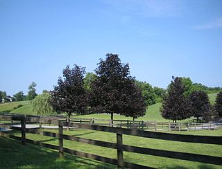
East Marlborough Township is a township in Chester County, Pennsylvania, United States. The population was 7,026 at the 2010 census. East Marlborough and West Marlborough townships were carved out of the larger Marlborough Township in 1729. The township is home to many Penn Oak trees, trees that were in existence when William Penn explored the area.

<span class="mw-page-title-main">Franklin Township, Chester County, Pennsylvania</span> Township in Pennsylvania, United States

Franklin Township is a township in Chester County, Pennsylvania, United States. The population was 4,352 at the 2010 census.

<span class="mw-page-title-main">London Britain Township, Chester County, Pennsylvania</span> Township in Pennsylvania, United States

London Britain Township is a township in Chester County, Pennsylvania, United States. The population was 3,139 at the 2010 census. White Clay Creek Preserve is a Pennsylvania state park in London Britain Township, along White Clay Creek.

<span class="mw-page-title-main">Lower Oxford Township, Pennsylvania</span> Township in Pennsylvania, United States

Lower Oxford Township is a township in Chester County, Pennsylvania, United States. The population was 5,420 at the 2020 census. Lincoln University, a historically black university, is located in the township.

<span class="mw-page-title-main">New Garden Township, Pennsylvania</span> Township in Pennsylvania, United States

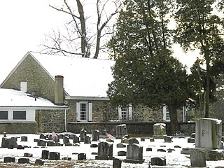
New Garden Township is a township in Chester County, Pennsylvania, United States, which was organized in 1714. The population was 11,363 at the 2020 census. New Garden is the center of the mushroom agribusiness in southeastern Pennsylvania with a higher concentration of composting, mushroom growing, packaging, and shipping businesses than in any other municipality in the area. It was named for the New Garden Friends' Meeting House, an eighteenth-century brick house of worship of the Religious Society of Friends, within its territorial limits.

<span class="mw-page-title-main">Pennsbury Township, Pennsylvania</span> Township in Pennsylvania, United States

Pennsbury Township is a township in Chester County, Pennsylvania, United States. The population was 3,604 at the 2010 census.

<span class="mw-page-title-main">South Coventry Township, Pennsylvania</span> Township in Pennsylvania, United States

South Coventry Township is a township in Chester County, Pennsylvania, United States. The population was 2,604 at the 2010 census.

<span class="mw-page-title-main">Upper Uwchlan Township, Pennsylvania</span> Township in Pennsylvania, United States

Upper Uwchlan Township is a township in Chester County, Pennsylvania, United States. The population was 11,227 at the 2010 census. The township included the community of Milford Mills before it was inundated by the creation of the Marsh Creek Dam in 1972.

<span class="mw-page-title-main">Valley Township, Chester County, Pennsylvania</span> Township in Pennsylvania, United States

Valley Township is a township in Chester County, Pennsylvania, United States. The population was 6,794 at the 2010 census.

<span class="mw-page-title-main">Wallace Township, Pennsylvania</span> Township in Pennsylvania, United States

Wallace Township is a township in Chester County, Pennsylvania, United States. The population was 3,458 at the 2010 census.

<span class="mw-page-title-main">West Brandywine Township, Pennsylvania</span> Township in Pennsylvania, United States

West Brandywine Township is a township that is located in Chester County, Pennsylvania, United States. The population was 7,394 at the time of the 2010 census.

<span class="mw-page-title-main">West Caln Township, Pennsylvania</span> Township in Pennsylvania, United States

West Caln Township is a township that is located in Chester County, Pennsylvania, United States. The population was 9,014 at the time of the 2010 census.

<span class="mw-page-title-main">West Nottingham Township, Pennsylvania</span> Township in Pennsylvania, United States

West Nottingham Township is a township in Chester County, Pennsylvania, United States. The population was 2,722 at the 2010 census.

<span class="mw-page-title-main">West Pikeland Township, Pennsylvania</span> Township in Pennsylvania, United States

West Pikeland Township is a township in Chester County, Pennsylvania, United States. The population was 4,024 at the 2010 census.

<span class="mw-page-title-main">West Sadsbury Township, Pennsylvania</span> Township in Pennsylvania, United States

West Sadsbury Township is a township in Chester County, Pennsylvania, United States. The population was 2,444 at the 2010 census.

References

  1. "2016 U.S. Gazetteer Files". United States Census Bureau. Retrieved Aug 13, 2017.
  2. 1 2 3 "QuickFacts: East Nottingham township, Chester County, Pennsylvania". census.gov. Census 2020. Retrieved 2021-10-08.
  3. 1 2 3 4 "Nottingham Lots / Rising Sun, MD". www.risingsunmd.org. Retrieved 2016-05-08.
  4. Johnston, George (2009-06-01). History of Cecil County, Maryland. Genealogical Publishing Com. ISBN   9780806379883.
  5. "National Register Information System". National Register of Historic Places . National Park Service. July 9, 2010.
  6. Bureau, US Census. "Census.gov". Census.gov. Retrieved 2023-04-26.
  7. "Archived copy". USA Today . Archived from the original on 2012-02-15. Retrieved 2017-08-26.{{cite web}}: CS1 maint: archived copy as title (link)
  8. "U.S. Census website". United States Census Bureau . Retrieved 2008-01-31.
  9. "DVRPC > Site Search". Archived from the original on 2019-04-09. Retrieved 2014-03-21.
  10. "East Nottingham Township map" (PDF). PennDOT. Retrieved March 13, 2023.