East Whiteland Township, Chester County, Pennsylvania

Last updated

East Whiteland Township
White Horse Tavern PA.JPG
Chester County Pennsylvania incorporated and unincorporated areas East Whiteland highlighted.svg
Location in Chester County and the state of Pennsylvania.
Pennsylvania in United States (US48).svg
Location of Pennsylvania in the United States
Coordinates: 40°02′20″N75°33′18″W / 40.03889°N 75.55500°W / 40.03889; -75.55500
CountryUnited States
StatePennsylvania
County Chester
Founded1704
Government
[1]
  TypeBoard of Supervisors
  SupervisorSue Drummond
  SupervisorScott Lambert
  SupervisorRichard Orlow
Area
[2]
  Total11.00 sq mi (28.50 km2)
  Land10.94 sq mi (28.32 km2)
  Water0.07 sq mi (0.17 km2)
Elevation
427 ft (130 m)
Population
 (2010)
  Total10,650
  Estimate 
(2016) [3]
11,517
  Density1,053.22/sq mi (406.64/km2)
Time zone UTC-5 (EST)
  Summer (DST) UTC-4 (EDT)
Area code 610
FIPS code 42-029-22056
Website www.eastwhiteland.org

East Whiteland Township is a township in Chester County, Pennsylvania, United States. The population was 13,913 at the 2020 Census. Mailing addresses associated with East Whiteland include Malvern, Frazer, and a small area of Exton. [4]

Contents

History

Founded in 1704, Whiteland Township was made up of what is today known as East and West Whiteland townships. The first European settlers were Welsh. The name Whiteland came from Whitford Garden in Flintshire, Wales. [5] Whiteland Township was divided into two townships in 1765.

Native Americans called the area "The Dark Valley" because of the numerous trees and undergrowth. During the American Revolution, Gen. George Washington and many of his troops camped at Malin Hall here. They were preparing for a September 16, 1777, encounter with British General William Howe. The Continental Army also camped near White Horse Inn on Swedesford Road. Because of bad weather, however, the "Battle of the Clouds" was never fought.

The Lapp Log House, St. Peter's Church in the Great Valley, Spring Mill Complex, and White Horse Tavern are listed on the National Register of Historic Places. [6]

Geography

According to the United States Census Bureau, the township has a total area of 11.0 square miles (28 km2), of which 0.04 square miles (0.10 km2), or 0.27%, is water. East Whiteland Township is located about 25 miles (40 km) west of Philadelphia.

The township has a ridge of hills along its northern and southern boundaries. These constitute the valley walls of the Great Valley, which runs generally west to east toward the Schuylkill River. In the center of the township, there is a somewhat uneven valley floor. The Great Valley contains a number of streams, including Valley Creek and Little Valley Creek, which is a narrow stream that goes across land and woodlands. [7]

Demographics

Historical population
CensusPop.Note
1930 1,334
1940 1,290−3.3%
1950 1,74034.9%
1960 5,078191.8%
1970 7,24242.6%
1980 8,46816.9%
1990 8,398−0.8%
2000 9,33311.1%
2010 10,65014.1%
2020 13,91730.7%
[8] [9]

At the 2010 census, the township was 77.1% non-Hispanic White, 3.3% Black or African American, 0.2% Native American, 11.6% Asian, and 1.5% were two or more races. 6.9% of the population were of Hispanic or Latino ancestry. [10]

As of the census [11] of 2000, there were 9,333 people, 3,254 households, and 2,255 families residing in the township. The population density was 848.6 inhabitants per square mile (327.6/km2). There were 3,460 housing units at an average density of 314.6 per square mile (121.5/km2). The racial makeup of the township was 89.57% White, 3.28% African American, 0.09% Native American, 4.98% Asian, 0.04% Pacific Islander, 0.73% from other races, and 1.31% from two or more races. Hispanic or Latino of any race were 2.42% of the population.

There were 3,254 households, out of which 34.9% had children under the age of 18 living with them, 58.3% were married couples living together, 7.7% had a female householder with no husband present, and 30.7% were non-families. 24.4% of all households were made up of individuals, and 5.8% had someone living alone who was 65 years of age or older. The average household size was 2.59 and the average family size was 3.13.

In the township the population was spread out, with 24.0% under the age of 18, 8.5% from 18 to 24, 29.6% from 25 to 44, 23.6% from 45 to 64, and 14.3% who were 65 years of age or older. The median age was 38 years. For every 100 females, there were 84.1 males. For every 100 females age 18 and over, there were 79.6 males.

The median income for a household in the township was $69,500, and the median income for a family was $75,818. Males had a median income of $55,969 versus $35,507 for females. The per capita income for the township was $30,258. About 3.9% of families and 4.7% of the population were below the poverty line, including 3.6% of those under age 18 and 6.5% of those age 65 or over.

Economy

Home to the Great Valley Corporate Center, the township also serves as U.S headquarters to several national and international firms including Siemens Health Services (formerly SMS), Vishay, SCT, Centocor and Aegon, as well as being home to numerous smaller businesses and retail shops. The Frazer Diner is a 1929 diner on U.S. Route 30 in Frazer.[ citation needed ]

Acme Markets has its headquarters in the township. [12] [13]

Education

The Great Valley School District serves as the public education for the township. The public schools serving the township are Kathryn D. Markley Elementary, Great Valley Middle School, and Great Valley High School. Penn State has a graduate center here, Penn State Great Valley. [14] LeBow College of Drexel University and Immaculata University are located in the township. [14] [15] [16]

Government

Board of Supervisors

East Whiteland Township is governed by a three-member Board of Supervisors elected at-large, who each serve six-year terms that include executive and legislative responsibilities. There is no mayor.

Transportation

Roads and highways

US 202 northbound in East Whiteland Township 2022-09-02 14 55 30 View north along U.S. Route 202 from the overpass for Sidley Road in East Whiteland Township, Chester County, Pennsylvania.jpg
US 202 northbound in East Whiteland Township

As of 2018, there were 69.14 miles (111.27 km) of public roads in East Whiteland Township, of which 22.11 miles (35.58 km) were maintained by the Pennsylvania Department of Transportation (PennDOT) and 47.03 miles (75.69 km) were maintained by the township. [17]

U.S. Route 202 is the main highway serving East Whiteland Township. It follows a southwest-northeast alignment through the central portion of the township. U.S. Route 30 follows Lancaster Avenue along a southwest-northeast alignment through the southern portion of the township. Pennsylvania Route 29 follows Morehall Road and Charlestown Road northwest from US 30 across the northeastern portion of the township. Pennsylvania Route 352 follows Sproul Road southeast from US 30 across the southern part of the township. Finally, Pennsylvania Route 401 follows Conestoga Road northwest from US 30 through central and western portions of the township.

Public transportation

The former main line of the Pennsylvania Railroad, currently owned and operated by Amtrak and also used by SEPTA, passes through the township. While no stations are located in the township, SEPTA Frazer Yard is a maintenance facility for the Paoli/Thorndale Line regional rail service. In 2019, the Delaware Valley Regional Planning Commission conducted a feasibility study for a new SEPTA station in East Whiteland and recommended a location near Immaculata University. [18]

SEPTA suburban bus route 92 runs along King Road from West Chester to King of Prussia, while route 204 runs along US 30 between Lionville and Paoli.

Related Research Articles

<span class="mw-page-title-main">Charlestown Township, Chester County, Pennsylvania</span> Township in Pennsylvania, United States

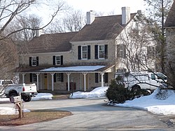
Charlestown Township is a township in Chester County, Pennsylvania, United States. The population was 6,003 at the 2020 census.

<span class="mw-page-title-main">Chesterbrook, Pennsylvania</span> Census-designated place in Pennsylvania, United States

Chesterbrook is a census-designated place (CDP) in Chester County, Pennsylvania, United States. It is located within the Philadelphia metropolitan area and just south of Valley Forge National Historical Park. The population was 4,589 at the 2010 census.

<span class="mw-page-title-main">East Bradford Township, Chester County, Pennsylvania</span> Township in Pennsylvania, United States

East Bradford Township is a township in Chester County, Pennsylvania, United States. The population was 10,308 at the 2020 census.

<span class="mw-page-title-main">East Goshen Township, Chester County, Pennsylvania</span> Township in Pennsylvania, United States

East Goshen Township is a township in Chester County, Pennsylvania, United States. The population was 18,026 at the 2010 census.

<span class="mw-page-title-main">East Marlborough Township, Chester County, Pennsylvania</span> Township in Pennsylvania, United States

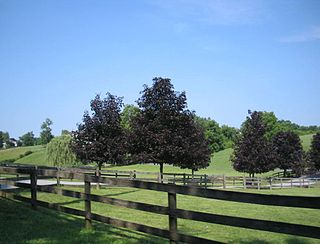
East Marlborough Township is a township in Chester County, Pennsylvania, United States. The population was 7,026 at the 2010 census. East Marlborough and West Marlborough townships were carved out of the larger Marlborough Township in 1729. The township is home to many Penn Oak trees, trees that were in existence when William Penn explored the area.

<span class="mw-page-title-main">Exton, Pennsylvania</span> Census-designated place in Pennsylvania, United States

Exton is a census-designated place (CDP) in West Whiteland Township in Chester County, Pennsylvania, United States. Its population was 5,622 at the 2020 census. The Exton Square Mall and Main Street at Exton are both located within Exton along with several other shopping centers, making Exton the major shopping district in Chester County.

<span class="mw-page-title-main">Malvern, Pennsylvania</span> Borough in Pennsylvania, United States

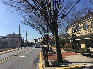
Malvern is a borough in Chester County, Pennsylvania, United States. Malvern is the terminus of the Philadelphia Main Line. It is 19.4 miles (31.2 km) west of Philadelphia. The population was 3,419 at the 2020 census.

<span class="mw-page-title-main">Sadsbury Township, Chester County, Pennsylvania</span> Township in Pennsylvania, United States

Sadsbury Township is a township in Chester County, Pennsylvania, United States. The population was 3,570 at the 2010 census.

<span class="mw-page-title-main">Tredyffrin Township, Pennsylvania</span> Township in Pennsylvania, United States

Tredyffrin Township is a township located in eastern Chester County, Pennsylvania, United States. The population was 29,332 at the 2010 census.

<span class="mw-page-title-main">Uwchlan Township, Pennsylvania</span> Township in Pennsylvania, United States

Uwchlan Township is a township in Chester County, Pennsylvania, United States. The population was 19,161 at the 2020 census.

<span class="mw-page-title-main">West Whiteland Township, Pennsylvania</span> Township in Pennsylvania, United States

West Whiteland Township is a township in Chester County, Pennsylvania, United States. The population was 19,632 at the 2020 census.

<span class="mw-page-title-main">Willistown Township, Pennsylvania</span> Township in Pennsylvania, United States

Willistown Township is a township in Chester County, Pennsylvania, United States. The population was 10,497 at the 2010 census. At the 1860 census, the population of Willistown was 1,521, and in 1980 it was 8,269.

<span class="mw-page-title-main">Edgmont Township, Delaware County, Pennsylvania</span> Township in Pennsylvania, United States

Edgmont Township is a township in Delaware County, Pennsylvania, United States. Edgmont contains the unincorporated community of Gradyville. The population was 3,987 at the 2010 census.

<span class="mw-page-title-main">Middletown Township, Delaware County, Pennsylvania</span> Home rule municipality in Pennsylvania, United States

Middletown Township is a township in Delaware County, Pennsylvania, United States. The population was 15,807 at the 2010 census. The Pennsylvania State University has an undergraduate satellite campus called Penn State Brandywine located in the north-central portion of the township. Located outside of Philadelphia, it constitutes part of the Delaware Valley.

<span class="mw-page-title-main">Thornbury Township, Delaware County, Pennsylvania</span> Township in Pennsylvania, United States

Thornbury Township is a township in Delaware County, Pennsylvania, United States. As of the 2010 U.S. census, the population was 8,028, up from 7,093 at the 2000 census. It is adjacent to, and was once joined with, Thornbury Township in Chester County. It includes part of the census designated place of Cheyney University.

<span class="mw-page-title-main">Franconia Township, Montgomery County, Pennsylvania</span> Township in Pennsylvania, United States

Franconia Township is a township in Montgomery County, Pennsylvania, United States. The population was 13,064 at the 2010 census.

<span class="mw-page-title-main">Whitemarsh Township, Pennsylvania</span> Home rule municipality in Pennsylvania, United States

Whitemarsh Township is a Home rule municipality in Montgomery County, Pennsylvania. It retains its former classification of "Township" in its official name despite being a home rule municipality. The population was 17,349 at the 2010 census. Whitemarsh is adjacent to the neighborhood of Andorra in the Roxborough section of Philadelphia, and is bordered in Montgomery County by Springfield, Upper Dublin, Whitpain, and Plymouth townships, Conshohocken, and the Schuylkill River, which separates it from Lower Merion Township.

<span class="mw-page-title-main">Nether Providence Township, Pennsylvania</span> Township in Pennsylvania, United States

Nether Providence Township is a first class township in Delaware County, Pennsylvania, United States. Many residents refer to the township by the name of its largest community, Wallingford, because the Wallingford postal code is used for most of the township. The population of the township was 13,706 at the 2010 census.

<span class="mw-page-title-main">Upper Providence Township, Delaware County, Pennsylvania</span> Home rule municipality in Pennsylvania, United States

Upper Providence Township is a township in Delaware County, Pennsylvania, United States, located around and to the north of the borough of Media, and approximately 15 miles (24 km) west of center city Philadelphia. The population was 10,142 at the 2010 census. The township lies between Ridley Creek on the west and Crum Creek on the east. Most of Ridley Creek State Park is in the township, towards the northern edge. Zoning is 98% residential, 1% commercial and 1% industrial, with minimal space zoned to commercial business.

<span class="mw-page-title-main">Frazer, Pennsylvania</span> Unincorporated community in Pennsylvania, United States

Frazer is a census-designated place (CDP) in East Whiteland Township in Chester County, Pennsylvania, United States. It is located along US 30 between Exton and Malvern, and is the northern terminus for Pennsylvania Route 352. The former main line of the Pennsylvania Railroad, currently owned and operated by Amtrak and also used by SEPTA, passes through Frazer. While no station is located there, SEPTA Frazer Yard is a maintenance facility for the Paoli/Thorndale Line regional rail service. In 2019, the Delaware Valley Regional Planning Commission conducted a feasibility study for a new SEPTA station in Frazer and recommended a location near Immaculata University.

References

  1. "Board of Supervisors". East whiteland Township. Retrieved February 25, 2020.
  2. "2016 U.S. Gazetteer Files". United States Census Bureau. Retrieved August 13, 2017.
  3. "Population and Housing Unit Estimates" . Retrieved June 9, 2017.
  4. "Archived copy". Archived from the original on December 28, 2009. Retrieved September 2, 2009.{{cite web}}: CS1 maint: archived copy as title (link)
  5. "Chester County Archives, Township & Borough Boundary History". Archived from the original on July 18, 2011. Retrieved November 30, 2008.
  6. "National Register Information System". National Register of Historic Places . National Park Service. July 9, 2010.
  7. "East Whiteland Township: About East Whiteland Township". Archived from the original on July 7, 2006. Retrieved October 25, 2006.
  8. "DVRPC > Site Search". Archived from the original on April 9, 2019. Retrieved March 21, 2014.
  9. "Census 2020".
  10. "Census 2010: Philadelphia gains, Pittsburgh shrinks in population". USA Today . Archived from the original on March 14, 2011.
  11. "U.S. Census website". United States Census Bureau . Retrieved January 31, 2008.
  12. "Acme Fast Facts Archived 2011-07-07 at the Wayback Machine ." Acme Markets. Retrieved on February 14, 2011. "Division Office Headquarters at 75 Valley Stream Parkway, Malvern, PA 19355"
  13. "Zoning Map". East Whiteland Township, Pennsylvania . Retrieved March 31, 2021.
  14. 1 2 "The Schools and Colleges Archived 2011-07-21 at the Wayback Machine ." East Whiteland Township. Retrieved on February 13, 2011.
  15. "East Whiteland township, Chester county, Pennsylvania [ permanent dead link ]." U.S. Census Bureau . Retrieved on June 16, 2009.
  16. Home page. Immaculata University. Retrieved on June 16, 2009.
  17. "East Whiteland Township map" (PDF). PennDOT. Retrieved March 13, 2023.
  18. "Train Station Feasibility Study". East Whiteland Township, PA. Retrieved June 14, 2023.