Fox Chase, Berks County, Pennsylvania

Last updated
Fox Chase, Berks County,
Pennsylvania
USA Pennsylvania location map.svg
Red pog.svg
Fox Chase
Usa edcp location map.svg
Red pog.svg
Fox Chase
Coordinates: 40°23′44″N75°57′44″W / 40.39556°N 75.96222°W / 40.39556; -75.96222 Coordinates: 40°23′44″N75°57′44″W / 40.39556°N 75.96222°W / 40.39556; -75.96222
Country United States
State Pennsylvania
County Berks
Township Muhlenberg
Population
 (2010)
  Total1,622
Time zone UTC-5 (Eastern (EST))
  Summer (DST) UTC-4 (EDT)

Fox Chase is a census-designated place [1] in Muhlenberg Township, Berks County, Pennsylvania, United States. It is located approximately 4 miles north of the city of Reading along the Schuylkill River. As of the 2010 census, the population was 1,622 residents. [2]

A census-designated place (CDP) is a concentration of population defined by the United States Census Bureau for statistical purposes only. CDPs have been used in each decennial census since 1980 as the counterparts of incorporated places, such as self-governing cities, towns, and villages, for the purposes of gathering and correlating statistical data. CDPs are populated areas that generally include one officially designated but currently unincorporated small community, for which the CDP is named, plus surrounding inhabited countryside of varying dimensions and, occasionally, other, smaller unincorporated communities as well. CDPs include small rural communities, colonias located along the U.S. border with Mexico, and unincorporated resort and retirement communities and their environs.

Muhlenberg Township, Berks County, Pennsylvania Township in Pennsylvania, United States

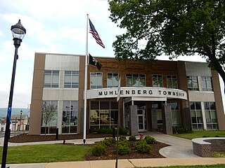
Muhlenberg Township is a township in Berks County, Pennsylvania, United States. The population was 19,628 at the 2010 census. Making it the third most populous township in Berks County after Spring Township and, Exeter Township. It was named for Lutheran pastor Henry Muhlenberg, who is on the township seal.

Berks County, Pennsylvania County in the United States

Berks County is a county located in the U.S. state of Pennsylvania. As of the 2010 census, the population was 411,442. The county seat is Reading.

Related Research Articles

Rossford, Ohio City in Ohio, United States

Rossford is a city in Wood County, Ohio, United States, located along the Maumee River in the Toledo metropolitan area. The population was 6,293 at the 2010 census. The town includes the intersection of Interstate 75 and the Ohio Turnpike. Rossford Public Library and WPAY serve the community.

Klarvatten, Edmonton Neighbourhood in Edmonton, Alberta, Canada

Klarvatten is a residential neighbourhood in north Edmonton, Alberta, Canada. Its location gives residents good access to CFB Edmonton.

Eastwood, Edmonton Neighbourhood in Edmonton, Alberta, Canada

Eastwood is a residential neighbourhood in north central Edmonton, Alberta, Canada. It is one of Edmonton's older neighbourhoods, with development starting in 1906. Today, most of the residential construction (88%) dates from after World War II.

Thorncliff, Edmonton Neighbourhood in Edmonton, Alberta, Canada

Thorncliff is a neighbourhood in west Edmonton, Alberta, Canada located immediately to the south of West Edmonton Mall. According to the neighbourhood description in the City of Edmonton Map Utility. the neighbourhood was designed to control urban sprawl and improve the delivery of services. Whitemud Drive, located just to the south of the neighbourhood, provides good access to destinations on the south side, including the University of Alberta, Fort Edmonton Park, and the Southgate Centre shopping mall.

Wellington, Edmonton Neighbourhood in Edmonton, Alberta, Canada

Wellington is a residential neighbourhood located in north west Edmonton, Alberta, Canada.

Pleasantview, Edmonton Neighbourhood in Edmonton, Alberta, Canada

Pleasantview is a residential neighbourhood in south west Edmonton, Alberta, Canada.

Kernohan, Edmonton Neighbourhood in Edmonton, Alberta, Canada

Kernohan is a residential neighbourhood located in the Clareview area of north east Edmonton, Alberta, Canada. It is "named for an early pioneer farmer who operated a grocery store here in the 1880s and 90s.

Glengarry, Edmonton Neighbourhood in Edmonton, Alberta, Canada

Glengarry is a residential neighbourhood located in north east Edmonton, Alberta, Canada. Northgate Centre, a major shopping mall, is located in the neighbourhood's north west corner. North Town Mall is located immediately to the north of Glengarry in the neighbourhood of Northmount.

Baumstown, Pennsylvania Census-designated place in Pennsylvania, United States

Baumstown is a census-designated place in Exeter Township, Berks County, Pennsylvania, near the borough of Birdsboro. It is located at the junction of U.S. Highway 422 and Pennsylvania Route 345. As of the 2010 census the population of Baumstown was 422 residents.

Grill, Pennsylvania Census-designated place in Pennsylvania, United States

Grill is a census-designated place in Cumru Township, Berks County, Pennsylvania. It is located just to the east of the borough of Kenhorst at the intersection of PA routes 625 and 724. The area is generally suburban in nature, and is served by the Governor Mifflin School District. As of the 2010 census, the population was 1,468 residents.

Colony Park, Pennsylvania Census-designated place in Pennsylvania, United States

Colony Park is a census-designated place in Spring Township, Berks County, Pennsylvania, United States. It is located just off US 222 about 1 mile northwest of the borough of Wyomissing. As of the 2010 census, the population was 1,076 residents.

Edenburg, Pennsylvania Census-designated place in Pennsylvania, United States

Edenburg is a census-designated place in Windsor Township, Berks County, Pennsylvania, United States. It is located along Old Route 22, and very close to I-78 about 2 miles from Hamburg. As of the 2010 census, the population was 681 residents.

Greenfields, Pennsylvania Census-designated place in Pennsylvania, United States

Greenfields is a census-designated place in Bern Township, Berks County, Pennsylvania. It is located about 1 mile to west of the city of Reading at the confluence of the Tulpehocken Creek and Schuylkill River. As of the 2010 census, the population was 1,170 residents.

Killi Village in Idlib, Syria

Killi is a village in northern Syria, administratively part of the Idlib Governorate, located northwest of Idlib. It is situated just west of the A'la Mountains. Nearby localities include Kaftin to the southeast, Maarrat al-Ikhwan and Kafr Yahmul to the south, Hizano to the southwest, Atarib to the northwest, Sarmada to the north, Barisha to the northeast and Qurqania to the east. According to the Syria Central Bureau of Statistics, Killi had a population of 7,157 in the 2004 census.

References

  1. "Archived copy". Archived from the original on 2013-12-21. Retrieved 2013-02-10.CS1 maint: Archived copy as title (link)
  2. https://www.census.gov/#