Bechtelsville, Pennsylvania

Last updated
Bechtelsville, Pennsylvania
Old Pennsylvania State Route 100 (5679547801).jpg
Old Pennsylvania Route 100 in Bechtelsville
Bechtelsville.png
Location of Bechtelsville in Berks County, Pennsylvania.
USA Pennsylvania location map.svg
Red pog.svg
Bechtelsville
Location of Bechtelsville in Pennsylvania
Usa edcp location map.svg
Red pog.svg
Bechtelsville
Bechtelsville (the United States)
Coordinates: 40°22′12″N75°37′43″W / 40.37000°N 75.62861°W / 40.37000; -75.62861
CountryUnited States
State Pennsylvania
County Berks
Area
[1]
  Total0.53 sq mi (1.37 km2)
  Land0.53 sq mi (1.37 km2)
  Water0.00 sq mi (0.01 km2)
Elevation
404 ft (123 m)
Population
 (2020) [2]
  Total884
  Density1,674.24/sq mi (647.03/km2)
Time zone UTC-5 (EST)
  Summer (DST) UTC-4 (EDT)
ZIP Code
19505
Area codes 610 and 484

Bechtelsville is a borough in Berks County, Pennsylvania, United States. The population was 884 at the 2020 census.

Contents

Geography

Bechtelsville is located at 40°22′12″N75°37′43″W / 40.37000°N 75.62861°W / 40.37000; -75.62861 (40.370078, −75.628590). [3] According to the U.S. Census Bureau, the borough has a total area of 0.5 square miles (1.3 km2), all land.

Transportation

Chestnut Street in Bechtelsville 2022-08-30 16 52 00 View southeast along East Chestnut Street just southeast of Railroad Street in Bechtelsville, Berks County, Pennsylvania.jpg
Chestnut Street in Bechtelsville

As of 2006, there were 4.06 miles (6.53 km) of public roads in Bechtelsville, of which 1.81 miles (2.91 km) were maintained by the Pennsylvania Department of Transportation (PennDOT) and 2.25 miles (3.62 km) were maintained by the borough. [4]

No numbered highways pass directly through Bechtelsville. Main thoroughfares in the borough include Main Street, Chestnut Street, Race Street and Mill Street. The closest state highway is Pennsylvania Route 100, which passes a short distance southeast of the borough.

Demographics

Historical population
CensusPop.Note
1900 381
1910 4179.4%
1920 50220.4%
1930 5499.4%
1940 5876.9%
1950 6032.7%
1960 6253.6%
1970 72816.5%
1980 83214.3%
1990 8643.8%
2000 9317.8%
2010 9421.2%
2020 884−6.2%
Sources: [5] [6] [7] [2]

At the 2010 census there were 942 people, 362 households, and 264 families living in the borough. The population density was 1,884 people per square mile (678.2 per km2). There were 362 housing units at an average density of 224 per square mile (266.6 per km2). The racial makeup of the borough was 98.3% White, 0.2% African American, 0.1% Asian, 0.1% from other races, and 1.2% from two or more races. Hispanic or Latino of any race were 1.3%. [6]

There were 362 households, 31.2% had children under the age of 18 living with them, 65.5% were married couples living together, 12.4% had a female householder with no husband present, and 27.1% were non-families. 20.4% of households were made up of individuals, and 7.5% were one person aged 65 or older. The average household size was 3.60 and the average family size was 3.98.

The age distribution was 24.6% under the age of 20, 7.4% from 20 to 24, 27.4% from 25 to 44, 29.7% from 45 to 64, and 11.0% 65 or older. The median age was 39.6 years. For every 100 females there were 92.25 males. For every 100 females age 18 and over, there were 91.6 males.

While the following data has not yet been released from the 2010 Census, as of the 2000 Census, the median household income was in the borough was $88,846, and the median family income was $92,045. Males had a median income of $46,938 versus $33,828 for females. The per capita income for the borough was $19,627. About 0.2% of families and 0.3% of the population were below the poverty line, including 0.1% of those under age 18 and 0.3% of those age 65 or over.

Public education

The borough is served by the Boyertown Area School District.

Related Research Articles

<span class="mw-page-title-main">West Kittanning, Pennsylvania</span> Borough in Pennsylvania, United States

West Kittanning is a borough in Armstrong County, Pennsylvania, United States. The population was 1,192 at the 2020 census.

<span class="mw-page-title-main">Lenhartsville, Pennsylvania</span> Borough in Pennsylvania, United States

Lenhartsville is a borough in Berks County, Pennsylvania, United States. The population was 180 at the 2020 census.

<span class="mw-page-title-main">Shoemakersville, Pennsylvania</span> Borough in Pennsylvania, United States

Shoemakersville is a borough in Berks County, Pennsylvania, United States. The population was 1,378 at the 2010 census, a decline from the figure of 2,124 tabulated in 2000.

<span class="mw-page-title-main">St. Lawrence, Pennsylvania</span> Borough in Pennsylvania, United States

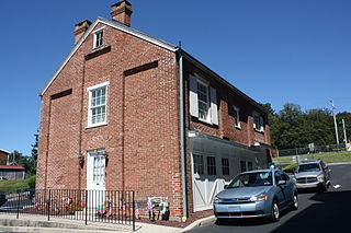
St. Lawrence, is a borough in Berks County, Pennsylvania, United States. The population was 1,809 at the 2010 census. It sits just east of Mount Penn and Reading. It is served by the Exeter Township School District.

<span class="mw-page-title-main">Topton, Pennsylvania</span> Borough in Pennsylvania, United States

Topton is a borough in Berks County, Pennsylvania, United States. The population was 2,069 at the 2010 census.

<span class="mw-page-title-main">South Fork, Pennsylvania</span> Borough in Pennsylvania, United States

South Fork is a borough in Cambria County, Pennsylvania, United States. It is part of the Johnstown, Pennsylvania Metropolitan Statistical Area. The population was 928 at the 2010 census, down from 1,138 at the 2000 census.

<span class="mw-page-title-main">Summit Hill, Pennsylvania</span> Borough in Pennsylvania, United States

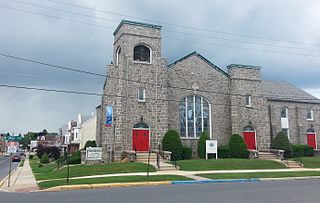
Summit Hill is a borough in Carbon County, Pennsylvania, United States. It is part of Northeastern Pennsylvania. The population was 3,034 at the 2010 census.

<span class="mw-page-title-main">Weatherly, Pennsylvania</span> Borough in Pennsylvania, United States

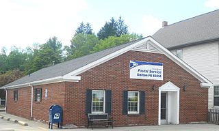
Weatherly is a borough in Carbon County, Pennsylvania, United States. It is part of Northeastern Pennsylvania and is located 12 miles (19 km) northwest of Jim Thorpe and 28 miles (45 km) south of Wilkes-Barre.

<span class="mw-page-title-main">Modena, Pennsylvania</span> Borough in Pennsylvania, United States

Modena is a borough in Chester County, Pennsylvania, United States. The population was 544 at the 2020 census. It was originally called Modeville, after the local Mode family.

<span class="mw-page-title-main">Parkesburg, Pennsylvania</span> Borough in Pennsylvania, United States

Parkesburg is a borough in Chester County, Pennsylvania, United States. The population was counted as 3,866 at the 2020 census. The ZIP code is 19365.

<span class="mw-page-title-main">Spring City, Pennsylvania</span> Borough in Pennsylvania, United States

Spring City is a borough in Chester County, Pennsylvania, United States. The population was 3,494 at the 2020 census. Spring City is a member of the Spring-Ford Area School District.

<span class="mw-page-title-main">Brownsville Township, Pennsylvania</span> Township in Pennsylvania, United States

Brownsville Township is a township in Fayette County, Pennsylvania, United States. The population was 536 at the 2020 census, a decline from the figure of 683 tabulated in 2010. It is served by the Brownsville School District.

<span class="mw-page-title-main">Dalton, Pennsylvania</span> Borough in Pennsylvania, United States

Dalton is a borough in Lackawanna County, Pennsylvania, United States. It is part of Northeastern Pennsylvania and is located approximately eight miles north of the city of Scranton in a suburban area known as "the Abingtons." Dalton is also approximately three miles north of Clarks Summit, the hub of the Abington community. The population was 1,283 at the 2020 census.

<span class="mw-page-title-main">Glendon, Pennsylvania</span> Place in Pennsylvania, United States

Glendon is a borough in Northampton County, Pennsylvania. The population of Glendon was 373 at the 2020 census. Glendon is part of the Lehigh Valley metropolitan area, which had a population of 861,899 and was thus the 68th-most populous metropolitan area in the U.S. as of the 2020 census.

<span class="mw-page-title-main">Wind Gap, Pennsylvania</span> Borough in Pennsylvania, United States

Wind Gap is a borough in Northampton County, Pennsylvania. The population of Wind Gap was 2,820 at the 2020 census. Wind Gap is part of the Lehigh Valley metropolitan area, which had a population of 861,899 and was the 68th-most populous metropolitan area in the U.S. as of the 2020 census.

<span class="mw-page-title-main">Union Dale, Pennsylvania</span> Borough in Pennsylvania, United States

Union Dale is a borough in Susquehanna County, Pennsylvania, United States. The borough was incorporated in 1885. Union Dale's population was 267 at the 2010 census.

<span class="mw-page-title-main">Elco, Pennsylvania</span> Borough in Pennsylvania, United States

Elco is a borough in Washington County, Pennsylvania, United States. The population was 263 at the 2020 census.

<span class="mw-page-title-main">North Charleroi, Pennsylvania</span> Borough in Pennsylvania, United States

North Charleroi is a borough in Washington County, Pennsylvania, United States. The population was 1,302 at the 2020 census.

<span class="mw-page-title-main">Waymart, Pennsylvania</span> Borough in Pennsylvania, United States

Waymart is a borough in Wayne County, Pennsylvania, United States. The borough's population was 1,341 at the time of the 2010 United States Census.

<span class="mw-page-title-main">McDonald, Pennsylvania</span> Borough in Pennsylvania, United States

McDonald is a borough in Allegheny and Washington counties in the U.S. state of Pennsylvania, 18 miles (29 km) southwest of Pittsburgh. The population was 2,056 at the 2020 census. Of this, 1,661 were in Washington County, and 395 were in Allegheny County.

References

  1. "ArcGIS REST Services Directory". United States Census Bureau. Retrieved October 12, 2022.
  2. 1 2 "Census Population API". United States Census Bureau. Retrieved Oct 12, 2022.
  3. "US Gazetteer files: 2010, 2000, and 1990". United States Census Bureau. 2011-02-12. Retrieved 2011-04-23.
  4. "Bechtelsville Borough map" (PDF). PennDOT. Retrieved March 13, 2023.
  5. "Census of Population and Housing". U.S. Census Bureau. Retrieved 11 December 2013.
  6. 1 2 "U.S. Census website". United States Census Bureau . Retrieved 2008-01-31.
  7. "Incorporated Places and Minor Civil Divisions Datasets: Subcounty Resident Population Estimates: April 1, 2010 to July 1, 2012". Population Estimates. U.S. Census Bureau. Archived from the original on 11 June 2013. Retrieved 11 December 2013.