Union Township, Berks County, Pennsylvania

Last updated
Union Township
Hopewell Furnace.JPG
Berks County Pennsylvania Incorporated areas Union Township Highlighted.svg
USA Pennsylvania location map.svg
Red pog.svg
Union Township
Location of Union Township in Pennsylvania
Usa edcp location map.svg
Red pog.svg
Union Township
Union Township (the United States)
Coordinates: 40°15′06″N75°44′35″W / 40.25167°N 75.74306°W / 40.25167; -75.74306
CountryUnited States
State Pennsylvania
County Berks
Area
  Total23.5 sq mi (61 km2)
  Land23.2 sq mi (60 km2)
  Water0.3 sq mi (0.8 km2)
Elevation
200 ft (60 m)
Population
 (2010)
  Total3,503
  Estimate 
(2016) [1]
3,593
  Density150/sq mi (58/km2)
Time zone UTC-5 (EST)
  Summer (DST) UTC-4 (EDT)
Area code(s) 610
Website https://www.unionberks.org/

Union Township is a township in Berks County, Pennsylvania, United States. The population was 3,503 at the 2010 census.

Contents

History

The French Creek State Park: Six Penny Day Use District, French Creek State Park: Organized Group Camp 4 District, and Hopewell Furnace National Historic Site are listed on the National Register of Historic Places. [2]

Geography

According to the U.S. Census Bureau, the township has a total area of 23.5 square miles (60.8 km2), of which 23.2 square miles (60.1 km2) is land and 0.3 square mile (0.8 km2) (1.28%) is water. The township is located in the Hopewell Big Woods.

Demographics

At the 2000 census, there were 3,453 people, 1,324 households, and 1,035 families living in the township. The population density was 148.9 inhabitants per square mile (57.5/km2). There were 1,370 housing units at an average density of 59.1 per square mile (22.8/km2). The racial makeup of the township was 98.03% White, 0.58% African American, 0.14% Native American, 0.12% Asian, 0.03% Pacific Islander, 0.29% from other races, and 0.81% from two or more races. Hispanic or Latino of any race were 0.96%. [3]

There were 1,324 households, 30.0% had children under the age of 18 living with them, 69.0% were married couples living together, 6.1% had a female householder with no husband present, and 21.8% were non-families. 17.5% of households were made up of individuals, and 7.3% were one person aged 65 or older. The average household size was 2.59 and the average family size was 2.93.

The age distribution was 21.6% under the age of 18, 6.0% from 18 to 24, 28.0% from 25 to 44, 29.7% from 45 to 64, and 14.7% 65 or older. The median age was 42 years. For every 100 females there were 100.3 males. For every 100 females age 18 and over, there were 97.6 males.

Historical population
CensusPop.Note
1980 2,615
1990 3,44031.5%
2000 3,4530.4%
2010 3,5031.4%
2016 (est.)3,593 [1] 2.6%
U.S. Decennial Census [4]

The median household income was $54,205 and the median family income was $61,048. Males had a median income of $42,685 versus $27,901 for females. The per capita income for the township was $26,014. About 1.8% of families and 2.8% of the population were below the poverty line, including 2.9% of those under age 18 and 4.7% of those age 65 or over.

Recreation

Most of French Creek State Park and a small portion of the Pennsylvania State Game Lands Number 43 are located in Union Township. [5] [6]

Transportation

PA Route 724 East in Union Township 2022-09-01 13 03 44 View east along Pennsylvania State Route 724 (Main Street) from the overpass for the Schuylkill River Trail in Union Township, Berks County, Pennsylvania.jpg
PA Route 724 East in Union Township

As of 2019, there were 44.93 miles (72.31 km) of public roads in Union Township, of which 11.68 miles (18.80 km) were maintained by the Pennsylvania Department of Transportation (PennDOT) and 33.25 miles (53.51 km) were maintained by the township. [7]

Pennsylvania Route 345 and Pennsylvania Route 724 are the numbered highways serving Union Township. PA 345 follows Shed Road along a northwest-southeast alignment through the middle of the township. PA 724 follows Main Street along an east-west alignment across the northern portion of the township.

Related Research Articles

<span class="mw-page-title-main">Birdsboro, Pennsylvania</span> Borough in Pennsylvania, United States

Birdsboro is a borough in Berks County, Pennsylvania, United States. It is located along the Schuylkill River 8 miles (13 km) southeast of Reading. As of the 2010 census, it had a population of 5,163. Birdsboro's economy had historically been rooted in large foundries and machine shops, none of which remain in operation today.

<span class="mw-page-title-main">Centre Township, Berks County, Pennsylvania</span> Township in Pennsylvania, United States

Centre Township is a township in Berks County, Pennsylvania, United States. The population was 4,140 at the 2020 census. It is in Schuylkill Valley School District.

<span class="mw-page-title-main">Colebrookdale Township, Pennsylvania</span> Township in Pennsylvania, United States

Colebrookdale Township is a township in Berks County, Pennsylvania, United States. The population was 5,127 at the 2020 census.

<span class="mw-page-title-main">Cumru Township, Pennsylvania</span> Township in Pennsylvania, United States

Cumru Township is a township in Berks County, Pennsylvania, United States. The population was 15,638 at the 2020 census. Nolde Forest Environmental Education Center, a Pennsylvania state park, is in Cumru Township.

<span class="mw-page-title-main">Longswamp Township, Pennsylvania</span> Township in Pennsylvania, United States

Longswamp Township is a township in Berks County, Pennsylvania, United States. The population was 5,551 at the 2020 census.

<span class="mw-page-title-main">Maidencreek Township, Pennsylvania</span> Township in Pennsylvania, United States

Maidencreek Township is a township in Berks County, Pennsylvania, United States. The population was 9,126 at the 2010 census.

<span class="mw-page-title-main">Marion Township, Berks County, Pennsylvania</span> Township in Pennsylvania, United States

Marion Township is a township in Berks County, Pennsylvania, United States. The population was 1,688 at the 2010 census.

<span class="mw-page-title-main">Oley Township, Pennsylvania</span> Township in Pennsylvania, United States

Oley Township is a township in Berks County, Pennsylvania, United States. As of the 2010 census, the township had a population of 3,620. Oley Township was originally formed in 1740 as a part of Philadelphia County, before Berks County was formed in 1752. The entire township was listed as a historic district by the National Register of Historic Places in 1983. Oley is a Native American name purported to mean "a hollow". Daniel Boone was born in Oley Township November 2, 1734.

<span class="mw-page-title-main">Ontelaunee Township, Pennsylvania</span> Township in Pennsylvania, United States

Ontelaunee Township is a township in Berks County, Pennsylvania, United States. The population was 1,646 at the 2010 census.

<span class="mw-page-title-main">Pike Township, Berks County, Pennsylvania</span> Township in Pennsylvania, United States

Pike Township is a township in Berks County, Pennsylvania, United States. The population was 1,723 at the 2010 census.

<span class="mw-page-title-main">Richmond Township, Berks County, Pennsylvania</span> Township in Pennsylvania, United States

Richmond Township is a township in Berks County, Pennsylvania, United States. The population was 3,397 at the 2010 census.

<span class="mw-page-title-main">Robeson Township, Pennsylvania</span> Township in Pennsylvania, United States

Robeson Township is a township in Berks County, Pennsylvania, United States. The population was 7,216 at the 2010 census.

<span class="mw-page-title-main">Spring Township, Berks County, Pennsylvania</span> Township in Pennsylvania, United States

Spring Township is a township in Berks County, Pennsylvania, United States. The population was 27,119 at the 2010 census, making it the second most populous municipality in Berks County after Reading.

<span class="mw-page-title-main">Upper Bern Township, Pennsylvania</span> Township in Pennsylvania, United States

Upper Bern Township is a township in Berks County, Pennsylvania, United States. The population was 1,734 at the 2010 census.

<span class="mw-page-title-main">East Pikeland Township, Pennsylvania</span> Township in Pennsylvania, United States

East Pikeland Township is a township in Chester County, Pennsylvania, United States. The population was 7,079 at the 2010 census.

<span class="mw-page-title-main">North Coventry Township, Pennsylvania</span> Township in Pennsylvania, United States

North Coventry Township is a township in Chester County, Pennsylvania, United States. The population was 7,866 at the 2010 census.

<span class="mw-page-title-main">Warwick Township, Chester County, Pennsylvania</span> Township in Pennsylvania, United States

Warwick Township is a township in Chester County, Pennsylvania, United States. The population was 2,507 at the 2010 census.

<span class="mw-page-title-main">Hopewell Township, Cumberland County, Pennsylvania</span> Township in Pennsylvania, United States

Hopewell Township is a township in Cumberland County, Pennsylvania, United States. The population was 2,329 at the 2010 census, up from 2,096 at the 2000 census.

<span class="mw-page-title-main">Independence Township, Washington County, Pennsylvania</span> Township in Pennsylvania, United States

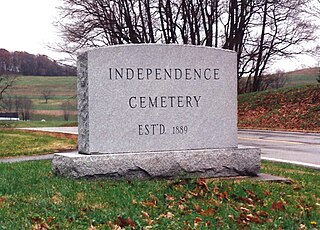
Independence Township is a township in Washington County, Pennsylvania, United States. The population was 1,557 at the 2010 census.

<span class="mw-page-title-main">Hopewell Township, York County, Pennsylvania</span> Township in Pennsylvania, United States

Hopewell Township is a township in York County, Pennsylvania, United States. The population was 5,267 at the 2020 census. It is served by the South Eastern School District, which provides public education.

References

  1. 1 2 "Population and Housing Unit Estimates" . Retrieved June 9, 2017.
  2. "National Register Information System". National Register of Historic Places . National Park Service. July 9, 2010.
  3. "U.S. Census website". United States Census Bureau . Retrieved 2008-01-31.
  4. "Census of Population and Housing". Census.gov. Retrieved June 4, 2016.
  5. https://viewer.nationalmap.gov/advanced-viewer/ The National Map, retrieved 24 October 2018
  6. Pennsylvania State Game Lands Number 43, retrieved 25 October 2018
  7. "Union Township map" (PDF). PennDOT. Retrieved March 14, 2023.