Laureldale, Pennsylvania

Last updated
Laureldale, Pennsylvania
Rosedale United Church of Christ, Laureldale PA 01.JPG
Rosedale United Church, built in Laureldale in 1928
Laureldale.png
Location of Laureldale in Berks County, Pennsylvania
USA Pennsylvania location map.svg
Red pog.svg
Laureldale
Location in Pennsylvania
Usa edcp location map.svg
Red pog.svg
Laureldale
Location in the United States
Coordinates: 40°23′21″N75°54′51″W / 40.38917°N 75.91417°W / 40.38917; -75.91417
CountryUnited States
StatePennsylvania
County Berks
Area
[1]
  Total0.81 sq mi (2.10 km2)
  Land0.81 sq mi (2.10 km2)
  Water0.00 sq mi (0.00 km2)
Elevation
400 ft (100 m)
Population
 (2020) [2]
  Total4,277
  Density5,280.25/sq mi (2,039.80/km2)
Time zone UTC-5 (EST)
  Summer (DST) UTC-4 (EDT)
ZIP Code
19605
Area codes 610 and 484
FIPS code 42-41768
Website www.laureldaleboro.org

Laureldale is a borough in Berks County, Pennsylvania, United States. The population was 4,277 at the 2020 census.

Contents

Geography

According to the U.S. Census Bureau, the borough has a total area of 0.8 square miles (2.1 km2), all land.

Demographics

Historical population
CensusPop.Note
1940 3,397
1950 3,5855.5%
1960 4,05113.0%
1970 4,51911.6%
1980 4,047−10.4%
1990 3,726−7.9%
2000 3,7590.9%
2010 3,9114.0%
2020 4,2779.4%
Sources: [3] [4] [5] [2]

At the 2010 census there were 3,911 people living in the borough. The racial makeup of the borough was 86.8% White, 2.5% African American, 0.4% Native American, 0.9% Asian, 0.0% Pacific Islander, 6.8% from other races, and 2.7% from two or more races. Hispanic or Latino of any race were 16.1%. [4]

Infrasturcture

Transportation

As of 2006, there were 15.08 miles (24.27 km) of public roads in Laureldale, of which 1.91 miles (3.07 km) were maintained by the Pennsylvania Department of Transportation (PennDOT) and 13.17 miles (21.20 km) were maintained by the borough. [6]

No numbered highways pass directly through Laureldale. The main thoroughfares in the borough include Kutztown Road and Elizabeth Avenue, which intersect near the center of town. The nearest numbered highway is U.S. Route 222 Business, which passes just west of the borough.

Related Research Articles

<span class="mw-page-title-main">Bechtelsville, Pennsylvania</span> Borough in Pennsylvania, United States

Bechtelsville is a borough in Berks County, Pennsylvania, United States. The population was 884 at the 2020 census.

<span class="mw-page-title-main">Centerport, Pennsylvania</span> Borough in Pennsylvania, United States

Centerport is a borough in north central Berks County, Pennsylvania, United States. The population was 314 at the 2020 census. The borough is in the Schuylkill Valley School District.

<span class="mw-page-title-main">Fleetwood, Pennsylvania</span> Borough in Pennsylvania, United States

Fleetwood, also called Schlegelschteddel in Pennsylvania Dutch, is a borough in Berks County, Pennsylvania, United States. The population was 4,049 at the 2020 census. It was home to the Fleetwood Metal Body company, an automobile coachbuilder purchased by Fisher Body and integrated into General Motors in 1931. The name lived on in the Cadillac Fleetwood automobile.

<span class="mw-page-title-main">Kenhorst, Pennsylvania</span> Borough in Pennsylvania, United States

Kenhorst is a borough in Berks County, Pennsylvania, United States. The population was 3,001 at the 2020 census.

<span class="mw-page-title-main">Lenhartsville, Pennsylvania</span> Borough in Pennsylvania, United States

Lenhartsville is a borough in Berks County, Pennsylvania, United States. The population was 180 at the 2020 census.

<span class="mw-page-title-main">Lower Alsace Township, Pennsylvania</span> Township in Pennsylvania, United States

Lower Alsace Township is a township in Berks County, Pennsylvania, United States. The population was 4,475 at the 2010 census. By area, it is the smallest township in Berks County.

<span class="mw-page-title-main">Lyons, Pennsylvania</span> Borough in Pennsylvania, United States

Lyons is a borough that is located in Berks County, Pennsylvania, United States. The population was 439 at the time of the 2020 census.

<span class="mw-page-title-main">Mohnton, Pennsylvania</span> Borough in Pennsylvania, United States

Mohnton is a borough in Berks County, Pennsylvania, United States. It had a population of 2,927 in the 2020 census.

<span class="mw-page-title-main">Mount Penn, Pennsylvania</span> Borough in Pennsylvania, United States

Mount Penn is a borough in Berks County, Pennsylvania, United States. The population was 3,240 at the 2020 census. The borough shares a name with a 1,120-foot-high (340 m) mountain that rises to the north and overlooks the city of Reading. The peak is sometimes recognized as the southern end of the Reading Prong group of mountains.

<span class="mw-page-title-main">Muhlenberg Township, Berks County, Pennsylvania</span> Township in Pennsylvania, United States

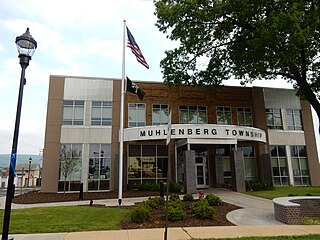
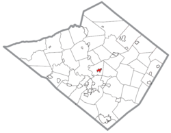
Muhlenberg Township is a township in Berks County, Pennsylvania, United States. The population was 21,915 at the 2020 census, making it the third-most populous township in Berks County after Spring Township and Exeter Township.

<span class="mw-page-title-main">Topton, Pennsylvania</span> Borough in Pennsylvania, United States

Topton is a borough in Berks County, Pennsylvania, United States. The population was 2,041 at the 2020 census.

<span class="mw-page-title-main">Wernersville, Pennsylvania</span> Borough in Pennsylvania, United States

Wernersville is a borough in Berks County, Pennsylvania, United States. The population was 2,776 at the 2020 census.

<span class="mw-page-title-main">Bowmanstown, Pennsylvania</span> Borough in Pennsylvania, United States

Bowmanstown is a borough in Carbon County, Pennsylvania. It is part of Northeastern Pennsylvania. The population was 937 at the 2010 census.

<span class="mw-page-title-main">Clifton Heights, Pennsylvania</span> Borough in Pennsylvania, United States

Clifton Heights is a borough in Delaware County, Pennsylvania, United States, located on Darby Creek 5 miles (8 km) west of downtown Philadelphia. As of the 2020 census, the population was 6,863.

<span class="mw-page-title-main">Yeadon, Pennsylvania</span> Borough in Pennsylvania, United States

Yeadon is a borough in Delaware County, Pennsylvania, United States. It borders the city of Philadelphia. The population was 11,443 at the 2010 census.

<span class="mw-page-title-main">Fountain Hill, Pennsylvania</span> Borough in Pennsylvania, United States

Fountain Hill is a borough in Lehigh County, Pennsylvania, United States. The population of Fountain Hill was 4,832 at the 2020 census, an increase over the figure of 4,597 tabulated in 2010. It is part of the Lehigh Valley metropolitan area, which had a population of 861,899 and was the 68th-most populous metropolitan area in the U.S. as of the 2020 census.

<span class="mw-page-title-main">Conshohocken, Pennsylvania</span> Borough in Pennsylvania, United States

Conshohocken is a borough on the Schuylkill River in Montgomery County, Pennsylvania in suburban Philadelphia. Historically a large mill town and industrial and manufacturing center, after the decline of industry in recent years Conshohocken has developed into a center of riverfront commercial and residential development. In the regional slang, it is sometimes referred to by the colloquial nickname Conshy.

<span class="mw-page-title-main">Hatfield, Pennsylvania</span> Borough in Pennsylvania, United States

Hatfield is a borough in Montgomery County, Pennsylvania, United States. The population was 3,290 at the time of the 2010 census. It is part of the North Penn Valley region that is centered around the borough of Lansdale. The borough is surrounded by Hatfield Township.

<span class="mw-page-title-main">East Bangor, Pennsylvania</span> Place in Pennsylvania, United States

East Bangor is a borough in Northampton County, Pennsylvania, US, with population 1,124 at the 2020 census. It is in the Lehigh Valley metropolitan region, which had a population of 861,899 and was the 68th-most populous metropolitan area in the U.S. as of the 2020 census.

<span class="mw-page-title-main">Glendon, Pennsylvania</span> Place in Pennsylvania, United States

Glendon is a borough in Northampton County, Pennsylvania. The population of Glendon was 373 at the 2020 census. Glendon is part of the Lehigh Valley metropolitan area, which had a population of 861,899 and was thus the 68th-most populous metropolitan area in the U.S. as of the 2020 census.

References

  1. "ArcGIS REST Services Directory". United States Census Bureau. Retrieved October 12, 2022.
  2. 1 2 "Census Population API". United States Census Bureau. Retrieved Oct 12, 2022.
  3. "Census of Population and Housing". U.S. Census Bureau. Retrieved 11 December 2013.
  4. 1 2 "U.S. Census website". United States Census Bureau . Retrieved 2008-01-31.
  5. "Incorporated Places and Minor Civil Divisions Datasets: Subcounty Resident Population Estimates: April 1, 2010 to July 1, 2012". Population Estimates. U.S. Census Bureau. Archived from the original on 11 June 2013. Retrieved 11 December 2013.
  6. "Laureldale Borough map" (PDF). PennDOT. Retrieved March 13, 2023.