
Mount Joy is a borough in Lancaster County, Pennsylvania, United States. The population was 8,346 at the 2020 census, and an estimated 8,323 in 2021.

Cambridge Springs is a borough with home rule status in Crawford County, Pennsylvania, United States. The population was 2,511 at the 2020 census, down from 2,595 at the 2010 census.
Selma is an unincorporated community and census-designated place (CDP) in Josephine County, Oregon, United States. As of the 2010 census it had a population of 695. It is located in the ZIP code of 97538.
Dorneyville is a census-designated place in Lehigh County, Pennsylvania. As of the 2010 census the population was 4,406. Dorneyville is located just west of Allentown in South Whitehall Township and Salisbury Township.

Conestoga is an unincorporated community and census-designated place (CDP) in Conestoga Township, Lancaster County, Pennsylvania, in the United States. At the 2010 census the population was 1,258. The Conestoga post office serves ZIP code 17516.

Wescosville is a census-designated place located in Lehigh County, Pennsylvania in the United States. It is located between Allentown and Trexlertown in Lower Macungie Township. It is part of the Lehigh Valley, which has a population of 861,899 and is the 68th most populated metropolitan area in the U.S. as of the 2020 census.
Cetronia is a census-designated place (CDP) in South Whitehall Township in Lehigh County, Pennsylvania, near Allentown. As of the 2010 census the population was 2,115. It includes the unincorporated communities of Cetronia, Sterlingworth, and Park Way Manor.

Flintstone is an unincorporated community and census-designated place (CDP) in Allegany County, Maryland, United States. As of the 2010 census it had a population of 177. It is part of the Cumberland, MD-WV Metropolitan Statistical Area.
Reinholds is an unincorporated community and census-designated place (CDP) in West Cocalico Township, Lancaster County, Pennsylvania, United States. As of the 2010 census the population was 1,803.

Refton is an unincorporated community and census-designated place (CDP) in Strasburg Township, Lancaster County, Pennsylvania, United States, with a ZIP code of 17568. The community is located along U.S. Route 222. As of the 2010 census the population was 298.
Lebanon is census-designated place (CDP) and unincorporated community in Marshall County, Oklahoma, United States. It has a post office with the ZIP code 73440.
Bowers is a census-designated place in Maxatawny Township, Berks County, Pennsylvania, United States. It is located near the borough of Lyons and is on Sacony Creek, a tributary of the Maiden Creek. As of the 2010 census, the population was 326 residents. Although Bowers has its own post office with the ZIP code of 19511, some residents are served by the Mertztown post office with the ZIP code of 19539.
Mertztown is a census-designated place in Longswamp Township, Berks County, Pennsylvania. It is located near the borough of Topton. As of the 2010 census, the population was 664 residents.

Shartlesville is a census-designated place in Upper Bern Township, Berks County, Pennsylvania. As of the 2010 census, the population was 455 residents.
Chinchilla is a village and census-designated place in Scott and South Abington townships, Lackawanna County, Pennsylvania, United States. The CDP's population was 2,098 at the time of the 2010 United States Census. It was known as "Leach's Flats" until supposedly renamed by a postmaster in the 1880s after her chinchilla-fur shawl. Chinchilla is located in the gorge of Leggetts Creek, which flows southward into the Lackawanna River on the north side of Scranton. Interstate 81, U.S. Route 6/11 and the Norfolk Southern Railroad use the gorge between Scranton and Clarks Summit. Chinchilla has its own post office, with ZIP Code 18410.

Frystown is a census-designated place in Bethel Township, in far western Berks County, Pennsylvania. It is located near the township line with Tulpehocken Township. The community is served by the Tulpehocken Area School District. As of the 2010 census, the population was 380 residents. The Little Swatara Creek forms the natural southern boundary of Frystown and flows westward into the Swatara Creek, a tributary of the Susquehanna River. Interstate 78 has an interchange with Route 645 in Frystown. The CDP is split between the Myerstown and Bethel post offices, which use the ZIP codes of 17067 and 19507, respectively.

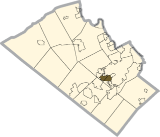
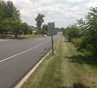
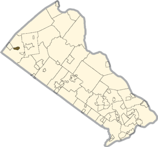
Spinnerstown is a census-designated place in Milford Township, Bucks County, Pennsylvania. It is located just NW of the Quakertown interchange of I-476 with Route 663. As of the 2010 census, the population was 1,826 residents.
Milford Square is a census-designated place in Milford Township, Bucks County, Pennsylvania. It is located along PA Route 663 near the borough of Trumbauersville. As of the 2010 census, the population was 897 residents. While the village has a PO Box post office with the ZIP code of 18935, the surrounding area uses the Quakertown ZIP code of 18951. It is located on the Unami Creek which drains into the Perkiomen Creek. It was formerly known as Heistville after the Heist family who operated Achey's Mill and lived in, and greatly renovated, the miller's home.

Wanamie is an unincorporated community and census-designated place in Newport Township, Luzerne County, Pennsylvania. It is located in the southwestern end of the Wyoming Valley and uses the Nanticoke zip code of 18634. The South Branch Newport Creek forms the natural eastern boundary of Wanamie and drains it northeastward via the Newport Creek into the Susquehanna River. The village is named after the Wanami tribe of the Lenni Lenape. As of the 2010 census, its population was 612.
Walnuttown is a census-designated place in Berks County, Pennsylvania, United States. It is mainly in Richmond Township but also in Maidencreek Township. It is a short distance west of Fleetwood and south of U.S. Route 222. Willow Creek flows west through it into Maiden Creek just east of the latter's mouth into the Schuylkill River. Walnuttown is served by the Fleetwood post office, which uses the ZIP code of 19522. As of the 2010 census the population of Walnuttown was 484. It is served by the Fleetwood Area School District.


