Guadalupe Island Biosphere Reserve

Last updated
Guadalupe Island Biosphere Reserve
Guadalupe Island Great White Shark Face On.jpg
A Great White Shark at Guadalupe Reserve.
Mexico relief location map.jpg
Red pog.svg
Location in Pacific Ocean
Location Baja California, Mexico
Coordinates 29°03′N118°16′W / 29.05°N 118.26°W / 29.05; -118.26 Coordinates: 29°03′N118°16′W / 29.05°N 118.26°W / 29.05; -118.26
Area4,770 square kilometres (1,840 sq mi)
Established2005
Guadalupe Island Guadalupe Island Map.gif
Guadalupe Island

The Guadalupe Island Biosphere Reserve, (Reserva de la Biosfera Isla Guadalupe in Spanish), is located in the Pacific Ocean and is part of Baja California state of Mexico. The Reserve consists of Guadalupe Island and several small islands nearby plus a large expanse of surrounding ocean. The Reserve was created by the government of Mexico on 25 April 2005 and is located 250 kilometres (160 mi) from the mainland. The Reserve is 4,770 square kilometres (1,840 sq mi) in size of which 263 square kilometres (102 sq mi) is land and the remainder is water. [1]

Contents

The Guadalupe Island Biosphere Reserve is in the Southern Californian Pacific Marine Ecoregion and recognized as an important site for preserving the biodiversity of marine and bird life and the often-unique island vegetation. In the 19th century the population of marine mammals was decimated by commercial hunters. The vegetation of Guadalupe Island was severely damaged by an excessive population of introduced goats and predation by feral cats has caused the extinction of several endemic bird species.

The Reserve attracts tourists to see marine mammals and other marine life, especially the great white shark, and for sport fishing. Since the designation of the island as a biosphere reserve, goats have been eliminated and programs to restore natural vegetation and wildlife have expanded. [2]

Geography

Guadalupe Island is 36 kilometres (22 mi) from north to south and 12 kilometres (7.5 mi) at its widest. The island is of volcanic origin and rugged and mountainous rising to a maximum elevation of 1,298 metres (4,259 ft) in the north. The northwest coast is characterized by precipitous sea cliffs which rise to a maximum elevation of 900 metres (3,000 ft). The entire island is arid or semi-arid, receiving about 120 millimetres (4.7 in) of precipitation annually at its southern end and somewhat more at the higher, cooler locations near its northern end. Most precipitation is in the winter months. Desert conditions are relieved by a heavy fog that blankets the higher slopes during much of the year and the fog drip which adds to the moisture available for vegetation. [3] [4] The only reliable source of fresh water on the island is one small spring located in the northeastern part of the island. About 100 seasonal fishermen live on the island. [5]

The entire preserve is within the waters of the California Current which is highly productive of sea life. The cold current moderates average temperatures on the island which range at sea level from 15 °C (59 °F) in January, the coolest month, to 20 °C (68 °F) in September, the warmest month. [6]

Flora and fauna

According to the National Biodiversity Information System of Comisión Nacional para el Conocimiento y Uso de la Biodiversidad (CONABIO) in Guadalupe Island Biosphere Reserve there are over 925 plant and animal species from which 36 are in at risk category and 60 are exotics. [7] [8]

Flora

In 2005, 223 species of vascular plants had been found on Guadalupe Island of which 39 were endemic. Included among those plants were five trees, three of them endemic: Guadalupe cypress (Cupress guadalupensis guadalupensis), Guadalupe pine (Pinus radiata var binata), and Guadalupe palm (Brahea edulis), Island oak (Querces tomantella), and California juniper (Juniperus Californica). [4]

The introduction of goats on the island by whalers or seal hunters in the early 19th century was catastrophic for the native vegetation. No predators, except occasional humans, controlled the goat population and it quickly multiplied to an estimated 100,000 by 1870 before declining as the goats ate most of the vegetation. Human visitors also introduced about 61 exotic species of plants which replaced the native vegetation with the result that more than 20 native species became extinct or endangered. By the time that the biosphere reserve was created in 2005, 41 percent of the island was barren of vegetation. Before the introduction of goats, forest and woodland covered about 15 percent of the land, but by 2000 less than one percent. The survival of many species was doubtful. In 2000, only 130 of Guadalupe Island pine still survived, having declined from 360 in 1966. Only 20 Island Oak survived plus a few hundred Guadalupe palms and 4,000 Guadalupe cypress. Only ten California juniper survived. Scientists believed that the possibilities for survival of the remnant forests were poor due to soil erosion, poor conditions for reproduction, and the potential for wildfires. The forests were located in the northern third of the island which is higher and wetter than the more southern parts. In the central portion of the island, the native grasses had been largely replaced by exotic species. In the southern third, characterized by desert scrub, much of the land was barren. [9] [10] [11]

Young pines have thrived since the elimination of goats from the island. Pinus radiata binata.jpg
Young pines have thrived since the elimination of goats from the island.

The first task for restoration of vegetation was to rid the island of goats. Most were captured and transported to the mainland for distribution to farmers. In 2007, the island became goat-free. Ten years later much of the vegetation was recovering. Seedlings of Guadalupe Island Pine numbered several thousand. A shrub, Ceanothus arboreus, had been rediscovered. Native vegetation was replacing introduced vegetation and formerly barren areas were now covered with desert scrub. [9] After ten years of observation, the Mexican government began active restoration programs in 2015 focused on reforestation, erosion control and fire prevention. A nursery located near the center of the island grows seedlings of native and endemic species, especially trees, and by 2018 had produced 90,000 plants. [12]

Fauna

A shark cage diving expedition at Guadalupe Island Great white shark cages at Isla Guadalupe, Mexico, November 2017. Shark cage diving with the MV Horizon. Animal estimated at 16-18 feet in length, age unknown.png
A shark cage diving expedition at Guadalupe Island
Guadalupe Island Great White Shark Underwater Tourism.jpg

The waters and coastlines around Guadalupe Island are the home to three species of pinnipeds. Two of them were saved from extinction because isolated colonies survived on Guadalupe. The Guadalupe fur seal (Arctocephalus townsendi) and the northern elephant seal (Mirounga angustirostris) were believed to be extinct in the late 19th century, the result of over-exploitation by hunters for their pelts and oil. A few Guadalupe fur seals were discovered in 1954 living in a cave on the island. [13] In 1892 the last two known northern elephant seals were seen on Guadalupe Island. A few more were likely present in nearby waters. From that low point—and despite scientists killing several seals for scientific purposes—the herd increased to 366 in 1923 and 469 in 1929. [14] The population of both species has increased. In 2015, 10,000 northern elephant seals were estimated to live on Guadalupe Island and 40,000 Guadalupe fur seals were estimated to inhabit the Pacific Islands of Mexico, including Guadalupe. [15]

Introduced feral cats (Felis catus) have caused the extinction of six species of birds on Guadalupe Island. About 400 cats remained on the island in 2015 despite an eradication program. Cats are anticipated to be eradicated by about 2025. With the reduction in the number of cats, the bird population, especially of seabirds has increased. In 2009, 27 species of seabirds no longer inhabited the Pacific islands of Mexico, including Guadalupe, but between 2010 and 2020 twenty-two species returned to the islands. [16] The Laysan albatross is a species highly vulnerable to predation. In 2015 an area with 220 albatross nests had been fenced off at the southern tip of the island to protect the nests from cats. Eradication programs for introduced mice, the principal food of the cats, are also underway. [17]

Great white sharks

Most of the tourists who visit Guadalupe Island come by boat for shark cage diving to see the great white shark in its habitat. More than 300 great white sharks are known to frequent the clear waters of Guadalupe, mostly on the northeastern coast. Male sharks arrive at the island in July and females in September and they remain near the island until February when they migrate about 1,600 kilometres (990 mi) westward to the White Shark Café in the Pacific Ocean between Guadalupe Island and Hawaii, making the journey in about 16 days. Individual sharks usually return to Guadalupe Island periodically. [18]

As of January 10, 2023, cage diving with great white sharks at Isla Guadalupe, Mexico, was permanently prohibited. The Mexican Government’s ban covers all tourism inside the reserve, including film production and liveaboard diving. [19]

Related Research Articles

<span class="mw-page-title-main">Revillagigedo Islands</span> Group of four volcanic islands in the Pacific Ocean

The Revillagigedo Islands or Revillagigedo Archipelago are a group of four volcanic islands in the Pacific Ocean, known for their unique ecosystem. They lie approximately 458 kilometres (285 mi) from Socorro Island south and southwest of Cabo San Lucas, the southern tip of the Baja California Peninsula, and 698 to 1,092 kilometres west of Manzanillo. Historically linked to the Mexican state of Colima, to which they were granted in 1861 to establish a penal colony, the islands are under Mexican federal property and jurisdiction.

<span class="mw-page-title-main">Guadalupe Island</span> Mexican island in the Pacific Ocean

Guadalupe Island is a volcanic island located 241 kilometres off the western coast of Mexico's Baja California Peninsula and about 400 km (200 nmi) southwest of the city of Ensenada in the state of Baja California, in the Pacific Ocean. The various volcanoes are extinct or dormant. In 2005 Guadalupe Island and its surrounding waters and islets were declared a biosphere reserve to restore its vegetation and to protect its population of marine mammals and birds. The island is a popular destination for great white shark cage diving. Guadalupe Island is inhabited only by scientists, military personnel operating a weather station, and a small group of seasonal fishermen. The island is mostly arid and has very little surface water.

<i>Cupressus guadalupensis</i> Species of conifer

Cupressus guadalupensis, the Guadalupe cypress, is a species of cypress from Guadalupe Island in the Pacific Ocean off western North America.
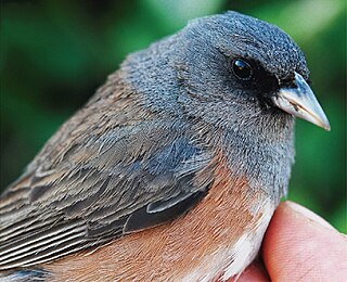
<span class="mw-page-title-main">Guadalupe junco</span> Species of bird

The Guadalupe junco is a small bird in the New World sparrow family that is endemic to Guadalupe Island off the western coast of Baja California, Mexico. Many taxonomic authorities classified it in 2008 as a subspecies of the dark-eyed junco. In 2016, it was re-classified as a full species.
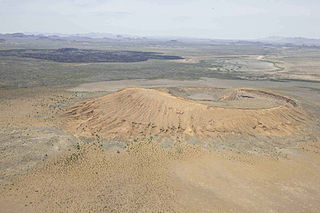
<span class="mw-page-title-main">El Pinacate y Gran Desierto de Altar Biosphere Reserve</span> UNESCO biosphere reserve in Sonora, Mexico

El Pinacate y Gran Desierto de Altar Biosphere Reserve is a biosphere reserve and UNESCO World Heritage Site managed by the federal government of Mexico, specifically by Secretariat of the Environment and Natural Resources, in collaboration with the state governments of Sonora and the Tohono O'odham.

San Pedro Mártir is the name of an island of Mexico, located in the Gulf of California, about halfway between the coast of Baja California and Sonora. San Pedro Mártir is located in the center of the Gulf of California and is the most remote island in the Sea of Cortez. It is located 51 km from Baja California and 53 km off the coast of Sonora. The island is 2 km long and 1.5 km maximum width, with a total of 2,729 km2 of total area. The island is uninhabited by humans and is 60 km from Bahía Kino, the nearest city in the state of Sonora on the west coast.

<span class="mw-page-title-main">Forests of Mexico</span>

The forests of Mexico cover a surface area of about 64 million hectares, or 34.5% of the country. These forests are categorized by the type of tree and biome: tropical forests, temperate forests, cloud forests, riparian forests, deciduous, evergreen, dry, moist, etc.. The agency in charge of Mexico's forests is the Comisión Nacional Forestal. Despite major reforms to the Mexican Constitution in 1992 regarding private land, Mexico would later enact major forest regulation laws in 1998 and 2003. Though no longer required to enforce land regulation in Mexico, Article 27 of the Mexican Constitution also still permits the Mexican Government to enact land regulation.
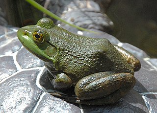
<span class="mw-page-title-main">Invasive species in Mexico</span>

Invasive species in Mexico are a major cause of biodiversity loss, altering ecosystems, affecting native species, damaging environmental services and public health, and causing economic losses. An invasive species is one native to a particular area that has been introduced into a new habitat, adapting and altering to suit its new conditions.

The Mapimí Biosphere Reserve is a UNESCO Biosphere Reserve located in the state of Durango in northern Mexico. It is one of three biosphere reserves representing the Chihuahuan Desert. The 342,388 hectares (1,321.97 sq mi) reserve is situated between the Neotropical and Nearctic biogeographic realms, in the Bolsón de Mapimí 1,150 metres (3,770 ft) above sea level. It contains three core areas in the Sierra de la Campana, the Laguna de las Palomas, a salt lagoon, and a desert habitat called Dunas de la Soledad. It comprises fragile warm desert and semi-desert ecosystems and rich, highly adapted but vulnerable plant systems, mainly xerophytic matorral scrub, and animal species such as the puma, mule deer, sandhill crane and the kit fox or zorrita del desiert along with scrub and desert grasslands.

<span class="mw-page-title-main">Ría Lagartos Biosphere Reserve</span>

Ría Lagartos Biosphere Reserve is a UNESCO Biosphere Reserve in the state of Yucatán, Mexico. The reserve is located at the eastern end of the coastal strip of the Yucatán Peninsula, with the Gulf of Mexico at its northern limit. The area encompasses coastal areas of the Gulf of Mexico and includes important wetlands designated under the Ramsar Wetlands Convention. The site presents a rich diversity of landscapes and ecosystems, such as mangroves, small estuaries, medium semi-evergreen forest, low deciduous forest, coastal dune vegetation, coastal lagoons, marshes (petenes) and savanna represented by tular vegetation, grasslands and reed beds that are the main nesting sites for marshland and sea birds.

<span class="mw-page-title-main">Islas Marías Biosphere Reserve</span>

The Islas MaríasBiosphere Reserve is a UNESCO Biosphere Reserve located in the Islas Marías in the municipality (municipio) of San Blas, Nayarit, Mexico. The 641,284.73 hectares (2,476.0142 sq mi) reserve includes ecosystems with a great wealth of species of biological, economic, scientific and cultural relevance. Its biological wealth is to be found in the dry forests of its landscape, in the mangroves, the succulent rosette scrubland, the reefs, coasts and pelagic environments it harbors.

<span class="mw-page-title-main">Volcán Tacaná Biosphere Reserve</span>

The Volcán Tacaná Biosphere Reserve is a UNESCO Biosphere Reserve at the Tacaná Volcano in Chiapas, Mexico, on the border with Guatemala. The volcano is part of the Central America Volcanic Arc. The 6,378 hectares (24.63 sq mi) reserve contains fragile ecosystems very rich in wild flora and fauna species of cultural, scientific, economic and biological relevance. Its rich biodiversity and high endemism are found particularly in the high mountain ecosystem and landscapes and in the volcanic edifice which presents geophysical features of great scientific and aesthetic value. Average annual rainfall can amount to 2,000–5,000 millimetres (79–197 in), as in the case of Soconusco.

The Janos Biosphere Reserve is a nature reserve in Janos, Chihuahua, Mexico. It protects a prairie ecosystem best known for its recovering and reintroduced species most notably the herd of American bison which became the first re-established in Mexico. It is the first federally protected area of Mexico with the main objective of protecting a grassland ecosystem.

Bavispe Flora and Fauna Protection Area is a protected area in the state of Sonora in northwestern Mexico.

Papigochic Flora and Fauna Protection Area is a protected area in Chihuahua state of Mexico. It covers an area of 2227.64 km2 in the eastern Sierra Madre Occidental. To the northwest it adjoins Tutuaca Flora and Fauna Protection Area.

Campo Verde Flora and Fauna Protection Area is a protected area in northern Mexico. It covers an area of 1080.67 km2 in northwestern Chihuahua, on the border with Sinaloa. It is at the eastern edge of the Sierra Madre Occidental, where it meets the Chihuahuan Desert.

Ocampo Flora and Fauna Protection Area is a protected area in northern Mexico. It covers an area of 3442.38 km2 in the state of Coahuila.

The Sierra de Huautla is a mountain range and biosphere reserve in central Mexico. Located in southern Morelos, the Sierra de Huautla is a southern extension of the Trans-Mexican Volcanic Belt range into the Balsas Basin. The dry forests of Sierra are home to a diverse community of animals and plants, and the reserve's outstanding biodiversity is recognized by UNESCO.

<span class="mw-page-title-main">Barranca de Metztitlán</span>

Barranca de Metztitlán is a biosphere reserve in Hidalgo state of Mexico. It is protected for its dramatic scenery of steep cliffs and deep winding canyons, and its distinctive flora and fauna.
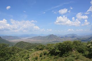
<span class="mw-page-title-main">Zicuirán-Infiernillo Biosphere Reserve</span>

Zicuirán-Infiernillo Biosphere Reserve is a biosphere reserve in western Mexico. It covers 2,651.18 km2 of the Sierra Madre del Sur range in the state of Michoacán, west of the Balsas River.

References

  1. Aguirre-Munoz, A. (2013). "Diagnostico de especies exoticas invasoras en las Reservas de la Biosfera y Areas Naturales Protegidas" (PDF). Biodiversidad. Grupo de Icologia y Conservacion de Islas. Retrieved 8 May 2021.
  2. Luna-Mendoza, Luciana (2018). "Ten years after feral goat eradication". Research Gate. Grupo de Ecologia y Conservacion de Islas. pp. 1071–1075. Retrieved 8 May 2021.
  3. Leon de la Luz, Jose Luis; Rebman, Jon P.; Oberbauer, Thomas (2003). "On the urgency of conservation on Guadalupe Island, Mexico: is it a lost paradise". Research Gate. Retrieved 10 May 2021.
  4. 1 2 Aguirre-Munoz 2013, pp. 20–22.
  5. "Programa de Manejo Isla Guadalupe" (PDF). CONANP. Government of Mexico. 2003. pp. 24–25. Retrieved 10 May 2021.
  6. "Normales climatológicas para Isla Guadalupe, B.C." Colegio de Postgraduados. Archived from the original on February 19, 2013. Retrieved January 4, 2013.
  7. Comisión Nacional para el Conocimiento y Uso de la Biodiversidad. "Enciclovida (2022). Reserva de la Biosfera Isla Guadalupe" . Retrieved August 29, 2022.
  8. Comisión Nacional para el Conocimiento y Uso de la Biodiversidad. "Naturalista (2022). Reserva de la Biosfera Isla Guadalupe" . Retrieved August 29, 2022.
  9. 1 2 Leon de la Luz, Rebman & Oberbauer 2003, pp. 1075–1080.
  10. Oberbauer, Thomas. "A Compilation of Estimated Historic and Current Vegetation Community Structure on Guadalupe Island, Mexico" (PDF). IWS Org. Retrieved 10 May 2021.
  11. Luna-Mendoza 2018, p. 1073.
  12. Luna-Mendoza 2018, p. 1073-1074.
  13. "Guadalupe Fur Seal". NOAA. Retrieved 10 May 2021.
  14. Huey, Laurence M. (May 1930). "Past and Present Status of the Northern Elephant Seal with a Note on the Guadalupe Fur Seal". Journal of Mammalogy. 11 (2): 188–191. doi:10.2307/1374066. JSTOR   1374066 . Retrieved 10 May 2021.
  15. "Fichas de evluacion ecologica de areas naturales protegidas del noroeste de Mexico" (PDF). Comision Nacional de Areas Naturales Protegidas. 2016. p. 17. Retrieved 10 May 2021.
  16. McBride, Abby. "Mexico's Conservation Efforts Spur Dramatic Recoveries for 20+ Species of Seabirds". All About Birds. Cornell Lab. Retrieved 14 May 2021.
  17. "Guadalupe Island, Baja California Invasive Mammal Eradication and Perspective for Ecological Restoration". Natural History of Ecological Restoration. Virginia Tech University. Retrieved 12 May 2021.
  18. "100 Años de Conservacion de Mexico: Areas Naturales Protigedas". Secretariat de Medio Ambiente y Recursos Naturales. Government of Mexico. Retrieved 12 May 2021.
  19. McGuire, David. "Mexico Closes down Great White Shark Cage Diving". Shark Stewards. Retrieved 19 April 2023.