A marine protected area is defined by the IUCN as "A clearly defined geographical space, recognised, dedicated and managed, through legal or other effective means, to achieve the long-term conservation of nature with associated ecosystem services and cultural values".[1]
The MPA is intended to provide safe nesting on the island for the endangered African Penguin, bank cormorants and terns, and to help the recovery of abalone and rock lobster stocks.[2]
This section needs expansion. You can help by adding to it. (January 2019)
Extent
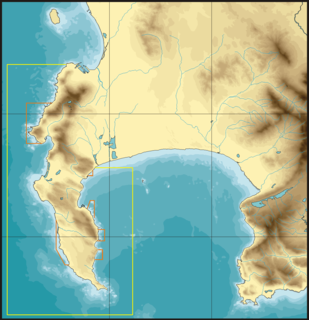
The MPA protects the water column, the sea bed, and the subsoil inside its boundaries, shares a boundary with the northern part of the existing Table Mountain National Park Marine Protected Area.[3] The area of sea protected is about 580km2.[2]
Boundaries
The MPA is an offshore and inshore protected area adjacent to the Table Mountain National Park Marine Protected Area in the Western Cape. Its boundaries are:[3]
Northern boundary: S33°45’, E18°0’ to S33°45’, E18°24’
Eastern boundary: S33°45’, E18°24’ to S33°54’, E18°24.06’
Southern boundary: S33°54’, E18°24.06’ to S33°54’, E18°0’
Western boundary: S33°54’, E18°0’ to S33°45’, E18°0’
Zonation
There are one restricted zone and two controlled zones in the MPA.[4]
Restricted areas
The boundaries of the Robben Island restricted zone are:[4]
Northern boundary: S33°47.58’, E18°12.12’ to S33°47.58’, E18°21.72’
Eastern boundary: S33°47.58’, E18°21.72’ to S33°54’, E18°21.72’
Southern boundary: S33°54’, E18°21.72’ to S33°54’, E18°12.12’
Western boundary: S33°54’, E18°12.12’ to S33°47.58’, E18°12.12’
Controlled areas
The boundaries of Robben Island controlled zone 1 are:[4]
Northern boundary: S33°45’, E18°0’ to S33°45’, E18°24’
Eastern boundary: S33°45’, E18°24’ to S33°54’, E18°24.06’
Eastern panhandle southern boundary: S33°54’, E18°24.06’ to S33°54’, E18°21.72’
Eastern panhandle western boundary: S33°54’, E18°21.72’ to S33°47.58’, E18°21.72’ (shared with restricted zone)
Central southern boundary: S33°47.58’, E18°21.72’ to S33°47.58’, E18°12.12’ (shared with restricted zone)
Main part eastern boundary: S33°47.58’, E18°12.12’ to S33°54’, E18°12.12’ (shared with restricted zone)
Main part southern boundary: S33°54’, E18°12.12’ to S33°54’, E18°0’
Western boundary: S33°54’, E18°0’ back to S33°45’, E18°0’
The boundaries of Robben Island controlled zone 2 are:[4]
Northern boundary: S33°46.38’, E18°20.58’ to S33°46.38’, E18°24’
Eastern boundary: S33°46.38’, E18°24’ to S33°50.16’, E18°24’
Southern boundary: S33°50.16’, E18°24’ to S33°50.22’, E18°21.72’
Western boundary: S33°50.22’, E18°21.72’ to S33°47.58’, E18°21.72’
Panhandle western boundary: S33°47.58’, E18°20.58’ to S33°46.38’, E18°20.58’
Controlled zone 2 is inside controlled zone 1.
Management
The marine protected areas of South Africa are the responsibility of the national government, which has management agreements with a variety of MPA management authorities with funding from the SA Government through the Department of Environmental Affairs (DEA).[1]
The Department of Agriculture, Forestry and Fisheries is responsible for issuing permits, quotas and law enforcement.[5]
This section is empty. You can help by adding to it. (February 2019)
Use
This section is empty. You can help by adding to it. (February 2019)
Scuba diving
A small number of recreational dive sites fall within the MPA, including several wrecks. There are also rocky reefs, but the reefs of the adjacent Table Mountain National Park Marine Protected Area are more popular due to greater biodiversity, more interesting topography and easier access. The Tygerberg formation sandstones and shales form relatively flat reefs and do not provide the granite corestone landforms found further south.
Named dive sites
Robben Island steamer wreck: S33°49.886′, E018°21.524′[6]
The climate of the South-western Cape is markedly different from the rest of South Africa, which is a summer rainfall region, receiving most of its rainfall during the summer months of December to February. The South-western Cape has a Mediterranean type climate, with most of its rainfall during the winter months from June to September.
During the summer the dominant factor determining the weather in the region is a high pressure zone, known as the Atlantic High, located over the South Atlantic ocean to the west of the Cape coast. Winds circulating in an anticlockwise direction from such a system reach the Cape from the south-east, producing periods of up to several days of high winds and mostly clear skies. These winds keep the region relatively cool. Because of its south facing aspect Betty's Bay is exposed to these winds.
Winter in the South-western Cape is characterised by disturbances in the circumpolar westerly winds, resulting in a series of eastward moving depressions. These bring cool cloudy weather and rain from the north west. The south westerly winds over the South Atlantic produce the prevailing south-westerly swell typical of the winter months, which beat on the exposed coastline.
Seasonal variations in sea conditions
This section is empty. You can help by adding to it. (February 2019)
Ecology
Marine ecoregions of the South African Exclusive Economic Zone: Robben Island Marine Protected Area is in the Benguela ecoregion.
The MPA is in the cool temperate Benguela ecoregion to the west of Cape Point which extends northwards to the Orange River. There are a moderate proportion of species endemic to South Africa along this coastline.[7]
Four major habitats exist in the sea in this region, three of them distinguished by the nature of the substrate. The substrate, or base material, is important in that it provides a base to which an organism can anchor itself, which is vitally important for those organisms which need to stay in one particular kind of place. Rocky shores and reefs provide a firm fixed substrate for the attachment of plants and animals. Some of these may have kelp forests, which reduce the effect of waves and provide food and shelter for an extended range of organisms. Sandy beaches and bottoms are a relatively unstable substrate and cannot anchor kelp or many of the other benthic organisms. Finally there is open water, above the substrate and clear of the kelp forest, where the organisms must drift or swim. Mixed habitats are also frequently found, which are a combination of those mentioned above.[8] There are no significant estuarine habitats in the MPA.
Rocky shores and reefs There are rocky reefs and mixed rocky and sandy bottoms. For many marine organisms the substrate is another type of marine organism, and it is common for several layers to co-exist. Examples of this are red bait pods, which are usually encrusted with sponges, ascidians, bryozoans, anemones, and gastropods, and abalone, which are usually covered by similar seaweeds to those found on the surrounding rocks, usually with a variety of other organisms living on the seaweeds.[8]:Ch.2
The type of rock of the reef is of some importance, as it influences the range of possibilities for the local topography, which in turn influences the range of habitats provided, and therefore the diversity of inhabitants. Sandstone and other sedimentary rocks erode and weather very differently, and depending on the direction of dip and strike, and steepness of the dip, may produce reefs which are relatively flat to very high profile and full of small crevices. These features may be at varying angles to the shoreline and wave fronts. There are fewer large holes, tunnels and crevices in sandstone reefs, but often many deep but low near-horizontal crevices.
Kelp forests Kelp forests are a variation of rocky reefs, as the kelp requires a fairly strong and stable substrate which can withstand the loads of repeated waves dragging on the kelp plants. The sea bamboo Ecklonia maxima grows in water which is shallow enough to allow it to reach to the surface with its gas-filled stipes, so that the fronds form a dense layer at or just below the surface, depending on the tide. The shorter split-fan kelp Laminaria pallida grows mostly on deeper reefs, where there is not so much competition from the sea bamboo. Both these kelp species provide food and shelter for a variety of other organisms, particularly the sea bamboo, which is a base for a wide range of epiphytes, which in turn provide food and shelter for more organisms.[8]:Ch.4
Sandy beaches and bottoms (including shelly, pebble and gravel bottoms) Sandy bottoms at first glance appear to be fairly barren areas, as they lack the stability to support many of the spectacular reef based species, and the variety of large organisms is relatively low. The sand is continually being moved around by wave action, to a greater or lesser degree depending on weather conditions and exposure of the area. This means that sessile organisms must be specifically adapted to areas of relatively loose substrate to thrive in them, and the variety of species found on a sandy or gravel bottom will depend on all these factors. Sandy bottoms have one important compensation for their instability, animals can burrow into the sand and move up and down within its layers, which can provide feeding opportunities and protection from predation. Other species can dig themselves holes in which to shelter, or may feed by filtering water drawn through the tunnel, or by extending body parts adapted to this function into the water above the sand.[8]:Ch.3
The open sea The pelagic water column is the major part of the living space at sea. This is the water between the surface and the top of the benthic zone, where living organisms swim, float or drift, and the food chain starts with phytoplankton, the mostly microscopic photosynthetic organisms that convert the energy of sunlight into organic material which feeds nearly everything else, directly or indirectly. In temperate seas there are distinct seasonal cycles of phytoplankton growth, based on the available nutrients and the available sunlight. Either can be a limiting factor. Phytoplankton tend to thrive where there is plenty of light, and they themselves are a major factor in restricting light penetration to greater depths, so the photosynthetic zone tends to be shallower in areas of high productivity.[8]:Ch.6Zooplankton feed on the phytoplankton, and are in turn eaten by larger animals. The larger pelagic animals are generally faster moving and more mobile, giving them the option of changing depth to feed or to avoid predation, and to move to other places in search of a better food supply.
Marine species diversity
This section is empty. You can help by adding to it. (February 2019)
Animals
This section is empty. You can help by adding to it. (February 2019)
The MPA is in the cool temperate Benguela ecoregion to the west of Cape Point which extends northwards to the Orange River. There are a moderate proportion of species endemic to South Africa along this coastline.[7]
Alien invasive species
This section is empty. You can help by adding to it. (January 2019)
Threats
This section is empty. You can help by adding to it. (January 2019)
Slipways and harbours in the MPA
This section is empty. You can help by adding to it. (January 2019)
See also
Marine protected areas of South Africa{{Cite journal|title=MPA Declarations |issue=10177 |journal=Regulation Gazette No. 42478 |volume=647 |date=23 May 2019 |url=https://cer.org.za/wp-content/uploads/2019/05/MPA-declarations.pdf |publisher=Government Printer |location=Pretoria }}{{Cite web |title=Protected Areas Register |url=https://dffeportal.environment.gov.za/portal/apps/webappviewer/index.html?id=7e27f116dd194c1f9d446dacc76fe483 |website=dffeportal.environment.gov.za |access-date=10 July 2022}}
The Table Mountain National Park Marine Protected Area is an inshore marine protected area around the Cape Peninsula, in the vicinity of Cape Town, South Africa. It was proclaimed in Government Gazette No. 26431 of 4 June 2004 in terms of the Marine Living Resources Act, 18 of 1998.
The Betty's Bay Marine Protected Area is part of the Kogelberg Biosphere Reserve. It is about 29 km south-east of Gordon's Bay and approximately 37 km north-west of Hermanus on the south-western coast of the Western Cape. It is in the Atlantic Ocean immediately adjacent to the town of Betty's Bay, in the Overstrand Municipal area.
The De Hoop Marine Protected Area lies between Arniston and the mouth of the Breede River on the south coast of South Africa adjacent to the De Hoop Nature Reserve. The MPA is 51 kilometres long, and extends 5 nautical miles to sea. The whole MPA is a restricted area and is part of the migratory route and calving area for Southern right whales. The area protects habitats for several economically important inshore reef fish species, and ensures the retention of marine biomass in this part of the coast. The limestone coastline is includes archaeological sites and middens that date back centuries. The MPA is close to the Breede River estuary and, provides protection for species like cob that breed in the estuary and then return to the ocean.
The Tstsikamma Marine Protected Area is a marine protected area on the south coast of South Africa, in both the Western Cape and Eastern Cape. It is on the coast of the Tsitsikamma National Park, and is one of the oldest MPAs in the country. The MPA provides protection for marine habitat and wildlife, including birds and threatened and endangered fish species.
The Agulhas Bank Complex Marine Protected Area is an offshore marine protected area on the continental shelf lying approximately 39 nautical miles southeast of Cape Agulhas off the Western Cape in the Exclusive Economic Zone of South Africa.
The Southeast Atlantic Seamounts Marine Protected Area is an offshore conservation region in the exclusive economic zone of South Africa
The Browns Bank Corals Marine Protected Area is an offshore conservation region in the exclusive economic zone of South Africa.
The Goukamma Marine Protected Area is an inshore conservation region near Knysna in the Western Cape province in the territorial waters of South Africa
The Amathole Offshore Marine Protected Area is an offshore conservation region, alongside the Amathole Marine Protected Area in the territorial waters of South Africa.
The Hluleka Marine Protected Area is an inshore conservation region in the territorial waters of the Eastern Cape province of South Africa
The Jutten Island Marine Protected Area is an inshore conservation region in the territorial waters of South Africa in Saldanha Bay, in the Western Cape.
The Namaqua National Park Marine Protected Area is an inshore conservation region in Namaqualand in the Northern Cape province in the territorial waters of South Africa. It is closely associated with the Namaqua National Park, with which it has a common border and management.
The Langebaan Lagoon Marine Protected Area is an inshore conservation region in the territorial waters of South Africa
The Malgas Island Marine Protected Area is an inshore conservation region encompassing Malgas Island, in the territorial waters of South Africa at the entrance to Saldanha Bay on the west coast of the Western Cape province.
The Pondoland Marine Protected Area is an inshore conservation region in the territorial waters of South Africa.
The Stilbaai Marine Protected Area is an inshore conservation region in the territorial waters near Stilbaai on the south coast of the Western Cape province of South Africa.
The Marcus Island Marine Protected Area is a inshore conservation region in the territorial waters of South Africa
The Sixteen Mile Beach Marine Protected Area is a coastal conservation region in the territorial waters of South Africa, near Saldanha Bay on the Western Cape coast. The MPA is part of the West Coast National Park which is the core component of the Cape West Coast Biosphere Reserve.
The Amathole Marine Protected Area is an inshore conservation region in the territorial waters of South Africa, near East London on the coast of the Eastern Cape.
The Trafalgar Marine Protected Area is an inshore conservation region in the territorial waters of South Africa in kwaZulu-Natal, between Port Edward and Margate.
This page is based on this Wikipedia article Text is available under the CC BY-SA 4.0 license; additional terms may apply. Images, videos and audio are available under their respective licenses.