Jenkins Township, Pennsylvania

Last updated

Jenkins Township, Pennsylvania
Jenkins TWP Muni Building LuzCo PA (cropped).jpg
Municipal Building in Inkerman
Map of Pennsylvania highlighting Luzerne County.svg
Map of Pennsylvania highlighting Luzerne County
Country United States
State Pennsylvania
County Luzerne
Region Greater Pittston
IncorporatedJune 24, 1852
Area
[1]
  Total13.98 sq mi (36.21 km2)
  Land13.69 sq mi (35.47 km2)
  Water0.29 sq mi (0.75 km2)
Population
 (2020) [2]
  Total4,282 Decrease2.svg
  Estimate 
(2021) [2]
4,337
  Density324.67/sq mi (125.35/km2)
Time zone UTC-5 (Eastern (EST))
  Summer (DST) UTC-4 (EDT)
FIPS code 42-079-37984
Website jenkinstownship.net

Jenkins Township is a township in the Greater Pittston area of Luzerne County, Pennsylvania, United States. The population was 4,282 at the 2020 census. [2]

Contents

History

Settlement

Isaac Gould and Joseph Gardner were the first permanent settlers in modern-day Jenkins Township. The first important settlement in the territory was Joseph Gardner's gristmill in 1794 (on Gardner's Creek). The first schoolhouse was built in the early 1810s. Jenkins Township was formed from a section of Pittston Township on June 24, 1852. [3] It was named after Col. John Jenkins [4] (who settled the area with his family in 1769). [5] He served as an officer in the American Revolution (1775-1782), and as a Representative of Luzerne County in the Pennsylvania Legislature (elected in 1797). [6]

Coal mining

Logging and farming were the first major employers in the region, but due to the abundance of anthracite coal under the township, the coal mining industry quickly expanded. Port Griffith was named in honor of one of the original stockholders of the Pennsylvania Coal Company. Other villages in the township (e.g., Port Blanchard, Inkerman, and Sebastopol) also played an important role in the mining industry. [3] On January 22, 1959, the Knox Mine Disaster in Port Griffith, Jenkins Township, claimed the lives of 12 people and essentially shut down the mining industry in Northeastern Pennsylvania. [7]

Contemporary history

The coal companies left behind a scarred landscape (e.g., culm banks) when they pulled out of the region. Today, Jenkins Township's economy is composed of an expanding warehousing industry.

On September 25, 1982, George Banks killed thirteen people in a shooting rampage in Jenkins Township and Wilkes-Barre City. [8]

Geography

Port Griffith, Jenkins Township PortGriffith2.jpeg
Port Griffith, Jenkins Township
An aerial view of Greater Pittston; Jenkins Township is visible near the middle (left of the Susquehanna River). Pittston City.jpg
An aerial view of Greater Pittston; Jenkins Township is visible near the middle (left of the Susquehanna River).

According to the United States Census Bureau, the township has a total area of 14.0 square miles (36.2 km2), of which 13.7 square miles (35.5 km2) is land and 0.27 square miles (0.7 km2), or 2.06%, is water. The township is served by the Pittston Area School District. It is drained by the Susquehanna River, which separates it from Wyoming and Exeter. The Eighth Street Bridge links Jenkins Township to Wyoming. The township's villages include Ewen, Inkerman, Old Boston, Port Blanchard, Port Griffith, and Sebastopol.

Jenkins Township can be divided into two separate regions (connected by a small strip of land). The northwestern portion of the township borders the Susquehanna River; it is mostly made up of homes and businesses. There is a small strip of land connecting the northwestern portion of the township to the southeastern region of the township. This small strip is less than a quarter of a mile wide and is flanked by the Borough of Yatesville (to the north) and the Borough of Laflin (to the south). The southeastern region of Jenkins is the largest by total area. I-81, I-476, and PA 315 travel through this section of the municipality; there are a few neighborhoods and warehouses located near these highways. Thick forests make up the very southeastern section of the township.

Neighboring municipalities

Demographics

Historical population
CensusPop.Note
2000 4,584
2010 4,442−3.1%
2020 4,282−3.6%
2021 (est.)4,337 [2] 1.3%
U.S. Decennial Census [9]

As of the census [10] of 2000, there were 4,584 people, 1,715 households, and 1,166 families residing in the township. The population density was 337.4 inhabitants per square mile (130.3/km2). There were 1,843 housing units at an average density of 135.7 per square mile (52.4/km2). The racial makeup of the township was 98.97% White, 0.26% African American, 0.07% Native American, 0.15% Asian, 0.02% Pacific Islander, 0.07% from other races, and 0.46% from two or more races. Hispanic or Latino of any race were 0.50% of the population.

There were 1,715 households, out of which 27.6% had children under the age of 18 living with them, 51.9% were married couples living together, 10.1% had a female householder with no husband present, and 32.0% were non-families. 28.6% of all households were made up of individuals, and 15.9% had someone living alone who was 65 years of age or older. The average household size was 2.48 and the average family size was 3.06.

In the township the population was spread out, with 20.0% under the age of 18, 6.7% from 18 to 24, 25.6% from 25 to 44, 24.1% from 45 to 64, and 23.6% who were 65 years of age or older. The median age was 44 years. For every 100 females, there were 83.4 males. For every 100 females age 18 and over, there were 79.4 males.

The median income for a household in the township was $39,103, and the median income for a family was $46,673. Males had a median income of $36,212 versus $23,534 for females. The per capita income for the township was $19,693. About 5.7% of families and 7.2% of the population were below the poverty line, including 11.7% of those under age 18 and 5.2% of those age 65 or over.

Related Research Articles

<span class="mw-page-title-main">Luzerne County, Pennsylvania</span> County in Pennsylvania, United States

Luzerne County is a county in the Commonwealth of Pennsylvania. According to the United States Census Bureau, the county has a total area of 906 square miles (2,350 km2), of which 890 square miles (2,300 km2) is land and 16 square miles (41 km2) is water. It is Northeastern Pennsylvania's second-largest county by total area. As of the 2020 census, the population was 325,594, making it the most populous county in the northeastern part of the state. The county seat and most populous city is Wilkes-Barre. Other populous communities include Hazleton, Kingston, Nanticoke, and Pittston. Luzerne County is included in the Scranton–Wilkes-Barre–Hazleton Metropolitan Statistical Area, which has a total population of 555,426 as of 2017. The county is part of the Northeastern Pennsylvania region of the state.

<span class="mw-page-title-main">Avoca, Pennsylvania</span> Borough in Pennsylvania, United States

Avoca is a borough within the Greater Pittston area of Luzerne County, Pennsylvania, United States. It is located 7.5 miles (12.1 km) northeast of Wilkes Barre and 3.4 miles (5.5 km) southwest of Scranton. The population was 2,501 at the time of the 2020 census. Wilkes-Barre/Scranton International Airport borders Avoca to the east.

<span class="mw-page-title-main">Bear Creek Township, Pennsylvania</span> Township in Pennsylvania, United States

Bear Creek Township is a township in Luzerne County, Pennsylvania, United States. The township has a total area of 67.8 square miles (176 km2), making it is the largest municipality in Luzerne County. The population was 2,752 at the 2020 census.

<span class="mw-page-title-main">Duryea, Pennsylvania</span> Borough in Pennsylvania, United States

Duryea is a borough in the Greater Pittston area of Luzerne County, Pennsylvania, United States, 9 miles (14 km) south of Scranton. The Susquehanna River marks Duryea's western boundary and the Lackawanna River flows through Duryea. It was incorporated as a borough in 1901, and had a notable switching rail yard, the Duryea yard, connecting the central Wyoming Valley to destinations in lower New York and down-state Pennsylvania. Coal mining and silk manufacturing were the chief industries in Duryea's early years. The population was 5,032 at the 2020 census.

<span class="mw-page-title-main">Exeter, Pennsylvania</span> Borough in Pennsylvania, United States

Exeter is a borough in the Greater Pittston-Wilkes-Barre area of Luzerne County, Pennsylvania, United States, about 10 miles (16 km) west of Scranton and a few miles north of Wilkes-Barre. It is located on the western bank of the Susquehanna River and has a total area of 5.0 square miles (12.9 km2). As of 2020, Exeter had a population of 5,513.

<span class="mw-page-title-main">Exeter Township, Luzerne County, Pennsylvania</span> Township in Pennsylvania, United States

Exeter Township is a township within the Greater Pittston area of Luzerne County, Pennsylvania, United States. The population was 2,047 at the 2020 census. Upper Exeter and Harding are two villages in the township.

<span class="mw-page-title-main">Huntington Township, Luzerne County, Pennsylvania</span> Township in Pennsylvania, United States

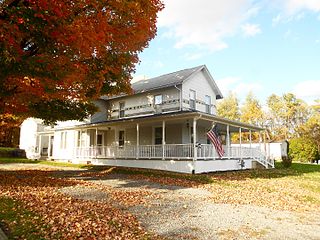
Huntington Township is an American township which is in Luzerne County, Pennsylvania. The population was 2,052 at the time of the 2020 census.

<span class="mw-page-title-main">Laflin, Pennsylvania</span> Borough in Pennsylvania, United States

Laflin is a borough in the Greater Pittston area of Luzerne County, Pennsylvania, United States. The population was 1,443 at the time of the 2020 census.

<span class="mw-page-title-main">Newport Township, Pennsylvania</span> First Class Township in Pennsylvania, United States

Newport Township is a township in Luzerne County, Pennsylvania, United States. As of 2020, the population was 4,444. Newport is located on the outskirts of Nanticoke City.

<span class="mw-page-title-main">Pittston, Pennsylvania</span> City in Pennsylvania, United States

Pittston is a city in Luzerne County, Pennsylvania, United States. The city lies in the Wyoming Valley on the east side of the Susquehanna River and on the south side of the Lackawanna River. It is approximately midway between Wilkes-Barre and Scranton. Pittston is 68.7 miles (110.6 km) north of Allentown and 129.2 miles (207.9 km) northwest of New York City.

<span class="mw-page-title-main">Pittston Township, Pennsylvania</span> Township in Pennsylvania, United States

Pittston Township is a township in Luzerne County, Pennsylvania. The population was 3,179 as of the 2020 census. The township is located within the Greater Pittston region. As of 2010, the total population of Greater Pittston was 48,020. The Wilkes-Barre/Scranton International Airport is located in Pittston Township.

<span class="mw-page-title-main">Plains Township, Pennsylvania</span> Township in Pennsylvania, United States

Plains Township is a township in Luzerne County, Pennsylvania, United States. The population was 9,816 at the 2020 census. The municipality is the birthplace of Chicago White Sox hall of famer Ed Walsh and John J. Yeosock, a United States Army general who commanded the 3rd U.S. Army during Operation Desert Shield and Operation Desert Storm. Mohegan Pennsylvania is a casino in Plains Township.

<span class="mw-page-title-main">West Pittston, Pennsylvania</span> Borough in Pennsylvania, United States

West Pittston is a borough in the Greater Pittston area of Luzerne County, Pennsylvania, United States. It is located on the Susquehanna River. In 2020, the population was 4,644.

<span class="mw-page-title-main">West Wyoming, Pennsylvania</span> Borough in Pennsylvania, United States

West Wyoming is a borough that is located in Luzerne County, Pennsylvania, United States. The borough is part of the Greater Pittston metro area.

<span class="mw-page-title-main">Wyoming, Pennsylvania</span> Borough in Luzerne County, Pennsylvania, US

Wyoming is a borough in the Greater Pittston area of Luzerne County, Pennsylvania, United States. It is located 5 miles (8 km) north of Wilkes-Barre, along the Susquehanna River. The population was 3,097 as of the 2020 census.

<span class="mw-page-title-main">Yatesville, Pennsylvania</span> Borough in Pennsylvania, United States

Yatesville is a borough in the Greater Pittston area of Luzerne County, Pennsylvania. The population was 638 as of the 2020 census.

<span class="mw-page-title-main">Pittston Area School District</span> School district in Pennsylvania

Pittston Area School District (PASD) is a mid-sized school district located in the Greater Pittston area of Luzerne County, Pennsylvania, the north-eastern part of the state, in the United States. The school district serves students from the city of Pittston, the boroughs of Avoca, Dupont, Duryea, Hughestown, Yatesville, Jenkins, and Pittston townships. Pittston Area School District encompasses approximately 42 square miles. According to 2000 federal census data, it serves a resident population of 30,034. In 2019, the residents' per capita income was $16,811 and the median family income was $40,063. Per school district officials, in school year 2005–06, the PASD provided basic educational services to 3,147 pupils through the employment of 196 teachers, 159 full-time and part-time support personnel, and 10 administrators.

<span class="mw-page-title-main">Greater Pittston</span> Region in Pennsylvania, United States

Greater Pittston is a 65.35 sq mi (169.3 km2) region in Luzerne County, Pennsylvania, in reference to the area in and around Pittston. As of 2010, the total population of Greater Pittston is 48,020. This region includes Avoca, Dupont, Duryea, Exeter Boro, Exeter Township, Hughestown, Jenkins Township, Laflin, Pittston Township, West Pittston, West Wyoming, Wyoming, and Yatesville. It is a subregion of Wyoming Valley.

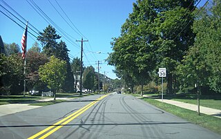
The 118th Pennsylvania House of Representatives District is located in northeastern Pennsylvania. The district has been represented by Democrat Jim Haddock since 2023.

<span class="mw-page-title-main">Inkerman, Pennsylvania</span> Census-designated place in Pennsylvania, United States

Inkerman is a census-designated place (CDP) in Jenkins Township, Luzerne County, Pennsylvania, United States. The population was 1,819 at the 2010 census.

References

  1. "2016 U.S. Gazetteer Files". United States Census Bureau. Retrieved August 14, 2017.
  2. 1 2 3 4 Bureau, US Census. "City and Town Population Totals: 2020—2021". Census.gov. US Census Bureau. Retrieved August 4, 2022.
  3. 1 2 "Jenkins Township".
  4. History of Luzerne County, Pennsylvania, with Biographical Selections, by Bradsby, Henry C., ed, 1893, Publisher: Chicago, S. B. Nelson, page 589
  5. Appletons' Cyclopedia of American Biography, 1600-1889, Vol III: Grinnell - Lockwood, page 426
  6. News Article: LEDGER-PHILADELPHIA, Thu November 27, 1924 "Pennsylvanians - Past and Present: Colonel John Jenkins, Officer of the Revolution" By F. A. Godcharles
  7. Chris Murley (2005). "Knox Mine Disaster". Archived from the original on December 30, 2016. Retrieved December 29, 2016.
  8. Robbins, William (September 26, 1982). "Gunman Kills 13 in a Pennsylvania Rampage". The New York Times . Retrieved March 3, 2018.
  9. "Census of Population and Housing". Census.gov. Retrieved June 4, 2016.
  10. "U.S. Census website". United States Census Bureau . Retrieved January 31, 2008.

41°17′00″N75°44′29″W / 41.28333°N 75.74139°W / 41.28333; -75.74139