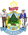
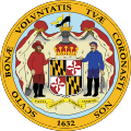
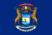
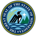
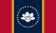
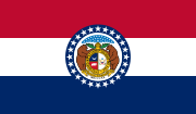
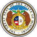
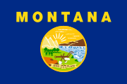
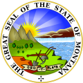
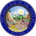
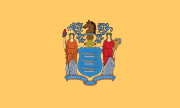
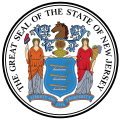
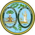
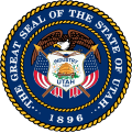
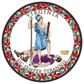
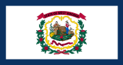
The following table displays the official flag, seal, and coat of arms of the 50 states, of the federal district, the 5 inhabited territories, and the federal government of the United States of America.
This is not a complete list of federally recognized tribes, and only represents some of the largest by population and reserved land area. See the Wikimedia links above for more symbols of Native American nations.
| Common and official names | Flag | Seal |
|---|---|---|
| Navajo Nation | 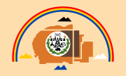 Details |  Details |
| Cherokee Nation |  Details |  Details |
| Choctaw Nation |  Details |  Details |
| Hopi Nation |  Details |  Details |
| Iroquois Confederacy |  Details |  Details |
| Osage Nation |  Details | 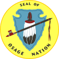 Details |


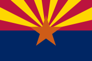
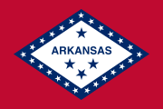
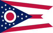
The flags of the U.S. states, territories, and the District of Columbia exhibit a variety of regional influences and local histories, as well as different styles and design principles. Modern U.S. state flags date from the turn of the 20th century, when states considered distinctive symbols for the 1893 World's Columbian Exposition in Chicago, Illinois. Most U.S. state flags were designed and adopted between 1893 and World War I.

The Territory of New Mexico was an organized incorporated territory of the United States from September 9, 1850, until January 6, 1912. It was created from the U.S. provisional government of New Mexico, as a result of Nuevo México becoming part of the American frontier after the Treaty of Guadalupe Hidalgo. It existed with varying boundaries until the territory was admitted to the Union as the U.S. state of New Mexico. This jurisdiction was an organized, incorporated territory of the US for nearly 62 years, the longest period of any territory in the contiguous United States.

The Territory of Utah was an organized incorporated territory of the United States that existed from September 9, 1850, until January 4, 1896, when the final extent of the territory was admitted to the Union as the State of Utah, the 45th state. At its creation, the Territory of Utah included all of the present-day State of Utah, most of the present-day state of Nevada save for Southern Nevada, much of present-day western Colorado, and the extreme southwest corner of present-day Wyoming.

The District of Louisiana, or Louisiana District, was an official and temporary United States government designation for the portion of the Louisiana Purchase that had not been organized into the Territory of Orleans or "Orleans Territory". The district officially existed from March 10, 1804, until July 4, 1805, when it was organized as the Louisiana Territory.

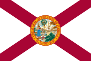
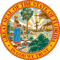
The flag of Florida consists of a red saltire on a white background, with the state seal superimposed on the center. The flag's current design has been in use since May 21, 1985, after the design of the Florida state seal was graphically improved and officially sanctioned for use by state officials.
The Territory of Alabama was an organized incorporated territory of the United States. The Alabama Territory was carved from the Mississippi Territory on August 15, 1817 and lasted until December 14, 1819, when it was admitted to the Union as the twenty-second state.

The Territory of Mississippi was an organized incorporated territory of the United States that was created under an organic act signed into law by President John Adams on April 7, 1798. It was dissolved on December 10, 1817, when the western half of the territory was admitted to the Union as the State of Mississippi. The eastern half was redesignated as the Alabama Territory; it was admitted to the Union as the State of Alabama on December 14, 1819. The Chattahoochee River played a significant role in the definition of the territory's borders. The population increased in the early 1800s from settlement, with cotton being an important cash crop.

The territory of the United States and its overseas possessions has evolved over time, from the colonial era to the present day. It includes formally organized territories, proposed and failed states, unrecognized breakaway states, international and interstate purchases, cessions, and land grants, and historical military departments and administrative districts. The last section lists informal regions from American vernacular geography known by popular nicknames and linked by geographical, cultural, or economic similarities, some of which are still in use today.
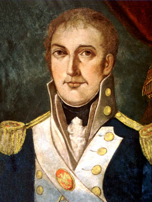
William Charles Cole Claiborne was an American politician, best known as the first non-colonial governor of Louisiana. He also has the distinction of possibly being the youngest member of the United States Congress in U.S. history, although reliable sources differ about his age.
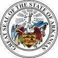
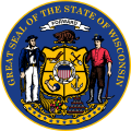
U.S. states, districts, and territories have representative symbols that are recognized by their state legislatures, territorial legislatures, or tradition. Some, such as flags, seals, and birds have been created or chosen by all U.S. polities, while others, such as state crustaceans, state mushrooms, and state toys have been chosen by only a few.
The "Old Southwest" is an informal name for the southwestern frontier territories of the United States from the American Revolutionary War c. 1780, through the early 1800s, at which point the US had acquired the Louisiana Territory, pushing the southwestern frontier toward what is today known as the Southwest.

The Seal of Louisiana is the official government emblem of the U.S. state of Louisiana. Originally devised in 1812, the latest version was enacted in 2006.
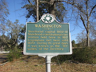
Washington is an unincorporated community in Adams County, Mississippi, United States. Located along the lower Mississippi, 6 miles (9.7 km) east of Natchez, it was the second and longest-serving capital of the Mississippi Territory.

The Great Seal of the State of Alabama is the state seal of the U.S. state of Alabama.

The following is an alphabetical list of articles related to the U.S. state of Mississippi.

The following outline is provided as an overview of and topical guide to the U.S. state of Mississippi:
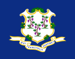
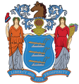
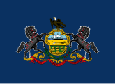
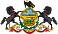
The coats of arms of the U.S. states are coats of arms, that are an official symbol of the state, alongside their seal. Eighteen states have officially adopted coats of arms. The former independent Republic of Texas and Kingdom of Hawaii each had a separate national coat of arms, which are no longer used.

Historical coats of arms of the U.S. states date back to the admission of the first states to the Union. Despite the widely accepted practice of determining early statehood from the date of ratification of the United States Constitution, many of the original colonies referred to themselves as states shortly after the Declaration of Independence was signed on 4 July 1776. Committees of political leaders and intellectuals were established by state legislatures to research and propose a seal and coat of arms. Many of these members were signers of the Articles of Confederation, Declaration of Independence, and United States Constitution. Several of the earliest adopted state coats of arms and seals were similar or identical to their colonial counterparts.