Greenwood, Missouri | |
---|---|
Coordinates: 38°51′03″N94°20′17″W / 38.85083°N 94.33806°W | |
Country | United States |
State | Missouri |
Counties | Jackson Cass |
Founded | 1867 |
Government | |
• Mayor | Dustin Young |
Area | |
• Total | 5.23 sq mi (13.54 km2) |
• Land | 5.22 sq mi (13.51 km2) |
• Water | 0.01 sq mi (0.03 km2) |
Elevation | 915 ft (279 m) |
Population (2020) | |
• Total | 6,021 |
• Density | 1,153.89/sq mi (445.56/km2) |
Time zone | UTC-6 (Central (CST)) |
• Summer (DST) | UTC-5 (CDT) |
ZIP code | 64034 |
Area code | 816 |
FIPS code | 29-29494 [3] |
GNIS feature ID | 2394246 [2] |
Website | www |
Greenwood is a city in Jackson and Cass counties in the U.S. state of Missouri. The population was 5,221 at the 2010 census. It is part of the Kansas City metropolitan area. [4]
Greenwood was laid out in 1867. [5] A post office called Greenwood has been in operation since 1866. [6] The city was incorporated in 1963. [7]
According to the United States Census Bureau, the city has a total area of 3.97 square miles (10.28 km2), all land. [8] The town has a small creek running through it in the southwest. The area that constitutes Greenwood is mainly lightly wooded and open fields northeast of its rail line, along with several small ponds. The area southwest of the rail line is mostly suburban, featuring housing along with a small downtown area.
Census | Pop. | Note | %± |
---|---|---|---|
1880 | 234 | — | |
1890 | 296 | 26.5% | |
1960 | 488 | — | |
1970 | 925 | 89.5% | |
1980 | 1,315 | 42.2% | |
1990 | 1,505 | 14.4% | |
2000 | 3,952 | 162.6% | |
2010 | 5,221 | 32.1% | |
2020 | 6,021 | 15.3% | |
U.S. Decennial Census [9] |
As of the census [10] of 2010, there were 5,221 people, 1,769 households, and 1,412 families living in the city. The population density was 1,315.1 inhabitants per square mile (507.8/km2). There were 1,838 housing units at an average density of 463.0 per square mile (178.8/km2). The racial makeup of the city was 91.7% White, 5.1% African American, 0.3% Native American, 0.5% Asian, 0.7% from other races, and 1.7% from two or more races. Hispanic or Latino of any race were 3.4% of the population.
There were 1,769 households, of which 51.0% had children under the age of 18 living with them, 66.2% were married couples living together, 8.9% had a female householder with no husband present, 4.7% had a male householder with no wife present, and 20.2% were non-families. 15.1% of all households were made up of individuals, and 2.6% had someone living alone who was 65 years of age or older. The average household size was 2.95 and the average family size was 3.30.
The median age in the city was 32.2 years. 32.6% of residents were under the age of 18; 6.7% were between the ages of 18 and 24; 34% were from 25 to 44; 20.6% were from 45 to 64; and 6.2% were 65 years of age or older. The gender makeup of the city was 49.9% male and 50.1% female.
As of the census [3] of 2000, there were 3,952 people, 1,352 households, and 1,122 families living in the city. The population density was 978.3 inhabitants per square mile (377.7/km2). There were 1,407 housing units at an average density of 348.3 per square mile (134.5/km2). The racial makeup of the city was 95.07% White, 2.25% African American, 0.30% Native American, 0.46% Asian, 0.05% Pacific Islander, 0.56% from other races, and 1.32% from two or more races. Hispanic or Latino of any race were 2.10% of the population.
There were 1,352 households, out of which 49.8% had children under the age of 18 living with them, 71.6% were married couples living together, 7.8% had a female householder with no husband present, and 17.0% were non-families. 13.2% of all households were made up of individuals, and 2.1% had someone living alone who was 65 years of age or older. The average household size was 2.92 and the average family size was 3.21.
In the city the population was spread out, with 32.6% under the age of 18, 6.0% from 18 to 24, 43.5% from 25 to 44, 12.9% from 45 to 64, and 4.9% who were 65 years of age or older. The median age was 30 years. For every 100 females, there were 101.0 males. For every 100 females age 18 and over, there were 98.8 males.
The median income for a household in the city was $62,574, and the median income for a family was $65,313. Males had a median income of $42,173 versus $28,750 for females. The per capita income for the city was $21,586. About 2.9% of families and 3.9% of the population were below the poverty line, including 5.7% of those under age 18 and 9.4% of those age 65 or over.
Greenwood is served by the Lee's Summit R-VII School District. This includes Greenwood Elementary School located inside Greenwood and both Summit Lakes Middle School and Lee's Summit West High School located in southern Lee's Summit.
Route 150 is a highway linking Greenwood to Southern Lee's Summit, Grandview, and to Overland Park at State Line Road.
Fairbank is a city in Buchanan and Fayette counties in the U.S. state of Iowa. The population was 1,111 at the time of the 2020 census.
Yates Center is a city in and the county seat of Woodson County, Kansas, United States. As of the 2020 census, the population of the city was 1,352.
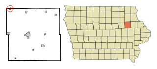
Chesterville is a town in Franklin County, Maine, United States. The population was 1,328 at the 2020 census.
Greenwood is a town in Oxford County, Maine, United States. The population was 774 at the 2020 census. The town was named for surveyor Alexander Greenwood. The village of Locke Mills, on State Route 26 in the northern part of Greenwood, is the town's urban center and largest settlement.
Woodstock is a town in Oxford County, Maine, United States. Woodstock is included in the Lewiston-Auburn, Maine metropolitan New England city and town area. The population was 1,352 at the 2020 census. The village of Bryant Pond, on State Route 26 in the northern part of Woodstock, is the town's urban center and largest settlement.
Oneida Charter Township is a charter township of Eaton County in the U.S. state of Michigan. The population was 3,986 at the 2020 United States Census, up from 3,865 in 2010.
Rockwood is a city in southeastern Wayne County in the U.S. state of Michigan. The population was 3,289 at the 2010 census.
Greenwood is a community on Saint Albans Bay on Lake Minnetonka in Hennepin County, Minnesota, United States just northeast of the community of Excelsior, Minnesota. The population was 688 at the 2010 census.
Marble is a city in Itasca County, Minnesota, United States. It is part of the chain of small mining towns known as the Iron Range. The population was 701 at the 2010 census.
Maplewood is a city in Ramsey County, Minnesota, United States. The population was 42,088 at the 2020 census. Maplewood is ten minutes' drive from downtown Saint Paul. It stretches along the northern and eastern borders of Saint Paul.
Imperial is a census-designated place (CDP) in Jefferson County, Missouri, United States, and is a suburb of St. Louis. The population was 4,947 at the 2020 census. Imperial was originally known as West Kimmswick, the historic Catholic church of St. John’s in Imperial, became an independent parish in 1869.
Northwoods is a city in St. Louis County, Missouri, United States. The population was 4,227 at the 2010 census.
Velda City is a city in St. Louis County, Missouri, United States. The population was 1,420 at the 2010 census.
Claremont is a city in Catawba County, North Carolina, United States. The population was 1,352 at the 2010 census. It is part of the Hickory–Lenoir–Morganton Metropolitan Statistical Area.
Fairlawn is a city in western Summit County, Ohio, United States, and a suburb of Akron. The population was 7,710 at the 2020 census. It is part of the Akron metropolitan area.
Halsey is a city in Linn County, Oregon, United States. The population was 904 at the 2010 census.
Greenwood Township is a township in Clearfield County, Pennsylvania, United States. The township has a population of 363 people, according to the 2020 United States census. Between Mahaffey and Grampian on U.S. Route 219, Greenwood Township contains the villages of Curry Run and Bells Landing. The West Branch of the Susquehanna River passes through it, along with several abandoned and presently used railroad grades.
Greenwood Township is a township in Columbia County, Pennsylvania. It is part of Northeastern Pennsylvania. The population was 1,888 at the 2020 census.
Vienna is a city in Wood County, West Virginia, United States, situated along the Ohio River. The population was 10,676 at the 2020 census. It is the second-largest city in the Parkersburg–Vienna metropolitan area.
Summit Township is a civil township of Jackson County in the U.S. state of Michigan. The population was 22,508 at the 2010 census.
{{cite web}}
: CS1 maint: bot: original URL status unknown (link)