Lee's Summit, Missouri

Last updated

Lee's Summit, Missouri
Historic Sites 037.JPG
Downtown Lee's Summit
Flag of Lee's Summit, Missouri.svg
Jackson County Missouri Incorporated and Unincorporated areas Lee's Summit Highlighted.svg
Location of Lee's Summit in Jackson County and the state of Missouri
USA Missouri location map.svg
Red pog.svg
Lee's Summit
Location in Missouri
Usa edcp location map.svg
Red pog.svg
Lee's Summit
Lee's Summit (the United States)
North America laea location map.svg
Red pog.svg
Lee's Summit
Lee's Summit (North America)
Coordinates: 38°55′02″N94°22′54″W / 38.91722°N 94.38167°W / 38.91722; -94.38167
CountryUnited States
State Missouri
Counties Jackson, Cass
IncorporatedOctober 28, 1865 [1]
Named for Dr. Pleasant Lea [1]
Government
  Type Council–manager
   Mayor William A. Baird [2]
   City manager Mark Dunning [3]
   City Council
Members [4]
  • Mia Prier
  • Hillary Shields
  • John Lovell
  • Andrew S. Felker
  • Phyllis Q. Eldson
  • Beto Lopez
  • Fred DeMoro
  • Faith Hodges
Area
[5]
  Total65.91 sq mi (170.71 km2)
  Land63.90 sq mi (165.49 km2)
  Water2.02 sq mi (5.22 km2)
Elevation
[6]
1,024 ft (312 m)
Population
 (2020) [7]
  Total101,108
  Rank 6th in Missouri
314th in the United States
  Density1,582.41/sq mi (610.97/km2)
Time zone UTC−6 (CST)
  Summer (DST) UTC−5 (CDT)
ZIP Codes
64015, 64063, 64064, 64081, 64082, 64083, 64086
Area code 816
FIPS codes 29095, 29037
GNIS feature ID2395669 [6]
Website cityofls.net

Lee's Summit is a city in the U.S. state of Missouri and is a suburb in the Kansas City metropolitan area. It resides in Jackson County (predominantly) as well as Cass County. [8] [9] As of the 2020 census, its population was 101,108, making it the 6th most populous city in both Missouri and the Kansas City metropolitan area. [7]

Contents

History

Lee's Summit circa 1877. From the 1877 Illustrated Historical Atlas of Jackson Co. Missouri LS Platt 1877.JPG
Lee's Summit circa 1877. From the 1877 Illustrated Historical Atlas of Jackson Co. Missouri

The "Town of Strother" (not to be confused with a town of the same name in Monroe County) was founded by William Bullitt Howard in October 1865. He named it for his wife, Maria D. Strother, the daughter of William D. Strother formerly of Bardstown, Kentucky. Howard came to Jackson County in 1842 from Kentucky, married Maria in 1844, and by 1850 he and Maria had 833 acres (3.37 km2) and a homestead 5 miles (8 km) north of town. Howard was arrested for being a Confederate in October 1862, near the beginning of the Civil War, and after being paroled he took his family back to Kentucky for the duration of the war. After the war ended he returned and, knowing that the Missouri Pacific Railroad was surveying a route in the area, platted the town with 70 acres (280,000 m2) in the fall of 1865 as the town of Strother. [1] [10] [11]

In November 1868, the town's name was changed to the "Town of Lee's Summit", most likely to honor early settler Dr. Pleasant John Graves Lea, [12] who had moved to Jackson County in 1849 from Bradley County, Tennessee. [10] Lea was listed as the postmaster of nearby Big Cedar in the 1855 United States Official Postal Guide. [13] [14] Dr. Lea was killed in August 1862 by Kansas Jayhawkers (or Redlegs). [15] [16]

When the surveyors for the Missouri Pacific Railroad came through, the local people and the railroad wanted to name the town in Dr. Lea's honor. He had a farm on the highest point and near the path of the tracks, and his murder had taken place near the site of the proposed depot. So they chose the name of "Lea's Summit", the "summit" portion to reflect its highest elevation on the Missouri Pacific Railroad between St. Louis and Kansas City. [12] But they misspelled the name "Lees Summit" (with two "e's"; "Lee" instead of "Lea"; and leaving out the apostrophe) on a boxcar that was serving as a station and donated by the Missouri Pacific, then a sign next to the tracks, and finally in the printed time schedule for the railroad. [1] [10] It may be that this misspelling stuck and the name has remained "Lee's Summit" ever since.

Since the name was already being circulated and published with two "e's", the town petitioned the state legislature and incorporated its name in 1868 as: "Town of Lee's Summit". [12]

The spelling is unusual because apostrophes are typically not included in place names due to potential confusion regarding whether the place is owned by the namesake person. Most possessive place names lack an apostrophe, such as Harpers Ferry, West Virginia.

The growth of the town can be studied through historic Sanborn maps, which document building types and uses in the city during the late nineteenth and early twentieth centuries. [17] [ importance? ]

In 1913, R. A. Long, the owner of a lumber company, began building his estate, named Longview Farm, on the western edge of the city and into part of Kansas City. [1] When complete, it had a mansion, five barns and 42 buildings in the 1,700 acres (6.9 km2). Harrison Metheny, grandfather of jazz legend Pat Metheny, was an electrician during the construction of Longview Farm.[ citation needed ] The farm also had a church, Longview Chapel Christian Church, which was completed in 1915. It soon became internationally known as a showplace farm. Today, one of the horse barns is home to Longview Farm Elementary. The church and mansion are on the National Register of Historic Places. Other parts of the farm have been turned into Longview Lake, Longview Community College, and a development called New Longview. [1] [12] Lee's Summit is also home to Missouri Town 1855 and Lee's Summit Historical Cemetery.

Geography

The location of Lee's Summit in relation to counties and state Lees summit.JPG
The location of Lee's Summit in relation to counties and state

Lee's Summit lies near Missouri's western border with Kansas and is further north than south relative to the rest of the state. The city borders Kansas City to the west and northwest, Independence, Missouri to the north, and a number of smaller, more rural cities to the south and east. [9] It is part of the Kansas City, MO-KS Metropolitan Statistical Area. [9]

According to the United States Census Bureau, the city has a total area of 65.911 square miles (170.71 km2), of which 63.895 square miles (165.49 km2) is land and 2.016 square miles (5.22 km2) is water. [5]

Demographics

Historical population
CensusPop.Note
1880 693
1890 1,36997.5%
1900 1,4536.1%
1910 1,4550.1%
1920 1,4670.8%
1930 2,03538.7%
1940 2,26311.2%
1950 2,55412.9%
1960 8,267223.7%
1970 16,23096.3%
1980 28,74177.1%
1990 46,41861.5%
2000 70,70052.3%
2010 91,36429.2%
2020 101,10810.7%
2023 (est.)104,6383.5%
U.S. Decennial Census [18] [ Link to precise page ]

2020 census

The 2020 United States census [19] counted 101,108 people, 37,664 households, and 27,316 families in Lee's Summit. The population density was 1,582.3 per square mile (611.0/km2). There were 39,495 housing units at an average density of 618.1 per square mile (238.7/km2). The racial makeup (including Hispanics in the racial counts) was 78.64% (79,516) white, 8.92% (9,019) black or African-American, 0.32% (321) Native American, 2.37% (2,401) Asian, 0.15% (147) Pacific Islander, 1.7% (1,714) from other races, and 7.9% (7,990) from two or more races.[ citation needed ] Hispanic or Latino of any race was 5.3% (5,398) of the population. [20]

Lee's Summit, Missouri – Racial and ethnic composition
Note: the U.S. census treats Hispanic/Latino as an ethnic category. This table excludes Latinos from the racial categories and assigns them to a separate category. Hispanics/Latinos may be of any race.
Race / Ethnicity (NH = Non-Hispanic)Pop 2000 [21] Pop 2010 [22] Pop 2020 [20] % 2000% 2010% 2020
White alone (NH)64,99176,50278,00391.93%83.73%77.15%
Black or African American alone (NH)2,4377,5088,8863.45%8.22%8.79%
Native American or Alaska Native alone (NH)2442482320.35%0.27%0.23%
Asian alone (NH)6911,5212,3720.98%1.66%2.35%
Pacific Islander alone (NH)431091420.06%0.12%0.14%
Some Other Race alone (NH)371383790.05%0.15%0.37%
Mixed Race or Multi-Racial (NH)8631,8095,6961.22%1.98%5.63%
Hispanic or Latino (any race)1,3943,5295,3981.97%3.86%5.34%
Total70,70091,364101,108100.00%100.00%100.00%

Of the 37,664 households, 34.9% had children under the age of 18; 58.6% were married couples living together; 23.3% had a female householder with no husband present. Of all households, 22.9% consisted of individuals and 9.3% had someone living alone who was 65 years of age or older. The average household size was 2.6 and the average family size was 3.1.

25.8% of the population was under the age of 18, 6.3% from 18 to 24, 25.6% from 25 to 44, 25.2% from 45 to 64, and 15.0% who were 65 years of age or older. The median age was 38.4 years. For every 100 females, the population had 90.7 males. For every 100 females ages 18 and older, there were 88.5 males.

The 2016-2020 5-year American Community Survey [23] estimates show that the median household income was $93,295 (with a margin of error of +/- $3,679) and the median family income was $108,397 (+/- $3,999). Males had a median income of $61,941 (+/- $2,306) versus $41,989 (+/- $1,903) for females. The median income for those above 16 years old was $50,625 (+/- $1,528). Approximately, 3.5% of families and 4.6% of the population were below the poverty line, including 6.2% of those under the age of 18 and 4.6% of those ages 65 or over.

2010 census

As of the 2010 census [24] [ Link to precise page ] of 2010, there were 91,364 people, 34,429 households, and 25,126 families living in the city. The population density was 1,442.2 inhabitants per square mile (556.8/km2). There were 36,679 housing units at an average density of 579.0 per square mile (223.6/km2). The racial makeup of the city was 86.1% White, 8.4% African American, 0.3% Native American, 1.7% Asian, 0.1% Pacific Islander, 1.1% from other races, and 2.4% from two or more races. Hispanic or Latino of any race were 3.9% of the population.

There were 34,429 households, of which 39.5% had children under the age of 18 living with them, 58.3% were married couples living together, 10.9% had a female householder with no husband present, 3.8% had a male householder with no wife present, and 27.0% were non-families. Of all households, 22.8% were made up of individuals, and 8.9% had someone living alone who was 65 years of age or older. The average household size was 2.63 and the average family size was 3.11.

The median age in the city was 37.2 years. 28% of residents were under the age of 18; 7.1% were between the ages of 18 and 24; 27% were from 25 to 44; 26.6% were from 45 to 64; and 11.5% were 65 years of age or older. The sex makeup of the city was 47.9% male and 52.1% female.

2000 census

As of the 2000 census,[ citation needed ] there were 70,700 people, 26,417 households, and 19,495 families living in the city. The population density was 1,188.0 inhabitants per square mile (458.7/km2). There were 27,311 housing units at an average density of 458.9 per square mile (177.2/km2). The racial makeup of the city was 93.17% White, 3.47% African American, 0.36% Native American, 0.99% Asian, 0.06% Pacific Islander, 0.52% from other races, and 1.42% from two or more races. Hispanic or Latino of any race were 1.97% of the population.

There were 26,417 households, out of which 40.8% had children under the age of 18 living with them, 62.1% were married couples living together, 8.9% had a female householder with no husband present, and 26.2% were non-families. Of all households, 22.0% were made up of individuals, and 9.2% had someone living alone who was 65 years of age or older. The average household size was 2.65 and the average family size was 3.12.

In the city, 29.2% of the population was under the age of 18, 6.6% was from 18 to 24, 33.1% from 25 to 44, 20.9% from 45 to 64, and 10.2% was 65 years of age or older. The median age was 35 years. For every 100 females, there were 91.9 males. For every 100 females age 18 and over, there were 87.4 males.

The median income for a household in the city was $60,905, and the median income for a family was $70,702. Males had a median income of $49,385 versus $32,837 for females. The per capita income for the city was $26,891. About 2.8% of families and 3.8% of the population were below the poverty line, including 4.7% of those under age 18 and 4.7% of those age 65 or over.

Economy

Top employers

According to the town's Economic Development Council, [25] the top employers in the city are:

#Employer# of employees
1Lee's Summit R-7 schools3,116
2 Homeland Security - USCIS 3,000
3 Saint Luke's East Hospital 1,430
4 Truman Medical Center - Lakewood 1,200
5John Knox Village1,000
6 GEHA Holdings Inc. 880
7City of Lee's Summit786
8Lee's Summit Medical Center730
9ReDiscover700
10CVS Caremark Call Center450
11 Metropolitan Community College - Longview 406
12 Quest Diagnostics 350
13 Unity Village 325
14Aspen Contracting300
15 Viracor-Eurofins 290
16IPL Plastics271
17R&D Leverage265

City government

Lee's Summit is a charter and council-manager form of government, represented by a mayor and a city council. The city council appoints a city manager. Each of the four districts are represented by two councilmembers whose terms are staggered and expire every four years. No councilmember may serve more than two consecutive terms. [2] [4]

Mayor

City manager

City council

Education

Lee's Summit is served by parts of three public school districts: Lee's Summit R-VII School District, Blue Springs R-IV School District, Raymore-Peculiar R-II School District. Lee's Summit has four religious private schools as well: Summit Christian Academy (formerly Lee's Summit Community Christian School), Our Lady of Presentation Catholic School, Lee's Summit Academy (formerly Libby Lane Academy), and St. Michael the Archangel Catholic High School. Longview Community College is located on the western edge of Lee's Summit and is part of Metropolitan Community College (Kansas City) system. It also is home to the Summit Technology Center which is a branch campus of the University of Central Missouri.

Lee's Summit has three public libraries, branches of the Mid-Continent Public Library, on Oldham Parkway, Colbern Road, and Blue Parkway. [26]

Climate

Lee's Summit experiences a four-season humid continental climate (Köppen climate classification Dfa) with cold days and nights during the winter, and hot days and muggy nights during the summer.

Climate data for Lee's Summit Municipal Airport [lower-alpha 1] and James A. Reed Memorial Wildlife Area [lower-alpha 2]
MonthJanFebMarAprMayJunJulAugSepOctNovDecYear
Record high °F (°C)73
(23)
80
(27)
87
(31)
91
(33)
91
(33)
103
(39)
108
(42)
107
(42)
107
(42)
95
(35)
82
(28)
73
(23)
108
(42)
Mean maximum °F (°C)59
(15)
65
(18)
77
(25)
83
(28)
88
(31)
93
(34)
98
(37)
98
(37)
92
(33)
85
(29)
73
(23)
63
(17)
99
(37)
Mean daily maximum °F (°C)39.0
(3.9)
44.3
(6.8)
55.4
(13.0)
65.5
(18.6)
74.8
(23.8)
84.0
(28.9)
88.3
(31.3)
86.9
(30.5)
79.0
(26.1)
67.1
(19.5)
54.0
(12.2)
43.2
(6.2)
65.1
(18.4)
Daily mean °F (°C)30.6
(−0.8)
35.1
(1.7)
45.4
(7.4)
55.5
(13.1)
65.3
(18.5)
74.7
(23.7)
79.0
(26.1)
77.3
(25.2)
69.0
(20.6)
57.2
(14.0)
45.1
(7.3)
34.7
(1.5)
55.7
(13.2)
Mean daily minimum °F (°C)22.1
(−5.5)
25.9
(−3.4)
35.4
(1.9)
45.5
(7.5)
55.9
(13.3)
65.4
(18.6)
69.7
(20.9)
67.6
(19.8)
59.0
(15.0)
47.2
(8.4)
36.2
(2.3)
26.3
(−3.2)
46.3
(8.0)
Mean minimum °F (°C)−3
(−19)
2
(−17)
13
(−11)
27
(−3)
39
(4)
50
(10)
56
(13)
54
(12)
40
(4)
28
(−2)
16
(−9)
2
(−17)
−6
(−21)
Record low °F (°C)−19
(−28)
−15
(−26)
−5
(−21)
11
(−12)
28
(−2)
35
(2)
48
(9)
43
(6)
29
(−2)
7
(−14)
0
(−18)
−25
(−32)
−25
(−32)
Average precipitation inches (mm)0.96
(24)
1.43
(36)
2.14
(54)
4.19
(106)
5.70
(145)
4.95
(126)
4.57
(116)
4.54
(115)
3.07
(78)
3.39
(86)
2.05
(52)
1.35
(34)
38.34
(972)
Average snowfall inches (cm)2.7
(6.9)
2.8
(7.1)
1.3
(3.3)
0.2
(0.51)
0.0
(0.0)
0.0
(0.0)
0.0
(0.0)
0.0
(0.0)
0.0
(0.0)
0.0
(0.0)
0.5
(1.3)
1.8
(4.6)
4.5
(11)
Average precipitation days (≥ 0.01 in)55810121099897698
Average snowy days (≥ 0.1 in)2210000000029
Source: NOAA [27] [28]

Infrastructure

Transportation

The Historic Jefferson Highway (known as the "Palm to Pine" highway) runs through Lee's Summit.

Major roads

Other

Healthcare

Two general medical and surgical hospitals which provide emergency services—Lee's Summit Medical Center and Saint Luke's East Hospital—are both located in Lee's Summit.

Media

Notable people

Notes

  1. Data used to calculate the average daily high temperatures, the average daily low temperatures, and the overall daily average temperatures of each month are from the Lee's Summit Municipal Airport (1991 to 2020). [27]
  2. Record high temperatures, record low temperatures, and the data used to calculate the mean monthly high temperatures, the mean monthly low temperatures, the average monthly precipitation and snowfall, the average days with precipitation of each month, and the average days with snowfall of each month are from the James A. Reed Memorial Wildlife Area (1962 to 2011). [28]

Related Research Articles

<span class="mw-page-title-main">Hope, Kansas</span> City in Dickinson County, Kansas

Hope is a city in southern Dickinson County, Kansas, United States. As of the 2020 census, the population of the city was 317.

<span class="mw-page-title-main">Elwood, Kansas</span> City in Doniphan County, Kansas

Elwood is a city in Doniphan County, Kansas, United States, located west across the Missouri River from Saint Joseph, Missouri. As of the 2020 census, the population of the city was 1,125.

<span class="mw-page-title-main">Highland, Kansas</span> City in Doniphan County, Kansas

Highland is a city in Doniphan County, Kansas, United States. As of the 2020 census, the population of the city was 903. It is home to Highland Community College.

<span class="mw-page-title-main">Merriam, Kansas</span> City in Kansas, United States

Merriam is a city in Johnson County, Kansas, United States, and part of the Kansas City Metropolitan Area. As of the 2020 census, the population of the city was 11,098. Merriam is included in the Shawnee Mission postal designation. It is also the headquarters of Seaboard Corporation.

<span class="mw-page-title-main">Lansing, Kansas</span> City in Kansas, United States

Lansing is a city in Leavenworth County, Kansas, United States. It is situated along the west side of the Missouri River and Kansas-Missouri state border. As of the 2020 census, the population of the city was 11,239. It is the second most populous city of Leavenworth County and is a part of the Kansas City metropolitan area. The Lansing Correctional Facility, which includes the state's main maximum-security prison, is located in Lansing.

<span class="mw-page-title-main">Bison, Kansas</span> City in Rush County, Kansas

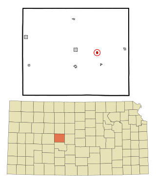
Bison is a city in Rush County, Kansas, United States. As of the 2020 census, the population of the city was 179.

<span class="mw-page-title-main">Barnes, Kansas</span> City in Washington County, Kansas

Barnes is a city in Washington County, Kansas, United States. As of the 2020 census, the population of the city was 165.

<span class="mw-page-title-main">Mindenmines, Missouri</span> City in Missouri, United States

Mindenmines is a city in Barton County, Missouri, United States. The population was 271 at the 2020 census. The city lies approximately four miles east of Frontenac, Kansas. It has possessed a post office since 1883. It is also the home of the Bank of Minden..

<span class="mw-page-title-main">East Lynne, Missouri</span> City in Missouri, United States

East Lynne is a city in eastern Cass County, Missouri The population was 303 at the 2010 census. It is part of the Kansas City metropolitan area within the United States.

<span class="mw-page-title-main">Harrisonville, Missouri</span> City in Missouri, United States

Harrisonville is a city in Cass County, Missouri, United States. The population was 10,121 at the 2020 census. It is the county seat of Cass County. It is part of the Kansas City metropolitan area.

<span class="mw-page-title-main">Pleasant Hill, Missouri</span> City in Missouri, United States

Pleasant Hill is a city in Cass and Jackson counties, Missouri, United States. The population was 8,113 at the 2010 census. It is part of the Kansas City metropolitan area.

<span class="mw-page-title-main">Gladstone, Missouri</span> City in Missouri, United States

Gladstone is a city in Clay County, Missouri, United States and a suburb of Kansas City. The City of Gladstone is located about 10–20 minutes from downtown Kansas City, and about 10–20 minutes from Kansas City International Airport. As of the 2020 census, the city population was 27,063. It is part of the Kansas City metropolitan area.

<span class="mw-page-title-main">Grain Valley, Missouri</span> City in Missouri, United States

Grain Valley is a city in Jackson County, Missouri, United States. Grain Valley is located in the Kansas City Metropolitan Area and is a suburb of Kansas City. The population was 12,854 at the 2010 census and an estimated 15,627 in 2020. It is 23 miles (37 km) east of downtown Kansas City.

<span class="mw-page-title-main">Greenwood, Missouri</span> City in Missouri, United States

Greenwood is a city in Jackson and Cass counties in the U.S. state of Missouri. The population was 5,221 at the 2010 census. It is part of the Kansas City metropolitan area.

<span class="mw-page-title-main">Unity Village, Missouri</span> Village in Missouri, United States

Unity Village is a village in Jackson County, Missouri, United States, bordering Kansas City and Lee's Summit. It is part of the Kansas City metropolitan area. Its population was 99 at the 2010 census. The founders of the Unity spiritual movement, Charles and Myrtle Fillmore, purchased a 58-acre farm in 1919 as a weekend getaway for employees of their downtown Kansas City headquarters. In March 1920, the land came to be known as Unity Farm, and the following purchase of 12 surrounding farms expanded the land to nearly 1,500 acres.

<span class="mw-page-title-main">Warrensburg, Missouri</span> City in Missouri

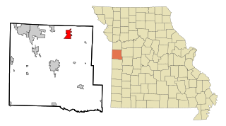
Warrensburg is a city in and the county seat of Johnson County, Missouri, United States. The population was 20,313 at the 2020 census. The Warrensburg Micropolitan Statistical Area consists of Johnson County. The city is a college town as it is home to the University of Central Missouri.

<span class="mw-page-title-main">Wellington, Missouri</span> City in Missouri, United States

Wellington is a city in Lafayette County, Missouri, and part of the Kansas City metropolitan area within the United States. It is located approximately 35 miles east of Kansas City. The population was 812 at the 2010 census.

<span class="mw-page-title-main">Henrietta, Missouri</span> City in Missouri, United States

Henrietta is a city in southern Ray County, Missouri, and part of the Kansas City metropolitan area within the United States. The population was 278 at the 2020 census.

<span class="mw-page-title-main">Holts Summit, Missouri</span> City in Missouri, United States

Holts Summit is a small city in Callaway County, Missouri. The population was 4,458 at the time of the 2020 census. Holts Summit is located 7 miles (11 km) northeast of Jefferson City, Missouri's state capital. It is part of the Jefferson City Metropolitan Area.

<span class="mw-page-title-main">East Mountain, Texas</span> City in Texas, United States

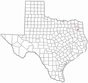
East Mountain is a city in Upshur and Gregg counties, Texas, United States. The population was 899 at the 2020 census, an increase over the figure of 797 tabulated in 2010.

References

  1. 1 2 3 4 5 6 "Lee's Summit History". City of Lee's Summit. Retrieved September 3, 2021.
  2. 1 2 "Mayor's Office". City of Lee's Summit. Retrieved April 27, 2016.
  3. "City Manager's Office". City of Lee's Summit. Retrieved March 23, 2023.
  4. 1 2 "City Council". City of Lee's Summit. Retrieved March 23, 2023.
  5. 1 2 "Gazetteer Files". U.S. Census Bureau. February 12, 2011. Retrieved April 23, 2011.
  6. 1 2 U.S. Geological Survey Geographic Names Information System: Lee's Summit, Missouri
  7. 1 2 "U.S. Census Bureau QuickFacts: Lee's Summit city, Missouri". U.S. Census Bureau. Retrieved March 3, 2023.
  8. Lee's Summit, Missouri, Municipal Code art. I, § 1.2 (2022). Retrieved March 23, 2023.
  9. 1 2 3 "City Map of Lee's Summit" (PDF). MODOT. 2022. Retrieved March 23, 2023.
  10. 1 2 3 Horner, John Arthur (November 8, 2013). "Here a Lea, There a Lea - Everywhere a Lea, a Lea! Part 1". Kansas City Public Library. Retrieved October 6, 2023.
  11. Wilcox, Pearl (1975). Jackson County Pioneers. Independence, Missouri. pp. 107–108. Retrieved July 6, 2008.
  12. 1 2 3 4 Union Historical Company (1881). The History of Jackson County, Missouri. Cornell University Library. Kansas City: Birdsall, Williams & Co. p. 342.
  13. "List of Postmasters". United States Official Postal Guide. United States Post Office Dept. July 1, 1855. Retrieved July 6, 2008.
  14. Horner, John Arthur (November 15, 2013). "Here a Lea, There a Lea - Everywhere a Lea, a Lea! Part 2". Kansas City Public Library. In January 1852 he was appointed as a US Postmaster.
  15. Lee's Summit Centennial, 1876–1965. June 1965. p. 6. Retrieved July 6, 2008.
  16. Horner, John Arthur (November 15, 2013). "Here a Lea, There a Lea - Everywhere a Lea, a Lea! Part 2". Kansas City Public Library. Retrieved October 6, 2023. On September 12, 1862, Dr. Pleasant Lea was murdered.
  17. "Sanborn Fire Insurance Maps of Missouri Collection". MU Special Collections. March 3, 2023. Archived from the original on March 28, 2004.
  18. "Census of Population and Housing". Census.gov. Retrieved June 4, 2015.
  19. "Explore Census Data". data.census.gov. Retrieved December 17, 2023.
  20. 1 2 "P2 Hispanic or Latino, and Not Hispanic or Latino by Race – 2020: DEC Redistricting Data (PL 94-171) – Lee's Summit city, Missouri". United States Census Bureau .
  21. "P004: Hispanic or Latino, and Not Hispanic or Latino by Race – 2000: DEC Summary File 1 – Lee's Summit city, Missouri". United States Census Bureau.
  22. "P2 Hispanic or Latino, and Not Hispanic or Latino by Race – 2010: DEC Redistricting Data (PL 94-171) – Lee's Summit city, Missouri". United States Census Bureau .
  23. "Explore Census Data". data.census.gov. Retrieved December 17, 2023.
  24. "U.S. Census website". United States Census Bureau . Retrieved July 8, 2012.
  25. "Lee's Summit Economic Development Council Workforce Major Employers" . Retrieved September 21, 2020.
  26. "Locations". Mid-Continent Public Library. Retrieved July 8, 2020.
  27. 1 2 "Station: LEES SUMMIT MUNI AP". U.S. Climate Normals 2020: U.S. Monthly Climate Normals (1991-2020). National Oceanic and Atmospheric Administration . Retrieved October 6, 2023.
  28. 1 2 "NowData – NOAA Online Weather Data". National Oceanic and Atmospheric Administration . Retrieved October 6, 2023.