Wellington, Missouri

Last updated
Wellington, Missouri
Wellington, Missouri March 27 2019.jpg
Downtown Wellington in March 2019
Lafayette County Missouri Incorporated and Unincorporated areas Wellington Highlighted.svg
Location of Wellington, Missouri
Coordinates: 39°08′18″N93°59′10″W / 39.13833°N 93.98611°W / 39.13833; -93.98611 Coordinates: 39°08′18″N93°59′10″W / 39.13833°N 93.98611°W / 39.13833; -93.98611
Country United States
State Missouri
County Lafayette
Area
[1]
  Total1.13 sq mi (2.92 km2)
  Land1.09 sq mi (2.82 km2)
  Water0.04 sq mi (0.09 km2)
Elevation
[2]
692 ft (211 m)
Population
 (2020)
  Total738
  Density677.06/sq mi (261.43/km2)
Time zone UTC-6 (Central (CST))
  Summer (DST) UTC-5 (CDT)
ZIP code
64097
Area code 816
FIPS code 29-78352 [3]
GNIS feature ID2397247 [2]
Website wellingtonmo.com

Wellington is a city in Lafayette County, Missouri, and part of the Kansas City metropolitan area within the United States. It is located approximately 35 miles east of Kansas City. The population was 812 at the 2010 census.

Contents

History

Wellington was laid out in 1837, and named after Arthur Wellesley, 1st Duke of Wellington, British commander at the Battle of Waterloo. [4] A post office called Wellington has been in operation since 1840. [5]

In November 2013, Leland Ray Kolkmeyer pled guilty, in federal court, of a fraud scheme in which he embezzled more than $1.5 million from Wellington-Napoleon Fire Protection District and Special Road District while being their former treasurer. [6] [7] [8]

Geography

According to the United States Census Bureau, the city has a total area of 1.13 square miles (2.93 km2), of which 1.09 square miles (2.82 km2) is land and 0.04 square miles (0.10 km2) is water. [9]

Wellington lies just a few miles east of Napoleon, Missouri, the two towns having been named after the commanders at the Battle of Waterloo. Approximately halfway between the two towns lies a small, unincorporated crossroads called "Waterloo".

Demographics

Historical population
CensusPop.Note
1880 378
1890 44618.0%
1900 52016.6%
1910 5587.3%
1920 87857.3%
1930 756−13.9%
1940 656−13.2%
1950 649−1.1%
1960 6510.3%
1970 72010.6%
1980 7808.3%
1990 779−0.1%
2000 7840.6%
2010 8123.6%
2020 738−9.1%
U.S. Decennial Census [10]

2010 census

As of the census [11] of 2010, there were 812 people, 322 households, and 225 families living in the city. The population density was 745.0 inhabitants per square mile (287.6/km2). There were 357 housing units at an average density of 327.5 per square mile (126.4/km2). The racial makeup of the city was 95.9% White, 1.0% African American, 0.2% Native American, 1.0% from other races, and 1.8% from two or more races. Hispanic or Latino of any race were 2.7% of the population.

There were 322 households, of which 34.2% had children under the age of 18 living with them, 55.0% were married couples living together, 10.9% had a female householder with no husband present, 4.0% had a male householder with no wife present, and 30.1% were non-families. 27.6% of all households were made up of individuals, and 11.5% had someone living alone who was 65 years of age or older. The average household size was 2.52 and the average family size was 3.06.

The median age in the city was 38.3 years. 27.5% of residents were under the age of 18; 7.7% were between the ages of 18 and 24; 24.7% were from 25 to 44; 26.8% were from 45 to 64; and 13.4% were 65 years of age or older. The gender makeup of the city was 48.9% male and 51.1% female.

2000 census

As of the census [3] of 2000, there were 784 people, 343 households, and 218 families living in the city. The population density was 714.0 inhabitants per square mile (275.7/km2). There were 361 housing units at an average density of 328.7 per square mile (126.9/km2). The racial makeup of the city was 98.47% White, 0.51% African American, 0.26% Native American, 0.13% Pacific Islander, 0.26% from other races, and 0.38% from two or more races. Hispanic or Latino of any race were 1.79% of the population.

There were 343 households, out of which 28.0% had children under the age of 18 living with them, 50.1% were married couples living together, 11.7% had a female householder with no husband present, and 36.2% were non-families. 32.7% of all households were made up of individuals, and 16.0% had someone living alone who was 65 years of age or older. The average household size was 2.26 and the average family size was 2.85.

In the city the population was spread out, with 23.1% under the age of 18, 7.9% from 18 to 24, 28.4% from 25 to 44, 23.1% from 45 to 64, and 17.5% who were 65 years of age or older. The median age was 39 years. For every 100 females, there were 97.0 males. For every 100 females age 18 and over, there were 89.6 males.

The median income for a household in the city was $32,500, and the median income for a family was $41,071. Males had a median income of $32,031 versus $23,250 for females. The per capita income for the city was $17,997. About 6.0% of families and 6.7% of the population were below the poverty line, including 7.6% of those under age 18 and 4.8% of those age 65 or over.

Notable person

Related Research Articles

<span class="mw-page-title-main">Lafayette County, Missouri</span> County in Missouri, United States

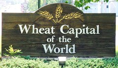
Lafayette County is a county in the western portion of Missouri, part of the Kansas City metropolitan area. As of the 2010 census, the population was 33,381. Its county seat is Lexington. The county was organized November 16, 1820 from Cooper County and originally named Lillard County for James Lillard of Tennessee, who served in the first state constitutional convention and first state legislature. It was renamed Lafayette County on February 16, 1825, in honor of Revolutionary War hero the Marquis de La Fayette, who was then visiting the United States.

<span class="mw-page-title-main">Hepler, Kansas</span> City in Crawford County, Kansas

Hepler is a city in Crawford County, Kansas, United States. As of the 2020 census, the population of the city was 90.

<span class="mw-page-title-main">Wellington, Kansas</span> City in Sumner County, Kansas

Wellington is a city in and the county seat of Sumner County, Kansas, United States. As of the 2020 census, the population of the city was 7,715.

<span class="mw-page-title-main">Amoret, Missouri</span> City in Missouri, United States

Amoret is a city in western Bates County, Missouri, and is part of the Kansas City metropolitan area within the United States. The population was 133 at the 2020 census.

<span class="mw-page-title-main">Amsterdam, Missouri</span> City in Missouri, United States

Amsterdam is a city in western Bates County, Missouri, and is part of the Kansas City metropolitan area within the United States. The population was 242 at the 2010 census.

<span class="mw-page-title-main">Hume, Missouri</span> City in Missouri, United States

Hume is a city in southwest Bates County, Missouri, and is part of the Kansas City metropolitan area within the United States. The population was 283 at the 2020 census.

<span class="mw-page-title-main">Kingston, Missouri</span> City in Missouri, United States

Kingston is a city in Caldwell County, Missouri, and is part of the Kansas City metropolitan area with the United States. The population was 290 at the 2020 census. It is the county seat of Caldwell County.

<span class="mw-page-title-main">East Lynne, Missouri</span> City in Missouri, United States

East Lynne is a city in eastern Cass County, Missouri The population was 303 at the 2010 census. It is part of the Kansas City metropolitan area within the United States.

<span class="mw-page-title-main">Gladstone, Missouri</span> City in Missouri, United States

Gladstone is a city in Clay County, Missouri, United States and a suburb of Kansas City. The City of Gladstone is located only 10 minutes from downtown Kansas City, and 10 minutes from Kansas City International Airport. As of the 2020 census, the city population was 27,063. It is part of the Kansas City metropolitan area.

<span class="mw-page-title-main">Mosby, Missouri</span> City in Missouri, United States

Mosby is a city in Clay County, Missouri, United States, along the Fishing River. The population was 101 at the 2020 census. It is part of the Kansas City metropolitan area.

<span class="mw-page-title-main">Randolph, Missouri</span> City in Missouri, United States

Randolph is a city in Clay County, Missouri, United States. The population was 57 at the 2020 census. It is completely surrounded by Kansas City and is a part of the Kansas City metropolitan area.

<span class="mw-page-title-main">Unity Village, Missouri</span> Village in Missouri, United States

Unity Village is a village in Jackson County, Missouri, United States, bordering Kansas City and Lee's Summit. Its population was 99 at the 2010 census. It is the world headquarters of Unity Church, which has over 2 million followers. The Unity Tower was designed by the Kansas City firm Boillot & Lauck and built in 1929 to store water. Unity Village is part of the Kansas City metropolitan area.

<span class="mw-page-title-main">Napoleon, Missouri</span> City in Missouri, United States

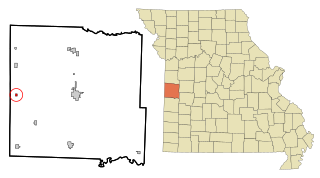
Napoleon is a city in Lafayette County, Missouri, and part of the Kansas City metropolitan area within the United States. It is located approximately 30 miles (48 km) east of Kansas City. The population was 222 at the 2010 census.

<span class="mw-page-title-main">Parkville, Missouri</span> City in Missouri, United States

Parkville is a city in Platte County, Missouri, United States and is a part of the Kansas City Metropolitan Area. The population was 7,177 at the 2020 census. Parkville is known for its antique shops, art galleries, and historic downtown. The city is home to Park University, English Landing Park, Platte Landing Park, and the National Golf Club of Kansas City. Large neighborhoods in Parkville include: Riss Lake, The National, Thousand Oaks, Creekside, Parkville Heights, River Hills, Riverchase, The Bluffs, Downtown, and Pinecrest.

<span class="mw-page-title-main">Weatherby Lake, Missouri</span> City in Missouri, United States

Weatherby Lake is a city in Platte County, Missouri and is part of the Kansas City metropolitan area within the United States, which borders Kansas City. The population was 1,723 as of the 2010 census.

<span class="mw-page-title-main">Henrietta, Missouri</span> City in Missouri, United States

Henrietta is a city in southern Ray County, Missouri, and part of the Kansas City metropolitan area within the United States. The population was 278 at the 2020 census.

<span class="mw-page-title-main">Wood Heights, Missouri</span> City in Missouri, United States

Wood Heights is a city in western Ray County, Missouri, and part of the Kansas City metropolitan area within the United States. The population was 757 at the 2020 census.

<span class="mw-page-title-main">Lake Annette, Missouri</span> City in Missouri, United States

Lake Annette is a city in Cass County, Missouri, United States. The population was 100 at the 2010 census. It is part of the Kansas City metropolitan area.

<span class="mw-page-title-main">Dearborn, Missouri</span> City in Missouri, United States

Dearborn is a city in Buchanan and Platte counties in the U.S. state of Missouri and is part of the Kansas City metropolitan area. The population was 496 at the 2010 census.

<span class="mw-page-title-main">Blackburn, Missouri</span> City in Missouri, United States

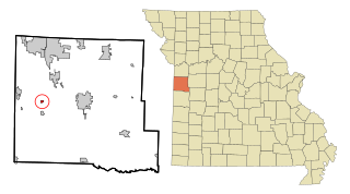
Blackburn is a city in Lafayette and Saline counties in the U.S. state of Missouri and is part of the Kansas City metropolitan area. The population was 249 at the 2010 census.

References

  1. "ArcGIS REST Services Directory". United States Census Bureau. Retrieved August 28, 2022.
  2. 1 2 U.S. Geological Survey Geographic Names Information System: Wellington, Missouri
  3. 1 2 "U.S. Census website". United States Census Bureau . Retrieved 2008-01-31.
  4. "Lafayette County Place Names, 1928–1945 (archived)". The State Historical Society of Missouri. Archived from the original on 24 June 2016. Retrieved 25 October 2016.
  5. "Post Offices". Jim Forte Postal History. Retrieved 25 October 2016.
  6. Public servant steals $1.5 million from two tiny towns in Missouri; The Kansas City Star; November 22, 2013.
  7. Treasurer admits to embezzling over $1 million from small towns’ funds; Fox4KC; November 22, 2013.
  8. Treasurer for road district and fire district pleads guilty to embezzling $1.5 million; justice.gov; November 20, 2013.
  9. "US Gazetteer files 2010". United States Census Bureau . Retrieved 2012-07-08.
  10. "Census of Population and Housing". Census.gov. Retrieved June 4, 2015.
  11. "U.S. Census website". United States Census Bureau . Retrieved 2012-07-08.
  12. Gregorian, Vahe (August 6, 2016). "U.S. archer Zach Garrett from Wellington, Mo., caps an amazing journey with silver in Rio". The Kansas City Star. Retrieved 2016-09-25.