A17 highway (Sri Lanka)

Last updated

The A 17 road is an A-Grade trunk road in Sri Lanka. It connects Galle with Madampe.

Galle City in Southern Province, Sri Lanka

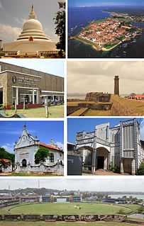
Galle is a major city in Sri Lanka, situated on the southwestern tip, 119 km from Colombo. Galle is the administrative capital of Southern Province, Sri Lanka and is the district capital of Galle District.

Madampe is a town situated in the Puttalam District, of North Western Province, Sri Lanka. Madampe is a town with historical importance which was ruled by king Thaniwallbha according to the history. There are two areas: Old town and New town which is also known as Silva town. Old town is located on Colombo- Chilaw main road. The new town is located on Kuliyapitiya road. The old town area is mainly occupied by Muslim community and consists of many shops. Town areas are occupied by commercial users: several super markets, shops, hardware stores, restaurants and other public institutions. Middle income class residential users are mostly occupied. The road network is well developed.

The A 17 passes through Bogahagoda, Imaduwa, Kananke, Akuressa, Pitabeddara, Morawaka, Kotapola, Deniyaya, Suriyakanda and Rakwana to reach Madampe.

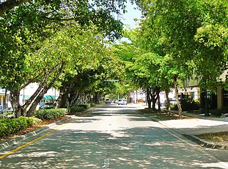
Imaduwa is a suburb of Galle city. It is located approximately 21 km away from the Galle city within Galle District of the Southern Province. It is situated on the boundary of Galle district and Matara District. It is a major centre which connects Matara District with Galle district. It is a major suburb on the A17 highway,after the Galle city.It is a major centre on the road for the vehicles and long distance buses run on the route. And also it is a four-way junction on the road. It connects Makumbura-Yakkalamulla-Imaduwa road and Dikkumbura(Ahangama)-Imaduwa road with the A17 highway which runs between Galle and Madampe.

Akuressa Town in Southern Province, Sri Lanka

Akuressa is located in Matara District of the Southern Province. It is located on the Matara–Deniyaya road, approximately 23.6 Km from Matara and 40.6 km from Galle.

Deniyaya Town in Southern Province, Sri Lanka

Deniyaya is a small town in Sri Lanka. It is located in Matara District of the Southern Province.

Related Research Articles

Salem, Virginia Independent city in Virginia, United States

Salem is an independent city in the U.S. commonwealth of Virginia. As of the 2010 census, the population was 24,802. It is the county seat of Roanoke County, although the two are separate jurisdictions. The Bureau of Economic Analysis combines the city of Salem with Roanoke County for statistical purposes.

Hotspot (geology) Volcanic regions thought to be fed by underlying mantle that is anomalously hot compared with the surrounding mantle

In geology, the places known as hotspots or hot spots are volcanic regions thought to be fed by underlying mantle that is anomalously hot compared with the surrounding mantle. Their position on the Earth's surface is independent of tectonic plate boundaries. There are two hypotheses that attempt to explain their origins. One suggests that hotspots are due to mantle plumes that rise as thermal diapirs from the core–mantle boundary. The other hypothesis is that lithospheric extension permits the passive rising of melt from shallow depths. This hypothesis considers the term "hotspot" to be a misnomer, asserting that the mantle source beneath them is, in fact, not anomalously hot at all. Well-known examples include the Hawaii, Iceland and Yellowstone hotspots.

Diamond interchange common type of road junction

A diamond interchange is a common type of road junction, used where a freeway crosses a minor road.

Greater Caucasus mountain range

Greater Caucasus is the major mountain range of the Caucasus Mountains.

European route E22 European road route from Wales to Russia

The European route E 22 is one of the longest European routes. It has a length of about 5,320 km (3,310 mi). Many of the E-roads have been extended into Asia since the year 2000; the E 22 was extended on 24 June 2002.

Nuzvid City in Andhra Pradesh, India

Nuzvid is a city in Krishna district of the Indian state of Andhra Pradesh. It serves as the administrative headquarters for Nuzvid mandal and Nuzvid revenue division.

Ford Motor Company operates several proving grounds worldwide, for development and validation testing of new vehicles.

European route E80 road in Europe

European route E 80, also known as Trans-European Motorway or TEM, is an A-Class West-East European route, extending from Lisbon, Portugal to Gürbulak, Turkey, on the border with Iran. The road connects 10 countries and has a length of approximately 6,102 kilometres (3,792 mi). At its eastern end it joins end-on with Asian Highway AH1 which continues all the way to Japan.

Seagull intersection

A seagull intersection or continuous green T-intersection is a type of three-way road intersection, usually used on high traffic volume roads and dual carriageways. This form of intersection is popular in Australia and New Zealand, and sometimes used in the United States and other countries.

Coral Way Neighborhood of Miami in Miami-Dade County, Florida, United States

Coral Way is a neighborhood within Miami, Florida that is defined by Coral Way, a road established by Coral Gables founder George E. Merrick during the 1920s. It is located in Miami-Dade County, Florida, United States.

MGM Dizzee World amusement park

MGM Dizzee World is a theme park located in Chennai, Tamil Nadu, India. It is located in East Coast Road. The park has a log flume, Ferris wheel, spider spin, roller coaster, the funny mountain, dashing cars, super trooper, a water world and it also hosts special seasonal shows.

The A 18 road is an A-Grade trunk road in Sri Lanka. It connects Nonagama with Pelmadulla.

The A 30 road is an A-Grade trunk road in Sri Lanka. It connects Vavuniya with Parayanalankulam.

The A 34 road is an A-Grade trunk road in Sri Lanka. It connects Mankulam with Mullaitivu.

Kavaraipettai is a suburb located at North Chennai. It is a town located in the Thiruvallur district in the Indian state of Tamil Nadu. It is about 30 miles (48 km) from Chennai.

The A3 Highway is an A-Grade trunk road in Sri Lanka. It connects the Peliyagoda with Negombo-Puttalam.

Kalahe Village in Central Province, Sri Lanka

Kalahe is a village in Galle District in Sri Lanka, located 7 km (4.3 mi) south-west of Galle and 3 km (1.9 mi) west of Unawatuna.

References

    Coordinates: 6°28′14″N80°37′37″E / 6.470454°N 80.627031°E / 6.470454; 80.627031

    Geographic coordinate system Coordinate system

    A geographic coordinate system is a coordinate system that enables every location on Earth to be specified by a set of numbers, letters or symbols. The coordinates are often chosen such that one of the numbers represents a vertical position and two or three of the numbers represent a horizontal position; alternatively, a geographic position may be expressed in a combined three-dimensional Cartesian vector. A common choice of coordinates is latitude, longitude and elevation. To specify a location on a plane requires a map projection.