
A diamond interchange is a common type of road junction, used where a freeway crosses a minor road.

Torit is a town in South Sudan.

Greater Caucasus is the major mountain range of the Caucasus Mountains.

Kanpur district, meaning Urban Kanpur District is one of the districts of the Uttar Pradesh state of India. It is a part of Kanpur division and its district headquarters is Kanpur.

Ponneri is a city located at North Chennai in Thiruvallur district in the Indian state of Tamil Nadu. It is located in Ponneri taluk. The neighbourhood is served by the Ponneri railway station of the Chennai Suburban Railway Network. Ponneri is selected among 100 cities for Smart city Development.As per the locals Subhash Chandra Bose stayed in Ponneri.It is one of the Fastest-growing suburbs of Chennai Metropolitan City.

The R426 road is a regional road in Ireland, which runs north-south from the N80 in Portlaoise, County Laois to the N78 in Castlecomer, County Kilkenny.

A seagull intersection or continuous green T-intersection is a type of three-way road intersection, usually used on high traffic volume roads and dual carriageways. This form of intersection is popular in Australia and New Zealand, and sometimes used in the United States and other countries.

Chifunde District is a district of Tete Province in western Mozambique. The principal town is Chifunde. The district is located in the north of the province, and borders with Zambia in the north, Malawi in the northeast, Macanga District in the east, Chiuta District in the south, and with Marávia District in the west. The area of the district is 9,403 square kilometres (3,631 sq mi). It has a population of 101,811 as of 2007.
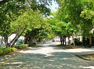
Coral Way is a neighborhood within Miami, Florida that is defined by Coral Way, a road established by Coral Gables founder George E. Merrick during the 1920s. It is located in Miami-Dade County, Florida, United States.
Ambattur taluk is a taluk of Chennai district of the Indian state of Tamil Nadu. The headquarters of the taluk is the neighbourhood of Ambattur. This taluk was created from a division of Ponneri taluk, Tiruvallur district. On 4 January 2018,Chennai district was expanded by annexing Ambattur taluk. The RTO code for Ambattur taluk is TN-13. The Revenue villages in Ambattur taluk are Ambattur, Korattur, Menambedu,Mugapair, Oragadam, Padi, and Pattravakkam

Matugga is an urban centre in the Central Region of Uganda.

Potheri is a town that comes under Maraimalai Nagar municipality of Chengalpattu taluk in Kanchipuram district, Tamil Nadu. It is about 2.5 km from Guduvancheri. SRM Institute of Science and Technology & Valliammai Engineering College are main institutions located here. It is a rapid growing village locality in the Southern part of the Metropolitan city Chennai.

Irumbuliyur Junction is one of the important junctions in the city of Chennai, India. It is located at Irumbuliyur near Tambaram in Chennai at the intersection of NH 45 with the Chennai Bypass.
Ariyalai Sithivinayakar Temple or Sithivinayakar Kovil is an ancient temple located about 100 metres (330 ft) west of A9 Road, around 5 kilometres (3.1 mi) from Jaffna Town. This was rehabilitated by Advocate Arulampalam circa 1918. This temple was visited by Mahama Gandi, Yogar Swami, Kunrakudi Adakal.
Opportunity Bank Uganda Limited (OBUL), is a credit institution in Uganda. In November 2011, the institution rebranded as Opportunity Bank Uganda.
The A 34 road is an A-Grade trunk road in Sri Lanka. It connects Mankulam with Mullaitivu.
The A 35 road is an A-Grade trunk road in Sri Lanka. It connects Paranthan with Mullaitivu.

Kololo Senior Secondary School, is a government-aided, mixed, middle and high, day school, in Uganda. Sometimes the school is referred to as Kololo High School.
Chandra Metro Mall is a shopping mall located at Virugambakkam, Chennai. The Mall with a built up area of 1.43 lakh sq.ft was opened on 9 April 2011. The mall has a five screen multiplex with a capacity of 1300 seats called as INOX-NATIONAL operated by INOX Leisure. The mall has Food Bazaar, E-Zone, Pantaloons as its major Anchors. The Food court is spread over an area of 10000 sq.ft. The mall was built after demolishing the erstwhile National Theatre.
ROKO Construction Limited, also Roko Construction Limited, but commonly referred to as ROKO, is a civil engineering and construction company in Uganda. It maintains its headquarters in Kampala, Uganda, and is active in Uganda, Rwanda, South Sudan and DR Congo.


