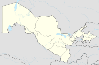
Qorasuv is a town in Qo‘rg‘ontepa District of Andijan Region in eastern Uzbekistan, about 50 km from the district capital of Andijan. The town's name means "black water" in Uzbek. It lies in the politically volatile and religiously conservative Fergana Valley, along the border with Kyrgyzstan. In 1989 it had a population of 19,500.

The N82 road is a national secondary road in Ireland, and is located entirely in Dublin. The route was designated along the Citywest Road, which runs through the Citywest Business Campus between the N81 west of Tallaght and the Citywest Interchange of the N7.
Udawalawe is a small town located in the southern part of the Ratnapura District in Sri Lanka. It is situated in close to the district's boundary with the Hambantota District and Monaragala District.

Baduria is a city and a municipality in Basirhat subdivision of North 24 Parganas district in the state of West Bengal, India.
The Trout River is a 20-mile-long (32 km) tributary of the St. Johns River in Duval County, Florida. Located entirely within Jacksonville, the river is brackish in its lower section. The widest point of the river is near the St. Johns River, where it is 0.6 miles (1.0 km) across. The Trout River has wetlands as far as the mouth of the river's longest tributary, the Ribault River.

Buduruwagala is an ancient buddhist temple in Sri Lanka. The complex consists of seven statues and belongs to the Mahayana school of thought. The statues date back to the 10th century. The gigantic Buddha statue still bears traces of its original stuccoed robe and a long streak of orange suggests it was once brightly painted. The central of the three figures to the Buddha's right is thought to be the Buddhist mythological figure-the Bodhisattva Avalokitesvara. To the left of this white painted figure is a female figure in the thrice-bent posture, which is thought to be his consort-Tara.

A seagull intersection or continuous green T-intersection is a type of three-way road intersection, usually used on high traffic volume roads and dual carriageways. This form of intersection is popular in Australia and New Zealand, and sometimes used in the United States and other countries.
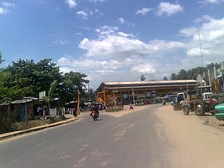
Matugama is a semi urban town surrounded by mountains. It is an electorate of the Kalutara district, in Western Province, Sri Lanka. The town is located 64 km to the south of Colombo. Matugama is also spelled as Mathugama.
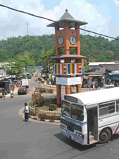
Bibile is a town located in Monaragala District, Uva Province of Sri Lanka. Bibile's land is important to Sri Lankan agriculture. It was well known for oranges, though still oranges grown there the original variety 'Bibile Sweet is no longer in existence. Bibile was known as 'Sinhale' in Martin Wickremesinghe's novel "Gamperaliya".
Monaragala electoral district is one of the 22 multi-member electoral districts of Sri Lanka created by the 1978 Constitution of Sri Lanka. The district is conterminous with the administrative district of Monaragala in the Uva province. The district currently elects 5 of the 225 members of the Sri Lankan Parliament and had 300,642 registered electors in 2010.

The A4 Highway is the longest highway in Sri Lanka, at 430 kilometres (270 mi) in length. It connects Colombo with Batticaloa, through a large number of important cities in Western, Sabaragamuwa, Uva and Eastern provinces.
The A 16 road is an A-Grade trunk road in Sri Lanka. It connects Beragala with Hali Ela.
The A 23 road is an A-Grade trunk road in Sri Lanka. It connects Wellawaya with Kumbalwela.
The A 31 road is an A-Grade trunk road in Sri Lanka. It connects Ampara with Karaitivu.
Gamini Vijith Vijithamuni Soysa is a Sri Lankan politician. He was the Chief Minister of Uva Province in Sri Lanka from July 2004 to Aug 2009. He was elected to the Sri Lankan Parliament in 1989, 2000, 2001 and 2010 from Monaragala.
Bibile electoral district was an electoral district of Sri Lanka between March 1960 and February 1989. The district was named after the town of Bibile in Monaragala District, Uva Province. The 1978 Constitution of Sri Lanka introduced the proportional representation electoral system for electing members of Parliament. The existing 160 mainly single-member electoral districts were replaced with 22 multi-member electoral districts. Bibile electoral district was replaced by the Monaragala multi-member electoral district at the 1989 general elections.
Monaragala electoral district was an electoral district of Sri Lanka between March 1960 and February 1989. The district was named after the town of Monaragala in Monaragala District, Uva Province. The 1978 Constitution of Sri Lanka introduced the proportional representation electoral system for electing members of Parliament. The existing 160 mainly single-member electoral districts were replaced with 22 multi-member electoral districts. Monaragala electoral district was replaced by the Monaragala multi-member electoral district at the 1989 general elections, the first under the proportional representation system, Monaragala continues to be a polling division of the multi-member electoral district.
Wellawaya electoral district was an electoral district of Sri Lanka between July 1977 and February 1989. The district was named after the town of Wellawaya in Monaragala District, Uva Province. The 1978 Constitution of Sri Lanka introduced the proportional representation electoral system for electing members of Parliament. The existing 160 mainly single-member electoral districts were replaced with 22 multi-member electoral districts. Wellawaya electoral district was replaced by the Monaragala multi-member electoral district at the 1989 general elections, the first under the proportional representation system.


