Afijio

Last updated

Afijio
LGA
Ese Oloja Hill in Aba Eleti Area, Ilora, Oyo, Nigeria. 04.jpg
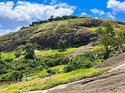
Ese Oloja hill in ilora, Afijio LGA
Nigeria location map.svg
Red pog.svg
Afijio
Africa location map.svg
Red pog.svg
Afijio
Coordinates: 7°43′27.5″N3°51′55.8″E / 7.724306°N 3.865500°E / 7.724306; 3.865500
CountryFlag of Nigeria.svg  Nigeria
State Oyo State
Government
  Local Government Chairman and the Head of the Local Government CouncilSunday Akindele Ojo (PDP)
Population
 (2010)2010 estimated population size of 152,193 using a growth rate of 3.2% from 2006 census figures.
  Total
152,193
Time zone UTC+1 (WAT)
Website Afijio
Afijio

Afijio is a Local Government Area in Oyo State, Nigeria. Its headquarter is in the town of Jobele. [1] [2]

Contents

It has an area of 722 km2 and a population of 134,173 at the 2006 census.

The postal code of the area is 211. [3]

History

In 1989, the then-Federal Military Government chose to separate the former Oyo Local Government Area into autonomous council districts, resulting in the formation of the current Afijio Local Government.

Afijio Local Council, as history has it, has been established three (3) times. The Afijio Provisional Authority was established in 1964. Second, in 1981, the entire area was merged with Oyo Local Government before it was reestablished as an autonomous political entity in May 1989 under the name Afijio, which is an acronym for Awe, Akinmoorin, Fiditi, Ilora, Imini, Jobele, Iware, Iluaje, Oluwatedo, and Ojutaye, the major towns that comprise the Local Government. [4]

Afijio Local Government is mostly controlled by Yorubas. [4] The indigenous peoples' primary religions are Christianity and Islam. Nonetheless, traditional believers operate freely within the council's jurisdiction.

Economy

The indigenous people of Afijio Local Government are largely farmers who grow a wide range of agricultural goods such as maize, yam, cassava, groundnut, fruit, cocoa and oil palm. [4]

Geography

The Afijio local government region has an average temperature of 28.5 degrees Celsius and a total size of 722 km squared. [1]


Political Wards in Afijio Local Government Area

The local government is governed by an elected chairman and 10 councilors elected from each ward.

Afijio local government area is sub-divided into 10 wards: Ilora I, Ilora II, Ilora III, Fiditi I, Fiditi II, Aawe I, Aawe II, Akinmorin/Jobele, Iware and Imini.

IIora I has 6 villages : IIora I , Eruwa , Lalate , Ologun Owe , Maya , Ijeun

Prominent towns and villages in Afijio

Notable People

References

  1. 1 2 3 "Afijio Local Government Area". www.manpower.com.ng. Retrieved 2022-03-05.
  2. "List of Local Government Areas (LGA), and City of Ibadan in Oyo State, Nigeria, Maps and Street Views, Geographic.org". geographic.org. Retrieved 2022-12-29.
  3. "Post Offices- with map of LGA". NIPOST. Archived from the original on 7 October 2009. Retrieved 2009-10-20.
  4. 1 2 3 "Afijio Local Government – Oyo State Government" . Retrieved 2022-03-05.