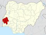
Oyo State is a state in southwestern Nigeria. Its capital is Ibadan, the third most populous city in the country and formerly the second most populous city in Africa. Oyo State is bordered to the north by Kwara State for 337 km, to the southeast by Osun State for 187 km, partly across the River Osun, and to the south by Ogun State, and to the west by the Republic of Benin for 98 km. With a projected population of 7,976,100 in 2022, Oyo State is the sixth most populous in the Nigeria.

Ningi is a town, a local government area, and an emirate in Bauchi State, Nigeria. The Ningi emirate comprises two local government areas, Ningi and Warji, with a combined area of 5,250 km2 and a population of 501,912 according to the 2006 Census. The Ningi local government area covers an area of 4,625 km2 with a population of 387,192 at the 2006 Census. The area is inhabited mostly by hausa people, Duwa, Ningawa.Yunusa Muhammadu Danyaya was the longes Emir to reigned who ascended the throne from 1978 until his death on 25 August 2024.
Nnewi South is a Local Government Area in Anambra South Senatorial Zone of Anambra State, Nigeria. Its population is approximately 1 million. Ukpor is the headquarters of Nnewi South.
Onitsha South is a Local Government Area in Anambrs North Senatorial zone of Anambra State, Nigeria. The headquarters is in Fegge, Onitsha. Onitsha South is predominantly commercial with popular markets such as Ochanja market which attracts thousands of buyers and sellers of variety of commodities. The revenue of Onitsha South Local Government Area is generated mostly from commercial activities.
Shelleng is a Local Government Area (LGA) of Adamawa State, North-east Nigeria.
Obingwa is a Local Government Area of Abia State, Nigeria. Its headquarters are in the town of Mgboko.
Konshisha is a local government area of Benue State, Nigeria. Its headquarters are in the town of Tse-Agberagba.
Fakai is a Local Government Area in Kebbi State, Nigeria. Its headquarters are in the town of Mahuta.
Madobi is a Local Government Area in Kano State, Nigeria. Its headquarters are in the town of Madobi.
Kiru is a Local Government Area in Kano State, Nigeria. Its headquarters are in the town of Kiru.
Chikun is a Local Government Area in central Kaduna State, Nigeria. It has an area of about 4,466 km2, and had a population of 372,272 as at the 2006 census. Its headquarters is located in the town of Kujama. The postal code of the area is 2438000.

Egbeda is a Local Government Area in the senatorial district of Oyo central in Ibadan less city of Oyo State, Nigeria. Its headquarters are in the town of Egbeda. Egbeda local government was carved out Lagelu Local government in 1989. The postal code of the area is 200109
Ibadan South-East is a Local Government Area in Oyo State, Nigeria. Its headquarters are at Mapo Hall. The postal code of the area is 200.
Ibadan South-West is a Local Government Area in Oyo State, Nigeria. Its headquarters are at Oluyole Estate in Ibadan. Districts in the area include Ring-Road, Oke-Ado, Oke-Bola Gege, Born-Photo, and Isale-Osi.
Ogo Oluwa is a Local Government Area in Oyo State, Nigeria. Its headquarters are in the town of Ajaawa.

Kajola is a Local Government Area in Oyo State, Nigeria. Its headquarters are in the town of Okeho.
Bungudu is a Local Government Area in Zamfara State, Nigeria. Its headquarters is in the town of Bungudu at12°16′00″N6°33′24″E.
Abaji is a local government area in the Federal Capital Territory of Nigeria, Abuja. The Abaji Area Council is the area council farthest from the city center and occupies approximately 1,100 square kilometers. Created in 1986, the council has a population of over 46,600 inhabitants according to a 2006 national census. As a gateway to the Federal Capital Territory (FCT), Abaji is a fast-growing area. There is a notable influx of arrivals, many moving in search of new means of livelihood.
Tudun Wada is a local government area in Kano State. The postal code is 710104.