Ifẹ̀ is an ancient Yoruba city in south-western Nigeria founded sometime between the years 500 BC-1000 BC. By 900AD, the city had become an important West African emporium producing sophisticated art forms. The city is located in present-day Osun State. Ifẹ̀ is about 218 kilometers northeast of Lagos with a population of over 500,000 people, which is the highest in Osun State according to population census of 2006.

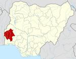
Osun State, occasionally known as the State of Osun by the state government, is a state in southwestern Nigeria; bounded to the east by Ekiti and Ondo states for 84 km and for 78 km respectively, to the north by Kwara State for 73 km, to the south by Ogun State for 84 km and to the west by Oyo State, mostly across the River Osun. Named for the River Osun—a vital river which flows through the state—the state was formed from the southeast of Oyo State on 27 August 1991 and has its capital as the city of Osogbo.

Iseyin is a town located in Oyo, Nigeria. It is approximately 100 km (62 mi) north of Ibadan. The town was estimated to have a population of 236,000, according to United Nations 2005 estimate, which increased to 362,990 in 2011, and has a total land mass of 2,341 km2 (904 sq mi). Its inhabitants are mostly of Yoruba origin and its ruler is the Aseyin of Iseyin, with the current being Oba Sefiu Oyebola Adeyeri III, Ajirotutu I.

Ìlá Òràngún is an ancient city in Osun State, Nigeria, that was the capital of an ancient city-state of the same name in the Igbomina area of Yorubaland in south-western Nigeria. Ìlá Òràngún is more populous than its sister-city, Òkè-Ìlá Òràngún, a town located about 7.5 miles (12 km) to the northeastern corner of Osun State. The latitude and longitude coordinates of Ila Orangun are 8.019116 and 4.901962 respectively. According to the information obtained from GeoNames geographical database, the population of Ila Orangun in Osun State, Nigeria is 179,192.

Bida is a Local Government Area in Niger State, Nigeria and a city on the A124 highway which occupies most of the area.
Offa is a city in Kwara State of Nigeria, with a population of about 166,112 inhabitants. The town is noted for its weaving and dyeing trade, using vegetable dyes made from locally grown indigo and other plants. Offa is well known for the cultivation of sweet potatoes and maize which also formed part of the favourite staple foods for the indigenes in the town. Cattle, goats and sheep are also raised there. The main religions practiced in the town are Islam, Christianity and traditional religions.
Shelleng is a Local Government Area (LGA) of Adamawa State, North-east Nigeria.
Gwiwa is a Local Government Area of Jigawa State, Nigeria. Its headquarters are in the town of Gwiwa which is a reminiscent of Kagara, a settlement that flourished around 1757c. According to oral tradition, Kagara was ransacked by an expedition sent by Bawa-jangwarzo as part of the wars that ensued between Katsina and Gobir. At that time the area was under the kingdom of Katsina until 1824 when Kazaure Emirate was curved out by the Sakkwato Caliphate. A number of legendary wells surround the old site of Kagara which is about 2 kilometers northwest of the present day Gwiwa town. The number of these wells suggest the size and influence of Kagara at that point in time. Other artefacts could also be found to illuminate on the historical significance of the area. There also exists a vast forest which served as fortress as well as pasture during intertribal wars before the advert of the Sakkwato Jihad in the 18th century. Gwiwa town was once a district headquarters at the inception of the indirect rule by the British. However, this was reverted and Gwiwa was reduced to a colonial out-post until in 1992 when it was made a Local Government headquarters. Generally, the area is arable and fertile. However the land is mainly of Katsina basic complex especially northward of Gwiwa. While some traces of sand dumes are found in the southern part of the local Government Area. It had an area of 450 km2 and a population of 124,517 at the 2006 census.

Egbeda is a Local Government Area in the senatorial district of Oyo central in Ibadan less city of Oyo State, Nigeria. Its headquarters are in the town of Egbeda. Egbeda local government was carved out Lagelu Local government in 1989. The postal code of the area is 200109
Ori Ire is a Local Government Area in Oyo State, Nigeria. Its headquarters are in the town of Ikoyi.

Kajola is a Local Government Area in Oyo State, Nigeria. Its headquarters are in the town of Okeho.
Olorunsogo is a Local Government Area in Oyo State, Nigeria. Its headquarters are in the town of Igbeti.
Shinkafi is a Local Government Area in Zamfara State of Nigeria. Its headquarters is in the town of Shinkafi an area of about 674mk2 and population of 135,649. It shares boundaries with Isa Local Government Area and Niger Republic from the north, Zurmi Local Government Area to the South and South-East, Maradun Local Government Area and Raba Local Government Area by the west. Distance from the State Capital, Gusau is approximately 116 km.
Birnin Magaji/Kiyaw is a Local Government Area in Zamfara State, Nigeria. Its headquarters are in the town of Birnin Magaji in the north of the LGA at12°33′00″N6°49′00″E. The LGA is also named from the town of Kiyaw to the south.
Bassa is a Local Government Area in the north of Plateau State, Nigeria, bordering Kaduna and Bauchi States. Its headquarters are in the town of Bassa at9°56′00″N8°44′00″E.
Degema is a Local Government Area in Rivers State, Nigeria. Its headquarter is in the town of Degema.
Ife South is a Local Government Area in Osun State, Nigeria. Its headquarters are in the town of Ifetedo at 7°11′00″N4°42′00″E.
Ileogbo is the headquarters of Aiyedire Local Government in Osun State, Nigeria. It is situated midway between Ibadan and Osogbo, the capitals of Oyo and Osun State. Ibadan is about 44 km to the south of Ileogbo while Osogbo is about 42 km to its north, Oyo 40 km to its west, while Gbongan and Ife are located to the east of the town.

Okeho is a town located in Kajola Oyo State South West Nigeria. It is the headquarters of Kajola Local Government.