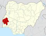
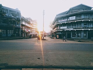
Ogbomosho is a city in Oyo State, south-western Nigeria. It was founded in the mid 17th century. The population was approximately 655,517 in 2024. It is the second largest city in Oyo State and also among the most populated in Nigeria. It is the 3rd most populated city in South Western Nigeria after Lagos and Ibadan. The City itself has 5 local governments, which makes it one of the largest cities in Nigeria. And the city is set to be the capital of the newly proposed state "OYO STATE". Although the principal inhabitants of the city are the Yoruba people, there are people from other parts of Nigeria and other West African countries who are residents in the city.

Mijas is a municipality in the Province of Málaga, in the autonomous community of Andalusia. Located on the southeastern coast of Spain, Mijas belongs to the region of Costa del Sol Occidental. Its center is a typical Andalusian white-washed village, Mijas Pueblo, located on a mountainside about 430 metres or 1,476 feet above sea level, in the heart of the Costa del Sol region.
Bungoma town is the capital of Bungoma County in Kenya. It was established as a trading centre in the early 20th century. It is located in Kenya's fertile Western region and at the foot of Mount Elgon, Kenya's second-highest mountain. The town and the surrounding areas boast one of Kenya's highest average rainfalls, making Bungoma one of the nation's most important food baskets.

Okrika is a town in Rivers State, Nigeria, and serves as the headquarters of Okrika Local Government Area. It is situated on an island south of Port Harcourt, functioning as a suburb of the city.

Sagamu or Ishagamu is an agglomeration of thirteen towns in southwestern Nigeria. It is located in Ogun State along the Ibu River and Eruwuru Stream between Lagos and Ibadan. It was founded in the mid 19th century by members of the Remo branch of the Yoruba people. The 13 towns are: Makun, Offin, Sonyindo, Epe, Ibido, Igbepa, Ado, Oko, Ipoji, Batoro, Ijoku, Ijagba and Latawa. It is the capital of Remo Kingdom, and the paramount ruler of the kingdom, the Akarigbo of Remo, has his palace is in the town of Offin.

A secondary suite is a self-contained apartments, cottages, or small residential units, that is located on a property that has a separate main, single-family home, duplex, or other residential unit. In some cases, the ADU or in-law is attached to the principal dwelling or is an entirely separate unit, located above a garage, across a carport, or in the backyard on the same property. Reasons for wanting to add a secondary suite to a property may be to receive additional income, provide social and personal support to a family member, or obtain greater security.
Orumba North is a Local Government Area in Anambra State, East-central Nigeria.
Ogori-Magongo is a Local Government Area in Kogi State, Nigeria. Its headquarters is in Akpafa. It was created from the old Okene Local Government Area for the Ogori and Magongo people. They occupy the land from Obehira Ebeba to Lampese up to Ososo in Edo state. An area of more than 79 km (31sqm) A population of 39,622 at the 2006 census.
Ibiono-Ibom is a Local Government Area of Akwa Ibom State in the south-south region of Nigeria. It has its administrative headquarters at Oko Ita.
Udung-Uko is a local government area in Akwa Ibom State, Nigeria. It was created in December 1996.

Surulere is a local government area located on the mainland in Lagos State, Nigeria. It has an area of 23 km2 (8.9 sq mi). At the 2006 census, there were 503,975 inhabitants, with a population density of 21,864 inhabitants per square kilometer. The local government area is bordered by Yaba, Mushin, and Ebute-Metta.
Apa local government area was first created on 23 March 1981. It became defunct on 31 December 1983, and was later re-created in August, 1991. The local government is located in the northwestern part of Makurdi, the capital of Benue State. It is bounded to the North by Agatu local government, to the East by Gwer West, to the South by Otukpo and to West by Omala local government area of Kogi State.
Irepodun/Ifelodun is a Local Government Area of Ekiti State, Nigeria. Irepodun/Ifelodun is predominantly a homogeneous society and carefully populated by Yoruba speaking people of the South West of Nigeria. It has an area of 356 km2 and a population of 129,149 at the 2006 census. The major religions of the people are Christianity and Islam while a percentage of the people are traditional religion worshippers.
Danja is a Local Government Area in Katsina State, Nigeria. Its headquarters is located in the town of Danja.
Takai is a Local Government Area in Kano State, Nigeria. Its headquarters are in the town of Takai to the north of the area on the A237 highway.
Lagelu is a Local Government Area in Oyo State, Nigeria. Its headquarters are in the town of Iyana Offa.
Oko Town is an Igbo speaking town in south eastern Nigeria. It is one of the 16 towns that make up the geopolitical area called Orumba North Local Government Area of Anambra state. It is the major economic town of the local government largely dependent on a very large student community and staff strength of the Federal Polytechnic, Oko.
Okanle is a village in Ifelodun Local Government of Kwara State, Nigeria. The Okanle Village Area Council was established in 1956 with other seven villages that included Fajeromi, Irapa, Basanyin, Arugbo, Surulere, Amberi. Okanle and Fajeromi are both located in Ifelodun Local Government of Kwara State. Okanle is less than 2 km away from Fajeromi. The villages are about 30 km from Ilorin along Offa/Ajase Ipo Road and exactly 6 km from Idofian town. Although a number of people engage in buying and selling as well as craftsmanship farming remains the primary source of livelihood. Household income is usually generated from farm produce as well as buying and selling. The communities are rich in forest resources hence the majority of the people derive their livelihood from the forests through hunting and farming. Apart from providing sources of income to the local people, forest resources are also used to maintain wellbeing, which are readily available in their natural forms. Knowledge about local medicines is usually handed down from generation to generation in oral form.

The Rio Negro Left Bank Environmental Protection Area is an environmental protection area in the state of Amazonas, Brazil. It protects an area of Amazon rainforest on the left bank of the Rio Negro near Manaus. There is a small human population, and sustainable use of forest resources is allowed. The southern section, near to Manaus, is subject to pressure from poor residents of an official settlement project who clear forest to make charcoal for sale in the city.

Abakaliki Rice is a type of rice cultivated predominantly in Ebonyi State, located in South Eastern Nigeria. Named after Abakaliki town, the State's capital, the term refers to all rice grown and cultivated within the 13 local government areas of the state.