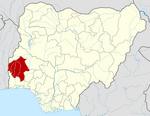
Ibadan is the capital and most populous city of Oyo State, in Nigeria. It is the third-largest city by population in Nigeria after Lagos and Kano, with a total population of 2,649,000 as of 2021, and over 3 million people within its metropolitan area. It is one of the country's largest cities by geographical area. At the time of Nigeria's independence in 1960, Ibadan was the largest and most populous city in the country, and the second-most populous in Africa behind Cairo. Ibadan is ranked one of the fastest-growing cities in sub-Saharan Africa, according to the UN Human Settlements Program (2022). It is also ranked third in West Africa in the tech startups index. Ibadan joined the UNESCO Global Network of Learning Cities in 2016.

Bauchi State is a state in the North-East geopolitical zone of Nigeria. It is bordered by Jigawa to the north, Yobe to the northeast, Gombe to the east, Taraba and Plateau to the south, Kaduna to the west and Kano to the northwest. It takes its name from the historic city of Bauchi, which also serves as its capital. The state was formed in 1976 when the former North-Eastern State was broken up. It originally included the area that is now Gombe State, which became a distinct state in 1996.

Nigeria has 774 local government areas (LGAs), each administered by a local government council consisting of a chairman, who is the chief executive, and other elected members, who are referred to as councillors. Each LGA is further subdivided into a minimum of ten and a maximum of twenty wards. A ward is administered by a councillor, who reports directly to the LGA chairman. The councillors fall under the legislative arm of the Local Government, the third tier of government in Nigeria, below the state governments and the federal government.
Ejigbo is a prominent city in Yoruba Land and the headquarters of Ejigbo Local Government Area, one of the oldest local government areas of Osun State in Nigeria. Ejigbo is strategically placed in the middle of the region, as 35 kilometres (22 mi) north-east of Iwo, 30 km (19 mi) from Ogbomoso in the north and 24 km (15 mi) from Ede in the south-east. It is about 40 km (25 mi) north-west of Osogbo, the capital of Osun State, and about 95 km (59 mi) north-east of Ibadan. It is part of the Ede North/Ede South/Egbedore/Ejigbo federal constituency. The population is 138,357 according to the GeoNames geographical database. The average elevation is 426 metres (1,398 ft).

Ukwa West is a Local Government Area in Abia State, Nigeria. Its headquarters is in the town of Oke Ikpe.
Umuahia North is a Local Government Area of Abia State, Nigeria. Its headquarters is in the city of Umuahia.
Ikpoba Okha is a Local Government Area of Edo State, Nigeria. Its headquarters is in the town of Idogbo, along Benin/Abraka Road. The LGA is made up of several towns and villages such as Evbuomodu, Uwusan, Obazagbon, Agedo, Evbumufi, Etiosa, Obadoloviyeyi, Obenevbugo, Obe, Oghoghobi, Okha, Obanyantor, Ekae, Utezi, Uhie, Ogheghe, Obagie Obaretin and so on. The estimated population of Ikpoba Okha is about 301,447 inhabitants, with the majority of the area’s dwellers being members of the Bini ethnic division.
Efon is a Local Government Area of Ekiti State, Nigeria. Its headquarters are in the town of Efon-Alaaye.

Enugu South is a Local Government Area of Enugu State, Nigeria. Its headquarters are in the town of Uwani, Nnobi Street Enugu, and covers the communities of Akwuke, Amechi, Ugwuaji, Obeagu, Awkunanaw and Amechi-Uwani. Enugu South is bounded to the north by Enugu North and to the east by Nkanu East local government areas. It falls within the Eastern senatorial districts of Enugu.
Danja is a Local Government Area in Katsina State, Nigeria. Its headquarters is located in the town of Danja.
Chikun is a Local Government Area in central Kaduna State, Nigeria. It has an area of about 4,466 km2, and had a population of 372,272 as at the 2006 census. Its headquarters is located in the town of Kujama. The postal code of the area is 2438000.
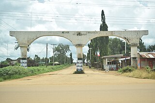
Jema'a is a Local Government Area in southern Kaduna State, Nigeria with headquarters at Kafanchan. The Local Government Council is chaired by Yunana Barde. It has an area of 1,384 km2 and a population of 278,202 at the 2006 census. The postal code of the area is 801.

Egbeda is a Local Government Area in the senatorial district of Oyo central in Ibadan less city of Oyo State, Nigeria. Its headquarters are in the town of Egbeda. Egbeda local government was carved out Lagelu Local government in 1989. The postal code of the area is 200109
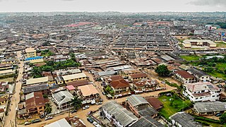
Ibadan North is a Local Government Area in Oyo State, Nigeria. Its headquarters stood at Agodi in Ibadan. The postal code of the area is 200.
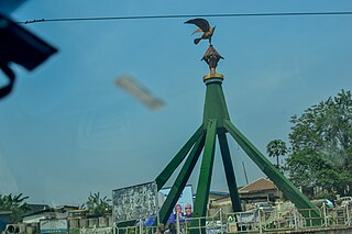
Ibadan North-West is a Local Government Area in Oyo State, Nigeria. Its headquarters are at Dugbe/Onireke. The postal code of the area is 200.
Ibadan South-East is a Local Government Area in Oyo State, Nigeria. Its headquarters are at Mapo Hall. The postal code of the area is 200.
Ibadan South-West is a Local Government Area in Oyo State, Nigeria. Its headquarters are at Oluyole Estate in Ibadan. Districts in the area include Ring-Road, Oke-Ado, Oke-Bola Gege, Born-Photo, and Isale-Osi.
Riyom is a Local Government Area in Plateau State, Nigeria. It was carved out of the old Barkin Ladi Local Government Area on 1 October 1996 by the government of General Sani Abacha. It is headquartered in the town of Riyom to the north of the area at 9°38′00″N8°46′00″E.
Ife North is a Local Government Area in Osun State, Nigeria. Its headquarters are in the town of Ipetumodu in the north of the area at7°31′00″N4°27′00″E.


