Ainsty, Wetherby

Last updated

Ainsty
Aerial photographs taken from Ainsty View, Wetherby (3rd May 2021) 007.jpg
Aerial view showing Ainsty Road and Ainsty Drive
Council houses on Ainsty Crescent.jpg
Former council houses on Ainsty Crescent
Leeds UK location map.svg
Red pog.svg
Ainsty
West Yorkshire UK location map.svg
Red pog.svg
Ainsty
Location within West Yorkshire
Metropolitan borough
Metropolitan county
Region
Country England
Sovereign state United Kingdom
Post town WETHERBY
Postcode district LS22
Dialling code 01937
Police West Yorkshire
Fire West Yorkshire
Ambulance Yorkshire
UK Parliament
List of places
UK
England
Yorkshire
53°56′18″N1°23′29″W / 53.9382°N 1.3914°W / 53.9382; -1.3914 Coordinates: 53°56′18″N1°23′29″W / 53.9382°N 1.3914°W / 53.9382; -1.3914

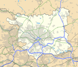
Ainsty is an area of Wetherby, West Yorkshire, England. Ainsty is in the north of Wetherby and runs as far as the border between North and West Yorkshire, to the north of this is Kirk Deighton.
Contents

Location

Ainsty lies close to Deighton Bar, generally accepted to include areas along Deighton Road and the Badgerwood Estate. Ainsty, by most definitions, generally encompasses the estates around Ainsty Road, Aire Road, Nidd Approach, Oakwood Road and the northern section of Barleyfields Road. The area nearing the end of Aire Road is sometimes known as Priest Hill.

History

Ainsty developed over many years, the earliest houses being built in the early 1950s and the latest of the houses being built in the mid-1990s by Bryant Homes. Ainsty contains a mix of private and council houses. The council housing as well as private housing around Coxwold Hill was built first, then in the 1960s, developer Ashtons built many houses (both semi detached and detached). Ashtons built many houses around West Yorkshire in this era, not only in Wetherby, but also in Holt Park, Knottingley and Mirfield.

Amenities

Deighton Bar Post Office on Aire Road Deighton Bar Post Office.jpg
Deighton Bar Post Office on Aire Road

Currently Ainsty has a decorating centre situated on the lower end of Ainsty Road, a Co-operative convenience store which opens late into the night further down Ainsty Road, a Post Office on Aire Road, named Deighton Bar post office. Ainsty also boasts a junior school (Deighton Gates primary school) and areas of open recreation. The Co-op was formerly a parade of shops and has had in the past between one and four shops on it at any time, with shops expanding into each other and then being divided up again to suit the owners. In the past this parade has had a launderette, tool hire shop, newsagent (Ainsty News), Nisa, Happy Shopper and independent convenience shop (Harves and Green Grocers). [1] The decorating centre for many years was a sandwich shop, while the parade of shops on Aire Road (all except the Post Office are now flats) has had a hairdresser, sports shop (Sports Zone) and other businesses in the past. There is no public house on the estate, however there is a working men's club on the Sandbeck Industrial estate, only a short walk from the estate, while the Bay Horse public house in Kirk Deighton serves residents in the area.

Transport

The estate lies close to junction 46 of the A1(M) and Wetherby service station. The First Leeds X98 bus service (Leeds City Square to Wetherby Deighton Bar) links the estate with Wetherby bus station, Linton, Collingham, Seacroft, Oakwood, Harehills and Leeds city centre. The estate is also linked to Knaresborough by Connexionsbuses service 780.

Related Research Articles

Wetherby Market town and civil parish in West Yorkshire, England

Wetherby is a market town and civil parish within the City of Leeds metropolitan borough, in West Yorkshire, England, close to the county's border with North Yorkshire and lies approximately 12 miles from Leeds, 12 mi (19 km) from York and 8 mi (13 km) from Harrogate. The town stands on the River Wharfe, and for centuries has been a crossing place and staging post on the Great North Road midway between London and Edinburgh.

Wortley, Leeds Human settlement in England

Wortley is an inner city area of Leeds, West Yorkshire, England. It begins one mile to the west of the city centre. The appropriate City of Leeds ward is called Farnley and Wortley.

Harehills Area of Leeds, West Yorkshire, England

Harehills is an inner-city area of east Leeds, West Yorkshire, England. It is approximately 1 mile (1.6 km) north east of Leeds city centre. Harehills is situated between the A58 and the A64. It sits in the Gipton & Harehills ward of Leeds City Council and the Leeds East parliamentary constituency, between Burmantofts and Gipton, and adjacent to Chapeltown.

Seacroft Suburb of Leeds, West Yorkshire, England

Seacroft is an outer-city suburb/township consisting mainly of council estate housing covering an extensive area of east Leeds, West Yorkshire, England. It lies in the LS14 Leeds postcode area, around 4 miles (6.4 km) east of Leeds city centre.

Roundhay Human settlement in England

Roundhay is a large suburb in north east Leeds, West Yorkshire, England. Roundhay had a population of 22,546 in 2011.

Gipton Human settlement in England

Gipton is a suburb of east Leeds, West Yorkshire, England, between the A58 to the north and the A64 to the south.

West Park, Leeds Human settlement in England

West Park is a suburb of north-west Leeds, West Yorkshire, England, north of Headingley. It is a mixed area of private suburban housing and suburban council estates. The name derives from its main park containing playing fields together with a conservation area of grassy meadow ending in woodland. The largest housing estate in West Park is Moor Grange.

Holt Park

Holt Park is a medium-sized low-rise 1970s housing estate in the northwest suburbs of Leeds, West Yorkshire, England. It is approximately 6 miles (10 km) from Leeds city centre situated between Tinshill, Cookridge and Adel, and is at the edge of the Leeds urban fringe, bordering the green belt which makes up two thirds of the metropolitan borough of the City of Leeds. The nearby Tinshill BT Tower dominates the skyline.

Ashtons Defunct house builder in Yorkshire

Ashtons was a housebuilder in Yorkshire in the 1950s, 1960s and 1970s.

Cross Gates Suburb in east Leeds, West Yorkshire, England

Cross Gates is a suburb in east Leeds, West Yorkshire, England.

Oakwood, Leeds Human settlement in England

Oakwood is a suburb of north-east Leeds, West Yorkshire, England, that lies between Gipton and Roundhay Park.

Richmond Hill, Leeds Human settlement in England

Richmond Hill is a district of Leeds, West Yorkshire, England. The district lies a mile to the east of the city centre between York Road, East End Park and Cross Green. The appropriate City of Leeds ward is Burmantofts and Richmond Hill.

Collingham, West Yorkshire Village and civil parish in West Yorkshire, England

Collingham is a village and civil parish 2 miles (3 km) south east of Wetherby in West Yorkshire, England. It is in the City of Leeds metropolitan borough. The population of the civil parish as of the 2011 census was 2,991.

Burley, Leeds Area of Leeds, West Yorkshire, England

Burley is an inner city area of Leeds, West Yorkshire, England, 1 mile (1.6 km) north-west of Leeds city centre, between the A65 Kirkstall Road at the south and Headingley at the north, in the Kirkstall ward.

Kirk Deighton Village and civil parish in North Yorkshire, England

Kirk Deighton is a village and civil parish in the Harrogate district of North Yorkshire, England. It is situated north-west of Wetherby, to which it is contiguous, and near the A1(M). The village was in the West Riding of Yorkshire, and Wetherby Rural District, until 1974, and is now on the border between West Yorkshire and North Yorkshire: the village is in North Yorkshire, and Wetherby in the Leeds metropolitan district of West Yorkshire. Kirk Deighton has a population of less than 500 people, measured at 484 in the 2011 Census.

Swarcliffe Area of the City of Leeds, West Yorkshire, England

Swarcliffe, originally the Swarcliffe Estate, is a district of Leeds, West Yorkshire, England. It is 4.9 miles (8 km) east of Leeds city centre, and within the LS14 Leeds postcode area. The district falls within the Cross Gates and Whinmoor ward of the Leeds Metropolitan Council.

Goldington Human settlement in England

Goldington is an electoral ward within the town of Bedford, Bedfordshire, England. It encompasses much of the historic village and parish of Goldington that was merged with Bedford in 1934, although some parts of the old village are within the neighbouring Newnham ward. It also includes two modern estates that are part of Renhold Parish.

History of Wetherby

The recorded history of Wetherby, a market town in the City of Leeds metropolitan borough, West Yorkshire, England, began in the 12th and 13th centuries when the Knights Templar and later the Knights Hospitallers were granted land and properties in Yorkshire. The preceptory founded in 1217 was at Ribston Park. In 1240 the Knights Templar were granted by Royal Charter of Henry III the right to hold a market in Wetherby. The charter stated the market should be held on Thursdays and an annual fair was permitted lasting three days over the day of St James the Apostle.

History of Seacroft

Seacroft pre-dates the Domesday book, with evidence of a settlement in the area from the Neolithic Age. Seacroft remained largely unchanged for centuries as a small Yorkshire village, until in the 1950s the area was developed into Leeds' largest council estate. In the 1960s and 1970s the building of Whinmoor and Swarcliffe enclosed Seacroft within other suburbs.

Hallfield Area of Wetherby, West Yorkshire, England

Hallfield or Hallfields is an area predominantly of council estates in Wetherby, West Yorkshire, England. The area is situated east of the town centre. The area is home to Wetherby High School.

References

  1. "Leeds Supermarkets | Find a Supermarket in Leeds". www.locallife.co.uk. Retrieved 27 April 2009.