Allendale, Illinois

Last updated

Allendale, Illinois
Allendale school.JPG
The Allendale Community Consolidated School
Wabash County Illinois Incorporated and Unincorporated areas Allendale Highlighted.svg
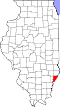
Location of Allendale in Wabash County, Illinois.
USA Illinois location map.svg
Red pog.svg
Allendale, Illinois
Location in Illinois
Usa edcp location map.svg
Red pog.svg
Allendale, Illinois
Allendale, Illinois (the United States)
North America laea location map.svg
Red pog.svg
Allendale, Illinois
Allendale, Illinois (North America)
Coordinates: 38°31′39″N87°42′37″W / 38.52750°N 87.71028°W / 38.52750; -87.71028 [1]
Country United States
State Illinois
County Wabash
Precinct Wabash
Area
[2]
  Total
0.31 sq mi (0.79 km2)
  Land0.31 sq mi (0.79 km2)
  Water0.00 sq mi (0.00 km2)
Elevation
[1]
479 ft (146 m)
Population
 (2020)
  Total
458
  Density1,491.86/sq mi (576.10/km2)
Time zone UTC-6 (CST)
  Summer (DST) UTC-5 (CDT)
ZIP code
62410
Area code 618
FIPS code 17-00815
GNIS feature ID2397935 [1]

Allendale is a village in Wabash Precinct, Wabash County, Illinois. The population was 458 at the 2020 census.

Contents

History

Allendale was founded in 1869, taking its name from Colonel C. M. Allen, a railroad official. [3]

1989 tornado

On January 7, 1989, an F4 tornado leveled a good portion of the town of Allendale and injured 55 of its residents. [4] The tornado directly impacted Allendale's school, destroying the grade school portion, built in the 1960s. The high school portion, built in the late 1920s, withstood the storm with minimal damage, despite being condemned two years earlier due to lobbying by Mt. Carmel's District 348 in an attempt to usurp District 17. Relief funds paid to build a brand new school to be used by the elementary and middle school students of District 17. Their moto was "NEVER BACK DOWN, NEVER GIVE UP." [ citation needed ]

Geography

Allendale is located 4 miles (6.4 km) northeast of Patton and 1.75 miles (2.82 km) east-northeast of Adams Corner.

According to the 2010 census, Allendale has a total area of 0.31 square miles (0.80 km2), all land. [5]

Demographics

Historical population
CensusPop.Note
1880 283
1920 451
1930 4622.4%
1940 432−6.5%
1950 4422.3%
1960 4655.2%
1970 425−8.6%
1980 61344.2%
1990 476−22.3%
2000 52810.9%
2010 475−10.0%
2020 458−3.6%
U.S. Decennial Census [6]

As of the census [7] of 2000, there were 528 people, 192 households, and 142 families residing in the village. The population density was 1,755.5 inhabitants per square mile (677.8/km2). There were 205 housing units at an average density of 681.6 per square mile (263.2/km2). The racial makeup of the village was 97.92% White, 0.76% African American, 0.95% from other races, and 0.38% from two or more races. Hispanic or Latino of any race were 1.14% of the population.

There were 192 households, out of which 35.4% had children under the age of 18 living with them, 60.9% were married couples living together, 10.4% had a female householder with no husband present, and 26.0% were non-families. 25.5% of all households were made up of individuals, and 12.0% had someone living alone who was 65 years of age or older. The average household size was 2.65 and the average family size was 3.20.

In the village, the population was spread out, with 28.4% under the age of 18, 10.2% from 18 to 24, 25.8% from 25 to 44, 23.7% from 45 to 64, and 11.9% who were 65 years of age or older. The median age was 37 years. For every 100 females, there were 98.5 males. For every 100 females age 18 and over, there were 93.8 males.

The median income for a household in the village was $31,705, and the median income for a family was $38,472. Males had a median income of $30,000 versus $16,719 for females. The per capita income for the village was $12,117. About 12.1% of families and 16.6% of the population were below the poverty line, including 26.4% of those under age 18 and 1.9% of those age 65 or over.

Education

It is in Allendale Community Consolidated School District 17, [8] which has grades Pre-Kindergarten through 8. [9] Students are sent onward to Mount Carmel High School, of the Wabash CUSD 348. [10]

Notes

  1. 1 2 3 U.S. Geological Survey Geographic Names Information System: Allendale, Illinois
  2. "2020 U.S. Gazetteer Files". United States Census Bureau. Retrieved March 15, 2022.
  3. Callary, Edward (September 29, 2008). Place Names of Illinois. University of Illinois Press. p. 5. ISBN   978-0-252-09070-7.
  4. http://ams.allenpress.com/perlserv/?request=get-abstract&doi=10.1175%2F1520-0434(1992)007%3C0588%3ASLSF%3E2.0.CO%3B2 Published by the American Meteorological Society Severe Local Storms Forecasting Robert H. Johns and Charles A. Doswell III
  5. "G001 - Geographic Identifiers - 2010 Census Summary File 1". United States Census Bureau. Archived from the original on February 13, 2020. Retrieved August 1, 2015.
  6. "Census of Population and Housing". Census.gov. Retrieved June 4, 2015.
  7. "U.S. Census website". United States Census Bureau . Retrieved January 31, 2008.
  8. "2020 CENSUS - SCHOOL DISTRICT REFERENCE MAP: Wabash County, IL" (PDF). U.S. Census Bureau . Retrieved June 15, 2024. - Text list
  9. "Allendale CCSD 17". National Center for Education Statistics . Retrieved June 15, 2024.
  10. "MOUNT CARMEL HIGH SCHOOL (9 - 12)". illinoisreportcard.com. Illinois State Board of Education . Retrieved June 15, 2024.