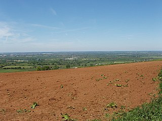
Hurst Hill or Cumnor Hurst is a 20.6-hectare (51-acre) biological and geological Site of Special Scientific Interest west of Oxford in Oxfordshire. It is a Geological Conservation Review site.

Smokejack Clay Pit is a 56-hectare (140-acre) geological Site of Special Scientific Interest east of Cranleigh in Surrey. It is a Geological Conservation Review site.

Muswell Hill is a 0.2-hectare (0.49-acre) geological Site of Special Scientific Interest north-west of Brill in Buckinghamshire. The local planning authorities are Buckinghamshire County Council and Aylesbury Vale District Council. It is listed by the Joint Nature Conservation Committee as a Geological Conservation Review site.
Bugle Quarry is a 0.08-hectare (0.20-acre) geological Site of Special Scientific Interest in Hartwell in Buckinghamshire. The local planning authority is Aylesbury Vale District Council. It has two entries in the Geological Conservation Review of the Joint Nature Conservation Committee.

Philpot's and Hook Quarries is a 2.6-hectare (6.4-acre) geological Site of Special Scientific Interest south-west of Sharpthorne in West Sussex. It is a Geological Conservation Review site.

Shipton-on-Cherwell and Whitehill Farm Quarries is a 30-hectare (74-acre) geological Site of Special Scientific Interest north of Kidlington in Oxfordshire. It is a Geological Conservation Review site.

Dry Sandford Pit is a 4.2-hectare (10-acre) biological and geological Site of Special Scientific Interest north-west of Abingdon-on-Thames in Oxfordshire. It is a Geological Conservation Review site and it is managed as a nature reserve by the Berkshire, Buckinghamshire and Oxfordshire Wildlife Trust.

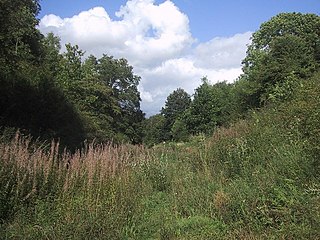
Hook Norton Cutting and Banks is a 6.7-hectare (17-acre) biological and geological Site of Special Scientific Interest south of Hook Norton in Oxfordshire. The site is in three areas, two of which are managed as a nature reserve called Hook Norton Cutting by Berkshire, Buckinghamshire and Oxfordshire Wildlife Trust. and are designated a Geological Conservation Review site.

Kirtlington Quarry is a 3.1-hectare (7.7-acre) geological Site of Special Scientific Interest west of Kirtlington in Oxfordshire. It is a Geological Conservation Review site, and it is part of the 7.4-hectare (18-acre) Kirtlington Quarry Local Nature Reserve.

Rock Edge is a 1.7-hectare (4.2-acre) geological Site of Special Scientific Interest in Oxford in Oxfordshire. It is a Geological Conservation Review site and a Local Nature Reserve

Ardley Cutting and Quarry is a 40.1-hectare (99-acre) biological and geological Site of Special Scientific Interest north-west of Bicester in Oxfordshire. It is a Geological Conservation Review site and an area of 11 hectares is managed by the Berkshire, Buckinghamshire and Oxfordshire Wildlife Trust as Ardley Wood Quarry. The site contains a Scheduled Monument, Ardley Wood moated ringwork, a Norman defended enclosure.

Woodeaton Quarry is a 7.3-hectare (18-acre) geological Site of Special Scientific Interest north of Oxford in Oxfordshire. It is a Geological Conservation Review site.

Horsehay Quarries is a 8.4-hectare (21-acre) geological Site of Special Scientific Interest west of Bicester in Oxfordshire. It is a Geological Conservation Review site.

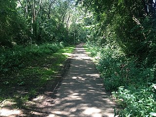
Littlemore Railway Cutting is a 0.5-hectare (1.2-acre) geological Site of Special Scientific Interest on the southern outskirts of Oxford in Oxfordshire. It is a Geological Conservation Review site.

Lyehill Quarry is a 2.8-hectare (6.9-acre) geological Site of Special Scientific Interest east of Oxford in Oxfordshire. It is a Geological Conservation Review site.

Neithrop Fields Cutting is a 1.4-hectare (3.5-acre) geological Site of Special Scientific Interest in Banbury in Oxfordshire. It is a Geological Conservation Review site.

Shellingford Crossroads Quarry is a 2.6-hectare (6.4-acre) geological Site of Special Scientific Interest west of Stanford in the Vale in Oxfordshire. It is a Geological Conservation Review site.

Sharp's Hill Quarry is a 2.4-hectare (5.9-acre) geological Site of Special Scientific Interest west of Banbury in Oxfordshire. It is a Geological Conservation Review site.

Sugworth is a 0.6-hectare (1.5-acre) geological Site of Special Scientific Interest north of Abingdon-on-Thames in Oxfordshire. It is a Geological Conservation Review site.


