
The Berkshire, Buckinghamshire and Oxfordshire Wildlife Trust (BBOWT), is a Wildlife Trust covering the counties of Berkshire, Buckinghamshire and Oxfordshire in England.

Thatcham Reed Beds is a 67.4-hectare (167-acre) biological Site of Special Scientific Interest east of Newbury in Berkshire. It is part of the Kennet & Lambourn Floodplain Special Area of Conservation and an area of 14 hectares is a Local Nature Reserve. An area of 35 hectares is managed by the Berkshire, Buckinghamshire and Oxfordshire Wildlife Trust.

Glyme Valley is a 28.9-hectare (71-acre) biological Site of Special Scientific Interest east of Chipping Norton in Oxfordshire. An area of 3 hectares is a nature reserve managed by the Berkshire, Buckinghamshire and Oxfordshire Wildlife Trust

Decoy Pit, Pools and Woods is a 17.7-hectare (44-acre) biological Site of Special Scientific Interest south of Aldermaston in Berkshire. An area of 8 hectares is a nature reserve called Decoy Heath, which is managed by the Berkshire, Buckinghamshire and Oxfordshire Wildlife Trust.

Bacombe and Coombe Hills is a 76.4-hectare (189-acre) biological Site of Special Scientific Interest in Upper Bacombe in Buckinghamshire. Bacombe Hill was formerly owned by Buckinghamshire County Council, which transferred it to Berkshire, Buckinghamshire and Oxfordshire Wildlife Trust in 2014. Coombe Hill is owned by the National Trust.
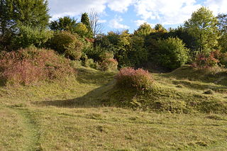
Aston Clinton Ragpits is a 2.9-hectare (7.2-acre) biological Site of Special Scientific Interest in Aston Clinton in Buckinghamshire. It is a former chalk quarry, which is now a nature reserve managed by the Berkshire, Buckinghamshire and Oxfordshire Wildlife Trust. It is in the Chilterns Area of Outstanding Natural Beauty.

Pilch Fields is an 11.1-hectare (27-acre) biological Site of Special Scientific Interest (SSSI) west of Great Horwood in Buckinghamshire. It is managed by the Berkshire, Buckinghamshire and Oxfordshire Wildlife Trust.

Weston Turville Reservoir is a 19 hectare biological Site of Special Scientific Interest south of Weston Turville in Buckinghamshire. It is owned by the Canal & River Trust, and the open water is leased to sailing and fishing clubs while the surrounding land is managed by the Berkshire, Buckinghamshire and Oxfordshire Wildlife Trust. The site is in the Chilterns Area of Outstanding Natural Beauty.

Shabbington Woods Complex is a 305.6-hectare (755-acre) biological Site of Special Scientific Interest (SSSI) between Horton-cum-Studley and Worminghall in Buckinghamshire. It comprises Shabbington Wood, Bernwood Forest, Hell Coppice, Oakley Wood and York's Wood. Shabbington Wood is owned by the Forestry Commission, and a small area of 7.5 hectares called Bernwood Meadows is managed by the Berkshire, Buckinghamshire and Oxfordshire Wildlife Trust.
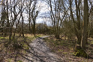
Rushbeds Wood is a 56-hectare (140-acre) nature reserve near Wotton Underwood in Buckinghamshire, managed by the Berkshire, Buckinghamshire and Oxfordshire Wildlife Trust (BBOWT). It is a surviving fragment of the ancient Bernwood Forest. The reserve is part of Rushbeds Wood and Railway Cutting, an 80.2-hectare (198-acre) biological Site of Special Scientific Interest. This includes a section of the Chiltern Main Line railway cutting, which runs along the north-east side of the BBOWT reserve.

Wildmoor Heath is a 91-hectare (220-acre) nature reserve south of Crowthorne in Berkshire. It is managed by the Berkshire, Buckinghamshire and Oxfordshire Wildlife Trust. The reserve is part of two Sites of Special Scientific Interest: Wildmoor Heath itself is part of Sandhurst to Owlsmoor Bogs and Heaths and a separate area called Broadmoor Bottom is part of Broadmoor to Bagshot Woods and Heaths.

Dry Sandford Pit is a 4.2-hectare (10-acre) biological and geological Site of Special Scientific Interest north-west of Abingdon-on-Thames in Oxfordshire. It is a Geological Conservation Review site and it is managed as a nature reserve by the Berkshire, Buckinghamshire and Oxfordshire Wildlife Trust.

Parsonage Moor is a 6-hectare (15-acre) nature reserve north-west of Abingdon-on-Thames in Oxfordshire, United Kingdom. It is managed by the Berkshire, Buckinghamshire and Oxfordshire Wildlife Trust. It is part of Cothill Fen, which is a Site of Special Scientific Interest and Special Area of Conservation. Part of it is in Cothill Fen and Parsonage Moor Nature Conservation Review site, Grade I.
Cothill Fen is a 43.3-hectare (107-acre) biological and geological Site of Special Scientific Interest north-west of Abingdon-on-Thames in Oxfordshire. It is a Special Area of Conservation and parts of it are a Geological Conservation Review site, a Nature Conservation Review site, Grade 1, and a National Nature Reserve. It also includes two areas which are nature reserves managed by the Berkshire, Buckinghamshire and Oxfordshire Wildlife Trust, Lashford Lane Fen and Parsonage Moor.

Hitchcopse Pit is a 3-hectare (7.4-acre) nature reserve north-west of Abingdon-on-Thames in Oxfordshire. It is managed by the Berkshire, Buckinghamshire and Oxfordshire Wildlife Trust. It is part of Frilford Heath, Ponds and Fens, which is a Site of Special Scientific Interest.

Bould Wood is a 58.2-hectare (144-acre) biological Site of Special Scientific Interest north of Shipton-under-Wychwood in Oxfordshire. An area of 23 hectares is Foxholes nature reserve, which is managed by the Berkshire, Buckinghamshire and Oxfordshire Wildlife Trust.

Lashford Lane Fen is a 7-hectare (17-acre) nature reserve north of Dry Sandford in Oxfordshire. It is managed by the Berkshire, Buckinghamshire and Oxfordshire Wildlife Trust. It is part of Cothill Fen, which is a Site of Special Scientific Interest and Special Area of Conservation.
