
Kennet and Lambourn Floodplain is a 23.4-hectare (58-acre) biological Site of Special Scientific Interest in six widely separated areas in the floodplains of the River Lambourn in Berkshire and the River Kennet in Wiltshire, England. It is a Nature Conservation Review site and part of the Kennet and Lambourn Floodplain Special Area of Conservation. One of the areas, Rack Marsh, is managed by the Berkshire, Buckinghamshire and Oxfordshire Wildlife Trust.
Bix Bottom is a 102.3-hectare (253-acre) biological Site of Special Scientific Interest north-west of Henley-on-Thames in Oxfordshire. It is owned and managed as Warburg Nature Reserve by the Berkshire, Buckinghamshire and Oxfordshire Wildlife Trust.
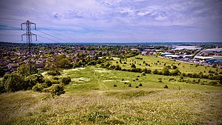
Blow's Down is a 33.1-hectare (82-acre) biological Site of Special Scientific Interest in Dunstable in Bedfordshire. It was notified in 1989 under Section 28 of the Wildlife and Countryside Act 1981, and the local planning authority is Central Bedfordshire Council. The site forms around half of the 62.3-hectare (154-acre) Blow's Downs nature reserve, which is managed by the Wildlife Trust for Bedfordshire, Cambridgeshire and Northamptonshire.

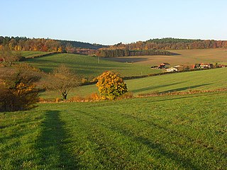
Glyme Valley is a 28.9-hectare (71-acre) biological Site of Special Scientific Interest east of Chipping Norton in Oxfordshire. An area of 3 hectares is a nature reserve managed by the Berkshire, Buckinghamshire and Oxfordshire Wildlife Trust

Lye Valley is a 2.3-hectare (5.7-acre) biological Site of Special Scientific Interest in Headington, a suburb of Oxford in Oxfordshire. It is part of the 4.5-hectare (11-acre) Lye Valley Local Nature Reserve, which is owned and managed by Oxford City Council.

Amwell Quarry or Amwell Nature Reserve is a 37 hectare biological Site of Special Scientific Interest in Great Amwell in Hertfordshire. The planning authority is East Hertfordshire District Council. It is also part of the Lee Valley Ramsar Site and Special Protection Area, and is owned and managed by the Hertfordshire and Middlesex Wildlife Trust.

Pilch Fields is an 11.1-hectare (27-acre) biological Site of Special Scientific Interest (SSSI) west of Great Horwood in Buckinghamshire. It is managed by the Berkshire, Buckinghamshire and Oxfordshire Wildlife Trust.

Weston Turville Reservoir is a 19 hectare biological Site of Special Scientific Interest south of Weston Turville in Buckinghamshire. It is owned by the Canal & River Trust, and the open water is leased to sailing and fishing clubs while the surrounding land is managed by the Berkshire, Buckinghamshire and Oxfordshire Wildlife Trust. The site is in the Chilterns Area of Outstanding Natural Beauty.

Buttlers Hangings is a 3.9-hectare (9.6-acre) Site of Special Scientific Interest north of West Wycombe in Buckinghamshire. It is in the Chilterns Area of Outstanding Natural Beauty.

Rushy Meadows is an 8.9-hectare (22-acre) biological Site of Special Scientific Interest on the western outskirts of Kidlington in Oxfordshire.

Kirtlington Quarry is a 3.1-hectare (7.7-acre) geological Site of Special Scientific Interest west of Kirtlington in Oxfordshire. It is a Geological Conservation Review site, and it is part of the 7.4-hectare (18-acre) Kirtlington Quarry Local Nature Reserve.

Ardley Cutting and Quarry is a 40.1-hectare (99-acre) biological and geological Site of Special Scientific Interest north-west of Bicester in Oxfordshire. It is a Geological Conservation Review site and an area of 11 hectares is managed by the Berkshire, Buckinghamshire and Oxfordshire Wildlife Trust as Ardley Wood Quarry. The site contains a Scheduled Monument, Ardley Wood moated ringwork, a Norman defended enclosure.

Cothill Fen is a 43.3-hectare (107-acre) biological and geological Site of Special Scientific Interest north-west of Abingdon-on-Thames in Oxfordshire. It is a Special Area of Conservation and parts of it are a Geological Conservation Review site, a Nature Conservation Review site, Grade 1, and a National Nature Reserve. It also includes two areas which are nature reserves managed by the Berkshire, Buckinghamshire and Oxfordshire Wildlife Trust, Lashford Lane Fen and Parsonage Moor.
Buckland Warren is a 0.04-hectare (0.099-acre) biological Site of Special Scientific Interest (SSSI) east of Faringdon in Oxfordshire.

Port Meadow with Wolvercote Common and Green is a 167.1-hectare (413-acre) biological Site of Special Scientific Interest in Oxford in Oxfordshire. It is a Nature Conservation Review site, Grade I, and part of Oxford Meadows Special Area of Conservation. The remains of Godstow Abbey, which is a Scheduled Monument, are in the north of the site.
Sinah Common is a 243-hectare (600-acre) biological Site of Special Scientific Interest on Hayling Island in Hampshire.

Wealden Edge Hangers is a 222.4-hectare (550-acre) biological Site of Special Scientific Interest north of Petersfield in Hampshire. An area of 48 hectares is Wealden Edge Hangers Local Nature Reserve and an area of 144.1 hectares is Ashford Hangers National Nature Reserve. Wealden Edge Hangers is part of the East Hampshire Hangers Special Area of Conservation.

Little Tew Meadows is a 40-hectare (99-acre) biological Site of Special Scientific Interest east of Chipping Norton in Oxfordshire.

Lashford Lane Fen is a 7-hectare (17-acre) nature reserve north of Dry Sandford in Oxfordshire. It is managed by the Berkshire, Buckinghamshire and Oxfordshire Wildlife Trust. It is part of Cothill Fen, which is a Site of Special Scientific Interest and Special Area of Conservation.
