
Polden Hills in Somerset, England are a long, low ridge, extending for 10 miles (16 km), and separated from the Mendip Hills, to which they are nearly parallel, by a marshy tract, known as the Somerset Levels. They are now bisected at their western end by the M5 motorway and a railway, the Bristol and Exeter Railway, part of the Great Western Main Line.

Brede Pit and Cutting is a 0.6-hectare (1.5-acre) geological Site of Special Scientific Interest in Brede in East Sussex. It is a Geological Conservation Review site.

Winchelsea Cutting is a 0.15-hectare (0.37-acre) geological Site of Special Scientific Interest on the southern outskirts of Winchelsea in East Sussex. It is a Geological Conservation Review site.

West Hoathly SSSI is a 0.7-hectare (1.7-acre) geological Site of Special Scientific Interest in Sharpthorne in West Sussex. It is a Geological Conservation Review site.

Hornchurch Cutting is a 0.8-hectare (2.0-acre) geological Site of Special Scientific Interest in Hornchurch in the London Borough of Havering. It is also a Geological Conservation Review site.
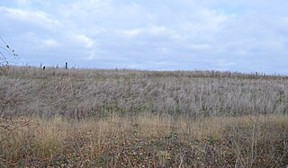
Warboys Clay Pit is a 12.6-hectare (31-acre) geological Site of Special Scientific Interest west of Warboys in Cambridgeshire. It is a Geological Conservation Review site.

Cranford St John SSSI is a 2.8-hectare (6.9-acre) geological Site of Special Scientific Interest in Cranford St John, east of Kettering in Northamptonshire. It is a Geological Conservation Review site.

Chillesford Church Pit is a 1.1-hectare (2.7-acre) geological Site of Special Scientific Interest in Chillesford, south of Saxmundham in Suffolk. It is a Geological Conservation Review site, and it is in the Suffolk Coast and Heaths Area of Outstanding Natural Beauty.

Pembury Cutting and Pit is a 1.6-hectare (4.0-acre) geological Site of Special Scientific Interest east of Tunbridge Wells in Kent. It is a Geological Conservation Review site.

Coneyhurst Cutting is a 0.2-hectare (0.49-acre) geological Site of Special Scientific Interest south-east of Billingshurst in West Sussex. It is a Geological Conservation Review site.

Dry Sandford Pit is a 4.2-hectare (10-acre) biological and geological Site of Special Scientific Interest north-west of Abingdon-on-Thames in Oxfordshire. It is a Geological Conservation Review site and it is managed as a nature reserve by the Berkshire, Buckinghamshire and Oxfordshire Wildlife Trust.
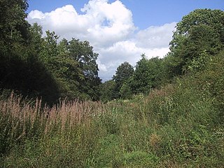
Hook Norton Cutting and Banks is a 6.7-hectare (17-acre) biological and geological Site of Special Scientific Interest south of Hook Norton in Oxfordshire. The site is in three areas, two of which are managed as a nature reserve called Hook Norton Cutting by Berkshire, Buckinghamshire and Oxfordshire Wildlife Trust. and are designated a Geological Conservation Review site.

Rock Edge is a 1.7-hectare (4.2-acre) geological Site of Special Scientific Interest in Oxford in Oxfordshire. It is a Geological Conservation Review site and a Local Nature Reserve

Ardley Cutting and Quarry is a 40.1-hectare (99-acre) biological and geological Site of Special Scientific Interest north-west of Bicester in Oxfordshire. It is a Geological Conservation Review site and an area of 11 hectares is managed by the Berkshire, Buckinghamshire and Oxfordshire Wildlife Trust as Ardley Wood Quarry. The site contains a Scheduled Monument, Ardley Wood moated ringwork, a Norman defended enclosure.

Woodeaton Quarry is a 7.3-hectare (18-acre) geological Site of Special Scientific Interest north of Oxford in Oxfordshire. It is a Geological Conservation Review site.

Lyehill Quarry is a 2.8-hectare (6.9-acre) geological Site of Special Scientific Interest east of Oxford in Oxfordshire. It is a Geological Conservation Review site.

Shellingford Crossroads Quarry is a 2.6-hectare (6.4-acre) geological Site of Special Scientific Interest west of Stanford in the Vale in Oxfordshire. It is a Geological Conservation Review site.
Sugworth is a 0.6-hectare (1.5-acre) geological Site of Special Scientific Interest north of Abingdon-on-Thames in Oxfordshire. It is a Geological Conservation Review site.
