
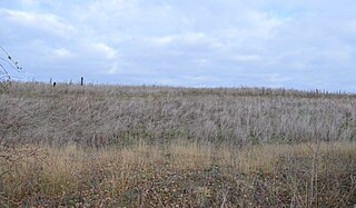
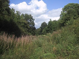
Aston Rowant Cutting is a 3.5-hectare (8.6-acre) geological Site of Special Scientific Interest south of Aston Rowant in Oxfordshire. It is a Geological Conservation Review site.
Warboys Clay Pit is a 12.6-hectare (31-acre) geological Site of Special Scientific Interest west of Warboys in Cambridgeshire. It is a Geological Conservation Review site.
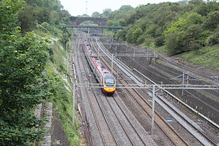
Roade Cutting is a 15.2-hectare (38-acre) geological Site of Special Scientific Interest along the West Coast Main Line north from Roade in Northamptonshire. It is a Geological Conservation Review site.

Cranford St John SSSI is a 2.8-hectare (6.9-acre) geological Site of Special Scientific Interest in Cranford St John, east of Kettering in Northamptonshire. It is a Geological Conservation Review site.

Stoke Tunnel Cutting, Ipswich is a 2.2-hectare (5.4-acre) geological Site of Special Scientific Interest in Ipswich in Suffolk. It is a Geological Conservation Review site.

Bradgate Park and Cropston Reservoir is a 399.7-hectare (988-acre) geological Site of Special Scientific Interest north–west of Leicester. It is also a Nature Conservation Review site, and Bradgate Park contains Geological Conservation Review sites and a Scheduled Monument.
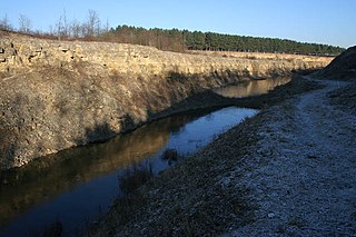
Sproxton Quarry is a 5.4 hectares geological Site of Special Scientific Interest north-east of Sproxton in Leicestershire. It is a Geological Conservation Review site.

Tilton Cutting is a 4.4 hectares geological Site of Special Scientific Interest west of Tilton on the Hill in Leicestershire. It is a Geological Conservation Review site, and is owned and managed by the Leicestershire and Rutland Wildlife Trust as Tilton Railway Cutting.

Coneyhurst Cutting is a 0.2-hectare (0.49-acre) geological Site of Special Scientific Interest south-east of Billingshurst in West Sussex. It is a Geological Conservation Review site.
Park Farm Cutting is a 0.2-hectare (0.49-acre) geological Site of Special Scientific Interest west of Pulborough in West Sussex. It is a Geological Conservation Review site.
Hook Norton Cutting and Banks is a 6.7-hectare (17-acre) biological and geological Site of Special Scientific Interest south of Hook Norton in Oxfordshire. The site is in three areas, two of which are managed as a nature reserve called Hook Norton Cutting by Berkshire, Buckinghamshire and Oxfordshire Wildlife Trust. and are designated a Geological Conservation Review site.

Ardley Cutting and Quarry is a 40.1-hectare (99-acre) biological and geological Site of Special Scientific Interest north-west of Bicester in Oxfordshire. It is a Geological Conservation Review site and an area of 11 hectares is managed by the Berkshire, Buckinghamshire and Oxfordshire Wildlife Trust as Ardley Wood Quarry. The site contains a Scheduled Monument, Ardley Wood moated ringwork, a Norman defended enclosure.

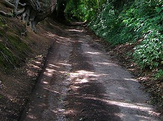
Littlemore Railway Cutting is a 0.5-hectare (1.2-acre) geological Site of Special Scientific Interest on the southern outskirts of Oxford in Oxfordshire. It is a Geological Conservation Review site.

Sharp's Hill Quarry is a 2.4-hectare (5.9-acre) geological Site of Special Scientific Interest west of Banbury in Oxfordshire. It is a Geological Conservation Review site.
Sugworth is a 0.6-hectare (1.5-acre) geological Site of Special Scientific Interest north of Abingdon-on-Thames in Oxfordshire. It is a Geological Conservation Review site.
