Limerick is a village in the Canadian province of Saskatchewan within the Rural Municipality of Stonehenge No. 73 and Census Division No. 3. The village is about 150 km (94 mi) north of the US border near the towns of Lafleche and Gravelbourg. The village is named after the Irish city of Limerick.
Estuary is a hamlet in RM of Deer Forks No. 232 in the Canadian province of Saskatchewan. Very little remains of the former village of 800, other than a private residence and a pioneer cemetery on a small hill known as Cemetery Hill, overlooking the South Saskatchewan River.

Vidora is an unincorporated community within the Rural Municipality of Reno No. 51, Saskatchewan, Canada. The community once had a population of 200 people in 1940 and has since declined to 1 resident. It previously held village status until it was dissolved as an unincorporated community on January 1, 1952. The community is located between Robsart and Consul on highway 21 & highway 13 known as the Red Coat Trail. Very little remains of the former village, only one home that is also used as a post office still stands as of 2008. There are many cement foundations and sidewalks still found scattered around the town site, including the remnants of the old bank vault to the former Municipality Office that was moved to Consul.

Brooking was once a community in the province of Saskatchewan, Canada. It was named after Brookings, South Dakota.
Milestone is a town in southeast Saskatchewan, Canada, on Highway 39. The town was named after C. W. Milestone in 1893. The town serves as a service centre for the neighbouring countryside with the area's economy dominated by agriculture.
Piapot is a hamlet within the Rural Municipality of Piapot No. 110, Saskatchewan, Canada. Listed as a designated place by Statistics Canada, the hamlet had a population of 50 in the Canada 2016 Census.
Mantario is a special service area in the Rural Municipality of Chesterfield No. 261 in the Canadian province of Saskatchewan.It held village status prior to June 30, 2007. The population was five people in 2011. The community is located 70 kilometres (43 mi) southwest of the town of Kindersley on Highway 44.
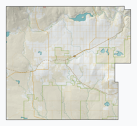
Ravenscrag is an unincorporated community within the Rural Municipality of White Valley No. 49, Saskatchewan, Canada. The community is located on Highway 614, along the Frenchman River, 60 kilometres (37 mi) east of the Alberta-Saskatchewan border and about 185 kilometres (115 mi) southwest of the city of Swift Current.

Scotsguard is an unincorporated community within the Rural Municipality of Bone Creek No. 108, Saskatchewan, Canada. The community is located on Highway 13, also known as the historic Red Coat Trail, about 10 km northeast of the town of Shaunavon.
Nashlyn is an unincorporated community within the Rural Municipality of Reno No. 51, Saskatchewan, Canada. The former townsite is located 15 kilometres (9.3 mi) west of Highway 18, about 10 kilometres (6.2 mi) south of the village of Consul and Highway 13.
Rangeview is an unincorporated community within the Rural Municipality of Reno No. 51, Saskatchewan, Canada. The former town-site is located 5 km west of Highway 18, about 15 km south of the community of Robsart and Highway 13.
Oxarat is an unincorporated community within Rural Municipality of Reno No. 51, Saskatchewan, Canada. The former town-site is located 15 km west of Highway 21, about 15 kilometres (9.3 mi) north of the village of Consul and Highway 13.
Anerley is an unincorporated community in the western region of Saskatchewan located about 4 km north of Highway 44, about 20 km southwest of the Outlook and is about 125 km south west of Saskatoon.
Ardill is a hamlet in RM of Lake Johnston No. 102, Saskatchewan, Canada. Listed as a designated place by Statistics Canada, the hamlet had a listed population of 0 in the Canada 2006 Census.
Senlac is a village in the Canadian province of Saskatchewan within the Rural Municipality of Senlac No. 411 and Census Division No. 13. The village was named after Senlac Hill, the location of the Battle of Hastings in England in 1066.
Hatton, also known as Forres, is an unincorporated community in Maple Creek Rural Municipality No. 111, Saskatchewan, Canada. The community is located on Highway 635, 10 km north of the Trans Canada Highway, and 20 km northwest of Maple Creek. Not much is left of the once prosperous town of 800 citizens, but an old pioneer cemetery and schoolhouse that is now a private residence.
Cummings is an unincorporated community within the Rural Municipality of Maple Creek No. 111, Saskatchewan, Canada. The community is located on Range road 295, 30 km northwest of Maple Creek.
Belanger is an unincorporated community within the Rural Municipality of Maple Creek No. 111, Saskatchewan, Canada. The community is located on Highway 706 50 km south of Maple Creek.
Cullen is a former hamlet in Benson Rural Municipality No. 35, Saskatchewan, Canada.
Woodley is an unincorporated community in Benson Rural Municipality No. 35, Saskatchewan, Canada. Woodley, like many other small communities throughout Saskatchewan, has struggled to maintain a steady population which made Woodley a ghost town.