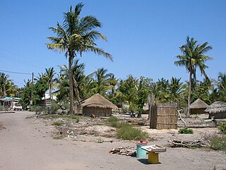
Vilankulo District or Vilanculos District is a district of Inhambane Province in south-east Mozambique. Its principal town is Vilankulo. The district is located at the east of the province, and borders with Inhassoro District in the north and Massinga District in the south and in the west. In the east, the district is bounded by the Indian Ocean. The area of the district is 5,867 square kilometres (2,265 sq mi). It has a population of 135,710 as of 2007.
Juan Espinoza Medrano District is one of the seven districts of the province Antabamba in Peru.
Carhuacallanga District is one of twenty-eight districts of the province Huancayo in Peru.

Sicaya District is one of twenty-eight districts of the province Huancayo in Peru.
Masma Chicche District is one of thirty-four districts of the province Jauja in Peru.
Conayca District is one of nineteen districts of the province Huancavelica in Peru.

Castrovirreyna District is one of thirteen districts of the Castrovirreyna Province in Peru.
Ocoyo District is one of sixteen districts of the province Huaytará in Peru.
Contamana District is one of six districts of the province Ucayali in Peru.

Gąsewo is a village in the administrative district of Gmina Bodzanów, within Płock County, Masovian Voivodeship, in east-central Poland. It lies approximately 3 kilometres (2 mi) south-west of Bodzanów, 22 km (14 mi) east of Płock, and 75 km (47 mi) north-west of Warsaw.

Stefanów is a village in the administrative district of Gmina Dobra, within Turek County, Greater Poland Voivodeship, in west-central Poland. It lies approximately 12 kilometres (7 mi) north of Dobra, 4 km (2 mi) south-east of Turek, and 120 km (75 mi) east of the regional capital Poznań.
Poxoréo is a municipality in the state of Mato Grosso in the Central-West Region of Brazil.
Albino Zertuche Municipality is a municipality in Puebla in south-eastern Mexico.
Atexcal (municipality) is a town and municipality in Puebla in south-eastern Mexico.
Chinantla Municipality is a municipality in Puebla in south-eastern Mexico.
Juan Galindo Municipality is a municipality in Puebla in south-eastern Mexico.
Teotlalco (municipality) is a town and municipality in Puebla in south-eastern Mexico.
Zapotitlán Municipality is a municipality in Puebla in south-eastern Mexico.

Antártica is a Chilean commune in Antártica Chilena Province, Magallanes y la Antártica Chilena Region, which covers all the Chilean Antarctic Territory, the territory in Antarctica claimed by Chile. It ranges from 53°W to 90°W and from the South Pole to 60°S, overlapping the Argentine and British Antarctic claims, and is the largest and least populated commune in Chile, being over 25 times the size of the next largest commune, Natales. It is administered by the Cabo de Hornos municipality in the South American mainland.


