Bagot, Northern Territory

Last updated

Bagot
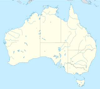
Darwin,  Northern Territory
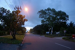
Bagot Community.jpg
Population265 (2016 census) [1]
Postcode(s) 0820
Location6.5 km (4 mi) from Darwin
LGA(s) City of Darwin
Territory electorate(s) Fong Lim
Federal Division(s) Solomon
Suburbs around Bagot:
Coconut Grove Coconut Grove Darwin International Airport
Ludmilla Bagot Darwin International Airport
Fannie Bay The Narrows Darwin International Airport

Bagot is an indigenous community in Ludmilla, a northern suburb of the city of Darwin, Northern Territory, Australia. It was named after John Tuthill Bagot, who was the Chief Secretary in the Strangways ministry of South Australia from 1868-70. [2]

Bagot Community human settlement in Northern Territory, Australia

Bagot Community is an Aboriginal community in Darwin in the Northern Territory of Australia. It was formerly known as the Bagot Aboriginal Reserve. It is now the largest Aboriginal community in Darwin, home to nearly 400 Aboriginal people.

Ludmilla, Northern Territory Suburb of Darwin, the Northern Territory, Australia

Ludmilla is a northern inner suburb of the city of Darwin, Northern Territory, Australia. Ludmilla is a predominantly residential suburb and is usually associated with the adjacent inner Darwin suburbs of Parap, Fannie Bay and Stuart Park. The indigenous community of Bagot is located in Ludmilla.
Darwin, Northern Territory City in the Northern Territory, Australia

Darwin is the capital city of the Northern Territory of Australia, situated on the Timor Sea. It is the largest city in the sparsely populated Northern Territory, with a population of 148,564. It is the smallest, wettest and most northerly of the Australian capital cities, and acts as the Top End's regional centre.

Bagot is also the name of the hundred which comprised Darwin and the surrounding area.

Hundred of Bagot (Northern Territory) Cadastral in the Northern Territory, Australia

The Hundred of Bagot is the cadastral unit of hundred for the city of Darwin, Northern Territory and also encompassing the city of Palmerston. It is one of the 14 hundreds that were proclaimed in the County of Palmerston. It was named after John Tuthill Bagot, who was the Chief Secretary in the Strangways ministry of South Australia from 1868-1870. The Hundred was enlarged in 1963 when the Governor-general revoked the Hundred of Sanderson and included this into Bagot, this was formerly located to the north of Bagot. Old maps of Darwin mention the Hundred of Bagot. The hundred is divided into sections.
Related Research Articles

Larrakeyah Suburb of Darwin, the Northern Territory, Australia

Larrakeyah is an inner suburb of Darwin, the capital city of Australia's Northern Territory.

Millner, Northern Territory Suburb of Darwin, the Northern Territory, Australia

Millner is a northern suburb in the city of Darwin, in the Northern Territory of Australia.

Tiwi, Northern Territory Suburb of Darwin, the Northern Territory, Australia

Tiwi is a northern suburb of the city of Darwin, Northern Territory, Australia. The suburb is bounded by Trower Road, Henbury Avenue and a coastal strip, separating Casuarina Beach and Lee Point Beach. It is in the Local Government Area of City of Darwin. It is home to Dripstone Middle School.

Rapid Creek, Northern Territory Suburb of Darwin, the Northern Territory, Australia

Rapid Creek is a northern suburb of the city of Darwin, Northern Territory, Australia.

Nakara, Northern Territory Suburb of Darwin, the Northern Territory, Australia

Nakara is a northern suburb of the city of Darwin, Northern Territory, Australia. The suburb it is bounded by Trower Road, Ellengowen Drive and Dripstone Road. It is in the local government area of City of Darwin. The suburb is mostly residential.

Alawa, Northern Territory Suburb of Darwin, the Northern Territory, Australia

Alawa is a northern suburb of the city of Darwin, Northern Territory, Australia. It is bounded by Trower and Dripstone Roads, Lakeside Drive and the Rapid Creek. It is in the local government area of City of Darwin.

Berrimah, Northern Territory Suburb of Darwin, the Northern Territory, Australia

Berrimah is an Eastern Suburb in the city of Darwin, in the Northern Territory of Australia.

Coconut Grove, Northern Territory Suburb of Darwin, the Northern Territory, Australia

Coconut Grove is a northern suburb of the city of Darwin, Northern Territory, Australia within the local government area of City of Darwin.

Hidden Valley, Northern Territory Suburb of Darwin, the Northern Territory, Australia

Hidden Valley is an eastern suburb in the city of Darwin, in the Northern Territory of Australia.

Jingili, Northern Territory Suburb of Darwin, the Northern Territory, Australia

Jingili is a northern suburb of the city of Darwin, Northern Territory, Australia.

Moil, Northern Territory Suburb of Darwin, the Northern Territory, Australia

Moil is a northern suburb of the city of Darwin, Northern Territory, Australia.

Lee Point, Northern Territory Suburb of Darwin, the Northern Territory, Australia

Lee Point is a northern suburb of the city of Darwin, Northern Territory, Australia.

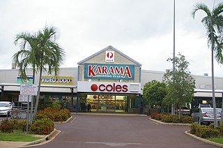
Karama, Northern Territory Suburb of Darwin, the Northern Territory, Australia

Karama is a Northern suburb of Darwin, Northern Territory, Australia.

Leanyer, Northern Territory Suburb of Darwin, the Northern Territory, Australia

Leanyer is a northern suburb of Darwin, in the Northern Territory of Australia.

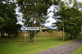
The Narrows, Northern Territory Suburb of Darwin, the Northern Territory, Australia

The Narrows is a northern inner suburb of the city of Darwin, Northern Territory, Australia.

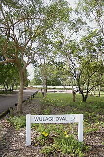
Wulagi, Northern Territory Suburb of Darwin, the Northern Territory, Australia

Wulagi is a Northern suburb of Darwin, Northern Territory, in the Northern Territory of Australia.

Winnellie, Northern Territory Suburb of Darwin, the Northern Territory, Australia

Winnellie is a northern suburb of Darwin, Northern Territory, in the Northern Territory of Australia.

Yarrawonga, Northern Territory Suburb of Darwin, the Northern Territory, Australia

Yarrawonga is an outer northern suburb of Palmerston. It is 21 km SE of the Darwin City and 2.1 km from Palmerston City. Its Local Government Area is the City of Palmerston.

References

  1. Australian Bureau of Statistics (27 June 2017). "2016 Community Profiles: Bagot (Indigenous Location)". 2016 Census of Population and Housing. Retrieved 28 June 2017. OOjs UI icon edit-ltr-progressive.svg
  2. "Territory Origins". Place Names Committee of the Northern Territory. Northern Territory Government. Retrieved 5 April 2013.

Coordinates: 12°24′57″S130°51′27″E / 12.41583°S 130.85750°E / -12.41583; 130.85750

Geographic coordinate system Coordinate system

A geographic coordinate system is a coordinate system that enables every location on Earth to be specified by a set of numbers, letters or symbols. The coordinates are often chosen such that one of the numbers represents a vertical position and two or three of the numbers represent a horizontal position; alternatively, a geographic position may be expressed in a combined three-dimensional Cartesian vector. A common choice of coordinates is latitude, longitude and elevation. To specify a location on a plane requires a map projection.